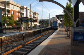
Transit-Oriented (TO)
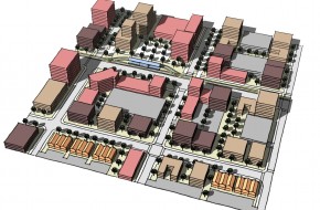
The TO layer encourages higher density development, higher levels of transportation system connectivity, and concentrations of housing and commercial activity around areas designated as mass transit stops. The intent is to create unique, mixed-use districts with housing and employment opportunities around the City’s future transit network. TO areas are characterized by a walkable environment, close proximity of buildings, and minimal land used for parking. These nodes of high intensity may be located within lower-intensity areas. Construction at higher intensity maximizes efficiency of the current and future transit system and minimizes reliance on private automobiles. The TO layer is applied within 1/4 mile of a node identified on the Land Use Plan.
Density Range
| UM | ||
| Gross Density | 15 – 60 du/acre | |
| Lot Sizes | vary | |
| Non-Residential Floor to Area Ratio (FAR) Range | Minimum of 0.5, typical of 1.5 | |
| UL | ||
| Gross Density | 7 – 40 du/acre | |
| Lot Sizes | vary | |
| Non-Residential Floor to Area Ratio (FAR) Range | Minimum of 0.4, typical of 1.2 |
DEVELOPMENT POLICIES
1.0 Site Design, Building Form, and Location
1.1 Site Design
- Project design should accommodate easy travel by walking, biking, and transit to the transit stop.
- Uses should share parking to minimize land area used for parking.
- Development should complement the goal of a mixed-use “village” environment around major stops or stations to provide easy access to multiple destinations including jobs, shopping, entertainment, and recreation.
- Incorporate shallow building setbacks and wide sidewalks to accommodate pedestrian activity.
- Customer-oriented development that exceeds traffic compatibility ranges may be allowed, provided that the impacts are mitigated using strategies contained in the compatibility matrix.
- Developments should have direct pedestrian access on each block face that they occupy.
- Create and maintain small block sizes.
2.0 Automobile and Pedestrian Connectivity
2.1 Automobile Connectivity
- Protect or establish a functioning and dense street grid.
- Connect the vehicular and pedestrian networks between individual developments.
- Limit curb cuts and automobile accessibility off of the primary commercial street.
2.2 Pedestrian Connectivity
- Multi-building developments should include internal pedestrian systems to encourage customers to park once for several destinations.
- Provide safe and direct pedestrian and bicycle access from adjacent public streets and trails.
