Goals
The goals below are in the form of statements describing ideal future conditions related to parks and recreation that our community has committed to work toward achieving. These goals establish priorities for our city and help community leaders make decisions regarding how our city grows. Clicking on any goal title will reveal the full goal statement and allow viewing of initiatives the City and its partners will undertake to accomplish the goal.
Oklahoma City's parks are funded, operated, and maintained in a way that gives people the amenities and park services they need in a safe and clean park environment.
We will develop and implement a comprehensive asset management and maintenance system with sufficient funding to improve the park user’s experience. A systematic assessment of maintenance needs and priorities will help ensure that funds for operations and maintenance are both adequate and targeted to address key needs. This assessment begins with developing and maintaining a thorough inventory of the condition, with maintenance and replacement needs, of existing parks and facilities. It then establishes a maintenance standard and sets criteria and investment priorities to reach this level. Finally, the assessment should evaluate the deployment of maintenance staff and make adjustments to realize efficiencies. The overall process establishes adequate annual funding through the city’s budget process to implement the management and maintenance program.
The Parks Master Plan recommends establishing a Mode II standard, as defined by the National Recreation and Parks Association. This standard, typical of peer cities, is associated with high-level maintenance of well developed park areas with reasonably high visitation.
We will adapt park landscapes and facilities to minimize costs that are not necessary for the successful operation of the park or service to users. High costs related to energy use, landscape maintenance, and obsolete facilities or materials do not benefit park users. In order to support increased maintenance funding, taxpayers must be convinced that funds are used in the most efficient way possible. This sometimes requires difficult choices, such as minimizing landscaped areas that unnecessarily require high cost and extensive maintenance, removing underutilized facilities, and disposing of unproductive parks so that resources can be concentrated in repairing facilities with highest use. Designed use of natural rather than manicured landscapes, climatically appropriate materials, and energy efficient technologies can reduce maintenance costs without compromising service to park users.
Create partnerships and programs involving civic groups, business organizations, governmental entities, coalitions, and non-profits to develop or enhance the following:
- School reading programs;
- Elementary school intramural sports leagues;
- Rehabilitation of school infrastructure and replacement of school equipment (athletic facilities, media center materials, computers, etc.);
- After-school programs that focus on mentoring or conflict resolution;
- Rehabilitation of City parks;
- Community involvement opportunities associated with public schools; and,
- Other projects or programs that improve neighborhood safety by working with children.
Explore public/private funding sources and management structures, including non-profit conservancies, to improve, operate, manage and maintain downtown parks and open spaces.
Develop a downtown park master plan that identifies the following:
- Opportunities for providing private parks and open space while still maintaining a dense, urban environment (such as vest pocket parks, rooftop gardens, plazas and courtyards);
- Linkages and connections between public and private parks;
- Programming and amenities that complement and support parks in the system; and
- Funding for operations and maintenance.
Establish partnerships and programs with neighborhood associations and other organizations to improve maintenance of parks by:
- Increasing participation in the OKC Beautiful’s “Adopt a Park” program. Participants can include nearby businesses, neighborhood associations, churches, schools, and nonprofit groups;
- Establishing incentives for participating in the“Adopt a Park” program, such as providing awards; and,
- Increasing volunteer park maintenance programs.
Reduce the City’s long term operations and maintenance costs by:
- Adapting more energy efficient technologies for park facilities;
- Using low water landscape palettes and recycled water for irrigation; and,
- Identifying and pursuing additional funding sources including: increased appropriations to the City’s Parks & Recreation Department; federal, state, or county funds; dedicated sales tax; impact fees/in lieu fees; private, corporate, and foundation grants; and business improvement or assessment districts.
Pursue all opportunities, including donations, conservation easements, inheritance trusts, naming rights, and developer incentives to accomplish the following:
- Acquiring new lands for parks, open space;
- Acquiring natural areas that provide greater opportunities for people to access nature;
- Maintaining existing and future parks, open space, and natural areas;
- Enhancing existing landscaping at parks and along trails by planting additional native vegetation.
We will provide reliable and diversified funding for park development, capital improvement, maintenance, and operations. In order to provide adequate resources for the park system, we must diversify funding sources beyond our current reliance on sales taxes. Because bonds and property taxes can be used for capital projects, the most immediate need is for additional maintenance and operation funding. But a complete program must use a spectrum of techniques and a variety of partners. Diversification must be equitable to all parts of the city and not burden low-income households or any one particular group or constituency.
The Parks Master Plan presents a variety of options for various aspects of park development and operation. Sources for maintenance and operations include endowments, stormwater utility and impact fees, dedicated sales taxes, user fees, and private support. Land acquisition and capital development techniques include land dedication requirements and payments based on impact and demand created by projects, private park development, bond issues, dedication of easements, and private philanthropy.
We will supplement public funding of park development and operations by building a network of partnerships with other public, nonprofit, and private agencies and organizations. Budget constraints, state law that limits revenue sources for operations, the need to catch up on maintenance and replacement and keep up with growth, and other factors mean that city funding alone probably cannot provide the resources necessary to build, maintain, and operate the park system that Oklahoma City needs. Partnerships can provide the extra support and assistance that the system needs – as the Parks Master Plan puts it, “they can help make the difference between a park system that struggles and one that sparkles.” The plan’s recommendations for partnerships include support organizations, corporate or health provider sponsorships, conservancies, a Parks Foundation, and advocacy groups. Conservancies have special value for iconic parks. A conservancy-like group supports Myriad Gardens. Other possibilities for conservancies include the four original parks for the 1910 Dunn Plan and the MAPS 3 Park in the Core to Shore district.
Explore public/private funding sources and management structures, including non-profit conservancies, to improve, operate, manage and maintain downtown parks and open spaces.
Establish partnerships and programs with neighborhood associations and other organizations to improve maintenance of parks by:
- Increasing participation in the OKC Beautiful’s “Adopt a Park” program. Participants can include nearby businesses, neighborhood associations, churches, schools, and nonprofit groups;
- Establishing incentives for participating in the“Adopt a Park” program, such as providing awards; and,
- Increasing volunteer park maintenance programs.
Increase the level of involvement and resources from agencies and other community groups to provide physical activity programming, such as after-school programs.
Reduce the City’s long term operations and maintenance costs by:
- Adapting more energy efficient technologies for park facilities;
- Using low water landscape palettes and recycled water for irrigation; and,
- Identifying and pursuing additional funding sources including: increased appropriations to the City’s Parks & Recreation Department; federal, state, or county funds; dedicated sales tax; impact fees/in lieu fees; private, corporate, and foundation grants; and business improvement or assessment districts.
Utilize private and public partnerships and determine appropriate locations and funding sources to build larger multi-generational centers that will replace existing, small, and outdated recreation centers.
Pursue all opportunities, including donations, conservation easements, inheritance trusts, naming rights, and developer incentives to accomplish the following:
- Acquiring new lands for parks, open space;
- Acquiring natural areas that provide greater opportunities for people to access nature;
- Maintaining existing and future parks, open space, and natural areas;
- Enhancing existing landscaping at parks and along trails by planting additional native vegetation.
Establish a parkland dedication program to ensure adequate provision of parks to serve future populations.
Use one or more of the following methods to ensure infrastructure and facility capacities are adequate for proposed development:
- Ongoing master planning to determine the necessary water, sewer, and road infrastructure to serve development.
- An impact fee system that collects funds for specific areas as they develop and installs needed infrastructure in a timely manner.
- Use of special service districts to ensure appropriate levels of service, sufficient revenue, and timely installation of infrastructure and facilities for each district.
- Require developers to construct or fully fund infrastructure or other improvements needed to serve their development, with reasonable accommodation for future adjacent or nearby development.
- Require developers to wait until the City (or the State as the case may be) constructs the infrastructure needed to serve their development.
- For development proposed in areas not currently within one-half mile of existing water infrastructure, require a service area study to first be completed to determine the best method for providing water to the service area.
We will maintain park assets to be consistent with community needs and constituencies, while maintaining the flexibility to adapt to future demographic changes. The City should develop and implement a program to evaluate, improve, and sometimes replace park facilities to fit the needs of nearby the residents. This program will evaluate each park in the system for its ability to serve its constituency and set priorities for deficiencies. When neighborhoods change so that parks no longer meet their needs, the park should be replanned or put to a more appropriate use, possibly through redevelopment. Park master plans with phased implementation programs will be developed in partnership with neighborhoods in their service areas.
We will develop and implement a plan for recreational services and programs tailored to community needs. Park assets are only a part of the story. Park programming, the activities that actually take place within these assets, should also respond to community needs. Meeting the twin objectives of maximizing efficiency and service requires a program that identifies and strengthens core focuses for recreation efforts. Programs should include an emphasis on health and wellness. Recreational offerings should include close partnership and coordination with schools, health care providers, and other organizations.
Determine whether existing parks and facilities are serving the specific needs of the community within the park’s service area. If the area has transitioned and the park no longer serves the needs of the surrounding community, either reprogram the park, declare park surplus, or seek redevelopment to a more fitting use.
Coordinate planning efforts with school districts to attempt concurrent land purchases for schools and parks.
Coordinate with school districts, local healthcare providers, and other community organizations to provide recreational programming not offered in nearby public parks or recreation centers, such as after-school fitness and education programs.
Prioritize capital improvement for parks that serve areas where populations are projected to increase.
Continue to create and enhance “big league city” amenities such as parks, public spaces, roadways, transit, cultural and recreational facilities, special districts, and gateways. Two specific possibilities for amenity enhancement include:
- Explore the feasibility of City-supported, high-quality landscaping along key transportation corridors as a means of enhancing the city’s appearance, image, and sense of place.
- Create gateways using public art features.
We will provide City services in areas that create the most benefit for dollar spent and where market demand exists. New services should be provided in areas of the city are the most efficient to serve considering both operating costs and capital investments. In many cases, this will involve incremental infrastructure extensions in contiguous areas, or where a new drainage basin can be opened in areas where market demand and city growth goals coincide. Possible sources to demonstrate market demand include housing demand studies, employment land studies, retail strategies, land supply analyses, and system-wide study for specific services. The findings from these market studies should be incorporated into planokc and used to inform General Obligation bonds, Capital Improvement Projects, and the land use plan.
Public financing is a particularly important instrument for directing growth. In general, public financing should be directed to areas that promote planokc’s overriding goal of healthy and sustainable development. For example, extending a strategic interceptor sewer that opens a basin to development may receive front-end public financing through revenue bonds.
When developing new areas, the City should ensure that services can support new development without diminishing service to existing neighborhoods. For example, the need to extend water to new development should not jeopardize the availability of fire suppression flow in existing neighborhoods.
We will use municipal utilities and services as catalysts to leverage neighborhood revitalization and redevelopment. Investments in infrastructure and City facilities support revitalization efforts by both targeting and preparing key areas for redevelopment. Improvements to infrastructure and City services should be correlated with redevelopment efforts, in order to provide accurate information to the private market regarding preferred land use locations, uses, and intensities.
Locate, design and upgrade City facilities and infrastructure in a manner that supports neighborhood revitalization and redevelopment.
Provide adequate infrastructure for new or expanding companies by giving priority to Capital Improvements in ER areas. Additionally, consider the implementation of impact fees for infrastructure in order to provide infrastructure in a timely manner and to better coordinate with private development.
Ensure adequate funds to maintain enhanced levels of service (including staffing) in places that have been or will be designated as special districts.
Prioritize and concentrate development where facilities, infrastructure, and services have capacity and in areas where the Police and Fire Departments are best able to respond. Guide the location and timing of development through the proactive and strategic installation of infrastructure.
Use one or more of the following methods to ensure infrastructure and facility capacities are adequate for proposed development:
- Ongoing master planning to determine the necessary water, sewer, and road infrastructure to serve development.
- An impact fee system that collects funds for specific areas as they develop and installs needed infrastructure in a timely manner.
- Use of special service districts to ensure appropriate levels of service, sufficient revenue, and timely installation of infrastructure and facilities for each district.
- Require developers to construct or fully fund infrastructure or other improvements needed to serve their development, with reasonable accommodation for future adjacent or nearby development.
- Require developers to wait until the City (or the State as the case may be) constructs the infrastructure needed to serve their development.
- For development proposed in areas not currently within one-half mile of existing water infrastructure, require a service area study to first be completed to determine the best method for providing water to the service area.
For development proposed in areas not currently within a sanitary sewer drainage basin, a drainage basin study should first be completed to determine the best method for sanitary sewer service.
Create and implement small area plans for neighborhoods or districts with special strategic importance or complications related to development or redevelopment.
Parks in Oklahoma City have facilities, programming, amenities, and activities well-matched to the recreational needs of residents and visitors.
We will develop and implement a comprehensive asset management and maintenance system with sufficient funding to improve the park user’s experience. A systematic assessment of maintenance needs and priorities will help ensure that funds for operations and maintenance are both adequate and targeted to address key needs. This assessment begins with developing and maintaining a thorough inventory of the condition, with maintenance and replacement needs, of existing parks and facilities. It then establishes a maintenance standard and sets criteria and investment priorities to reach this level. Finally, the assessment should evaluate the deployment of maintenance staff and make adjustments to realize efficiencies. The overall process establishes adequate annual funding through the city’s budget process to implement the management and maintenance program.
The Parks Master Plan recommends establishing a Mode II standard, as defined by the National Recreation and Parks Association. This standard, typical of peer cities, is associated with high-level maintenance of well developed park areas with reasonably high visitation.
We will adapt park landscapes and facilities to minimize costs that are not necessary for the successful operation of the park or service to users. High costs related to energy use, landscape maintenance, and obsolete facilities or materials do not benefit park users. In order to support increased maintenance funding, taxpayers must be convinced that funds are used in the most efficient way possible. This sometimes requires difficult choices, such as minimizing landscaped areas that unnecessarily require high cost and extensive maintenance, removing underutilized facilities, and disposing of unproductive parks so that resources can be concentrated in repairing facilities with highest use. Designed use of natural rather than manicured landscapes, climatically appropriate materials, and energy efficient technologies can reduce maintenance costs without compromising service to park users.
Create partnerships and programs involving civic groups, business organizations, governmental entities, coalitions, and non-profits to develop or enhance the following:
- School reading programs;
- Elementary school intramural sports leagues;
- Rehabilitation of school infrastructure and replacement of school equipment (athletic facilities, media center materials, computers, etc.);
- After-school programs that focus on mentoring or conflict resolution;
- Rehabilitation of City parks;
- Community involvement opportunities associated with public schools; and,
- Other projects or programs that improve neighborhood safety by working with children.
Explore public/private funding sources and management structures, including non-profit conservancies, to improve, operate, manage and maintain downtown parks and open spaces.
Develop a downtown park master plan that identifies the following:
- Opportunities for providing private parks and open space while still maintaining a dense, urban environment (such as vest pocket parks, rooftop gardens, plazas and courtyards);
- Linkages and connections between public and private parks;
- Programming and amenities that complement and support parks in the system; and
- Funding for operations and maintenance.
Establish partnerships and programs with neighborhood associations and other organizations to improve maintenance of parks by:
- Increasing participation in the OKC Beautiful’s “Adopt a Park” program. Participants can include nearby businesses, neighborhood associations, churches, schools, and nonprofit groups;
- Establishing incentives for participating in the“Adopt a Park” program, such as providing awards; and,
- Increasing volunteer park maintenance programs.
Reduce the City’s long term operations and maintenance costs by:
- Adapting more energy efficient technologies for park facilities;
- Using low water landscape palettes and recycled water for irrigation; and,
- Identifying and pursuing additional funding sources including: increased appropriations to the City’s Parks & Recreation Department; federal, state, or county funds; dedicated sales tax; impact fees/in lieu fees; private, corporate, and foundation grants; and business improvement or assessment districts.
Pursue all opportunities, including donations, conservation easements, inheritance trusts, naming rights, and developer incentives to accomplish the following:
- Acquiring new lands for parks, open space;
- Acquiring natural areas that provide greater opportunities for people to access nature;
- Maintaining existing and future parks, open space, and natural areas;
- Enhancing existing landscaping at parks and along trails by planting additional native vegetation.
We will use private parks to meet local needs in certain settings in developing areas, subject to maintenance standards and commitments. Parks, including neighborhood parks, have traditionally been part of civic life, open and welcome to the general public. On the other hand, smaller neighborhood parks are primarily used by residents of a specific local area and are increasingly difficult and expensive for a municipal parks department to develop and maintain. This leads to an increasing acceptance and even encouragement of private parks, controlled and maintained by the residents of a specific neighborhood or subdivision and not necessarily available to the general public.
The Parks Master Plan anticipates that most local park demands in new growth and rural areas will be met by private parks. Oklahoma City should accept the development of private parks as part of a program to meet level of service standards for these areas. However, public neighborhood parks should be developed as part of or adjacent to school sites, along trails and major pedestrian or bicycle routes, and along greenway corridors. New private parks, when developed, should follow specific management and maintenance standards.
Use established mechanisms/tools to allow property owners to provide for the perpetual maintenance, repair and reconstruction of private roads, sidewalks, trails, utilities, and parks in new housing developments by requiring funding mechanisms such as:
- Maintenance bonds/escrows
- Special assessment districts, such as Business Improvement District or Special Improvement District
- Covenants requiring compulsory membership in an incorporated Property Owners Association whose members will be financially liable for any such maintenance, repair, or reconstruction costs.
Incorporate these financing options into the platting process (or zoning process in the case of PUDs).
Construct all private roads and utilities to comply with minimum design and paving standards as outlined in the City of Oklahoma City Subdivision Regulations, including those related to the appropriate Street Typology.
Develop a downtown park master plan that identifies the following:
- Opportunities for providing private parks and open space while still maintaining a dense, urban environment (such as vest pocket parks, rooftop gardens, plazas and courtyards);
- Linkages and connections between public and private parks;
- Programming and amenities that complement and support parks in the system; and
- Funding for operations and maintenance.
Require new subdivisions in under-served areas to construct and maintain private parks to serve those residents. Establish standards for private parks so that their quality is on par with public parks.
Approve construction of new private parks only when the following provisions are specified:
- Identification of a party, group, or entity responsible for park maintenance;
- Adoption of maintenance standards for private park facilities, equipment, and natural areas;
- Establishment of a maintenance and inspections schedule;
- Guarantees of a funding source for long-term maintenance (maintenance bonds, open space escrow, fees etc.).
We will maintain park assets to be consistent with community needs and constituencies, while maintaining the flexibility to adapt to future demographic changes. The City should develop and implement a program to evaluate, improve, and sometimes replace park facilities to fit the needs of nearby the residents. This program will evaluate each park in the system for its ability to serve its constituency and set priorities for deficiencies. When neighborhoods change so that parks no longer meet their needs, the park should be replanned or put to a more appropriate use, possibly through redevelopment. Park master plans with phased implementation programs will be developed in partnership with neighborhoods in their service areas.
We will develop and implement a plan for recreational services and programs tailored to community needs. Park assets are only a part of the story. Park programming, the activities that actually take place within these assets, should also respond to community needs. Meeting the twin objectives of maximizing efficiency and service requires a program that identifies and strengthens core focuses for recreation efforts. Programs should include an emphasis on health and wellness. Recreational offerings should include close partnership and coordination with schools, health care providers, and other organizations.
Determine whether existing parks and facilities are serving the specific needs of the community within the park’s service area. If the area has transitioned and the park no longer serves the needs of the surrounding community, either reprogram the park, declare park surplus, or seek redevelopment to a more fitting use.
Coordinate planning efforts with school districts to attempt concurrent land purchases for schools and parks.
Coordinate with school districts, local healthcare providers, and other community organizations to provide recreational programming not offered in nearby public parks or recreation centers, such as after-school fitness and education programs.
Prioritize capital improvement for parks that serve areas where populations are projected to increase.
Continue to create and enhance “big league city” amenities such as parks, public spaces, roadways, transit, cultural and recreational facilities, special districts, and gateways. Two specific possibilities for amenity enhancement include:
- Explore the feasibility of City-supported, high-quality landscaping along key transportation corridors as a means of enhancing the city’s appearance, image, and sense of place.
- Create gateways using public art features.
We will develop larger multi-generational community/recreation centers with good access to replace the current model of smaller centers in community parks. The community survey demonstrated a strong demand for indoor facilities that emphasize health and wellness, as well as other activities. Until now, the city has employed a model of many small, dispersed centers within community parks. Nationally, these older centers are being replaced by larger, better-equipped multi-generational facilities that offer more variety and quality of programming. These centers combine aquatics centers, adult and senior wellness, health and fitness, and even special event facilities in one package. Where feasible, the transition should make maximum use of existing investments. Sites for facilities should put a very high emphasis on multi-modal access, including pedestrian connections, on-street bicycle routes, multi-purpose trails, and frequent transit service.
Utilize private and public partnerships and determine appropriate locations and funding sources to build larger multi-generational centers that will replace existing, small, and outdated recreation centers.
We will provide an appropriate level of service to citizens of all parts of the city. The Parks Master Plan identified level of service standards and deficits experienced by each of its four tiers. These level of service goals recognize that park service expectations are not the same for each tier. For example, central city areas with higher population densities, lower average household incomes, and less access to alternative facilities require (and should expect) a different level of service from rural areas with very low population and less dependence on the public recreation system.
We will provide full local park service in existing urban areas by filling current level of service gaps. Existing local and regional parks will provide most park services in developed areas. The City’s new park focus in these neighborhoods will concentrate on filling service gaps. The City should conduct a site selection and acquisition process for new park sites within areas that lack adequate local park service. Park sites should be considered for access and their ability to stabilize neighborhoods and encourage new private investment. A partnership of public funds through bond issues and private philanthropic contributions may provide financing for development of parks within these established, under-served neighborhoods, particularly when they are very dependent on public park service.
We will concentrate on developing regional public parks in developing areas and establish local parks through other means. Developing areas also require park service, but new park acquisition and development is difficult with limited capital and operational budgets. In these areas, with their lower population densities, the City’s focus should be on regional parks, with their ability to serve a larger population. In developing areas, local parks should focus on joint use with school sites or along trails when using public funds for purchase and development. Local parks that serve specific neighborhood needs should be privately built and operated. Regional or public local park development in development areas may be funded in part through an impact fee, based on the proportionate park area demand generated by new households multiplied by a factor for acquisition and park development.
Determine whether existing parks and facilities are serving the specific needs of the community within the park’s service area. If the area has transitioned and the park no longer serves the needs of the surrounding community, either reprogram the park, declare park surplus, or seek redevelopment to a more fitting use.
Coordinate planning efforts with school districts to attempt concurrent land purchases for schools and parks.
Modify codes and regulations to establish separate dedication requirements for parkland that excludes areas otherwise necessary or dedicated for drainage or detention as these areas should not receive credit to serve both purposes.
Ensure all homes are within walking distance of a park based on level of service standards for each urban land use typology by updating codes and regulations for new construction and by improving connections and access between existing parks and neighborhoods.
Establish procedures for creating new joint school/park sites, including the division of maintenance responsibilities.
Increase the number of joint-use agreements that allow community access to school playgrounds outside of school hours to improve neighborhood access to recreational facilities.
Increase the level of involvement and resources from agencies and other community groups to provide physical activity programming, such as after-school programs.
Prioritize capital improvement to construct linkages and connections from the existing urban parks and open space system to neighborhoods, commercial areas, employment centers, and community facilities.
Locate, design and upgrade City facilities and infrastructure in a manner that supports neighborhood revitalization and redevelopment.
Continue to create and enhance “big league city” amenities such as parks, public spaces, roadways, transit, cultural and recreational facilities, special districts, and gateways. Two specific possibilities for amenity enhancement include:
- Explore the feasibility of City-supported, high-quality landscaping along key transportation corridors as a means of enhancing the city’s appearance, image, and sense of place.
- Create gateways using public art features.
We will plan and develop a signature system of Downtown parks and open spaces to leverage economic development, promote quality of life, and enhance adjacent neighborhoods. Parks and open spaces are fundamental to Oklahoma City’s drive to transform its center. The Oklahoma River project has converted an underutilized river to the greenway, trail, and recreation system that has become a trademark feature for the city. The Core to Shore development program uses a connected network of parks and public spaces, featuring the 40-acre MAPS 3 Park, as the catalyst for a massive redevelopment project that will bring new neighborhoods and jobs to the center of the city. Completion of this system, supported by excellent maintenance and event programming, will realize the potential of this unique system. But in addition to serving the needs of adjacent new neighborhoods, the downtown park system can serve the needs of adjacent neighborhoods, especially areas like Capitol Hill and other adjacent southside neighborhoods. These areas should be connected to the riverfront and downtown systems by a combination of trails, complete street routes with excellent pedestrian and bicycle accommodations, and frequent transit service.
Develop a downtown park master plan that identifies the following:
- Opportunities for providing private parks and open space while still maintaining a dense, urban environment (such as vest pocket parks, rooftop gardens, plazas and courtyards);
- Linkages and connections between public and private parks;
- Programming and amenities that complement and support parks in the system; and
- Funding for operations and maintenance.
We will improve efficiencies in City operations and in providing public services through efficient growth. Increased efficiency follows two tracks. First, basic City operations should provide maximum value to the taxpayers per dollar spent. Second, the city’s growth should be economical and efficient so that it contributes to rather than detracts from fiscal stability.
Maximizing efficiency in City operations means establishing and maintaining appropriate staff levels and ensuring that staff is fully utilized; introducing technology and other innovations; avoiding duplications through information sharing and consolidation of functions where possible; and increasing cost recovery where possible by establishing fees and charges that reflect the actual cost of services.
Maximizing the benefits and efficiencies of growth is a primary theme of planokc, and is reflected throughout this document. While a comparison of the three development scenarios and preference for the “efficiency” scenario as the future growth model has many benefits, the choice is ultimately economic. The efficiency scenario accommodates the same amount of growth for $82 million less per year than continuing present trends. New techniques of financing development such as impact fees should also be considered to ensure that future development pays equitably for the cost of infrastructure that it demands.
Prioritize neighborhoods for revitalization and re-investment in order to reverse the decline associated with poor maintenance of public infrastructure and other property by using the following objective criteria:
- Low economic opportunity;
- Low educational attainment;
- Poor health outcomes;
- Poor housing environments;
- Low neighborhood quality; and,
- Existing capacity to support the revitalization efforts; and other important indicators.
In conjunction with City regulatory changes, such as significant modifications to zoning ordinances, building codes, or subdivision regulations, assess the effects of the proposed modifications on housing development costs and overall housing affordability, considering the balance between housing affordability and other objectives such as environmental quality, urban design quality, maintenance of neighborhood character and protection of public health, safety and welfare. This assessment should be integrated into the code amendment process, identify barriers to housing affordability, and include recommended mitigation.
Use established mechanisms/tools to allow property owners to provide for the perpetual maintenance, repair and reconstruction of private roads, sidewalks, trails, utilities, and parks in new housing developments by requiring funding mechanisms such as:
- Maintenance bonds/escrows
- Special assessment districts, such as Business Improvement District or Special Improvement District
- Covenants requiring compulsory membership in an incorporated Property Owners Association whose members will be financially liable for any such maintenance, repair, or reconstruction costs.
Incorporate these financing options into the platting process (or zoning process in the case of PUDs).
Construct all private roads and utilities to comply with minimum design and paving standards as outlined in the City of Oklahoma City Subdivision Regulations, including those related to the appropriate Street Typology.
Evaluate public facilities and public property for unsafe conditions such as poor lighting (quality and quantity); blind spots; poor maintenance conditions; and other unsafe conditions. Prioritize improvements to these facilities and properties based on the following criteria: a) Proximity and condition of nearby neighborhoods; and b) Cost/benefit associated with mitigating the unsafe condition and maintaining the improvement.
Continue to ensure that rates to wholesale customers, for example, nearby jurisdictions, are based on up-to-date cost of service studies.
Form a working partnership with the library system, both the Metropolitan Library System and the Oklahoma Department of Libraries, to coordinate timing of facility expansions, improvements, and new facility siting with other types of civic resources, such as schools, fire stations, parks, and projected growth and demand for those resources. This should also include identifying a mechanism to provide library services in Canadian County.
Support annexation or deannexation actions that improve City service efficiency; improve fiscal sustainability; and/or contribute to regional goals related to transportation systems or environmental resources.
Locate, design and upgrade City facilities and infrastructure in a manner that supports neighborhood revitalization and redevelopment.
Study the impact of vacant parcels on places and special districts, and determine how best to mitigate any negative impacts.
Prioritize street maintenance projects in the Capital Improvement Plan based on the Public Works Department’s street condition data and traffic volumes.
Improve efficiency of City operations through the following means:
- To the extent possible, base fees and charges on the cost of services and goods provided depending on location.
- Investigate and implement technological approaches to improving local government efficiency and service quality.
Provide public services in the most cost-effective manner through efficient growth by:
- Implementing an impact fee structure that varies by district according to actual cost.
- Studying the impacts of altering the pricing of utilities to factor in how the location of a user impacts the cost of providing them utility services.
- Exploring the use of fee-based revenue methods for maintaining infrastructure, such as transportation facilities, utility systems, and other public infrastructure.
- Altering zoning ordinance and subdivision regulations to allow more efficient development patterns.
Prioritize and concentrate development where facilities, infrastructure, and services have capacity and in areas where the Police and Fire Departments are best able to respond. Guide the location and timing of development through the proactive and strategic installation of infrastructure.
Use one or more of the following methods to ensure infrastructure and facility capacities are adequate for proposed development:
- Ongoing master planning to determine the necessary water, sewer, and road infrastructure to serve development.
- An impact fee system that collects funds for specific areas as they develop and installs needed infrastructure in a timely manner.
- Use of special service districts to ensure appropriate levels of service, sufficient revenue, and timely installation of infrastructure and facilities for each district.
- Require developers to construct or fully fund infrastructure or other improvements needed to serve their development, with reasonable accommodation for future adjacent or nearby development.
- Require developers to wait until the City (or the State as the case may be) constructs the infrastructure needed to serve their development.
- For development proposed in areas not currently within one-half mile of existing water infrastructure, require a service area study to first be completed to determine the best method for providing water to the service area.
For development proposed in areas not currently within a sanitary sewer drainage basin, a drainage basin study should first be completed to determine the best method for sanitary sewer service.
Encourage redevelopment and infill development on vacant, underutilized, and brownfield sites in urbanized areas.
Encourage the integration of different land uses in urban areas through the following means:
- Promote the use of performance standards in place of existing zoning methods (which address incompatibility by separating uses). Performance-based regulations should focus on achieving compatibility between uses by addressing the following:
- Noise, odors and air quality
- Traffic and parking (allow flexible, but sufficient parking)
- Site layout and building design
- Waste
- Safety
- Lighting (glare control, placement, and shielding)
- Delivery hours
- Enhance transit service (bus and rail).
- Prevent large areas of concentration of any particular land use such as multi-family or commercial.
Catalyze infill development on vacant, underutilized, and brownfield sites in urbanized areas by:
- Investing in infrastructure improvements;
- Improving multi-modal transportation networks;
- Improving parks and open spaces;
- Improving schools and other civic resources;
- Exploring innovative methods such as:
- A public-private partnership to purchase problem properties in target areas and build or rehabilitate homes while improving infrastructure and amenities
- An infill house plan program similar to Sacramento or Milwaukee
- Identifying and removing barriers to rehabilitation and/or replacement of residential buildings.
- Establishing a position in the City to facilitate medium- and large-scale redevelopment projects through the development process by guiding interactions with City departments, allied agencies, and utility companies.
Encourage the adaptive reuse of underutilized structures and the revitalization of older, economically distressed neighborhoods.
Prioritize maintaining the strength of existing commercial nodes and corridors over providing new areas for commercial development.
Continue promoting the re-use, redevelopment, and revitalization of low-performing or declining commercial areas.
Enable increased densities as appropriate to individual land use typology areas by addressing financial incentives and disincentives through evaluating the feasibility of strategies such as:
- Impact fees and/or transportation utility fees that vary by district according to actual cost;
- Assessing solid waste charges according to actual cost;
- Private solid waste services where it is impractical for the City to provide service such as in rural areas.
Create design standards and guidelines for the design, materials, shared amenities, and accessibility of high density urban residential development. Standards and guidelines should promote privacy and livability in a high density, mixed-use environment.
Adopt subdivision regulations that ensure new neighborhoods meet the basic needs of residents while supporting an efficient development pattern. Regulations should cover:
- Open space (passive and active),
- Demonstration of sustainable funding levels for common area and facility maintenance costs,
- Walkability and bikeability,
- Internal and external street connectivity,
- Block length,
- Integration of uses,
- Integration of a variety of home sizes,
- Integration of a variety of unit types, and
- Preservation of Environmentally Sensitive Areas.
Regulations could be based on a point scale to allow flexibility, while still requiring basic minimum thresholds be met.
New regulations should remove the existing requirement for development in Rural LUTAs to connect to water and sewer systems and establish a minimum one-acre lot size for lots with on-site sewer treatment.
Oklahoma City's park system is accessible to its users by a connected system including roadways, transit, trails, bicycle facilities, and sidewalks.
We will ensure that street improvements and expansions to the network serve the development vision of planokc. The Land Use Plan, the foundation of planokc, is based on efficient use of land resources, and incremental, market-based extensions of urban development. Road construction projects in undeveloped areas can have the opposite effect by encouraging decentralized development. Both city and regional road plans should reinforce the vision of efficiency by focusing on enhancing the existing network, addressing areas of congestion and poor operation, increasing network connectivity and route choice, and using new street extensions to guide development in desirable directions.
We will implement the street typology concept. The street typologies combine the function and context of streets to produce design standards. Our subdivision ordinances and design practices should be amended to be consistent with these standards. Different land uses and intensities of development also require streets with the ability to handle the traffic they generate. Therefore, new development should be located on streets of appropriate type and capacity, or include measures necessary to supply the required capacity.
Coordinate the design, development, expansion, and/or investment in transportation projects with the Land Use Typology map.
Require traffic impact analyses with all comprehensive plan amendments requests to change to a higher intensity LUTA.
Require the construction of new streets, streetscapes, and street widening projects to implement the design components of the assigned street typologies established in this plan.
Share parking among contiguous developments.
Revise Subdivision Regulations and development standards to reflect the street typology standards.
Identify and prioritize freight infrastructure projects that are needed to maintain mobility and enhance the city’s (and region’s) economic competitiveness.
Undertake targeted parking studies to determine existing parking capacity and develop appropriate parking standards based on land use, location, and demand.
Require sidewalks on both sides of all streets in urban LUTAs and in the Rural Residential LUTA for subdivisions with densities greater than 1 unit per acre.
Maintain historical lot and block sizes where possible and appropriate.
Assess the need for additional funds for citywide road maintenance beyond past average annual expenditures. If additional funds are needed for street maintenance, explore the feasibility of:
- Implementing a transportation utility fee; or
- Increasing the proportion of G.O. Bond money spent on street maintenance over past levels.
We will design and implement a bicycle route system based on getting people to priority destinations. The current Bicycle Transportation Plan provides a two-phased network of potential bike routes. This network is based on evaluating various streets for bicycle suitability, and provides a solid foundation for implementation. The system should now be refined by considering destinations and designing routes that assemble on-street segments and trails into an entire network that serves multiple destinations.
We will incorporate appropriate support features such as bike parking and wayfinding signage into the system. On and off-street facilities function best with relatively inexpensive support facilities like parking and information graphics. Zoning ordinances and cost-sharing programs can both require, and encourage through incentives, bike parking for appropriate land uses, like major commercial, multi-family, and mixed use development. Desirable city actions include installing bike parking in public parking structures and business districts and encouraging bike “corrals” in which one parking space is dedicated to bike parking in neighborhood business districts.
Identify areas that could be used to establish a greenbelt network throughout the City that connect major employment centers, commercial sites, parks, and key locations within major residential neighborhoods. Use the greenbelt as the backbone for a bicycle trails network which all other bicycle trails feed into.
Create and implement a citywide bicycle and pedestrian master plan that addresses riders of all levels.
Require the placement of secure, properly positioned bicycle parking within multi-family and commercial development, and in all public parking garages.
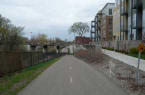
We will design or retrofit trails to provide convenient and barrier-free access to adjacent streets and major destinations. A trail that provides miles but does not connect to its surroundings may provide benefits to people seeking workouts, but it fails in its transportation mission to move people to places. In addition, poor access or visibility to and from surroundings can create public safety problems as well. We must design new trails and retrofit existing trails to provide frequent and comfortable access to wayside destinations and streets, with clear signage that helps orient users to their location.
Create a standards for trails based on industry standards, “Crime Prevention Through Environmental Design” principles, expected use, and surrounding land uses.
Acquire easements in new and existing developments to develop and connect trails.
Establish connections between parks, residential areas, and other points of interest by constructing additional bike routes, trails and pedestrian paths to meet the growing demands for recreation and alternative transportation routes.
Require that new development tie into the park and trail system by providing linkages to existing parks or dedicating new park land. Connect existing parks and neighborhoods to create a continuous system of open spaces, for example along stream corridors.
We will develop and implement a strategic plan for the city’s pedestrian network, building on the foundation of the 2013 Sidewalk Master Plan for MAPS 3. The 2013 Sidewalk Master Plan was a significant step forward, including an analysis of pedestrian demand in different parts of the city. However, its primary purpose was to identify priority projects for a specific sidewalk construction category of MAPS 3. Many of these projects supply new sidewalks along major corridors with high demand, based on a systematic rating system. These are extremely important, but many other problems remain, including:
- Neighborhood sidewalks on local streets that provide access to destinations such as schools and transit stops.
- Barriers to pedestrian travel such as major intersections, long arterial street crossings, and signal timing.
- Relationship of sidewalks to other parts of the active transportation network, including multi-modal streets, bicycle facilities, transit, connections to adjacent development, and trail access.
These issues require an expanded pedestrian system plan that:
- Identifies a Complete Streets Network prioritizing pedestrian corridors that should be developed and funded as part of the city’s transportation program. The MAPS 3 and previous bond issue study provide a starting point for this network.
- Establishes standards for local sidewalk coverage and a process to evaluate pedestrian service on a neighborhood by neighborhood basis. An example of such a standard would be provision of a complete and well-maintained web of sidewalks within a 1/2 mile walking radius of elementary and middle schools.
- Identifies key pedestrian barriers that obstruct access for important user groups, including children and older adults. This effort should include standards and techniques to minimize these barriers.
- Relates other active modes or facilities to the sidewalk network.
- Provides a phased implementation program that may include individual categories of funding, such as neighborhood target areas and major network investments.
Enhance the safety and walkability of the sidewalk network through:
- Establishing a citywide bicycle and pedestrian master plan that includes an inventory of sidewalk locations and conditions, and priorities for enhancement.
- Implementing sidewalk improvements through future bond issues, CIP projects or other sources of funding as prioritized in the citywide bicycle and pedestrian master plan.
- Maintaining currency of the citywide bicycle and pedestrian master plan.
- Explore the feasibility of the City assuming responsibility for sidewalk maintenance.
Establish requirements for providing alternate pedestrian routes when construction activity prohibits use of existing facilities.
We will provide complete sidewalk networks to serve local parks. People within the realistic walking radius (or “walkshed”) of a local park should have pedestrian facilities – sidewalks, paths, or trails – that connect to that park. Creating such a pedestrian web around parks includes:
- Analyzing sidewalk coverage within the walkshed, (½ mile for neighborhood parks and one mile for community parks) for interruptions and barriers.
- Evaluating current park access points and their relationship to the pedestrian system.
- Establishing priority routes to parks and focusing funding on closing gaps and removing barriers, including intersection design issues.
- Providing signage and wayfinding information to direct users to parks destinations.
- Within new developments, require street patterns and pedestrian links that provide direct routes to private parks, school parks, and public trails.
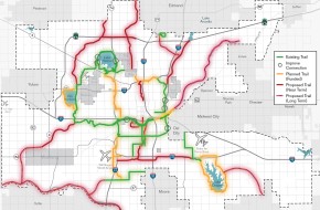
We will complete trails to serve all parts of Oklahoma City to meet the community priority placed on trails and increase access to parks. As discussed in connectokc, trails are both a recreational and transportation resource. The basic trail system identified by the Parks Master Plan included four major phases of trail development:
- The existing trail system.
- Programmed trails, including the MAPS 3 trails and a Katy Trail extension.
- Near-term off-street trails, connecting the trail core to outlying parts of the urban area.
- Long-term off-street trails, extending the city system to the periphery of Oklahoma City.
The programmed system should be completed by 2020, by which time priorities should be set for completion of the longer-term system components. The ability to provide park access should be a strong factor in setting priorities.
Other trail-related actions should include:
- Designating on-street routes that connect neighborhoods to trail access points. These routes should focus on low-volume, direct streets that include continuous sidewalks and pavement markings.
- Requiring developments to dedicate trail segments designated by the trails master plan.
- Enhancing the recreational trail experience with landscaping, fitness facilities, wayfinding signage, rest areas, and other amenities.
We will improve the usefulness of transit as a way of getting to parks. Parks can be hard to serve by transit because they rarely generate the trip volume at specific times that help support service. However, we can take steps that help transit service adapt to park needs. Directions include increasing service on potential high-volume routes that serve major park and recreation facilities, and locating new investments, such as multi-generational centers, on sites with good transit service. We also should be open to transportation solutions other than fixed route transit. Examples are special services or brokering of other transportation providers to serve time specific needs, such as after school service to a major recreation facility.
Modify Subdivision Regulations to require new development adjacent to public trails to provide sufficient connections to the trails.
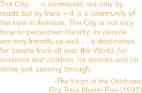
Update, implement, and maintain the currency of the 1997 Oklahoma City Trails Master Plan.
Enhance the safety and walkability of the sidewalk network through:
- Establishing a citywide bicycle and pedestrian master plan that includes an inventory of sidewalk locations and conditions, and priorities for enhancement.
- Implementing sidewalk improvements through future bond issues, CIP projects or other sources of funding as prioritized in the citywide bicycle and pedestrian master plan.
- Maintaining currency of the citywide bicycle and pedestrian master plan.
- Explore the feasibility of the City assuming responsibility for sidewalk maintenance.
Develop a downtown park master plan that identifies the following:
- Opportunities for providing private parks and open space while still maintaining a dense, urban environment (such as vest pocket parks, rooftop gardens, plazas and courtyards);
- Linkages and connections between public and private parks;
- Programming and amenities that complement and support parks in the system; and
- Funding for operations and maintenance.
Ensure all homes are within walking distance of a park based on level of service standards for each urban land use typology by updating codes and regulations for new construction and by improving connections and access between existing parks and neighborhoods.
Acquire easements in new and existing developments to develop and connect trails.
Establish connections between parks, residential areas, and other points of interest by constructing additional bike routes, trails and pedestrian paths to meet the growing demands for recreation and alternative transportation routes.
Require that new development tie into the park and trail system by providing linkages to existing parks or dedicating new park land. Connect existing parks and neighborhoods to create a continuous system of open spaces, for example along stream corridors.
Prioritize capital improvement to construct linkages and connections from the existing urban parks and open space system to neighborhoods, commercial areas, employment centers, and community facilities.
Adopt subdivision regulations that ensure new neighborhoods meet the basic needs of residents while supporting an efficient development pattern. Regulations should cover:
- Open space (passive and active),
- Demonstration of sustainable funding levels for common area and facility maintenance costs,
- Walkability and bikeability,
- Internal and external street connectivity,
- Block length,
- Integration of uses,
- Integration of a variety of home sizes,
- Integration of a variety of unit types, and
- Preservation of Environmentally Sensitive Areas.
Regulations could be based on a point scale to allow flexibility, while still requiring basic minimum thresholds be met.
New regulations should remove the existing requirement for development in Rural LUTAs to connect to water and sewer systems and establish a minimum one-acre lot size for lots with on-site sewer treatment.
We will develop and implement new land development regulations that support the Land Use Typology Area system of integrated uses and greater flexibility and efficiency. Our current development ordinances date from a time when we valued low density and separation of different land uses higher than city life. The fact that low density increases the cost of services and infrastructure gives us pause. That, combined with our successes at building places that people want to experience has moved us in new directions. The zoning code, which divides the city into 26 single-use “base” districts, 7 special districts, and 16 overlay districts, discourages the trends toward new development forms. We must modernize these codes to implement the LUTA concept and provide both the flexibility and protection that benefit contemporary developers and their neighbors alike.
Despite its large number of specific districts, our zoning ordinance does not provide adequate protections for neighborhoods or guarantees to approving agencies on actual performance or design of projects. This forces the Planning Commission and City Council to use Planned Unit Developments (PUDs), tying developers to a specific project and building design. PUDs are actually intended for a different purpose – to encourage innovative, comprehensively planned developments– and are overly rigid when applied to more routine projects.
Revisions to Oklahoma City’s land development regulations could move in several directions, from modifying existing zoning districts with new performance and design standards to establishing a new structure that uses the Land Use Typology Areas as the basic development districts for the city. The LUTAs, as presented in Chapter Two, permit a variety of uses, but establish permitted ranges of development intensity. The LUTA system achieves compatibility between different types or intensities of uses by implementing performance standards, design guidelines, and transitional methods. These techniques give specific and predictable guidance to builders and developers, and address such areas as operating effects, traffic, parking, design, scale, and safety, avoiding the unnecessary overuse of PUDs. A LUTA-based system would incorporate the criteria for locations and supporting transportation and infrastructure established by this plan for individual land uses.
We will execute a smooth transition between the existing zoning code and new land development ordinances. Development ordinances are complicated and difficult to change because people have become accustomed to them, rough spots and all. Migrating to an alternative concept will take time and care. In the meantime, the City will evaluate using a hybrid approach, mixing the existing zoning districts with the LUTA/mixed use concept. One way of accomplishing this is to group the zoning districts that are consistent with the intensity and use ranges of LUTAs, and apply compatibility policies and design standards to developments within them. The existing zoning ordinance could then be modified to include these compatibility standards. New rezoning requests would be evaluated for consistency with the LUTA in which they are located. If the new project is adjacent to a different land use, the compatibility policies and standards would apply to the design of that project.
Coordinate the design, development, expansion, and/or investment in transportation projects with the Land Use Typology map.
Require the construction of new streets, streetscapes, and street widening projects to implement the design components of the assigned street typologies established in this plan.
Revise Subdivision Regulations and development standards to reflect the street typology standards.
Routinely assess the City’s development standards, design guidelines, and development review procedures to ensure that they reflect current trends in best-practice and allow for innovative design techniques and evolving methods in low-impact development.
Enhance existing development standards and establish design guidelines for areas outside of the City’s existing Design Review Overlay Districts. Development standards and design guidelines could include the following provisions:
- Minimize views and prominence of parking lots in relation to structures on a site.
- Sense of proportion (street width to building height, human scale)
- Pedestrian orientation of structures and architectural detailing/fenestration
- Terminated vistas
- Reduce the predominance of residential garages in the design of the front facades of single-family residences.
- Inclusion of front porches into the design of residential structures.
- Internal orientation of parking facilities and garages in multi-family developments.
- Improved pedestrian safety and enhanced pedestrian access through parking lots.
Reuse brownfield, greyfield, and other vacant building sites to provide new opportunities for mixed-used and mixed-income housing.
Catalyze the rehabilitation of abandoned structures by amending codes to facilitate the adaptive reuse of existing buildings for residential use.
Develop a City program to rehabilitate or redevelop dilapidated properties, including a land bank to receive donated properties from property owners who can no longer maintain their properties.
Create regulations/standards/guidelines that focus on design and/or compatibility principles which are sensitive to the surrounding urban form, especially in areas that are stable or improving and whose character is well-established. These provisions should also help ensure compatibility between lower- and higher- intensity land uses.
Add legislative priorities for state laws to:
- Strengthen the City’s ability to obtain specific performance of property owners cited for code violations.
- Speed up the demolition process for long-time boarded properties that cannot be rehabilitated.
- Strengthen the City’s ability to require property owners to rehabilitate or sell neglected, boarded-up properties.
- Expedite the clearing of properties involved in probate.
Ensure that safety is factored into the design of neighborhoods through the following policies:
- Incorporate development standards and guidelines into the Subdivision Regulations that integrate the principles of Crime Prevention Through Environmental Design (CPTED) and increase safety and social interaction.
- Create a pre-development checklist with criteria to evaluate how safety is designed into a project.
- Establish a pre-development process wherein safety is considered in the design of projects.
- Involve the Fire and Police Departments in reviewing proposed development and redevelopment to provide input on any safety-related design concerns.
Adopt new citywide site design and building regulations that ensure new developments meet basic functional and aesthetic minimums related to:
- Walkability and bike-ability
- Internal and external street connectivity
- Integration of uses
- Signage
- Building location
- Building appearance
- Open space (passive and active)
Encourage the integration and mixing of land uses in urban areas.
Mitigate negative impacts of compactness by:
- Updating nuisance code to better address noise, smell, vibration, property maintenance, panhandling, animal control, delivery hours limits, and other possible negative effects.
- Updating the sign ordinance to reduce visual clutter.
In order to promote compatibility between different uses, establish standards and guidelines that ensure all developments are pedestrian-friendly and human scale at street frontages and property lines.
Prioritize and concentrate development where facilities, infrastructure, and services have capacity and in areas where the Police and Fire Departments are best able to respond. Guide the location and timing of development through the proactive and strategic installation of infrastructure.
Encourage the integration of different land uses in urban areas through the following means:
- Promote the use of performance standards in place of existing zoning methods (which address incompatibility by separating uses). Performance-based regulations should focus on achieving compatibility between uses by addressing the following:
- Noise, odors and air quality
- Traffic and parking (allow flexible, but sufficient parking)
- Site layout and building design
- Waste
- Safety
- Lighting (glare control, placement, and shielding)
- Delivery hours
- Enhance transit service (bus and rail).
- Prevent large areas of concentration of any particular land use such as multi-family or commercial.
Ensure the ongoing compatibility and appropriateness of development in Planned Unit Developments (PUDs) and Simplified Planned Unit Developments (SPUDs) by:
- Exploring the establishment of expiration dates for PUDs and SPUDs that have not been initiated after a certain period of time;
- Establish a procedure to ensure PUDs build-out according to approved plans.
Enable increased densities as appropriate to individual land use typology areas by addressing financial incentives and disincentives through evaluating the feasibility of strategies such as:
- Impact fees and/or transportation utility fees that vary by district according to actual cost;
- Assessing solid waste charges according to actual cost;
- Private solid waste services where it is impractical for the City to provide service such as in rural areas.
Encourage unified planning for all adjoining land owned or controlled by a project’s developer to ensure proper circulation and land use relationships.
Evaluate existing regulations for effectiveness in promoting density and mixed-use development and in addressing surface parking. Develop a new urban design code for downtown and other key districts to promote healthy mixes of land uses that are compatible and complementary.
Adopt subdivision regulations that ensure new neighborhoods meet the basic needs of residents while supporting an efficient development pattern. Regulations should cover:
- Open space (passive and active),
- Demonstration of sustainable funding levels for common area and facility maintenance costs,
- Walkability and bikeability,
- Internal and external street connectivity,
- Block length,
- Integration of uses,
- Integration of a variety of home sizes,
- Integration of a variety of unit types, and
- Preservation of Environmentally Sensitive Areas.
Regulations could be based on a point scale to allow flexibility, while still requiring basic minimum thresholds be met.
New regulations should remove the existing requirement for development in Rural LUTAs to connect to water and sewer systems and establish a minimum one-acre lot size for lots with on-site sewer treatment.
Revise subdivision and zoning regulations to allow increased densities as appropriate. For example, density potential could be increased by allowing “cottage” or “pocket” neighborhoods and accessory dwelling units (additional dwelling units allowed on owner-occupied properties) where appropriate.
Public and private parks are designed to achieve optimum safety, accessibility, and attractiveness while reflecting the character of the surrounding community.
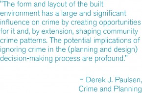
We will incorporate design and maintenance practices to create safer environments in both established and new neighborhoods. Addressing the impact of the neighborhood environment on public safety will follow two tracks: 1) reviewing new projects (including subdivisions and major new developments) and incorporating safe environmental design standards into their design, and 2) auditing existing neighborhoods for unsafe conditions and correcting problem areas.
Safety evaluation of new projects will start with developing design standards and guidelines, using the principles of Crime Prevention Through Environmental Design as a starting point. Our public safety departments should develop specific areas of expertise in these principles and be fully integrated into the City’s project review and approval process.
Established neighborhoods present different challenges. Partnerships between City staff and community organizations will analyze the neighborhood environment and local crime patterns to identify and correct specific problems. The most common issues include overgrown lots, hidden spaces, and vacant and deteriorated buildings. We must be aggressive in such areas as vegetation control and demolition of buildings beyond feasible repair.
Response times when emergencies occur are also an important factor in the interaction between public safety and environmental design. Neighborhood designs should increase the efficiency of public safety operations and ensure that the greatest number of residents can be reached in the shortest amount of time by emergency responders. This should include strategic improvements in existing neighborhoods and efficient design in new neighborhoods.
Systematic evaluation and correction of design aspects of new projects and inherently unsafe environments in established areas will be necessary to ensure a safe environment for all residents of Oklahoma City.
We will correct unsafe building elements and design conditions in public facilities and outdoor spaces. The City should lead in providing safe and secure facilities and properties. This is especially important in distressed neighborhoods, where a public park or center may be seen as a refuge. All publicly accessed properties should be assessed for unsafe conditions, including but not limited to poor lighting, blind spots, and maintenance hazards. Once this inventory has been completed, priorities for repair should be set and incorporated into the capital program.
Graffiti and vandalism in public areas are special and persistent problems. Uncorrected incidents suggest neglect in a neighborhood, which in turn encourages both more vandalism and serious criminal activity. Graffiti can be controlled through an aggressive removal policy, best accomplished in partnership with neighborhood residents. Cooperative action for productive purposes has the secondary benefit of building a sense of neighborhood effectiveness and establishing credibility for improvement efforts all of which help reconstruct the social fabric.
Improve the functionality and efficiency of the street network by:
- Providing direct connections from residential developments to nearby places and to each other.
- Providing street and sidewalk stubs to adjacent vacant land in anticipation of future development.
- Connecting new development to existing street and sidewalk stubs, and to existing trail, open space, and bicycle networks.
- Reducing block sizes and use of dead-end streets.
- Maintaining the existing street grid to preserve connectivity and mobility options.
Revise subdivision regulations to include connectivity standards and guidelines that require greater street connectivity, and provide allowances for pedestrian and bicycle connections when street connectivity cannot be made.
Establish a process for existing neighborhoods to request traffic calming, including how to evaluate the request, select the appropriate type of calming treatment, and fund recommendations.
Require sidewalks on both sides of all streets in urban LUTAs and in the Rural Residential LUTA for subdivisions with densities greater than 1 unit per acre.
Reverse the detrimental impact of vacant and abandoned buildings through the following efforts:
- Develop an Abandoned Buildings program geared toward a significant reduction in vacancies by creating incentives and/or penalties that discourage prolonged building abandonment and help the City to recoup the costs associated with vacated buildings. Use fees generated by this program to help fund redevelopment of abandoned buildings.
- Assess the feasibility of potential reuse options for dilapidated or abandoned buildings. Define and establish criteria to help identify buildings that are too far gone and/or too costly to feasibly rehabilitate, and consider a coordinated demolition program for those buildings.
- Seek changes in state legislation to enhance the City’s ability to maintain and improve its neighborhoods including:
- Laws which would speed up the demolition process for long-term dilapidated or abandoned properties that cannot be rehabilitated, and
- Laws which would strengthen the City’s ability to require property owners to rehabilitate or sell neglected, boarded-up properties.
Target specific areas of the city for enhanced safety and proactive enforcement. Selection of target areas will be informed by the Intelligence Led Policing program, with coordinated involvement from Police, Code Enforcement, Public Works Department, Planning, and community-based organizations.
Create regulations/standards/guidelines that focus on design and/or compatibility principles which are sensitive to the surrounding urban form, especially in areas that are stable or improving and whose character is well-established. These provisions should also help ensure compatibility between lower- and higher- intensity land uses.
Improve parking provisions in neighborhoods that are near vibrant commercial corridors/areas by improving parking and corridor design, non-vehicular networks, transit, and signage.
Establish a Crime-Free Multifamily Housing Program designed to keep multifamily housing developments safe from crime and perceptions of crime by:
- Supporting partnerships between the police, property managers, property owners, and tenants.
- Providing training to managers and owners about screening applicants, fire safety, fair housing, and other components of ‘active property management’.
- Providing a security assessment based on Crime Prevention Through Environmental Design (CPTED) principles.
- Conducting safety meetings with residents/tenants.
Ensure that safety is factored into the design of neighborhoods through the following policies:
- Incorporate development standards and guidelines into the Subdivision Regulations that integrate the principles of Crime Prevention Through Environmental Design (CPTED) and increase safety and social interaction.
- Create a pre-development checklist with criteria to evaluate how safety is designed into a project.
- Establish a pre-development process wherein safety is considered in the design of projects.
- Involve the Fire and Police Departments in reviewing proposed development and redevelopment to provide input on any safety-related design concerns.
Evaluate public facilities and public property for unsafe conditions such as poor lighting (quality and quantity); blind spots; poor maintenance conditions; and other unsafe conditions. Prioritize improvements to these facilities and properties based on the following criteria: a) Proximity and condition of nearby neighborhoods; and b) Cost/benefit associated with mitigating the unsafe condition and maintaining the improvement.
Establish criteria for locating, designing, and improving public and private parks to enhance safety and security, including:
Locating new parks in areas that are highly visible and accessible from surrounding residential streets and utilize trails to increase activity and visibility in parks.
Utilizing Crime Prevention Through Environmental Design principles, which includes controlled access, visibility, lighting, etc. for new parks and retrofitting/redesign of existing parks.
Improve safety of users of the parks and trails system by:
- Providing good lighting, emergency call boxes, and regular police patrols along the trail system.
- Providing shelter structures along the trail networks and determining the appropriate spacing for such structures. Structures could be relatively small to keep costs down but should be sturdy and easy to maintain.
Utilize existing natural streams as amenities in public parks, and regularly monitor and maintain stream banks for safety of park users.
Revise subdivision regulations to require development adjacent to parks and public open spaces to maintain open sight lines to parks and public open space. Reduce/limit residential rear yards, fences, walls, and physical and visual enclosures around park and public open space perimeters. Encourage designs that allow homes to face into parks or where side yards are located near parks.
Incorporate Crime Prevention Through Environmental Design (CPTED) principles into city-wide design standards for development and redevelopment of public and private projects. CPTED principles include: 1) Territorially – physically define spaces as public or private and the appropriate use is obvious even to outside observers; 2) Access Control – deny access to soft targets; 3) Natural Surveillance – make it easy to observe all users of/in a particular territory/space; 4) Maintenance and Management – ensure equipment is functioning (lights, gates, etc.), landscape is kept neat especially to preserve surveillance.
Maximize fire safety through actions such as:
Modifying regulations and guidelines to prevent subdivisions with a single point of access – except those with fewer than 10 homes.
Developing a vegetation management program targeting the wildland/urban interface, including rights-of-way in rural areas, and incorporating recommendations from the National Fire Protection Association’s Firewise Communities initiative.
Requiring residential sprinklers for developments located in Rural Land Use Typologies.
Requiring exceptional, effective, and easy access to sites augmented by a thorough system of connections within and between developments.
Evaluate development proposals to assess design components that contribute to or detract from safety and analyze emergency response capacity and capability.
Ensure resources and funds remain dedicated to crime prevention programs, including but not limited to: block watches; graffiti removal; education and outreach associated with elder fraud, identity theft, and sexual predators; safe driver programs for automobiles, motorcycles, and bicycles; after-school and youth diversion programs that provide recreational and educational support (tutoring, homework help, etc.); and other crime prevention programs. Ensure planokc is maintained to support and reflect the City’s priorities to provide a safe and secure community.
Reinforce existing partnerships and create new partnerships with allied agencies and non-profits to intervene early and often with at-risk youth redirecting them from participation in criminal activities to educational opportunities, job training, community service projects, neighborhood and business improvement programs, and other community building projects and/or programs.
Adopt design standards to enable emergency management resources to be highly effective, such as resilient buildings, interconnected transportation networks, and other design considerations that help ensure community safety and recovery.
Reduce crime and improve feelings of safety through long term efforts such as:
- Improving design regulations to maximize crime prevention through appropriate urban design,
- Developing community-based activities, programs, and facilities that reduce crime and develop life skills, such as after school and youth diversion programs and facilities for recreation and educational support (e.g., tutoring, homework help, etc.),
- Encouraging more compact development to increase effectiveness of individual officers by ensuring less travel time and more engagement,
- Implementing a “good landlord” program,
- Exploring enhancements to police operations such as:
- Committing to a certain number of officers per capita and/or per square mile of urbanized area,
- Increasing patrols (automobile, bicycle, or on foot) in targeted areas,
- Evaluating needs on a regular basis for increasing the number of key positions, such as detectives, to meet demands,
- Coordinating neighborhood improvement efforts (such as the Strong Neighborhoods Initiative and the Vacant and Abandoned Buildings program) with policing efforts, and
- Supporting efforts to obtain more effective criminal justice law, such as stricter gang laws.
Catalyze infill development on vacant, underutilized, and brownfield sites in urbanized areas by:
- Investing in infrastructure improvements;
- Improving multi-modal transportation networks;
- Improving parks and open spaces;
- Improving schools and other civic resources;
- Exploring innovative methods such as:
- A public-private partnership to purchase problem properties in target areas and build or rehabilitate homes while improving infrastructure and amenities
- An infill house plan program similar to Sacramento or Milwaukee
- Identifying and removing barriers to rehabilitation and/or replacement of residential buildings.
- Establishing a position in the City to facilitate medium- and large-scale redevelopment projects through the development process by guiding interactions with City departments, allied agencies, and utility companies.
Encourage the adaptive reuse of underutilized structures and the revitalization of older, economically distressed neighborhoods.
We will continue and expand our program to locate, plan, and build our parks for safety. When new parks are developed, their initial planning should include an assessment of security needs. Locations should have good street exposure and visibility. Park design and programming should be guided by the Crime Prevention through Environmental Design principles, which uses design to maximize public safety.
Create a standards for trails based on industry standards, “Crime Prevention Through Environmental Design” principles, expected use, and surrounding land uses.
Target specific areas of the city for enhanced safety and proactive enforcement. Selection of target areas will be informed by the Intelligence Led Policing program, with coordinated involvement from Police, Code Enforcement, Public Works Department, Planning, and community-based organizations.
Evaluate public facilities and public property for unsafe conditions such as poor lighting (quality and quantity); blind spots; poor maintenance conditions; and other unsafe conditions. Prioritize improvements to these facilities and properties based on the following criteria: a) Proximity and condition of nearby neighborhoods; and b) Cost/benefit associated with mitigating the unsafe condition and maintaining the improvement.
Establish criteria for locating, designing, and improving public and private parks to enhance safety and security, including:
Locating new parks in areas that are highly visible and accessible from surrounding residential streets and utilize trails to increase activity and visibility in parks.
Utilizing Crime Prevention Through Environmental Design principles, which includes controlled access, visibility, lighting, etc. for new parks and retrofitting/redesign of existing parks.
Improve safety of users of the parks and trails system by:
- Providing good lighting, emergency call boxes, and regular police patrols along the trail system.
- Providing shelter structures along the trail networks and determining the appropriate spacing for such structures. Structures could be relatively small to keep costs down but should be sturdy and easy to maintain.
Utilize existing natural streams as amenities in public parks, and regularly monitor and maintain stream banks for safety of park users.
Protect the health of park visitors by utilizing the most environmentally friendly least toxic means available of reducing weeds and other pests to acceptable levels.
Revise subdivision regulations to require development adjacent to parks and public open spaces to maintain open sight lines to parks and public open space. Reduce/limit residential rear yards, fences, walls, and physical and visual enclosures around park and public open space perimeters. Encourage designs that allow homes to face into parks or where side yards are located near parks.
Incorporate Crime Prevention Through Environmental Design (CPTED) principles into city-wide design standards for development and redevelopment of public and private projects. CPTED principles include: 1) Territorially – physically define spaces as public or private and the appropriate use is obvious even to outside observers; 2) Access Control – deny access to soft targets; 3) Natural Surveillance – make it easy to observe all users of/in a particular territory/space; 4) Maintenance and Management – ensure equipment is functioning (lights, gates, etc.), landscape is kept neat especially to preserve surveillance.
Ensure resources and funds remain dedicated to crime prevention programs, including but not limited to: block watches; graffiti removal; education and outreach associated with elder fraud, identity theft, and sexual predators; safe driver programs for automobiles, motorcycles, and bicycles; after-school and youth diversion programs that provide recreational and educational support (tutoring, homework help, etc.); and other crime prevention programs. Ensure planokc is maintained to support and reflect the City’s priorities to provide a safe and secure community.
We will use design features and materials that are attractive, economical, and sustainable in the long run, and recognize that parks are a canvas for human activity. Ultimately, parks are for and about their users and, except in rare circumstances, are brought to life by the people and the activities within them. Therefore, park design should maintain the flexibility to adapt and change – to be places for play, exploration, gardens, art, thinking, running, informal games, room for creativity and improvisation – without getting in the way of their users. And, as they change, they should use materials that work well and remain sustainable for the long run. For example, native plant materials may require some time and care to become established, but will save money and create more attractive and hardy landscapes over the long haul. Good and flexible design, public safety, social space, and environmental quality should converge as we rehabilitate existing parks and contemplate new ones.
Using performance standards related to flow quantity, quality, and pattern, modify development regulations, codes, and policies to support the use of green infrastructure/low impact development techniques to mimic natural systems for developments within aquifer recharge zones with moderate or high vulnerability or in areas where streams and riparian areas have been channelized or developed (primarily in the Downtown, UH, and UM LUTAs). Low impact development techniques include but are not limited to:
- Onsite treating or filtering of stormwater contaminants.
- Discharging run-off as sheet-flow after passing through grassy or vegetated open space areas, rather than discharging run-off through concentrated outfalls.
- Creating attractive open space amenities that double as stormwater detention, retention, and / or filtering systems.
- Utilizing pervious pavement, pavers, or asphalt in appropriate locations (i.e. sidewalks, parking spaces, trails, patios, etc.).
- Utilizing planters (at grade or raised), vegetated landscape strips adjacent to roads and parking areas, and alternative curbing designs (allowing stormwater to easily move from impervious areas to pervious areas), to encourage stormwater infiltration and temporary detention.
- Rain Gardens
- Bioswales
- Green streets and alleys
- Green roofs
- Rooftop collection
- Underground detention
- Increased tree canopy preservation/tree planting
- Land/open space conservation
- Cluster development
Establish development regulations to help protect Oklahoma City’s water resources through standards that:
- Require buffers, setbacks, and vegetation conservation requirements to protect riparian and littoral zones and filter waterborne pollutants from development activities and storm water runoff. Buffer widths should be based on water quality function and wildlife habitat needs.
- Encourage natural drainage systems and methods for onsite infiltration and onsite sediment retention.
- Require new developments to maintain or decrease the site’s pre-development runoff rate.
- Allow low-impact development design features such as pervious pavement, rain gardens, landscaped parkways, and alternative curbing designs.
- Reduce the amount of impervious surfaces allowed in buffer zones around Environmentally Sensitive Areas.
- Restore watershed features such as forest, wetlands, and natural stream channels.
Revise the landscape ordinance to include the following:
- Define terms such as invasive species, exotic/non-native species, and native/indigenous species
- Require removal of invasive species from existing sites, and prohibit such species from being planted or maintained in new development.
- Provide a reference list of native plants and drought-tolerant plants.
- Provide incentives for using native and drought-tolerant plants and disincentives for using high-water plants and turf grass.
- Establish requirements for using design practices that minimize the need for supplemental irrigation.
Enhance the City’s ability to improve the appearance of existing parks through the following:
- Targeted cleanup and beautification program;
- Seek sponsors to donate funds to improve park signage and lighting;
- Litter and graffiti abatement program.
Enhance public park design standards to allow for public art and innovative design solutions regarding stormwater management, use of native vegetation, open space, and play areas.
Explore the use of artificial turf, alternative materials and or other types of ground covers that do not require heavy maintenance or frequent mowing.
Replace existing high-maintenance, high-water plant material with attractive native plants.
Study the feasibility of allowing community gardens in some park areas and create a community garden pilot program.
Utilize existing natural streams as amenities in public parks, and regularly monitor and maintain stream banks for safety of park users.
Protect the health of park visitors by utilizing the most environmentally friendly least toxic means available of reducing weeds and other pests to acceptable levels.
We will incorporate crime prevention principles into the City’s design regulations and guidelines. Previous elements of the plan, including playokc and liveokc, introduced the concept of Crime Prevention Through Environmental Design principles (CPTED), which use common-sense design features to minimize opportunities for criminal activity. CPTED principles apply on a wide range of scales, from individual site vegetation choices to citywide development patterns.
Oklahoma City should incorporate CPTED principles into its design standards for development and redevelopment of public and private projects. Some cities (including Wichita, Kansas) have established ordinances that officially integrate CPTED principles into their design standards, while others use them as guidelines and adapt for their own use.
The City can encourage the use of CPTED principles through:
- Encouraging land use planning that mixes uses and extends hours of activity and “eyes on the street.”
- Establishing neighborhood territoriality by which adjacent residents and businesses can monitor activity in the public realm. a mixture of uses in neighborhoods.
- Lighting and building design guidelines.
- Landscaping guidelines that avoid hidden places.
- Building code enforcement and resolution and elimination of chronic vacancy and structural deterioration.
The City’s project review and approval process should include Police Department participation to provide specific public safety recommendations. The department should maintain an officer on staff with a specialty in CPTED and its principles. This staff member should also provide outreach to the development community to provide special training to builders, developers, and design professionals on safe community design.
Create a standards for trails based on industry standards, “Crime Prevention Through Environmental Design” principles, expected use, and surrounding land uses.
Establish access management requirements that limit driveways on arterials and collectors and increase connections between uses to improve safety and traffic efficiency.
Limit driveways on arterials and collectors and increase connections between uses to improve safety and traffic efficiency.
Ensure proper access to and between subdivisions in order to offer a choice in routes for residents, multiple access points for emergency responders, and to reduce vehicle congestion at arterial intersections. Contiguous developments should share access whenever feasible.
Establish a process for existing neighborhoods to request traffic calming, including how to evaluate the request, select the appropriate type of calming treatment, and fund recommendations.
Require sidewalks on both sides of all streets in urban LUTAs and in the Rural Residential LUTA for subdivisions with densities greater than 1 unit per acre.
Target specific areas of the city for enhanced safety and proactive enforcement. Selection of target areas will be informed by the Intelligence Led Policing program, with coordinated involvement from Police, Code Enforcement, Public Works Department, Planning, and community-based organizations.
Establish a Crime-Free Multifamily Housing Program designed to keep multifamily housing developments safe from crime and perceptions of crime by:
- Supporting partnerships between the police, property managers, property owners, and tenants.
- Providing training to managers and owners about screening applicants, fire safety, fair housing, and other components of ‘active property management’.
- Providing a security assessment based on Crime Prevention Through Environmental Design (CPTED) principles.
- Conducting safety meetings with residents/tenants.
Ensure that safety is factored into the design of neighborhoods through the following policies:
- Incorporate development standards and guidelines into the Subdivision Regulations that integrate the principles of Crime Prevention Through Environmental Design (CPTED) and increase safety and social interaction.
- Create a pre-development checklist with criteria to evaluate how safety is designed into a project.
- Establish a pre-development process wherein safety is considered in the design of projects.
- Involve the Fire and Police Departments in reviewing proposed development and redevelopment to provide input on any safety-related design concerns.
Establish criteria for locating, designing, and improving public and private parks to enhance safety and security, including:
Locating new parks in areas that are highly visible and accessible from surrounding residential streets and utilize trails to increase activity and visibility in parks.
Utilizing Crime Prevention Through Environmental Design principles, which includes controlled access, visibility, lighting, etc. for new parks and retrofitting/redesign of existing parks.
Improve safety of users of the parks and trails system by:
- Providing good lighting, emergency call boxes, and regular police patrols along the trail system.
- Providing shelter structures along the trail networks and determining the appropriate spacing for such structures. Structures could be relatively small to keep costs down but should be sturdy and easy to maintain.
Incorporate Crime Prevention Through Environmental Design (CPTED) principles into city-wide design standards for development and redevelopment of public and private projects. CPTED principles include: 1) Territorially – physically define spaces as public or private and the appropriate use is obvious even to outside observers; 2) Access Control – deny access to soft targets; 3) Natural Surveillance – make it easy to observe all users of/in a particular territory/space; 4) Maintenance and Management – ensure equipment is functioning (lights, gates, etc.), landscape is kept neat especially to preserve surveillance.
Maximize fire safety through actions such as:
Modifying regulations and guidelines to prevent subdivisions with a single point of access – except those with fewer than 10 homes.
Developing a vegetation management program targeting the wildland/urban interface, including rights-of-way in rural areas, and incorporating recommendations from the National Fire Protection Association’s Firewise Communities initiative.
Requiring residential sprinklers for developments located in Rural Land Use Typologies.
Requiring exceptional, effective, and easy access to sites augmented by a thorough system of connections within and between developments.
Evaluate development proposals to assess design components that contribute to or detract from safety and analyze emergency response capacity and capability.
Ensure that planokc is periodically updated to coordinate/correspond with the City’s Emergency Operation Plan and vice versa.
Adopt design standards to enable emergency management resources to be highly effective, such as resilient buildings, interconnected transportation networks, and other design considerations that help ensure community safety and recovery.
Encourage the integration and mixing of land uses in urban areas.
In order to promote compatibility between different uses, establish standards and guidelines that ensure all developments are pedestrian-friendly and human scale at street frontages and property lines.
Oklahoma City's park system provides multiple opportunities for people to enjoy a healthy lifestyle.
We will maintain park assets to be consistent with community needs and constituencies, while maintaining the flexibility to adapt to future demographic changes. The City should develop and implement a program to evaluate, improve, and sometimes replace park facilities to fit the needs of nearby the residents. This program will evaluate each park in the system for its ability to serve its constituency and set priorities for deficiencies. When neighborhoods change so that parks no longer meet their needs, the park should be replanned or put to a more appropriate use, possibly through redevelopment. Park master plans with phased implementation programs will be developed in partnership with neighborhoods in their service areas.
We will develop and implement a plan for recreational services and programs tailored to community needs. Park assets are only a part of the story. Park programming, the activities that actually take place within these assets, should also respond to community needs. Meeting the twin objectives of maximizing efficiency and service requires a program that identifies and strengthens core focuses for recreation efforts. Programs should include an emphasis on health and wellness. Recreational offerings should include close partnership and coordination with schools, health care providers, and other organizations.
Determine whether existing parks and facilities are serving the specific needs of the community within the park’s service area. If the area has transitioned and the park no longer serves the needs of the surrounding community, either reprogram the park, declare park surplus, or seek redevelopment to a more fitting use.
Coordinate planning efforts with school districts to attempt concurrent land purchases for schools and parks.
Coordinate with school districts, local healthcare providers, and other community organizations to provide recreational programming not offered in nearby public parks or recreation centers, such as after-school fitness and education programs.
Prioritize capital improvement for parks that serve areas where populations are projected to increase.
Continue to create and enhance “big league city” amenities such as parks, public spaces, roadways, transit, cultural and recreational facilities, special districts, and gateways. Two specific possibilities for amenity enhancement include:
- Explore the feasibility of City-supported, high-quality landscaping along key transportation corridors as a means of enhancing the city’s appearance, image, and sense of place.
- Create gateways using public art features.
We will develop larger multi-generational community/recreation centers with good access to replace the current model of smaller centers in community parks. The community survey demonstrated a strong demand for indoor facilities that emphasize health and wellness, as well as other activities. Until now, the city has employed a model of many small, dispersed centers within community parks. Nationally, these older centers are being replaced by larger, better-equipped multi-generational facilities that offer more variety and quality of programming. These centers combine aquatics centers, adult and senior wellness, health and fitness, and even special event facilities in one package. Where feasible, the transition should make maximum use of existing investments. Sites for facilities should put a very high emphasis on multi-modal access, including pedestrian connections, on-street bicycle routes, multi-purpose trails, and frequent transit service.
Utilize private and public partnerships and determine appropriate locations and funding sources to build larger multi-generational centers that will replace existing, small, and outdated recreation centers.





 Download PDF