Our Situation
Streets and Roadways
The street system is our largest public capital asset, and its maintenance and ability to move people and goods safely and efficiently are fundamental to the city’s health. Planning for the improvement of our streets must consider condition, connectivity, accommodation of different travel modes, access management, and land use context.
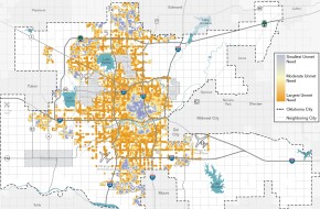
Street condition. Achieving our overall idea of safe and efficient movement for all begins with the street network already in place. In the planokc Citizen Survey, the most frequently mentioned transportation priority was repair and rehabilitation of existing streets. Many street segments, including neighborhood streets, require significant repair or resurfacing.
Connectivity and the traffic network. A lack of secondary streets with good connections inhibits our ability to provide safe and efficient access. Without good neighborhood street links, people making short trips may be forced onto arterials. Mixing local and through traffic adds to congestion and conflicts on our major streets and expressways. We also lack good street connections within many neighborhoods. People like the convenience of cars, but do not like effects like noise, too much traffic, and excessive speeds. So street layouts are often indirect, often use cul-de-sacs, and sometimes have only one way in or out. These designs make responding to emergency responses and providing services harder. We do not design a building with only one exit or with confusing exit routes – we shouldn’t design neighborhoods that way either.
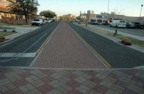
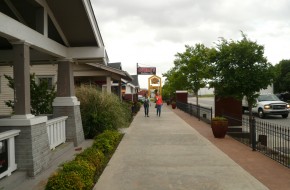
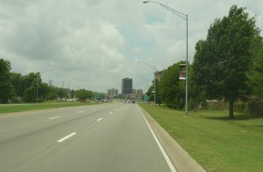
Multi-modal corridors. To meet the mission of moving people, Oklahoma City’s streets should accommodate all the ways that people travel. But too often, our streets only serve cars. This does not mean that every street accommodates every form of transportation. But it does mean that the system should provide safe routes for pedestrians and bicyclists, even if they are on parallel or secondary routes.
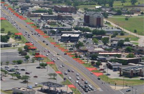
Access management. Streets operate most efficiently when “friction” – conflicts created when decelerating, accelerating, turning, or other interruptions to the flow – are minimized. Major surface streets both serve through traffic and provide local access to businesses, industries, and homes. These needs must be balanced, but when access is unmanaged – too many driveways, curb cuts, or other points of entry or exit – efficiency drops and the probability of crashes increases.
Land use and street capacity. In discussing the concepts of Land Use and Street Typologies, Chapter Two made the point that development should be served by the appropriate type of street. Thus, high intensity development should generally locate on or near high capacity streets, and vice versa. While this seems clear, we have many examples to the contrary, especially on the fringe of the city. This, combined with poor street connectivity and lack of alternative routes, leads to further congestion and possible risks in emergency situations.
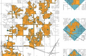
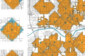
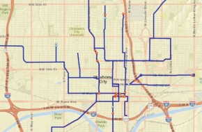
Examples of poor (bottom left) and good (bottom right) street connectivity in Oklahoma City.
The orange area represents one mile traveled from the blue starting point on the existing road network in any direction.
The blue area represents one mile traveled on a perfectly connected road network from the blue point.
While the individual areas in the examples at bottom left offer some connections to the arterials, the lack of internal connections limits the areas accessible in a mile of travel on the street network.
The street systems shown at bottom right offer better connectivity. The area’s accessibility is far greater, dramatically increasing the ability of people to walk and bike to surrounding uses. This also decreases the amount of out-of-direction travel.
Fewer miles driven
Well-connected networked streets provide greater mobility and access. By their very nature, networked streets provide shorter, more direct routes between destinations. This increases the efficiency and reliability of the road network.
Better for Public Safety
Increasing route options reduces emergency response time by allowing emergency vehicles more direct access. And having more route options increase the systems resilience by reduces the risk that an area will become inaccessible if a particular part of the roadway is blocked by a traffic accident or an obstacle such as a fallen tree or power line.
Less congestion
Poorly-networked streets typically concentrate local traffic on a few arterials because there is no other route available—but well-connected street systems encourage area trips to occur on local streets instead of arterials or highways. This preserves capacity on arterials and highways for more regional trips and lessens the need for widening those roads, making more funding available for maintenance of existing streets.
During times of congestion or construction, drivers have more opportunities to switch to different routes and avoid delay. This is especially important for emergency responders as they need the fastest, most direct route to a fire or medical emergency.
Better pedestrian and bicycle access
A connected street system also benefits cyclists and pedestrians. Shorter, more direct trips make alternative modes of travel viable and often, the more desirable choice. This further reduces congestion and has a multitude of public health benefits.
Transit
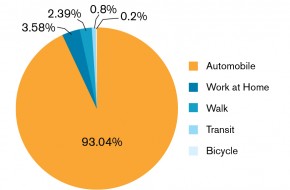
Public transportation, mostly by electric streetcars, was basic to the early growth of Oklahoma City. Streetcar coverage was largely in the area bound by Eastern and Portland Avenues on the east and west, and North 36th to South 29th on the north and south. After 1947, public transportation converted to bus service and the percent of people using transit declined steadily. By 2010, only 0.8% of commuters used transit for travel to work, lowest among the nation’s fifty largest metropolitan areas. However, that long-term trend is beginning to reverse, and the Central Oklahoma Transit and Parking Authority (COTPA), the City agency responsible for public transportation and parking operations, is taking major steps to revitalize transit service.
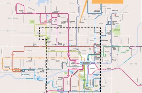
System re-branding and redesign. In April, 2014, Oklahoma City’s transit system rolled out a major re-branding and route reconfiguration, implementing recommendations from the Transit Service Analysis for a streamlined route structure, more direct lines, elimination of non-productive routes, and greater frequency. A modernization of the system brand, now called EMBARK, accompanied these route changes. These changes are also the first step toward accomplishing a key recommendation of the Fixed Guideway Study (FGS) of 2008, which recommended Enhanced Bus service on the basic route network.
Service Hours. Despite system improvements, our transit system shuts down early and does not operate on Sunday, which is unusual for a city our size. This is the result of limited funding, a small fleet, and relatively low rider density. But ridership trends are changing, and are likely to change more with the coming of high density urban developments like in the Core to Shore area. Limited hours also limit access to jobs for off-hour workers, although services other than fixed route buses are often more efficient for these trips.
Geographic Coverage. EMBARK’s service area is spread over 244 square miles, which spreads its small bus fleet over a very large territory. Many parts of the city do not have good transit potential, lacking the density or general preferences necessary to support transit. However, other areas have significant potential, including employment concentrations and urban districts with appeal to both residents and visitors like Will Rogers International Airport, Paseo, Stockyards, Capitol Hill, Asian District, and Stockyards.
Support infrastructure. The weak link in most transit systems is the waiting period at stops or during transfers between routes. Critical elements include shelter from the elements, lighting for security, information about routes and the times of upcoming arrivals, and good pedestrian access to stops. This is especially true in Oklahoma City, where many trips require passengers to use two or even more routes.
New technologies. As of 2014, Oklahoma City’s transit service is provided by fixed route local buses, some rush hour commuter expresses, and supporting paratransit. This will be changing. MAPS 3 includes funding for a modern streetcar to serve Downtown and Midtown. The Fixed Guideway Study proposes Bus Rapid Transit (BRT) service on three major corridors, enhanced bus service on the basic system, and commuter rail on a corridor between Edmond and Norman. A transit hub is also planned at the current Santa Fe station on Gaylord Boulevard. These changes as they occur are certain to change routes, schedules, and the market for public transportation.
Multi-modal access. The “active transportation” umbrella usually includes public transportation because most people have to walk or bike to bus stops or transit centers. A traditional problem for transit has been the trip from home at the beginning of the trip or to the destination at the end. For people walking to stops, the typical service corridor is limited to one-fourth mile on either side of the line. Bicycles can increase this distance, but facilities are needed to encourage their use.
Density. Low density is an issue for many transit systems and is seen as a particular problem in Oklahoma City, with its gross density of only about 1,000 people per square mile. However, it is important to realize that this is an average, and that some areas and corridors have densities that support transit. In addition, the Efficiency Scenario, supported by the community and consumer preferences, and identified by both the Housing and Community Appearance surveys, suggests redevelopment and new growth at higher densities
Transit passengers are likely to see new types of services as EMBARK and other agencies work to increase the importance of transit to the city’s transportation scene.
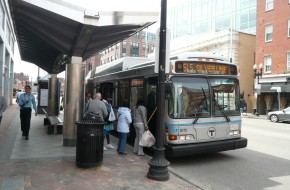
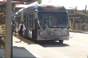
Enhanced bus is a better version of our existing local buses. They may include more shelters, electronic schedule information, fewer stops, and vehicles with amenities. Like current buses, though, they continue to operate in mixed traffic.
Bus rapid transit (BRT) has some of the characteristics of rail vehicles, including greater capacity, low floor loading, and well-spaced stations. They may have their own lanes or even roadways, and offer significantly faster service than conventional buses.
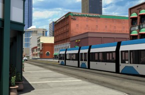
Modern streetcars operate on rails in streets and usually are powered by electricity in overhead wires. The vehicles usually have substantial capacity and low-floor loading, and are being used frequently as circulators in downtown areas.
Commuter rail typically includes cars either self-propelled or pulled in trains by locomotives, and provide fast, peak hour service between suburbs and central cities. Stations are widely spaced.
Bicycle Facilities
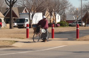
As a means of transportation, the bicycle is highly flexible, uses only the fuel created by its operator, makes little noise, and is capable of moving at traffic speeds in many urban situations.
Lack of continuity. We have made progress toward increasing the role of bicycles in our transportation system. Two examples of this progress are the Katy Trail on the east side and bike lanes on Shartel Avenue. A true network should provide routes that lead without interruption to important destinations. The Shartel bikeway, for example, ends on the north at Interstate 44, forcing cyclists continuing north onto busy arterials.
Coverage. Riding a bike for at least short trips can be an efficient option for most people. Therefore, an effective network should serve every appropriate part of the city. The type of infrastructure will change from one area to another, depending on the density of housing and destinations and the character of the street system.
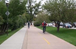
Connections and user comfort and capability. Because most bicycle routes will use streets, good connectivity within and between neighborhoods will also help produce a good bicycle network. Lower-volume streets that lead to destinations are especially important because they provide safe and comfortable routes. When poor street connectivity forces cyclists to busier roads that feel less safe and more stressful, the number of people who consider bicycling for transportation drops. Some experienced cyclists operate confidently in all types of traffic, but many prospective cyclists are much less comfortable. Potential growth for bicycle transportation rests with this “interested but concerned” group, which responds well to facilities like bike lanes, cycle tracks, and well-designed paths that provide greater separation between cars and bikes.
Support facilities. In addition to routes and street adaptation, support facilities are also needed to encourage bicycle transportation. These include convenient bike parking and storage, wayfinding information, and bicycle-sensitive sensors at traffic signals. When these features are lacking, unintended problems occur. For example, bicyclists often respond to a lack of signal detection by going though red lights, which in turn creates bad habits and a poor public perception. Without parking, bicycles are parked in places that can present obstacles to pedestrians and damage to trees and property. On the other hand, providing these features suggests that bicycles belong as an important part of the transportation network.
Safety education. Motorists and bicyclists are too often unaware of their respective legal requirements and responsibilities, and the rules of etiquette in sharing road space. This leads to conflicts and even injury when road rage results. This can be especially true in a city like ours, where bicycling for transportation is still relatively uncommon and some motorists are unaware or even hostile to cyclists.
Trails
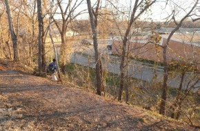
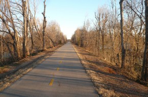
Trails and multi-use paths are important resources for both bicyclists and pedestrians, and serve basic transportation and recreational needs. A major purpose of trails is the provision of access to parks and recreational attractions. Trails fall within the comfort level and capabilities of a wide range of people because of their separation from motor vehicles and easy grades. But they also present challenges.
Disconnected trails. The city has about 70 miles of trail in six major trail corridors: the Oklahoma River, Katy, South Grand, Bert Cooper (Lake Hefner), Hefner-Overholser, and Tinker-Draper Trails, and lakeside trails around Lakes Hefner and at Lake Overholser. MAPS 3 will help link these into a citywide loop by adding the West River Trail, connecting the River Trail and Lake Overholser; linking Lake Hefner with the Riverfront; and a trail around Lake Stanley Draper. Some major trails remain separated from the rest of the network, and local links from on-street routes are missing.
Links to surrounding neighborhoods and destinations. To provide access to destinations, trails should have frequent and convenient links to local streets, adjacent neighborhoods, and logical destinations like schools and shopping. Some of our existing trail corridors have characteristics that make these linkages relatively difficult. These problems include use of former railbeds on elevated embankments (the Katy) or infrequent connections to bridges or neighborhood streets (the Oklahoma River). Ramps and access points along all trails both increase their usefulness and create safer environments for the trail user.
User conflicts. Trails serve a variety of users, including pedestrians (on both two and four legs), bicyclists, and in-line skaters. These user groups operate at different speeds, and sometimes lack consideration for each other. In some cities with heavy user volumes, heavily used trails have been divided into pedestrian and bicycle tracks. At present, this does not seem necessary in Oklahoma City, but better connectedness may generate heavier future use.
Trail design and support facilities. Effective trail design involves much more than a linear path. Because trails are often separated from streets and hidden from casual public view, emergency communications and locators become very important. Trail users need wayfinders, mileage markers, and standardized signage to orient themselves. Intersection design requires careful design consideration, particularly in situations with unusual potential for conflicts like median paths (Grand Boulevard) or sidepaths (wide multi-use paths along streets).
Funding for capital development and maintenance. Trails in Oklahoma City are normally considered to be recreational facilities and compete with parks for scarce maintenance funding. Capital development is also expensive and competes with other priorities for limited local and federal funding.
Sidewalks
Sidewalks are the core of the city’s pedestrian system and serve a variety of functions, including routes to schools and parks, short distance travel within neighborhoods and to convenience services, recreational walking, and trips to one or more destinations after parking or leaving a bus. A web of continuous sidewalks in a neighborhood is necessary to provide full pedestrian mobility, but only some of the city’s areas display this kind of service.
Limited areas of service. Most of Oklahoma City has poor sidewalk coverage or no sidewalks at all. Reasonably good networks occur in the traditional city core and in new neighborhoods where relatively recent subdivision regulations now require sidewalks along streets. But in the intervening period, pedestrian circulation was generally not valued and, in an automobile culture, developers and even the City viewed sidewalks as an unnecessary expense.
Condition. Even where sidewalks are present, data on their condition, safety, and usability are limited. Problems such as deteriorating paving, tree roots, obstructions, and lack of ADA accessible intersection crossings are not well documented, making it difficult to allocate rehabilitation resources efficiently or toward specific priority areas. The MAPS 3 sidewalk master plan has established a system to evaluate sidewalk conditions and set priorities.
Funding. Traditionally, sidewalks were regarded as a benefit to adjacent property owners and their construction is funded by special assessments. Because property owners typically do not want to pay these costs, gaps remain unfilled and sidewalk segments missing or in poor condition. Also, while property owners normally are required to maintain sidewalks, these responsibilities are not clear and rarely enforced.
Barriers to full pedestrian access. When sidewalks do exist, barriers like busy streets, difficult intersections, lack of signals, and freeways can block natural pedestrian routes.
Freight
Issues related to freight movements largely center around rail service and its impact on aspects of the City’s transportation network.
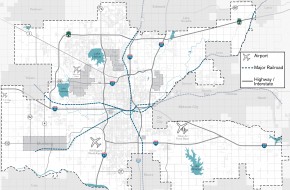
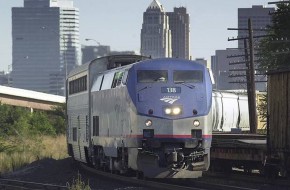
North-south rail volumes. The north-south Burlington Northern Santa Fe main line is the highest volume rail freight corridor through the city, and also is the route of the Heartland Flyer, Amtrak’s only service to Oklahoma City. Increasing freight loads are expected to degrade service by 2035. Maintaining a good service level will require increased capacity along this corridor. In addition, the Fixed Guideway Study identifies the Edmond-Norman north-south corridor as the highest demand corridor for commuter rail, also requiring additional capacity.
Intermodal Facility. Oklahoma City, at the junction of three major interstate highways and the nation’s two largest railroads, presents tremendous potential for an intermodal freight hub. The city lacks a crane equipped facility along a major rail line with close access to the interstate system, and has not identified a potential site for such a facility.
Local impact. While some railroad crossings are grade-separated and allow relatively free flow of local traffic, surface crossings interrupt traffic patterns – a problem likely to grow worse as freight loads increase with more frequent, longer trains. These interruptions also affect neighborhoods by creating noise, safety issues, and presenting barriers between residential areas.






 Download PDF