Goals
The goals below are in the form of statements describing ideal future conditions related to preservation, appearance, and culture that our community has committed to work toward achieving. These goals establish priorities for our city and help community leaders make decisions regarding how our city grows. Clicking on any goal title will reveal the full goal statement and allow viewing of initiatives the City and its partners will undertake to accomplish the goal.
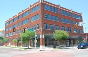
Oklahoma City values its history and protects its cultural and built resources through appropriate rehabilitation and preservation.
We will develop a comprehensive strategy for the identification, retention, preservation, and revitalization of the city’s historic, cultural, and architectural resources. Oklahoma City has nine locally designated historic districts, and four locally designated individual landmarks. Additionally, the city has many other historic and architectural resources, including nearly 100 properties and over two-dozen districts listed on the National Register of Historic Places, and many more potential local or National Register districts and landmarks. We need to improve our understanding of the extent and condition of our existing historic resources and consider the state of current practice and the impact of current development patterns, existing policies, and regulations on those resources. A comprehensive historic preservation plan will identify future preservation and rehabilitation focuses, and establish the basis for new and improved policies, review guidelines, and incentives to conserve our spectrum of historic assets in the built environment.
A historic preservation plan also has another significant function: increasing public awareness and knowledge of preservation and its role in community development. Educational programs should address three objectives:
- Increasing community understanding on the role of preservation and support for specific programs.
- Increasing knowledge and competence of property owners as they work on historic properties.
- Educating owners and developers on the process, potential markets, and available incentives for preservation projects.
We will create targeted incentives for preservation processes, aimed at potential obstacles. The historic preservation plan will recommend new tools to help deliver real projects. Some of these tools may include low-interest or forgivable loans, Tax Increment Financing, historic tax credits, preservation easements (the first of which was recently accepted), and expedited review processes. These strategies should focus on two general areas: financing gaps created by some of the contingencies of historically appropriate preservation and adaptive reuse, and concerns by developers about delays or uncertainties during the project development process.
We will revise and adopt new ordinances that ensure consistency in the review of projects that affect historic properties. All historic preservation programs involve the review of projects. Every case is different, and the review process must deal with difficult issues such as economic feasibility, level of deterioration, impact of change or even loss of a building on a neighborhood. Establishing consistency in this process ensures a strong program.
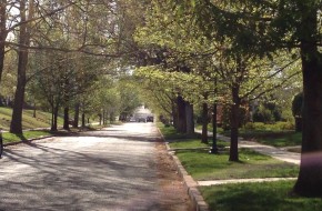
Maintain the traditional grid street pattern where it currently exists, reconnect it where possible, and keep alleys open and functioning. When improving older streets in neighborhoods, maintain original street widths and curb radii.
Maintain historical lot and block sizes where possible and appropriate.
Develop and adopt a city-wide Historic Preservation Plan to comprehensively address the identification, retention, preservation, and revitalization of the City’s historic, cultural, archeological, and architectural resources. The plan could be used to accomplish the following:
- Consolidate existing documentation on the City’s historic resources, including historic surveys, reports and studies, and existing local, state, and national designations in order to identify areas of recognized significance and areas that are under-/undocumented. Use this information to set priorities for additional research.
- Evaluate the impact of current development patterns, existing policies, and regulations on City-wide historic resources, and adopt new policies, guidelines, or ordinance amendments as necessary to address weaknesses, inconsistencies, and regulatory or financial disincentives for preservation.
- Identify buildings, sites, or districts for potential new Historic Preservation and Historic Landmark zoning, Legacy Resource designation, or for eligibility to take advantage of other tools including National Register nomination and related tax credits, preservation easements, and others.
- Develop policies, regulations, and guidelines for a City-wide review of all work impacting historic resources including, but not limited to, treatment of dilapidated or vacant and abandoned buildings, review of demolitions proposed outside of HP/HL designated areas, and review of the impact that new development has on historic resources located outside the City core.
Establish new incentives and raise awareness of existing incentives that stimulate the preservation and rehabilitation of historic resources. Incentives could include:
- Preservation easements, low-interest or forgivable rehabilitation loans, and Tax Increment Financing Districts for historic buildings, sites, and districts.
- Tools and practices for public/private partnerships to ensure the preservation and retention of top-priority historic resources whose deterioration or demolition would present an irreparable and highly significant loss to the City and beyond.
- Existing city, state, and federal tools and incentives for rehabilitation, including state and federal tax credits for certified rehabilitation.
- Expedited review process for projects involving infill sites.
Protect the unique character of National Register-listed properties or districts and local Historic Districts and ensure that development and redevelopment is compatible with historic resources and character.
Revise ordinances for design districts and design review procedures to ensure consistency in the treatment of historic properties, including the assessment of demolition proposals, the identification of historic or significant properties, and the consideration of the impact that the alteration or demolition of individual properties has on the context and continuity of the surrounding environment.
Coordinate with civic and professional organizations and relevant advocacy groups to:
- Develop improved programming and content that educates the public, key professionals, and city leaders about the economic and environmental benefits of historic preservation and adaptive reuse, including facts about retrofitting historic buildings to meet modern living and energy needs, costs of rehabilitation, and ways for older buildings to comply with accessibility and other code requirements.
- Develop resources for owners of historic properties, including hands-on training clinics or demonstration projects, a guidebook providing before-and-after examples of reused buildings in Oklahoma City, outreach and free assistance with the design review process, and a clearinghouse of information and design, labor, and materials resources for preservation, restoration, and revitalization.
Establish policy or adopt ordinance language to ensure that City-owned or controlled historic buildings are appropriately recognized, maintained and repaired, or rehabilitated. Potential methods to be considered could include:
- Attach a preservation restriction or easement to historic properties that are surplused by the City.
- Assess the historic status of City-owned or controlled properties in order to follow through with formal HP/HL zoning, National Register listing, or other historic designation as appropriate.
- Incorporate early and substantive review of city improvement projects to assess potential impacts on historic buildings, and adopt alternatives that minimize or eliminate the impacts when necessary.
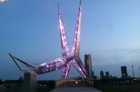
We will develop a Cultural Heritage Plan to preserve and promote heritage, arts, community development, cultural resources and understanding. This plan would be developed cooperatively by cultural groups, artists and institutions, potentially convened by the City. Its intention is not to supersede the planning efforts of any group, but rather to map significant areas, cultural resources, and a series of actions that can bring the arts, culture, and significant natural features closer to the overall community. Its special focuses include increasing linkages and mutual participation between cultural groups, the arts community, and the larger Oklahoma City community. It will reinforce the importance of historic sites and that expression of art that is most accessible to all because it requires no admission – public art.
Ensure that public art is integrated into the planning and implementation for key initiatives such as Core to Shore, Project 180, MAPS 3 and other City projects as well as downtown, neighborhoods, cultural districts, and commercial districts.
Make it easier for arts and cultural projects to navigate the City’s design review, zoning, licensing, and permit processes.
Provide a centralized area(s) for artists to live and work (e.g. Paseo, Film Row) by targeting districts within the city that have become centers for all types (performing, visual, literary, etc.) of art.
Develop and implement a Comprehensive Public Art Master Plan to:
- Establish goals and a framework for the rational development of a public art program for Oklahoma City
- Integrate public art into each of the City’s key development initiatives and community sectors with a plan for both permanent and temporary placement processes that facilitate new public art coordination and investment.
- Create an administrative and financial structure (with roles and responsibilities) to efficiently and effectively facilitate multi-departmental and multi-agency public art partnerships.
- Evaluate the current development/design/art review processes and make recommendations for improved and streamlined public art policies and procedures for both permanent and temporary public art (including murals).
- Involve the community in the process of public art selection to build consensus for the program.
- Include an educational component to reinforce the value of public art in the public realm for all ages and cultures.
- Provide a plan for maintaining the value and physical integrity of the City’s public art collection.
Coordinate efforts to educate the public regarding the location of all public art installations and potential locations for future installations. Such efforts could include:
- Producing educational materials for each newly commissioned work in the City’s Public Art collection and making these available to the publiC.
- Providing educational materials detailing the locations of public art installations, such as walking tour guides, podcasts, physical markers, or web-based maps.
- Developing and adopting a Physical Master Plan to promote public art “districts” for key areas, including the Riverfront, downtown, the airport.
- Establishing a collection management system for public art to catalogue artist, location, condition, value and other details of public interest.
Identify the economic value of cultural resources in attracting tourism and reinvest a share of tourism revenue to sustain and expand these resources.
Explore the implementation of the following efforts to increase the economic impact of cultural activities and arts programs:
- Efforts organized by Oklahoma City Office of Arts and Cultural Affairs:
- Formalize neighborhood-based cultural economic development plans
- Work with groups interested in establishing a vacant storefronts program with artists
- Establish a public art program to include local artists
- Coordinate a master list of artist opportunities
- Convene organizers of events and festivals to share knowledge and resources
- Coordinate use of publicly-owned space for use by artists.
- Efforts coordinated by Cultural Development Corporation of Central OK (CDCOK):
- Clarify roles among arts service entities
- Expand business skills training for artists
- Build capacity among nonprofits for fiscal/project sponsorship
- Strengthen partnerships and engagement with higher education resources
- Provide artist fellowships in partnership with philanthropies
- Evolve CDCOK into an economic development entity
- Efforts led by artists:
- Build a multi-disciplinary artist network
- Conduct an Annual Artist Summit
- Pilot art sales program based on the Community Supported Art model
- Recognize outstanding contributions by artists to the region
Protect the unique character of National Register-listed properties or districts and local Historic Districts and ensure that development and redevelopment is compatible with historic resources and character.
Develop and adopt a Cultural Heritage Plan with the objective of reviving, explaining, commemorating, and integrating the City’s cultural history through its cultural districts, landmarks, and facilities. The plan could be used to accomplish the following:
- Develop a cultural map of the City identifying the location of all cultural resources, landmarks, and cultural districts. Convert this information into maps and guides for residents and visitors so they may visit Oklahoma City’s cultural and historic sites using their preferred transportation method (walking tours, bike tours, river tours, transit routes, driving routes, etc.).
- Develop an effective and attractive cultural signage program, including kiosk type directories in pedestrian areas, coordinated and designed to direct residents and visitors to major art and cultural sites or districts in the City. The program may also include such items as markers and temporary seasonal or event-based banners.
- Examine opportunities to maintain and expand existing art and cultural facilities and to attract new ones. Coordinate a cultural needs assessment to determine future space needs, cultural variety potential, and potential sites to accommodate improvements.
- Protect and facilitate the enhancement of existing and emerging arts and cultural districts throughout the City to preserve the unique character of these diverse neighborhoods.
- Assess the accessibility of the City’s art and cultural facilities and resources to determine if improvements are necessary. Recommend ways to enhance access and linkages to art and cultural facilities and resources via new sidewalks, trails, and pedestrian amenities and/or expanded transit service.
Establish development standards and design guidelines for new cultural, civic, and sporting facilities that address site design, architecture, compatibility, pedestrian-orientation and access, landscaping, and the inclusion of public art.
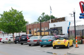
We will provide incentives and investments that produce a favorable environment for private investment on underutilized sites. In Oklahoma City, we have tended to view land as an inexhaustible and disposable resource, reducing the desirability of older areas and decreasing land values, while expanding the city’s boundaries outward. The surveys and process of planokc show that this view is also changing, as citizens place a high value on using existing infrastructure and urban land effectively and rebuilding established neighborhoods. Preferences are also changing, as many families appreciate active urban places like Midtown and Automobile Alley that provide living, shopping, entertainment, and work places with good walking, bike, and transit access. Effective use of existing land resources is a central principle of Chapter Two’s land use vision.
Redevelopment and infill depend on major private investment. City policy and action can create the conditions that help this private investment occur.
Directions for these policies include:
- Site assembly. Multiple property owners, often absent or very difficult to find, can make it impossible to put together sites for redevelopment. The City can help private developers by helping them assemble sites.
- Infrastructure and street improvement. While redevelopment and infill sites usually have infrastructure, these facilities are sometime obsolete and require improvement. Redevelopment can provide the impetus for making necessary public investments in these assets.
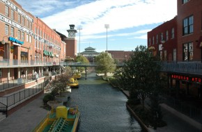
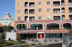
- Public investments. Parks, schools, civic facilities, pedestrian and bicycle facilities, streetscapes, and other amenities can provide anchors that are proven to generate private development. The Bricktown Canal is an excellent example of a public amenity that has paid for itself many times over in private investment. Similarly, the new MAPS 3 Park will inevitably become the catalyst for the Core to Shore redevelopment.
- Code improvement and proactive enforcement. Poor property maintenance, unattractive and cluttered signs, and public or operating nuisances can degrade the value of surrounding property and discourage reinvestment. Updated ordinances and consistent, enforcement will minimize these disincentives and create momentum for new private development.
Establish new incentives and raise awareness of existing incentives that stimulate the preservation and rehabilitation of historic resources. Incentives could include:
- Preservation easements, low-interest or forgivable rehabilitation loans, and Tax Increment Financing Districts for historic buildings, sites, and districts.
- Tools and practices for public/private partnerships to ensure the preservation and retention of top-priority historic resources whose deterioration or demolition would present an irreparable and highly significant loss to the City and beyond.
- Existing city, state, and federal tools and incentives for rehabilitation, including state and federal tax credits for certified rehabilitation.
- Expedited review process for projects involving infill sites.
Support and incentivize the adaptive use of existing buildings, infill development, and brownfield development.
Modify codes and/or regulations to create opportunities for more income diversity and mixed-income neighborhoods by allowing a variety of housing ownership and leasing arrangements, diverse housing sizes and types – including accessory dwelling units, carriage homes, lofts, live-work spaces, cottages, and manufactured/modular housing. Modifications should allow an increase the variety of ownership opportunities to include condominiums, ownership cooperatives (such as mutual housing associations, limited equity cooperatives, etc.) by identifying and removing regulatory barriers. Recommend improvements to protections for owners, developers, and lenders.
Priority should be given to projects that achieve efficiencies described elsewhere in planokc, such as dwelling units that are located to have easy access to each other and to other daily needs including jobs, recreation, and schools.
Maximize the use of all appropriate state, federal, local, and private funding for the development, preservation, and rehabilitation of housing affordable to a variety of income groups, including those that integrate low-income housing units in otherwise market-rate housing developments and support the creation and/or expansion of mixed-income communities.
Integrate housing rehabilitation programs with neighborhood revitalization programs. These programs should include assistance to property owners to renovate the existing housing stock with improvements that reduce utility and maintenance costs for owners and occupants, conserve energy, conserve water, and reduce greenhouse gas emissions.
Establish new or expand existing financing methods and/or mechanisms available to new and redevelopment mixed-income projects in urban areas. These could include: direct investment of public housing funds, tax-increment financing, bonds, revolving loans, housing program funds and/or other proven public-private partnership models.
Create and/or enhance Community Development Corporations (CDCs) and Community Housing Development Organizations (CHDOs) to increase their capacity to provide mixed-income housing, especially in targeted infill areas.
Reuse brownfield, greyfield, and other vacant building sites to provide new opportunities for mixed-used and mixed-income housing.
Prevent concentration of low-income populations by providing housing opportunities for all income groups in targeted redevelopment areas of the city with a particular focus on mixed-income projects, especially on those projects that have a public funding component.
In conjunction with City regulatory changes, such as significant modifications to zoning ordinances, building codes, or subdivision regulations, assess the effects of the proposed modifications on housing development costs and overall housing affordability, considering the balance between housing affordability and other objectives such as environmental quality, urban design quality, maintenance of neighborhood character and protection of public health, safety and welfare. This assessment should be integrated into the code amendment process, identify barriers to housing affordability, and include recommended mitigation.
Add legislative priorities for state laws to:
- Strengthen the City’s ability to obtain specific performance of property owners cited for code violations.
- Speed up the demolition process for long-time boarded properties that cannot be rehabilitated.
- Strengthen the City’s ability to require property owners to rehabilitate or sell neglected, boarded-up properties.
- Expedite the clearing of properties involved in probate.
Strategically use subsidized housing programs along with other City services and programs to revitalize targeted areas of the city.
Support infill development on vacant, underutilized, and brownfield sites by:
- Allowing densities sufficient to incentivize infill in older areas
- Focusing resources on target neighborhoods to build positive momentum
- Evaluating and adjusting zoning in areas where infill is desired
- Reducing permit fees and processing time for infill development proposals
- Waiving the requirement for traffic impact analyses for infill development proposals
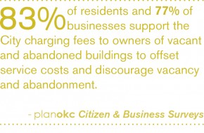
- Establishing an Abandoned Buildings Program and enhancing it over time by:
- Seeking changes in City ordinance and State statute where necessary to allow for cost recovery of police and fire services costs caused by vacant buildings
- Using revenue collected beyond Vacant and Abandoned Buildings program administration cost for neighborhood improvements
- Submitting land bank legislation to the State Legislature and establishing a land bank authorized to acquire, rehabilitate, and dispose of abandoned properties
- Offering temporary or short term catalyzing incentives for the first “infillers” in target neighborhoods. Incentives may include small grants and/or low interest loans from a revolving loan fund or for property improvements.
- Evaluating the possibility of basing property taxes on only land value and not improvements, thereby encouraging high intensity use of well-positioned land and discouraging underutilization and long–term vacancy.
Mitigate negative impacts of compactness by:
- Updating nuisance code to better address noise, smell, vibration, property maintenance, panhandling, animal control, delivery hours limits, and other possible negative effects.
- Updating the sign ordinance to reduce visual clutter.
Prioritize and concentrate development where facilities, infrastructure, and services have capacity and in areas where the Police and Fire Departments are best able to respond. Guide the location and timing of development through the proactive and strategic installation of infrastructure.
Create and implement small area plans for neighborhoods or districts with special strategic importance or complications related to development or redevelopment.
Identify priority areas where the City can maximize private investment by providing public infrastructure and amenities including:
- Transit;
- Parks, trails, sidewalks;
- Streets;
- Arts and cultural facilities.
Encourage redevelopment and infill development on vacant, underutilized, and brownfield sites in urbanized areas.
Catalyze infill development on vacant, underutilized, and brownfield sites in urbanized areas by:
- Investing in infrastructure improvements;
- Improving multi-modal transportation networks;
- Improving parks and open spaces;
- Improving schools and other civic resources;
- Exploring innovative methods such as:
- A public-private partnership to purchase problem properties in target areas and build or rehabilitate homes while improving infrastructure and amenities
- An infill house plan program similar to Sacramento or Milwaukee
- Identifying and removing barriers to rehabilitation and/or replacement of residential buildings.
- Establishing a position in the City to facilitate medium- and large-scale redevelopment projects through the development process by guiding interactions with City departments, allied agencies, and utility companies.
Encourage the adaptive reuse of underutilized structures and the revitalization of older, economically distressed neighborhoods.
We will place a priority on increasing the economic strength and growth of viable existing commercial nodes and corridors. Commercial development typically flees to the “next new thing,” leaving previous locations for new sites, usually in growth areas. While understandable, this trend leaves older commercial areas underutilized with more marginal businesses and vacancy, lower rents, and reduced upkeep and investment. While market conditions and age will inevitably make some areas less competitive, we must maintain the strength of our existing viable districts. This program may include:
- Improving the function and convenience of commercial areas with improved transportation access, including better local circulation, enhanced transit service, and internal and external pedestrian and bicycle linkages.
- Creating a better physical environment through streetscape and public space investments.
- Providing financial incentives like tax increment financing for site and building upgrades, and for introduction of new uses into single-use commercial areas.
- Creating new parking standards for mixed-use projects that recognize that different uses generate their highest parking demands at different times.
- Encouraging new commercial within redevelopment areas, benefitting existing retailing by introducing new nearby attractions.
We will implement strategies for the reuse and redevelopment of low-performing commercial areas. Cities don’t stand still and neither do retail markets. Some of the city’s commercial areas are no longer viable in their current form, but still siphon some commercial activity from other, stronger districts. We will implement strategies for revitalization of these underutilized but still important districts.
Create and implement small area plans for neighborhoods or districts with special strategic importance or complications related to development or redevelopment.
Prioritize maintaining the strength of existing commercial nodes and corridors over providing new areas for commercial development.
Continue promoting the re-use, redevelopment, and revitalization of low-performing or declining commercial areas.
Incentives for new regional retail development should only be considered if the proposed project truly creates a new regional destination for the city and does not significantly cannibalize sales from existing Regional Districts.
Regional-, community-, and neighborhood-scale retail developments should provide an internal vehicle and pedestrian circulation system between new and existing centers and individual stores that draws on the following principles:
- Concentrate access for new retail development at shared primary entrance points. Primary entrance points should be aligned with access points immediately across intersecting roads. Limit curb cuts on primary highways and arterials.
- Provide pedestrian circulation, including sidewalks and median breaks along interior and exterior fronting roads and within parking lots.
- Encourage coordinated development of retail centers in order to facilitate internal pedestrian and vehicle circulation and optimal center performance.
Wayfinding mechanisms and other placemaking features should be strongly encouraged in new and existing commercial districts.
Landscaping is located, designed, and maintained to ensure an attractive and safe community.
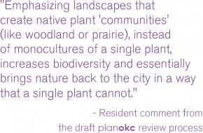
We will update and improve the city’s landscape ordinances. Improvements will address the objectives of improving community appearance, minimizing land use incompatibilities, improving air quality, and managing the city’s micro-climate. These ordinances also must address the long-term by including maintenance in their requirements. This starts with requiring native trees and plants that are adapted to the central Oklahoma climate. Use of native and drought tolerant plants lowers irrigation requirements, lowers cost, and conserves water.
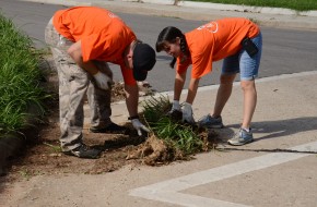
We will educate the public on the use of native materials and proper maintenance. Preconceived notions of an aesthetically pleasing landscape often lead to the use of high-maintenance materials like non-native grasses. To overcome these inclinations, educational materials, demonstration gardens, and targeted corridor improvement projects should advertise both the beauty and benefits of proper installation and maintenance of native landscapes.
We will develop better procedures for reporting, citing and enforcement of violations. The current system for enforcement of landscaping requirements is complaint based, resulting in inconsistent maintenance on private properties and along many public rights-of-way. Improved procedures for code enforcement affecting private properties and additional funding sources for public areas should establish a clear level of expectation across the city.
Routinely assess the City’s development standards, design guidelines, and development review procedures to ensure that they reflect current trends in best-practice and allow for innovative design techniques and evolving methods in low-impact development.
Enhance existing development standards and establish design guidelines for areas outside of the City’s existing Design Review Overlay Districts. Development standards and design guidelines could include the following provisions:
- Minimize views and prominence of parking lots in relation to structures on a site.
- Sense of proportion (street width to building height, human scale)
- Pedestrian orientation of structures and architectural detailing/fenestration
- Terminated vistas
- Reduce the predominance of residential garages in the design of the front facades of single-family residences.
- Inclusion of front porches into the design of residential structures.
- Internal orientation of parking facilities and garages in multi-family developments.
- Improved pedestrian safety and enhanced pedestrian access through parking lots.
Develop distinctive standards for different types and categories of walls and fences, emphasizing durability, aesthetics, and visual continuity in materials and design with particular consideration of zoning classification.
Initiate new efforts to reduce sign clutter and improve the aesthetics of signs, while allowing for adequate and visible business identification by the following potential measures:
- Restrict new billboards and eliminate or reduce the number of existing billboards.
- Require non-conforming signs to be removed or be brought into compliance with existing regulations within a specific timeframe.
- Consider new standards in the Sign Ordinance to improve limits on the size, height, and number of signs.
- Improve proactive enforcement of the City’s sign regulations to curtail the placement of illegal signs and ensure adequate maintenance of signs.
Incorporate natural features (such as ponds, lakes, streams, rock outcroppings, stands of mature trees, and/or sizable individual trees) into the design of all residential, commercial, and industrial projects rather than eliminating, hiding, or limiting access to those features.
Establish streetscape standards requiring attractive entry features and the provision of accessible common open space in new neighborhoods.
Develop and adopt new standards/guidelines to promote new residential subdivision designs that orient residential neighborhoods toward adjacent complementary uses or features such as parks, schools, open space, and neighborhood serving commercial sites, promoting improved direct accessibility and more seamless community integration.
Develop and adopt new standards to minimize the detrimental appearance of accessory utility equipment (i.e. transformers, cable cabinets, telephone cabinets, utility meters, valves, etc.) by integrating them into less prominent areas of the site design or by screening them with landscaping, artistic features, or architectural materials compatible with the primary structures. If not encouraged, artistic embellishment (creating urban ambiance with imaginatively designed/painted screens) should not be prohibited. Ensure that such facilities are situated so that they do not impede pedestrian access.
Enhance the City’s Landscape Ordinance by accomplishing the following objectives:
- Add guidelines and recommendations for landscape design that minimizes the need for supplemental irrigation.
- Clarify responsibilities and standards for landscape maintenance, including within public rights-of-way.
- Incentivize the use of drought-tolerant and native plants.
- Restrict the use of turf grass to the greatest extent feasible.
- Evaluate existing landscape standards for parking lots and consider making revisions that would result in more landscape buffering on parking lot fringes and more internal landscaping.
- Evaluate existing landscape standards to determine whether new standards should be adopted to help screen or buffer parking structures.
- Evaluate existing landscape standards in comparison to best practices and peer cities to determine whether minimum site landscaping standards should be revised and/or restructured to result in increased landscaping.
Consider the adoption of improved requirements to screen parked vehicles from view with enhanced landscaping, berming, low screen walls, and existing or proposed buildings, or some combination of those elements.
Establish a funded beautification program and source of funding to provide facade and landscaping enhancements along targeted industrial corridors.
Improve landscape design, installation, and landscape maintenance compliance through the following actions:
- Produce informational materials and work with local media to publicize the benefits of limiting turf areas (e.g. reduced water use, less mowing) and highlight the positive effects on property values and aesthetics that result from proper installation and maintenance of landscaping.
- Develop a program, including informational outreach, to inform property owners of their responsibilities to maintain right-of-way areas, the procedures for enforcement, and the applicable fines.
- Identify specific corridors with the worst landscape maintenance conditions and initiate coordinated clean-up programs in those locations.
- Install demonstration gardens/landscapes in select civic/public locations to provide practical examples of how to integrate drought tolerant and low maintenance plants in commercial and residential installations.
- Improve efficiency and effectiveness of the process for reporting, citing, and proactive enforcement violations for maintenance and compliance with landscape requirements.
- Explore the establishment of landscape improvement/maintenance districts where property owners are assessed a pro-rata share of the costs to properly and uniformly maintain landscaping within the district boundaries.
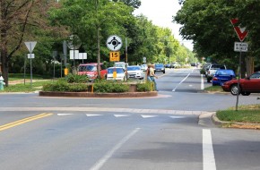
Develop a Master Streetscape Program to improve the appearance along major arterial streets. The program should outline methods for establishing a uniform streetscape appearance (with distinctive designs for individual streets or classifications of streets) through appropriate tree placement, species, and spacing, and coordinating the location of street trees in proximity to utilities, sidewalks, street lights and structures, and appropriate sidewalk designs. Differentiation in streetscape designs could be designated by street typology, designated areas, or other factors.
Using performance standards related to flow quantity, quality, and pattern, modify development regulations, codes, and policies to support the use of green infrastructure/low impact development techniques to mimic natural systems for developments within aquifer recharge zones with moderate or high vulnerability or in areas where streams and riparian areas have been channelized or developed (primarily in the Downtown, UH, and UM LUTAs). Low impact development techniques include but are not limited to:
- Onsite treating or filtering of stormwater contaminants.
- Discharging run-off as sheet-flow after passing through grassy or vegetated open space areas, rather than discharging run-off through concentrated outfalls.
- Creating attractive open space amenities that double as stormwater detention, retention, and / or filtering systems.
- Utilizing pervious pavement, pavers, or asphalt in appropriate locations (i.e. sidewalks, parking spaces, trails, patios, etc.).
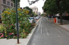
- Utilizing planters (at grade or raised), vegetated landscape strips adjacent to roads and parking areas, and alternative curbing designs (allowing stormwater to easily move from impervious areas to pervious areas), to encourage stormwater infiltration and temporary detention.
- Rain Gardens
- Bioswales
- Green streets and alleys
- Green roofs
- Rooftop collection
- Underground detention
- Increased tree canopy preservation/tree planting
- Land/open space conservation
- Cluster development
Revise development regulations to require the following factors to be addressed in development and redevelopment proposals:
- Preservation of existing natural resources, such as wooded areas, habitat areas, and floodplains.
- Utilization of natural treatments and methods to stabilize or rehabilitate stream and river banks as a means to preserve downstream habitats.
- Integration of a variety of native or compatible non-native, non-invasive plant species.
- Mitigation of impacts of development on habitat, wildlife corridors, riparian and littoral areas, and water quality, through actions such as restoration or re-vegetation of disturbed natural areas and replacement of trees/habitat on-site or off-site.
- Management of invasive plant and animal species.
- Management and maintenance of natural areas, common areas and drainage areas.
- Impact on surface and groundwater supply.
- Impact on water quality caused by land uses and activities.
- Impacts on floodplains, riparian and littoral areas and wetlands and areas with significant landforms.
Revise the landscape ordinance to include the following:
- Define terms such as invasive species, exotic/non-native species, and native/indigenous species
- Require removal of invasive species from existing sites, and prohibit such species from being planted or maintained in new development.
- Provide a reference list of native plants and drought-tolerant plants.
- Provide incentives for using native and drought-tolerant plants and disincentives for using high-water plants and turf grass.
- Establish requirements for using design practices that minimize the need for supplemental irrigation.
Preserve natural habitat, maintain wildlife food sources, and reduce the risk of propagating invasive plant species by utilizing vegetation native to Oklahoma, preferably central Oklahoma, for all mitigation and habitat restoration efforts associated with new development and redevelopment projects, public and private, to the greatest extent possible.
Establish an Urban Forestry Program and City Urban Forester position to achieve the following:
- Measure and monitor tree canopy coverage and habitat on a regular basis so that any policies, programs, and regulations may be adjusted accordingly as situations change. Establish a process to maintain current data.
- Develop and maintain regulations, policies, processes, and programs that focus on protection and preservation of native trees.
- Provide assistance with proper tree selection, location, and maintenance to prevent power outages, reduce property damage, and coordinate emergency response during natural disaster events (excessive snow and ice, tornadoes, etc.), address the urban heat island effect, and reduce energy costs, etc.
- Establish programs such as tree give-aways, neighborhood planting programs, and education workshops.
- Provide resources to the public about tree selection, management, and care.
- Seek grant funding for community tree planting to improve City parks, publicly maintained rights-of-way and other areas of the city.
- Inventory the City’s street trees and develop a tree replacement program.
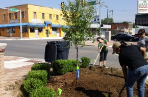
- Partner with volunteer and nonprofit organizations to recruit volunteers for tree planting and maintenance and to coordinate community-wide tree planting efforts.
Develop and adopt a tree preservation ordinance that achieves the following:
- Defines methods of preservation;
- Defines situations where preservation of trees is mandatory versus optional;
- Establishes incentives for tree preservation;
- Establishes mitigation options if preservation cannot be accomplished; and
- Establishes penalties for unauthorized tree removal.
Pursue methods to reduce the impact of the urban heat island effect on Oklahoma City by:
- Establishing a minimum canopy coverage requirement over paved surfaces such as parking lots.
- Instating a “continuous canopy” requirement for new streets and street reconstruction projects.
- Promoting the use of building and roofing materials that reduce heat island effects.
Modify development and subdivision regulations, and City policies to minimize alteration of natural landforms and native vegetation and maximize retention of distinctive natural features for public and private projects.
Establish development regulations that help improve air quality, including:
- Specifying construction controls that reduce airborne dust;
- Increasing landscaping and tree planting to absorb carbon dioxide and air pollutants; and
- Encouraging development patterns and densities that support alternative modes of transportation in the urban LUTAs.
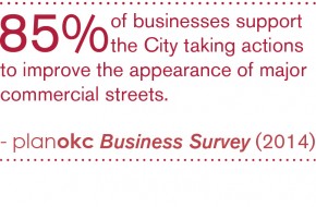
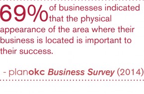
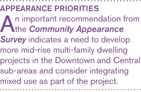
We will update and enhance design standards and guidelines that apply to areas outside existing Design Review Districts. The Community Appearance Survey identified residents’ support for pedestrian-oriented amenities and human-scaled development. Appealing living spaces combine ingredients such as street and sidewalk environments, properly scaled buildings, visual interest, well-placed and designed furniture, and other elements. Updated standards will address the lessons and results of the Community Appearance Survey and provide practical and cost-effective design guidance and choices. They will address scale, materials, variety, visual quality, signs and graphics, and environmental sensitivity. The effort to update and enhance these standards will involve all stakeholders. They will also be routinely reviewed against best practices, allowing innovative design techniques and incorporating new techniques in low-impact development.
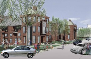
We will remove obstacles to greater design variety within residential construction. Community Appearance Survey participants strongly supported residential designs that included front porches and minimized garage exposure. These findings and the Housing Demand Study results both indicated interest in smaller lots and greater housing product variety, especially among younger households. Both the sustainokc and liveokc elements speak to the need for more diverse housing types. Design guidelines should illustrate ways to achieve higher densities in configurations that are consistent with citizen preferences. In addition, city standards and regulations that discourage design features like rear-loaded garages or mixed density housing should be modified.
We will improve regulation of sign scale, number, and placement. Sign images were the lowest rated urban design element in the Community Appearance Survey. New sign regulations will be fashioned as part of land development ordinance revisions to reduce clutter and increase legibility. Code direction will include limits on the number of permitted signs, increased use of ground signs, location standards, better overall size limitations, and requirements for sign master plans for large projects.
We will develop a Great Streets Program to improve the appearance of major arterial streets. Oklahoma City has implemented a Downtown Streetscape Master Plan, and should extend the concept of cohesive standards for landscaping, lighting, street furniture, sidewalk and crosswalk design, utility placement and treatment, and other elements to other streets of civic importance. This effort is related to the street typology concept presented in Chapter Two. The master planning effort will identify corridors of visual significance and establish vocabularies of materials and treatments that will be applied during widenings or reconstruction projects or on a stand-alone basis.
Routinely assess the City’s development standards, design guidelines, and development review procedures to ensure that they reflect current trends in best-practice and allow for innovative design techniques and evolving methods in low-impact development.
Enhance existing development standards and establish design guidelines for areas outside of the City’s existing Design Review Overlay Districts. Development standards and design guidelines could include the following provisions:
- Minimize views and prominence of parking lots in relation to structures on a site.
- Sense of proportion (street width to building height, human scale)
- Pedestrian orientation of structures and architectural detailing/fenestration
- Terminated vistas
- Reduce the predominance of residential garages in the design of the front facades of single-family residences.
- Inclusion of front porches into the design of residential structures.
- Internal orientation of parking facilities and garages in multi-family developments.
- Improved pedestrian safety and enhanced pedestrian access through parking lots.
Establish a list of preferred and discouraged building materials for all zoning districts.
Develop distinctive standards for different types and categories of walls and fences, emphasizing durability, aesthetics, and visual continuity in materials and design with particular consideration of zoning classification.
Initiate new efforts to reduce sign clutter and improve the aesthetics of signs, while allowing for adequate and visible business identification by the following potential measures:
- Restrict new billboards and eliminate or reduce the number of existing billboards.
- Require non-conforming signs to be removed or be brought into compliance with existing regulations within a specific timeframe.
- Consider new standards in the Sign Ordinance to improve limits on the size, height, and number of signs.
- Improve proactive enforcement of the City’s sign regulations to curtail the placement of illegal signs and ensure adequate maintenance of signs.
Make it easier for arts and cultural projects to navigate the City’s design review, zoning, licensing, and permit processes.
Establish new incentives and raise awareness of existing incentives that stimulate the preservation and rehabilitation of historic resources. Incentives could include:
- Preservation easements, low-interest or forgivable rehabilitation loans, and Tax Increment Financing Districts for historic buildings, sites, and districts.
- Tools and practices for public/private partnerships to ensure the preservation and retention of top-priority historic resources whose deterioration or demolition would present an irreparable and highly significant loss to the City and beyond.
- Existing city, state, and federal tools and incentives for rehabilitation, including state and federal tax credits for certified rehabilitation.
- Expedited review process for projects involving infill sites.
Develop and implement a Comprehensive Public Art Master Plan to:
- Establish goals and a framework for the rational development of a public art program for Oklahoma City
- Integrate public art into each of the City’s key development initiatives and community sectors with a plan for both permanent and temporary placement processes that facilitate new public art coordination and investment.
- Create an administrative and financial structure (with roles and responsibilities) to efficiently and effectively facilitate multi-departmental and multi-agency public art partnerships.
- Evaluate the current development/design/art review processes and make recommendations for improved and streamlined public art policies and procedures for both permanent and temporary public art (including murals).
- Involve the community in the process of public art selection to build consensus for the program.
- Include an educational component to reinforce the value of public art in the public realm for all ages and cultures.
- Provide a plan for maintaining the value and physical integrity of the City’s public art collection.
Allow the reuse of vacant storefronts as exhibition space for local artists.
Protect the unique character of National Register-listed properties or districts and local Historic Districts and ensure that development and redevelopment is compatible with historic resources and character.
Revise ordinances for design districts and design review procedures to ensure consistency in the treatment of historic properties, including the assessment of demolition proposals, the identification of historic or significant properties, and the consideration of the impact that the alteration or demolition of individual properties has on the context and continuity of the surrounding environment.
Provide incentives for private development projects that include public art.
Incorporate natural features (such as ponds, lakes, streams, rock outcroppings, stands of mature trees, and/or sizable individual trees) into the design of all residential, commercial, and industrial projects rather than eliminating, hiding, or limiting access to those features.
Establish streetscape standards requiring attractive entry features and the provision of accessible common open space in new neighborhoods.
Develop and adopt new standards/guidelines to promote new residential subdivision designs that orient residential neighborhoods toward adjacent complementary uses or features such as parks, schools, open space, and neighborhood serving commercial sites, promoting improved direct accessibility and more seamless community integration.
Develop and adopt new standards to minimize the detrimental appearance of accessory utility equipment (i.e. transformers, cable cabinets, telephone cabinets, utility meters, valves, etc.) by integrating them into less prominent areas of the site design or by screening them with landscaping, artistic features, or architectural materials compatible with the primary structures. If not encouraged, artistic embellishment (creating urban ambiance with imaginatively designed/painted screens) should not be prohibited. Ensure that such facilities are situated so that they do not impede pedestrian access.
Facilitate and coordinate burial of overhead power and communications distribution lines.
Enhance the City’s Landscape Ordinance by accomplishing the following objectives:
- Add guidelines and recommendations for landscape design that minimizes the need for supplemental irrigation.
- Clarify responsibilities and standards for landscape maintenance, including within public rights-of-way.
- Incentivize the use of drought-tolerant and native plants.
- Restrict the use of turf grass to the greatest extent feasible.
- Evaluate existing landscape standards for parking lots and consider making revisions that would result in more landscape buffering on parking lot fringes and more internal landscaping.
- Evaluate existing landscape standards to determine whether new standards should be adopted to help screen or buffer parking structures.
- Evaluate existing landscape standards in comparison to best practices and peer cities to determine whether minimum site landscaping standards should be revised and/or restructured to result in increased landscaping.
Develop and adopt new standards/guidelines that result in improvements to parking structure design including the following potential measures:
- Design parking structures to be architecturally integrated with adjoining primary structure(s).
- Include integrated storefronts or other active uses on the ground floors of parking structures that are adjacent to public sidewalks and other pedestrian plazas.
- Enhanced exterior façades of structures by integrating architectural features and materials that complement the character of the surrounding area, or screening with vegetation.
Develop standards/guidelines that require architectural articulation, variety, and interest on large structures adjacent to public streets by limiting long stretches of unbroken wall planes.
Define responsibilities and assurances for maintaining, repairing, or replacing community walls and fences. Consider creating programs for routine and consistent maintenance of fencing along arterial roadways that could include fencing assessment districts, long-term bonds, or assigned HOA maintenance of community fencing.
Consider the adoption of improved requirements to screen parked vehicles from view with enhanced landscaping, berming, low screen walls, and existing or proposed buildings, or some combination of those elements.
Use light fixtures and street furniture in the public right-of-way that complement established or evolving cultural or design districts.
Create a public outreach program designed to explain and promote the benefits of urban design principles and design review districts.
Develop a Master Streetscape Program to improve the appearance along major arterial streets. The program should outline methods for establishing a uniform streetscape appearance (with distinctive designs for individual streets or classifications of streets) through appropriate tree placement, species, and spacing, and coordinating the location of street trees in proximity to utilities, sidewalks, street lights and structures, and appropriate sidewalk designs. Differentiation in streetscape designs could be designated by street typology, designated areas, or other factors.
Establish development standards and design guidelines for new cultural, civic, and sporting facilities that address site design, architecture, compatibility, pedestrian-orientation and access, landscaping, and the inclusion of public art.
Using performance standards related to flow quantity, quality, and pattern, modify development regulations, codes, and policies to support the use of green infrastructure/low impact development techniques to mimic natural systems for developments within aquifer recharge zones with moderate or high vulnerability or in areas where streams and riparian areas have been channelized or developed (primarily in the Downtown, UH, and UM LUTAs). Low impact development techniques include but are not limited to:
- Onsite treating or filtering of stormwater contaminants.
- Discharging run-off as sheet-flow after passing through grassy or vegetated open space areas, rather than discharging run-off through concentrated outfalls.
- Creating attractive open space amenities that double as stormwater detention, retention, and / or filtering systems.
- Utilizing pervious pavement, pavers, or asphalt in appropriate locations (i.e. sidewalks, parking spaces, trails, patios, etc.).
- Utilizing planters (at grade or raised), vegetated landscape strips adjacent to roads and parking areas, and alternative curbing designs (allowing stormwater to easily move from impervious areas to pervious areas), to encourage stormwater infiltration and temporary detention.
- Rain Gardens
- Bioswales
- Green streets and alleys
- Green roofs
- Rooftop collection
- Underground detention
- Increased tree canopy preservation/tree planting
- Land/open space conservation
- Cluster development
Revise development regulations to require the following factors to be addressed in development and redevelopment proposals:
- Preservation of existing natural resources, such as wooded areas, habitat areas, and floodplains.
- Utilization of natural treatments and methods to stabilize or rehabilitate stream and river banks as a means to preserve downstream habitats.
- Integration of a variety of native or compatible non-native, non-invasive plant species.
- Mitigation of impacts of development on habitat, wildlife corridors, riparian and littoral areas, and water quality, through actions such as restoration or re-vegetation of disturbed natural areas and replacement of trees/habitat on-site or off-site.
- Management of invasive plant and animal species.
- Management and maintenance of natural areas, common areas and drainage areas.
- Impact on surface and groundwater supply.
- Impact on water quality caused by land uses and activities.
- Impacts on floodplains, riparian and littoral areas and wetlands and areas with significant landforms.
Revise the landscape ordinance to include the following:
- Define terms such as invasive species, exotic/non-native species, and native/indigenous species
- Require removal of invasive species from existing sites, and prohibit such species from being planted or maintained in new development.
- Provide a reference list of native plants and drought-tolerant plants.
- Provide incentives for using native and drought-tolerant plants and disincentives for using high-water plants and turf grass.
- Establish requirements for using design practices that minimize the need for supplemental irrigation.
Establish an Urban Forestry Program and City Urban Forester position to achieve the following:
- Measure and monitor tree canopy coverage and habitat on a regular basis so that any policies, programs, and regulations may be adjusted accordingly as situations change. Establish a process to maintain current data.
- Develop and maintain regulations, policies, processes, and programs that focus on protection and preservation of native trees.
- Provide assistance with proper tree selection, location, and maintenance to prevent power outages, reduce property damage, and coordinate emergency response during natural disaster events (excessive snow and ice, tornadoes, etc.), address the urban heat island effect, and reduce energy costs, etc.
- Establish programs such as tree give-aways, neighborhood planting programs, and education workshops.
- Provide resources to the public about tree selection, management, and care.
- Seek grant funding for community tree planting to improve City parks, publicly maintained rights-of-way and other areas of the city.
- Inventory the City’s street trees and develop a tree replacement program.
- Partner with volunteer and nonprofit organizations to recruit volunteers for tree planting and maintenance and to coordinate community-wide tree planting efforts.
Pursue methods to reduce the impact of the urban heat island effect on Oklahoma City by:
- Establishing a minimum canopy coverage requirement over paved surfaces such as parking lots.
- Instating a “continuous canopy” requirement for new streets and street reconstruction projects.
- Promoting the use of building and roofing materials that reduce heat island effects.
Modify development and subdivision regulations, and City policies to minimize alteration of natural landforms and native vegetation and maximize retention of distinctive natural features for public and private projects.
Modify codes and/or regulations to create opportunities for more income diversity and mixed-income neighborhoods by allowing a variety of housing ownership and leasing arrangements, diverse housing sizes and types – including accessory dwelling units, carriage homes, lofts, live-work spaces, cottages, and manufactured/modular housing. Modifications should allow an increase the variety of ownership opportunities to include condominiums, ownership cooperatives (such as mutual housing associations, limited equity cooperatives, etc.) by identifying and removing regulatory barriers. Recommend improvements to protections for owners, developers, and lenders.
Priority should be given to projects that achieve efficiencies described elsewhere in planokc, such as dwelling units that are located to have easy access to each other and to other daily needs including jobs, recreation, and schools.
Ensure that new publicly financed developments – those which directly use or receive public dollars – with more than 100 units or with densities greater than 10 units/acre are located where they have easy access to frequent transit service.
Establish a program or series of programs that significantly improve the quality, appearance, and perception of rental housing throughout the city. Program components should include: 1) owner, manager, and tenant education; 2) code enforcement and inspections; 3) design standards/considerations that promote safety; 4) high attention to property maintenance; and 5) other relevant best practices.
Establish new or expand existing financing methods and/or mechanisms available to new and redevelopment mixed-income projects in urban areas. These could include: direct investment of public housing funds, tax-increment financing, bonds, revolving loans, housing program funds and/or other proven public-private partnership models.
Create regulations/standards/guidelines that focus on design and/or compatibility principles which are sensitive to the surrounding urban form, especially in areas that are stable or improving and whose character is well-established. These provisions should also help ensure compatibility between lower- and higher- intensity land uses.
In conjunction with City regulatory changes, such as significant modifications to zoning ordinances, building codes, or subdivision regulations, assess the effects of the proposed modifications on housing development costs and overall housing affordability, considering the balance between housing affordability and other objectives such as environmental quality, urban design quality, maintenance of neighborhood character and protection of public health, safety and welfare. This assessment should be integrated into the code amendment process, identify barriers to housing affordability, and include recommended mitigation.
Use established mechanisms/tools to allow property owners to provide for the perpetual maintenance, repair and reconstruction of private roads, sidewalks, trails, utilities, and parks in new housing developments by requiring funding mechanisms such as:
- Maintenance bonds/escrows
- Special assessment districts, such as Business Improvement District or Special Improvement District
- Covenants requiring compulsory membership in an incorporated Property Owners Association whose members will be financially liable for any such maintenance, repair, or reconstruction costs.
Incorporate these financing options into the platting process (or zoning process in the case of PUDs).
Construct all private roads and utilities to comply with minimum design and paving standards as outlined in the City of Oklahoma City Subdivision Regulations, including those related to the appropriate Street Typology.
Adopt design standards applicable to both new and remodeled libraries focusing on integrating the building and the site into existing neighborhoods and urban fabric, reducing their dependence on automobiles and increasing their access by other modes, especially walking, biking, and transit.
Maximize fire safety through actions such as:
Modifying regulations and guidelines to prevent subdivisions with a single point of access – except those with fewer than 10 homes.
Developing a vegetation management program targeting the wildland/urban interface, including rights-of-way in rural areas, and incorporating recommendations from the National Fire Protection Association’s Firewise Communities initiative.
Requiring residential sprinklers for developments located in Rural Land Use Typologies.
Requiring exceptional, effective, and easy access to sites augmented by a thorough system of connections within and between developments.
Adopt design standards to enable emergency management resources to be highly effective, such as resilient buildings, interconnected transportation networks, and other design considerations that help ensure community safety and recovery.
Adopt new citywide site design and building regulations that ensure new developments meet basic functional and aesthetic minimums related to:
- Walkability and bike-ability
- Internal and external street connectivity
- Integration of uses
- Signage
- Building location
- Building appearance
- Open space (passive and active)
Require all new utility lines to be buried and bury existing utility lines when possible (e.g., when roads are widened).
Mitigate negative impacts of compactness by:
- Updating nuisance code to better address noise, smell, vibration, property maintenance, panhandling, animal control, delivery hours limits, and other possible negative effects.
- Updating the sign ordinance to reduce visual clutter.
In order to promote compatibility between different uses, establish standards and guidelines that ensure all developments are pedestrian-friendly and human scale at street frontages and property lines.
Develop design standards and guidelines for industrial development. Standards and guidelines should address: sensitive design and placement of buildings; screening or prohibiting outdoor storage; parcel sizes which allow for long term expansion for individual users; special landscaping requirements addressing screening and landscaping adjacent to residential areas and along highway and arterial streets; standards for the suitable location, orientation and screening of loading bays; and buffering treatments for truck access points.
Create design standards and guidelines for the design, materials, shared amenities, and accessibility of high density urban residential development. Standards and guidelines should promote privacy and livability in a high density, mixed-use environment.
Evaluate existing regulations for effectiveness in promoting density and mixed-use development and in addressing surface parking. Develop a new urban design code for downtown and other key districts to promote healthy mixes of land uses that are compatible and complementary.
Adopt subdivision regulations that ensure new neighborhoods meet the basic needs of residents while supporting an efficient development pattern. Regulations should cover:
- Open space (passive and active),
- Demonstration of sustainable funding levels for common area and facility maintenance costs,
- Walkability and bikeability,
- Internal and external street connectivity,
- Block length,
- Integration of uses,
- Integration of a variety of home sizes,
- Integration of a variety of unit types, and
- Preservation of Environmentally Sensitive Areas.
Regulations could be based on a point scale to allow flexibility, while still requiring basic minimum thresholds be met.
New regulations should remove the existing requirement for development in Rural LUTAs to connect to water and sewer systems and establish a minimum one-acre lot size for lots with on-site sewer treatment.
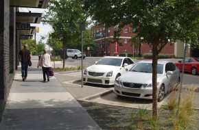
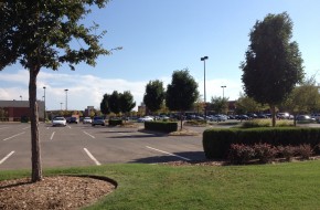
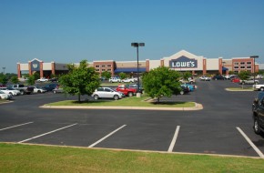
We will increase landscaping and design requirements in parking areas. Tree plantings and landscaping in parking lots have multiple benefits. Trees shade parking areas and decrease the heat island effect, help orient customers in large parking lots, manage circulation, and can be integrated into design elements that provide safe paths for pedestrians. In addition, parking lots should provide safe and pleasant paths from public walks and paths and transit stops to the front door of major projects and destinations. In some cases, parking lots can be designed for multiple purposes, acting as public spaces or markets during specific events. New parking design standards for Oklahoma City should incorporate contemporary practices for improved parking lot design.
We will integrate parking structures into primary structures. In appropriate high intensity settings, parking structures should be used to the maximum degree possible. When located along streets, parking structures should be activated at street level by storefronts, public art, or other details to avoid blank walls. The exterior facades of structures should be enhanced and complement the architectural features and materials of the surrounding area as a means to disguise the function of the structure and to minimize the detrimental aesthetic impacts of such facilities.
Enhance existing development standards and establish design guidelines for areas outside of the City’s existing Design Review Overlay Districts. Development standards and design guidelines could include the following provisions:
- Minimize views and prominence of parking lots in relation to structures on a site.
- Sense of proportion (street width to building height, human scale)
- Pedestrian orientation of structures and architectural detailing/fenestration
- Terminated vistas
- Reduce the predominance of residential garages in the design of the front facades of single-family residences.
- Inclusion of front porches into the design of residential structures.
- Internal orientation of parking facilities and garages in multi-family developments.
- Improved pedestrian safety and enhanced pedestrian access through parking lots.
Enhance the City’s Landscape Ordinance by accomplishing the following objectives:
- Add guidelines and recommendations for landscape design that minimizes the need for supplemental irrigation.
- Clarify responsibilities and standards for landscape maintenance, including within public rights-of-way.
- Incentivize the use of drought-tolerant and native plants.
- Restrict the use of turf grass to the greatest extent feasible.
- Evaluate existing landscape standards for parking lots and consider making revisions that would result in more landscape buffering on parking lot fringes and more internal landscaping.
- Evaluate existing landscape standards to determine whether new standards should be adopted to help screen or buffer parking structures.
- Evaluate existing landscape standards in comparison to best practices and peer cities to determine whether minimum site landscaping standards should be revised and/or restructured to result in increased landscaping.
Develop and adopt new standards/guidelines that result in improvements to parking structure design including the following potential measures:
- Design parking structures to be architecturally integrated with adjoining primary structure(s).
- Include integrated storefronts or other active uses on the ground floors of parking structures that are adjacent to public sidewalks and other pedestrian plazas.
- Enhanced exterior façades of structures by integrating architectural features and materials that complement the character of the surrounding area, or screening with vegetation.
Consider the adoption of improved requirements to screen parked vehicles from view with enhanced landscaping, berming, low screen walls, and existing or proposed buildings, or some combination of those elements.
Develop a Master Streetscape Program to improve the appearance along major arterial streets. The program should outline methods for establishing a uniform streetscape appearance (with distinctive designs for individual streets or classifications of streets) through appropriate tree placement, species, and spacing, and coordinating the location of street trees in proximity to utilities, sidewalks, street lights and structures, and appropriate sidewalk designs. Differentiation in streetscape designs could be designated by street typology, designated areas, or other factors.
Using performance standards related to flow quantity, quality, and pattern, modify development regulations, codes, and policies to support the use of green infrastructure/low impact development techniques to mimic natural systems for developments within aquifer recharge zones with moderate or high vulnerability or in areas where streams and riparian areas have been channelized or developed (primarily in the Downtown, UH, and UM LUTAs). Low impact development techniques include but are not limited to:
- Onsite treating or filtering of stormwater contaminants.
- Discharging run-off as sheet-flow after passing through grassy or vegetated open space areas, rather than discharging run-off through concentrated outfalls.
- Creating attractive open space amenities that double as stormwater detention, retention, and / or filtering systems.
- Utilizing pervious pavement, pavers, or asphalt in appropriate locations (i.e. sidewalks, parking spaces, trails, patios, etc.).
- Utilizing planters (at grade or raised), vegetated landscape strips adjacent to roads and parking areas, and alternative curbing designs (allowing stormwater to easily move from impervious areas to pervious areas), to encourage stormwater infiltration and temporary detention.
- Rain Gardens
- Bioswales
- Green streets and alleys
- Green roofs
- Rooftop collection
- Underground detention
- Increased tree canopy preservation/tree planting
- Land/open space conservation
- Cluster development
Revise development regulations to require the following factors to be addressed in development and redevelopment proposals:
- Preservation of existing natural resources, such as wooded areas, habitat areas, and floodplains.
- Utilization of natural treatments and methods to stabilize or rehabilitate stream and river banks as a means to preserve downstream habitats.
- Integration of a variety of native or compatible non-native, non-invasive plant species.
- Mitigation of impacts of development on habitat, wildlife corridors, riparian and littoral areas, and water quality, through actions such as restoration or re-vegetation of disturbed natural areas and replacement of trees/habitat on-site or off-site.
- Management of invasive plant and animal species.
- Management and maintenance of natural areas, common areas and drainage areas.
- Impact on surface and groundwater supply.
- Impact on water quality caused by land uses and activities.
- Impacts on floodplains, riparian and littoral areas and wetlands and areas with significant landforms.
Revise the landscape ordinance to include the following:
- Define terms such as invasive species, exotic/non-native species, and native/indigenous species
- Require removal of invasive species from existing sites, and prohibit such species from being planted or maintained in new development.
- Provide a reference list of native plants and drought-tolerant plants.
- Provide incentives for using native and drought-tolerant plants and disincentives for using high-water plants and turf grass.
- Establish requirements for using design practices that minimize the need for supplemental irrigation.
Establish an Urban Forestry Program and City Urban Forester position to achieve the following:
- Measure and monitor tree canopy coverage and habitat on a regular basis so that any policies, programs, and regulations may be adjusted accordingly as situations change. Establish a process to maintain current data.
- Develop and maintain regulations, policies, processes, and programs that focus on protection and preservation of native trees.
- Provide assistance with proper tree selection, location, and maintenance to prevent power outages, reduce property damage, and coordinate emergency response during natural disaster events (excessive snow and ice, tornadoes, etc.), address the urban heat island effect, and reduce energy costs, etc.
- Establish programs such as tree give-aways, neighborhood planting programs, and education workshops.
- Provide resources to the public about tree selection, management, and care.
- Seek grant funding for community tree planting to improve City parks, publicly maintained rights-of-way and other areas of the city.
- Inventory the City’s street trees and develop a tree replacement program.
- Partner with volunteer and nonprofit organizations to recruit volunteers for tree planting and maintenance and to coordinate community-wide tree planting efforts.
Pursue methods to reduce the impact of the urban heat island effect on Oklahoma City by:
- Establishing a minimum canopy coverage requirement over paved surfaces such as parking lots.
- Instating a “continuous canopy” requirement for new streets and street reconstruction projects.
- Promoting the use of building and roofing materials that reduce heat island effects.
Modify development and subdivision regulations, and City policies to minimize alteration of natural landforms and native vegetation and maximize retention of distinctive natural features for public and private projects.
Improve parking provisions in neighborhoods that are near vibrant commercial corridors/areas by improving parking and corridor design, non-vehicular networks, transit, and signage.
Amend the landscape ordinance to increase the number of trees and landscaped islands required in parking lots.
Provide incentives for developers to build parking garages in high density areas. Include design requirements for projects receiving incentives.
We will establish an urban forestry program, directed by a city forester, to manage and improve the city’s tree canopy. This program’s primary function will be to preserve and manage the existing tree canopy, increase the area with tree cover, and ensure that new projects utilize landscape materials appropriate to Oklahoma City’s climate and environment. This will be accomplished by:
- Monitoring and managing the City’s “urban forest,” the trees on public lands and right-of-ways;
- Providing technical assistance and advice to private residents, businesses, and property owners; and
- Developing enforceable standards and incentives through preparation of an Urban Landscape Guide and revision of the existing landscape ordinance. Ordinance revisions should improve landscape requirements and provide both requirements and incentives for tree preservation in new projects.
Establish incentives such as a simplified permitting process, reduced application fees, and special recognition for projects that:
- Utilize best management practices or other low-impact development methods for storm water management.
- Bring buried streams to the surface and restore riparian habitat.
- Install bridge systems instead of culverts for stream crossings to help maintain the natural ecosystem associated with the stream.
Revise development regulations to require the following factors to be addressed in development and redevelopment proposals:
- Preservation of existing natural resources, such as wooded areas, habitat areas, and floodplains.
- Utilization of natural treatments and methods to stabilize or rehabilitate stream and river banks as a means to preserve downstream habitats.
- Integration of a variety of native or compatible non-native, non-invasive plant species.
- Mitigation of impacts of development on habitat, wildlife corridors, riparian and littoral areas, and water quality, through actions such as restoration or re-vegetation of disturbed natural areas and replacement of trees/habitat on-site or off-site.
- Management of invasive plant and animal species.
- Management and maintenance of natural areas, common areas and drainage areas.
- Impact on surface and groundwater supply.
- Impact on water quality caused by land uses and activities.
- Impacts on floodplains, riparian and littoral areas and wetlands and areas with significant landforms.
Develop a manual of best management practices that can be integrated into City codes. These include, but are not limited to:
- Tree care and management.
- Tree planting.
- Tree protection.
- Street trees (location, conflicts, maintenance, etc. – in addition to general tree care guidelines).
- Placement of utilities (e.g., under streets vs. under park strips)
- Low impact development techniques.
- Habitat protection and restoration.
- Conservation easements and/or subdivisions.
Establish an Urban Forestry Program and City Urban Forester position to achieve the following:
- Measure and monitor tree canopy coverage and habitat on a regular basis so that any policies, programs, and regulations may be adjusted accordingly as situations change. Establish a process to maintain current data.
- Develop and maintain regulations, policies, processes, and programs that focus on protection and preservation of native trees.
- Provide assistance with proper tree selection, location, and maintenance to prevent power outages, reduce property damage, and coordinate emergency response during natural disaster events (excessive snow and ice, tornadoes, etc.), address the urban heat island effect, and reduce energy costs, etc.
- Establish programs such as tree give-aways, neighborhood planting programs, and education workshops.
- Provide resources to the public about tree selection, management, and care.
- Seek grant funding for community tree planting to improve City parks, publicly maintained rights-of-way and other areas of the city.
- Inventory the City’s street trees and develop a tree replacement program.
- Partner with volunteer and nonprofit organizations to recruit volunteers for tree planting and maintenance and to coordinate community-wide tree planting efforts.
Develop and adopt a tree preservation ordinance that achieves the following:
- Defines methods of preservation;
- Defines situations where preservation of trees is mandatory versus optional;
- Establishes incentives for tree preservation;
- Establishes mitigation options if preservation cannot be accomplished; and
- Establishes penalties for unauthorized tree removal.
Preserve mature healthy trees and incorporate them into the design of new development or redevelopment projects to the greatest extent possible. Include provisions and best management practices to ensure proper tree protection throughout the construction process. Best management practices include but are not limited to:
- The use of proper pruning techniques;
- Appropriate watering;
- Installation of protective fencing at the drip lines of trees or groups of trees;
- Designated material storage areas; and
- Approved equipment and vehicle parking and maintenance areas.
Provide the public with resources, tools, and guidance to deal with environmental hazards, such as:
- Information about safe disposal options for household contaminants such as motor oils, paints, computers, televisions, batteries, etc.
- Information on environmental hazards, such as brownfield sites.
- Information about funds available to assist with environmental cleanups.
Pursue methods to reduce the impact of the urban heat island effect on Oklahoma City by:
- Establishing a minimum canopy coverage requirement over paved surfaces such as parking lots.
- Instating a “continuous canopy” requirement for new streets and street reconstruction projects.
- Promoting the use of building and roofing materials that reduce heat island effects.
Establish development regulations that help improve air quality, including:
- Specifying construction controls that reduce airborne dust;
- Increasing landscaping and tree planting to absorb carbon dioxide and air pollutants; and
- Encouraging development patterns and densities that support alternative modes of transportation in the urban LUTAs.
Preserve overall landscape character and natural landforms (rolling hills, native vegetation, etc.) to the greatest extent possible.
Protect and preserve natural resources, by:
- Identifying and mapping valuable natural resources, such as, native prairies.
- Maintaining a comprehensive inventory and assessment of natural resources and critical habitats.
- Identifying opportunities to create an interconnected green infrastructure network throughout and beyond Oklahoma City’s municipal boundaries via existing trail and greenway projects, parks, stream corridors, and natural areas.
- Seeking the voluntary sale of land or dedication of conservation easements on private land that is identified as critical habitat or is necessary to link wildlife corridors.
- Pursuing protection of strategically identified natural areas by placing them in conservation easements or land banks, and reserving them for future use as open space and passive recreational areas.
- Managing invasive plant and animal species.
- Partnering with applicable State agencies and non-profit entities.
Identify and protect critical habitats for state and federally listed threatened or endangered species.
Identify migratory birds and their nesting sites prior to construction. Protect migratory birds and their nesting sites throughout the construction process and refrain from construction near nesting sites until migratory birds are no longer actively nesting and have moved on from the site. Verify compliance with Migratory Bird Treaty Act.
We will develop new site and building design guidelines and regulations and increase property maintenance standards and enforcement. Better community appearance is largely based on raising people’s expectations of how they should both develop and maintain their own property. New standards will establish better minimum expectations for how buildings and sites should look and function. These new standards should not add burdens or excessive costs, but should establish new basic assumptions about how we build, whether our projects are small convenience stores or a large mixed use developments. We often judge community appearance by the routine rather than the unique.
The same holds true for private property maintenance. Maintenance quality is contagious – care produces more care, and neglect produces more neglect. Again, our standards, technical assistance programs, and ultimately enforcement should move toward a higher level of care in our own individual environments.
We will improve the appearance of our streets. The public environment, all too often viewed as nobody’s responsibility, should in fact lead the way in creating upgraded appearance standards. In the planokc Business Survey, local businesses overwhelmingly cited “improving the appearance of major commercial streets” as the most important way to improve the appearance of the city.
After 2007 Bond Election resurfacing projects are complete, the City will assess the need for additional funds for citywide road maintenance beyond average annual expenditures. The assessment will be based on citizen satisfaction surveys, traffic volumes, and street condition data maintained by the Public Works Department. The City will also explore the feasibility of burying existing utility lines where possible and requiring all new utility lines to be buried. These efforts toward improving the quality of basic street appearance will continue and will encourage adjacent property owners to follow suit.
We will reduce litter and graffiti. The City will enhance litter and graffiti control through public awareness efforts and stricter laws and enforcement. Active code enforcement should be increased in targeted areas, including retail plan areas, special districts, and areas that are part of the Strong Neighborhoods Initiative (SNI).
We will reduce the impact of sign pollution. The City will update the sign code to reduce the visual impact of signs. Good standards actually improve readability and communicate business messages better than a cacophony of competing signs. The City can also explore reduction of sign pollution through amortization (gradual elimination as the service lives of signs expires) of existing signs that do not conform with new requirements.
Initiate new efforts to reduce sign clutter and improve the aesthetics of signs, while allowing for adequate and visible business identification by the following potential measures:
- Restrict new billboards and eliminate or reduce the number of existing billboards.
- Require non-conforming signs to be removed or be brought into compliance with existing regulations within a specific timeframe.
- Consider new standards in the Sign Ordinance to improve limits on the size, height, and number of signs.
- Improve proactive enforcement of the City’s sign regulations to curtail the placement of illegal signs and ensure adequate maintenance of signs.
Initiate efforts to educate the public regarding programs that provide assistance for neighborhood clean-up efforts. Such efforts could include the following:
- Provide assistance to residents to make housing and neighborhood improvements and provide training in property maintenance skills.
- Develop and organize volunteer programs (such as adopt-a-street, adopt-a-park, and neighborhood clean-up days) and/or coordinate efforts to obtain grant funding to establish community clean-up programs in neighborhoods where inadequate property maintenance is prevalent.
- Publicize Bulk Waste Days and/or explore the possibility of adding more days/increased frequency.
- Develop a list of outside funding sources that could be used for property maintenance and make this information available to all citizens, especially those in targeted low-income areas.
- Establish public educational programs and advertising campaigns to discourage littering. Education should begin at the elementary level and continue through the adult level.
Intensify code enforcement in areas where specific and/or chronic violations have detrimental impacts on community appearance. Such efforts could include:
- Implement stricter enforcement of property maintenance regulations and consider more significant penalties for violations.
- Increase emphasis on the enforcement of littering laws. Impose fines against littering in a uniform and consistent manner to reinforce a public perception that littering does carry a definite risk.
- Immediately report and ensure expedient removal of graffiti that is visible from interstate highways and other important/designated viewshed corridors.
Incorporate natural features (such as ponds, lakes, streams, rock outcroppings, stands of mature trees, and/or sizable individual trees) into the design of all residential, commercial, and industrial projects rather than eliminating, hiding, or limiting access to those features.
Develop and adopt new standards to minimize the detrimental appearance of accessory utility equipment (i.e. transformers, cable cabinets, telephone cabinets, utility meters, valves, etc.) by integrating them into less prominent areas of the site design or by screening them with landscaping, artistic features, or architectural materials compatible with the primary structures. If not encouraged, artistic embellishment (creating urban ambiance with imaginatively designed/painted screens) should not be prohibited. Ensure that such facilities are situated so that they do not impede pedestrian access.
Facilitate and coordinate burial of overhead power and communications distribution lines.
Develop standards/guidelines that require architectural articulation, variety, and interest on large structures adjacent to public streets by limiting long stretches of unbroken wall planes.
Use light fixtures and street furniture in the public right-of-way that complement established or evolving cultural or design districts.
Establish a funded beautification program and source of funding to provide facade and landscaping enhancements along targeted industrial corridors.
Establish incentives such as a simplified permitting process, reduced application fees, and special recognition for projects that:
- Utilize best management practices or other low-impact development methods for storm water management.
- Bring buried streams to the surface and restore riparian habitat.
- Install bridge systems instead of culverts for stream crossings to help maintain the natural ecosystem associated with the stream.
Revise the landscape ordinance to include the following:
- Define terms such as invasive species, exotic/non-native species, and native/indigenous species
- Require removal of invasive species from existing sites, and prohibit such species from being planted or maintained in new development.
- Provide a reference list of native plants and drought-tolerant plants.
- Provide incentives for using native and drought-tolerant plants and disincentives for using high-water plants and turf grass.
- Establish requirements for using design practices that minimize the need for supplemental irrigation.
Develop and adopt a tree preservation ordinance that achieves the following:
- Defines methods of preservation;
- Defines situations where preservation of trees is mandatory versus optional;
- Establishes incentives for tree preservation;
- Establishes mitigation options if preservation cannot be accomplished; and
- Establishes penalties for unauthorized tree removal.
Preserve mature healthy trees and incorporate them into the design of new development or redevelopment projects to the greatest extent possible. Include provisions and best management practices to ensure proper tree protection throughout the construction process. Best management practices include but are not limited to:
- The use of proper pruning techniques;
- Appropriate watering;
- Installation of protective fencing at the drip lines of trees or groups of trees;
- Designated material storage areas; and
- Approved equipment and vehicle parking and maintenance areas.
Modify development and subdivision regulations, and City policies to minimize alteration of natural landforms and native vegetation and maximize retention of distinctive natural features for public and private projects.
Preserve overall landscape character and natural landforms (rolling hills, native vegetation, etc.) to the greatest extent possible.
Establish a program or series of programs that significantly improve the quality, appearance, and perception of rental housing throughout the city. Program components should include: 1) owner, manager, and tenant education; 2) code enforcement and inspections; 3) design standards/considerations that promote safety; 4) high attention to property maintenance; and 5) other relevant best practices.
Quickly repair damage caused by vandalism, including graffiti, to minimize negative impacts on neighborhoods. Coordinate the efforts of existing programs, such as the Police Department’s Removal Unit, the Public Works Department’s Removal Unit, and Oklahoma County’s “SHINE” program to increase responses in targeted areas and expand the area which can be covered. Increase participation by the business community, such as donations of paint and time.
Adopt new citywide site design and building regulations that ensure new developments meet basic functional and aesthetic minimums related to:
- Walkability and bike-ability
- Internal and external street connectivity
- Integration of uses
- Signage
- Building location
- Building appearance
- Open space (passive and active)
Increase proactive code enforcement efforts, including litter control, and graffiti clean-up in targeted areas (e.g., SNI areas, and special districts).
Require all new utility lines to be buried and bury existing utility lines when possible (e.g., when roads are widened).
Increase tourism, publicize the city’s quality of life, and increase the city’s profile as a regional vacation destination by working with the Conventions and Visitors Bureau using the following strategies:
- Package vacations that highlight the city’s amenities and destinations.
- Conduct a tourism market study and plan to identify opportunities to increase visitation from in-state and out-of-state groups and households.
- Publicize information highlighting the city’s amenities, destinations and transportation options (e.g., Spokies, transit, walking tours, and river boat tours).
- Direct visitors (through maps, walking, biking, and river tours, and driving and streetcar routes) to Oklahoma City’s cultural and historic sites, and commercial districts.
Continue to create and enhance “big league city” amenities such as parks, public spaces, roadways, transit, cultural and recreational facilities, special districts, and gateways. Two specific possibilities for amenity enhancement include:
- Explore the feasibility of City-supported, high-quality landscaping along key transportation corridors as a means of enhancing the city’s appearance, image, and sense of place.
- Create gateways using public art features.
Mitigate negative impacts of compactness by:
- Updating nuisance code to better address noise, smell, vibration, property maintenance, panhandling, animal control, delivery hours limits, and other possible negative effects.
- Updating the sign ordinance to reduce visual clutter.
Commercial buildings should be built at the street rather than behind a parking lot in order to promote pedestrian circulation, multipurpose shopping trips, and walkable and attractive streetscapes. Large-scale commercial buildings with parking in front should screen parking lots with the coordinated development of out-parcels (pad sites) and with landscaping.
Amend the landscape ordinance to increase the number of trees and landscaped islands required in parking lots.
Create design standards and guidelines for the design, materials, shared amenities, and accessibility of high density urban residential development. Standards and guidelines should promote privacy and livability in a high density, mixed-use environment.
Oklahoma City is recognized for its appreciation and preservation of historic, architectural, and cultural assets.
We will develop a comprehensive strategy for the identification, retention, preservation, and revitalization of the city’s historic, cultural, and architectural resources. Oklahoma City has nine locally designated historic districts, and four locally designated individual landmarks. Additionally, the city has many other historic and architectural resources, including nearly 100 properties and over two-dozen districts listed on the National Register of Historic Places, and many more potential local or National Register districts and landmarks. We need to improve our understanding of the extent and condition of our existing historic resources and consider the state of current practice and the impact of current development patterns, existing policies, and regulations on those resources. A comprehensive historic preservation plan will identify future preservation and rehabilitation focuses, and establish the basis for new and improved policies, review guidelines, and incentives to conserve our spectrum of historic assets in the built environment.
A historic preservation plan also has another significant function: increasing public awareness and knowledge of preservation and its role in community development. Educational programs should address three objectives:
- Increasing community understanding on the role of preservation and support for specific programs.
- Increasing knowledge and competence of property owners as they work on historic properties.
- Educating owners and developers on the process, potential markets, and available incentives for preservation projects.
We will create targeted incentives for preservation processes, aimed at potential obstacles. The historic preservation plan will recommend new tools to help deliver real projects. Some of these tools may include low-interest or forgivable loans, Tax Increment Financing, historic tax credits, preservation easements (the first of which was recently accepted), and expedited review processes. These strategies should focus on two general areas: financing gaps created by some of the contingencies of historically appropriate preservation and adaptive reuse, and concerns by developers about delays or uncertainties during the project development process.
We will revise and adopt new ordinances that ensure consistency in the review of projects that affect historic properties. All historic preservation programs involve the review of projects. Every case is different, and the review process must deal with difficult issues such as economic feasibility, level of deterioration, impact of change or even loss of a building on a neighborhood. Establishing consistency in this process ensures a strong program.
Maintain the traditional grid street pattern where it currently exists, reconnect it where possible, and keep alleys open and functioning. When improving older streets in neighborhoods, maintain original street widths and curb radii.
Maintain historical lot and block sizes where possible and appropriate.
Develop and adopt a city-wide Historic Preservation Plan to comprehensively address the identification, retention, preservation, and revitalization of the City’s historic, cultural, archeological, and architectural resources. The plan could be used to accomplish the following:
- Consolidate existing documentation on the City’s historic resources, including historic surveys, reports and studies, and existing local, state, and national designations in order to identify areas of recognized significance and areas that are under-/undocumented. Use this information to set priorities for additional research.
- Evaluate the impact of current development patterns, existing policies, and regulations on City-wide historic resources, and adopt new policies, guidelines, or ordinance amendments as necessary to address weaknesses, inconsistencies, and regulatory or financial disincentives for preservation.
- Identify buildings, sites, or districts for potential new Historic Preservation and Historic Landmark zoning, Legacy Resource designation, or for eligibility to take advantage of other tools including National Register nomination and related tax credits, preservation easements, and others.
- Develop policies, regulations, and guidelines for a City-wide review of all work impacting historic resources including, but not limited to, treatment of dilapidated or vacant and abandoned buildings, review of demolitions proposed outside of HP/HL designated areas, and review of the impact that new development has on historic resources located outside the City core.
Establish new incentives and raise awareness of existing incentives that stimulate the preservation and rehabilitation of historic resources. Incentives could include:
- Preservation easements, low-interest or forgivable rehabilitation loans, and Tax Increment Financing Districts for historic buildings, sites, and districts.
- Tools and practices for public/private partnerships to ensure the preservation and retention of top-priority historic resources whose deterioration or demolition would present an irreparable and highly significant loss to the City and beyond.
- Existing city, state, and federal tools and incentives for rehabilitation, including state and federal tax credits for certified rehabilitation.
- Expedited review process for projects involving infill sites.
Protect the unique character of National Register-listed properties or districts and local Historic Districts and ensure that development and redevelopment is compatible with historic resources and character.
Revise ordinances for design districts and design review procedures to ensure consistency in the treatment of historic properties, including the assessment of demolition proposals, the identification of historic or significant properties, and the consideration of the impact that the alteration or demolition of individual properties has on the context and continuity of the surrounding environment.
Coordinate with civic and professional organizations and relevant advocacy groups to:
- Develop improved programming and content that educates the public, key professionals, and city leaders about the economic and environmental benefits of historic preservation and adaptive reuse, including facts about retrofitting historic buildings to meet modern living and energy needs, costs of rehabilitation, and ways for older buildings to comply with accessibility and other code requirements.
- Develop resources for owners of historic properties, including hands-on training clinics or demonstration projects, a guidebook providing before-and-after examples of reused buildings in Oklahoma City, outreach and free assistance with the design review process, and a clearinghouse of information and design, labor, and materials resources for preservation, restoration, and revitalization.
Establish policy or adopt ordinance language to ensure that City-owned or controlled historic buildings are appropriately recognized, maintained and repaired, or rehabilitated. Potential methods to be considered could include:
- Attach a preservation restriction or easement to historic properties that are surplused by the City.
- Assess the historic status of City-owned or controlled properties in order to follow through with formal HP/HL zoning, National Register listing, or other historic designation as appropriate.
- Incorporate early and substantive review of city improvement projects to assess potential impacts on historic buildings, and adopt alternatives that minimize or eliminate the impacts when necessary.
We will reinforce the city’s existing cultural districts and expand the network into new areas. The city’s cultural districts have specific zoning and urban design regulations. They are “experience centers” that strengthen their surrounding neighborhoods. This program should be enhanced in two ways:
- Reinforcing existing districts through small-scale public realm projects (identifying graphics, sidewalk and streetscape improvements, wayfinding); cross-marketing; and integration into an “active loop,” linking the nodes with pedestrian and bicycle routes.
- Expanding the program to new cultural districts, including the four pending districts and others that might be identified through the historic preservation plan and other neighborhood planning processes.
Ultimately, the culture districts should be viewed as, and evolve, into a connected network of attractions.
Ensure that public art is integrated into the planning and implementation for key initiatives such as Core to Shore, Project 180, MAPS 3 and other City projects as well as downtown, neighborhoods, cultural districts, and commercial districts.
Make it easier for arts and cultural projects to navigate the City’s design review, zoning, licensing, and permit processes.
Provide a centralized area(s) for artists to live and work (e.g. Paseo, Film Row) by targeting districts within the city that have become centers for all types (performing, visual, literary, etc.) of art.
Coordinate efforts to educate the public regarding the location of all public art installations and potential locations for future installations. Such efforts could include:
- Producing educational materials for each newly commissioned work in the City’s Public Art collection and making these available to the publiC.
- Providing educational materials detailing the locations of public art installations, such as walking tour guides, podcasts, physical markers, or web-based maps.
- Developing and adopting a Physical Master Plan to promote public art “districts” for key areas, including the Riverfront, downtown, the airport.
- Establishing a collection management system for public art to catalogue artist, location, condition, value and other details of public interest.
Identify the economic value of cultural resources in attracting tourism and reinvest a share of tourism revenue to sustain and expand these resources.
Showcase local talent by incorporating the work of artists into City activities such as wall displays, public information efforts, and special events.
Explore the implementation of the following efforts to increase the economic impact of cultural activities and arts programs:
- Efforts organized by Oklahoma City Office of Arts and Cultural Affairs:
- Formalize neighborhood-based cultural economic development plans
- Work with groups interested in establishing a vacant storefronts program with artists
- Establish a public art program to include local artists
- Coordinate a master list of artist opportunities
- Convene organizers of events and festivals to share knowledge and resources
- Coordinate use of publicly-owned space for use by artists.
- Efforts coordinated by Cultural Development Corporation of Central OK (CDCOK):
- Clarify roles among arts service entities
- Expand business skills training for artists
- Build capacity among nonprofits for fiscal/project sponsorship
- Strengthen partnerships and engagement with higher education resources
- Provide artist fellowships in partnership with philanthropies
- Evolve CDCOK into an economic development entity
- Efforts led by artists:
- Build a multi-disciplinary artist network
- Conduct an Annual Artist Summit
- Pilot art sales program based on the Community Supported Art model
- Recognize outstanding contributions by artists to the region
Use light fixtures and street furniture in the public right-of-way that complement established or evolving cultural or design districts.
Create a public outreach program designed to explain and promote the benefits of urban design principles and design review districts.
Develop and adopt a Cultural Heritage Plan with the objective of reviving, explaining, commemorating, and integrating the City’s cultural history through its cultural districts, landmarks, and facilities. The plan could be used to accomplish the following:
- Develop a cultural map of the City identifying the location of all cultural resources, landmarks, and cultural districts. Convert this information into maps and guides for residents and visitors so they may visit Oklahoma City’s cultural and historic sites using their preferred transportation method (walking tours, bike tours, river tours, transit routes, driving routes, etc.).
- Develop an effective and attractive cultural signage program, including kiosk type directories in pedestrian areas, coordinated and designed to direct residents and visitors to major art and cultural sites or districts in the City. The program may also include such items as markers and temporary seasonal or event-based banners.
- Examine opportunities to maintain and expand existing art and cultural facilities and to attract new ones. Coordinate a cultural needs assessment to determine future space needs, cultural variety potential, and potential sites to accommodate improvements.
- Protect and facilitate the enhancement of existing and emerging arts and cultural districts throughout the City to preserve the unique character of these diverse neighborhoods.
- Assess the accessibility of the City’s art and cultural facilities and resources to determine if improvements are necessary. Recommend ways to enhance access and linkages to art and cultural facilities and resources via new sidewalks, trails, and pedestrian amenities and/or expanded transit service.
Establish a program to develop place-making capacity in the city. The program should promote the economic and quality-of-life benefits of place-making investments and should:
- Establish and maintain partnerships between the City, the private sector, and “place management” organizations.
- Provide funding and City staff support for “place management” organizations.
Create specialized districts for large cultural or ethnic groups to enhance the diversity and perceptions of the city. Identify appropriate areas and create master plans with urban design guidelines specialized to the cultural history on display. For example, one special district could be themed for the Hispanic/Latino community. Such a district would include associated thematic infrastructure, amenity, design, public art, and streetscape improvements.
We will update and enhance design standards and guidelines that apply to areas outside existing Design Review Districts. The Community Appearance Survey identified residents’ support for pedestrian-oriented amenities and human-scaled development. Appealing living spaces combine ingredients such as street and sidewalk environments, properly scaled buildings, visual interest, well-placed and designed furniture, and other elements. Updated standards will address the lessons and results of the Community Appearance Survey and provide practical and cost-effective design guidance and choices. They will address scale, materials, variety, visual quality, signs and graphics, and environmental sensitivity. The effort to update and enhance these standards will involve all stakeholders. They will also be routinely reviewed against best practices, allowing innovative design techniques and incorporating new techniques in low-impact development.
We will remove obstacles to greater design variety within residential construction. Community Appearance Survey participants strongly supported residential designs that included front porches and minimized garage exposure. These findings and the Housing Demand Study results both indicated interest in smaller lots and greater housing product variety, especially among younger households. Both the sustainokc and liveokc elements speak to the need for more diverse housing types. Design guidelines should illustrate ways to achieve higher densities in configurations that are consistent with citizen preferences. In addition, city standards and regulations that discourage design features like rear-loaded garages or mixed density housing should be modified.
We will improve regulation of sign scale, number, and placement. Sign images were the lowest rated urban design element in the Community Appearance Survey. New sign regulations will be fashioned as part of land development ordinance revisions to reduce clutter and increase legibility. Code direction will include limits on the number of permitted signs, increased use of ground signs, location standards, better overall size limitations, and requirements for sign master plans for large projects.
We will develop a Great Streets Program to improve the appearance of major arterial streets. Oklahoma City has implemented a Downtown Streetscape Master Plan, and should extend the concept of cohesive standards for landscaping, lighting, street furniture, sidewalk and crosswalk design, utility placement and treatment, and other elements to other streets of civic importance. This effort is related to the street typology concept presented in Chapter Two. The master planning effort will identify corridors of visual significance and establish vocabularies of materials and treatments that will be applied during widenings or reconstruction projects or on a stand-alone basis.
Routinely assess the City’s development standards, design guidelines, and development review procedures to ensure that they reflect current trends in best-practice and allow for innovative design techniques and evolving methods in low-impact development.
Enhance existing development standards and establish design guidelines for areas outside of the City’s existing Design Review Overlay Districts. Development standards and design guidelines could include the following provisions:
- Minimize views and prominence of parking lots in relation to structures on a site.
- Sense of proportion (street width to building height, human scale)
- Pedestrian orientation of structures and architectural detailing/fenestration
- Terminated vistas
- Reduce the predominance of residential garages in the design of the front facades of single-family residences.
- Inclusion of front porches into the design of residential structures.
- Internal orientation of parking facilities and garages in multi-family developments.
- Improved pedestrian safety and enhanced pedestrian access through parking lots.
Establish a list of preferred and discouraged building materials for all zoning districts.
Develop distinctive standards for different types and categories of walls and fences, emphasizing durability, aesthetics, and visual continuity in materials and design with particular consideration of zoning classification.
Initiate new efforts to reduce sign clutter and improve the aesthetics of signs, while allowing for adequate and visible business identification by the following potential measures:
- Restrict new billboards and eliminate or reduce the number of existing billboards.
- Require non-conforming signs to be removed or be brought into compliance with existing regulations within a specific timeframe.
- Consider new standards in the Sign Ordinance to improve limits on the size, height, and number of signs.
- Improve proactive enforcement of the City’s sign regulations to curtail the placement of illegal signs and ensure adequate maintenance of signs.
Make it easier for arts and cultural projects to navigate the City’s design review, zoning, licensing, and permit processes.
Establish new incentives and raise awareness of existing incentives that stimulate the preservation and rehabilitation of historic resources. Incentives could include:
- Preservation easements, low-interest or forgivable rehabilitation loans, and Tax Increment Financing Districts for historic buildings, sites, and districts.
- Tools and practices for public/private partnerships to ensure the preservation and retention of top-priority historic resources whose deterioration or demolition would present an irreparable and highly significant loss to the City and beyond.
- Existing city, state, and federal tools and incentives for rehabilitation, including state and federal tax credits for certified rehabilitation.
- Expedited review process for projects involving infill sites.
Develop and implement a Comprehensive Public Art Master Plan to:
- Establish goals and a framework for the rational development of a public art program for Oklahoma City
- Integrate public art into each of the City’s key development initiatives and community sectors with a plan for both permanent and temporary placement processes that facilitate new public art coordination and investment.
- Create an administrative and financial structure (with roles and responsibilities) to efficiently and effectively facilitate multi-departmental and multi-agency public art partnerships.
- Evaluate the current development/design/art review processes and make recommendations for improved and streamlined public art policies and procedures for both permanent and temporary public art (including murals).
- Involve the community in the process of public art selection to build consensus for the program.
- Include an educational component to reinforce the value of public art in the public realm for all ages and cultures.
- Provide a plan for maintaining the value and physical integrity of the City’s public art collection.
Allow the reuse of vacant storefronts as exhibition space for local artists.
Protect the unique character of National Register-listed properties or districts and local Historic Districts and ensure that development and redevelopment is compatible with historic resources and character.
Revise ordinances for design districts and design review procedures to ensure consistency in the treatment of historic properties, including the assessment of demolition proposals, the identification of historic or significant properties, and the consideration of the impact that the alteration or demolition of individual properties has on the context and continuity of the surrounding environment.
Provide incentives for private development projects that include public art.
Incorporate natural features (such as ponds, lakes, streams, rock outcroppings, stands of mature trees, and/or sizable individual trees) into the design of all residential, commercial, and industrial projects rather than eliminating, hiding, or limiting access to those features.
Establish streetscape standards requiring attractive entry features and the provision of accessible common open space in new neighborhoods.
Develop and adopt new standards/guidelines to promote new residential subdivision designs that orient residential neighborhoods toward adjacent complementary uses or features such as parks, schools, open space, and neighborhood serving commercial sites, promoting improved direct accessibility and more seamless community integration.
Develop and adopt new standards to minimize the detrimental appearance of accessory utility equipment (i.e. transformers, cable cabinets, telephone cabinets, utility meters, valves, etc.) by integrating them into less prominent areas of the site design or by screening them with landscaping, artistic features, or architectural materials compatible with the primary structures. If not encouraged, artistic embellishment (creating urban ambiance with imaginatively designed/painted screens) should not be prohibited. Ensure that such facilities are situated so that they do not impede pedestrian access.
Facilitate and coordinate burial of overhead power and communications distribution lines.
Enhance the City’s Landscape Ordinance by accomplishing the following objectives:
- Add guidelines and recommendations for landscape design that minimizes the need for supplemental irrigation.
- Clarify responsibilities and standards for landscape maintenance, including within public rights-of-way.
- Incentivize the use of drought-tolerant and native plants.
- Restrict the use of turf grass to the greatest extent feasible.
- Evaluate existing landscape standards for parking lots and consider making revisions that would result in more landscape buffering on parking lot fringes and more internal landscaping.
- Evaluate existing landscape standards to determine whether new standards should be adopted to help screen or buffer parking structures.
- Evaluate existing landscape standards in comparison to best practices and peer cities to determine whether minimum site landscaping standards should be revised and/or restructured to result in increased landscaping.
Develop and adopt new standards/guidelines that result in improvements to parking structure design including the following potential measures:
- Design parking structures to be architecturally integrated with adjoining primary structure(s).
- Include integrated storefronts or other active uses on the ground floors of parking structures that are adjacent to public sidewalks and other pedestrian plazas.
- Enhanced exterior façades of structures by integrating architectural features and materials that complement the character of the surrounding area, or screening with vegetation.
Develop standards/guidelines that require architectural articulation, variety, and interest on large structures adjacent to public streets by limiting long stretches of unbroken wall planes.
Define responsibilities and assurances for maintaining, repairing, or replacing community walls and fences. Consider creating programs for routine and consistent maintenance of fencing along arterial roadways that could include fencing assessment districts, long-term bonds, or assigned HOA maintenance of community fencing.
Consider the adoption of improved requirements to screen parked vehicles from view with enhanced landscaping, berming, low screen walls, and existing or proposed buildings, or some combination of those elements.
Use light fixtures and street furniture in the public right-of-way that complement established or evolving cultural or design districts.
Create a public outreach program designed to explain and promote the benefits of urban design principles and design review districts.
Develop a Master Streetscape Program to improve the appearance along major arterial streets. The program should outline methods for establishing a uniform streetscape appearance (with distinctive designs for individual streets or classifications of streets) through appropriate tree placement, species, and spacing, and coordinating the location of street trees in proximity to utilities, sidewalks, street lights and structures, and appropriate sidewalk designs. Differentiation in streetscape designs could be designated by street typology, designated areas, or other factors.
Establish development standards and design guidelines for new cultural, civic, and sporting facilities that address site design, architecture, compatibility, pedestrian-orientation and access, landscaping, and the inclusion of public art.
Using performance standards related to flow quantity, quality, and pattern, modify development regulations, codes, and policies to support the use of green infrastructure/low impact development techniques to mimic natural systems for developments within aquifer recharge zones with moderate or high vulnerability or in areas where streams and riparian areas have been channelized or developed (primarily in the Downtown, UH, and UM LUTAs). Low impact development techniques include but are not limited to:
- Onsite treating or filtering of stormwater contaminants.
- Discharging run-off as sheet-flow after passing through grassy or vegetated open space areas, rather than discharging run-off through concentrated outfalls.
- Creating attractive open space amenities that double as stormwater detention, retention, and / or filtering systems.
- Utilizing pervious pavement, pavers, or asphalt in appropriate locations (i.e. sidewalks, parking spaces, trails, patios, etc.).
- Utilizing planters (at grade or raised), vegetated landscape strips adjacent to roads and parking areas, and alternative curbing designs (allowing stormwater to easily move from impervious areas to pervious areas), to encourage stormwater infiltration and temporary detention.
- Rain Gardens
- Bioswales
- Green streets and alleys
- Green roofs
- Rooftop collection
- Underground detention
- Increased tree canopy preservation/tree planting
- Land/open space conservation
- Cluster development
Revise development regulations to require the following factors to be addressed in development and redevelopment proposals:
- Preservation of existing natural resources, such as wooded areas, habitat areas, and floodplains.
- Utilization of natural treatments and methods to stabilize or rehabilitate stream and river banks as a means to preserve downstream habitats.
- Integration of a variety of native or compatible non-native, non-invasive plant species.
- Mitigation of impacts of development on habitat, wildlife corridors, riparian and littoral areas, and water quality, through actions such as restoration or re-vegetation of disturbed natural areas and replacement of trees/habitat on-site or off-site.
- Management of invasive plant and animal species.
- Management and maintenance of natural areas, common areas and drainage areas.
- Impact on surface and groundwater supply.
- Impact on water quality caused by land uses and activities.
- Impacts on floodplains, riparian and littoral areas and wetlands and areas with significant landforms.
Revise the landscape ordinance to include the following:
- Define terms such as invasive species, exotic/non-native species, and native/indigenous species
- Require removal of invasive species from existing sites, and prohibit such species from being planted or maintained in new development.
- Provide a reference list of native plants and drought-tolerant plants.
- Provide incentives for using native and drought-tolerant plants and disincentives for using high-water plants and turf grass.
- Establish requirements for using design practices that minimize the need for supplemental irrigation.
Establish an Urban Forestry Program and City Urban Forester position to achieve the following:
- Measure and monitor tree canopy coverage and habitat on a regular basis so that any policies, programs, and regulations may be adjusted accordingly as situations change. Establish a process to maintain current data.
- Develop and maintain regulations, policies, processes, and programs that focus on protection and preservation of native trees.
- Provide assistance with proper tree selection, location, and maintenance to prevent power outages, reduce property damage, and coordinate emergency response during natural disaster events (excessive snow and ice, tornadoes, etc.), address the urban heat island effect, and reduce energy costs, etc.
- Establish programs such as tree give-aways, neighborhood planting programs, and education workshops.
- Provide resources to the public about tree selection, management, and care.
- Seek grant funding for community tree planting to improve City parks, publicly maintained rights-of-way and other areas of the city.
- Inventory the City’s street trees and develop a tree replacement program.
- Partner with volunteer and nonprofit organizations to recruit volunteers for tree planting and maintenance and to coordinate community-wide tree planting efforts.
Pursue methods to reduce the impact of the urban heat island effect on Oklahoma City by:
- Establishing a minimum canopy coverage requirement over paved surfaces such as parking lots.
- Instating a “continuous canopy” requirement for new streets and street reconstruction projects.
- Promoting the use of building and roofing materials that reduce heat island effects.
Modify development and subdivision regulations, and City policies to minimize alteration of natural landforms and native vegetation and maximize retention of distinctive natural features for public and private projects.
Modify codes and/or regulations to create opportunities for more income diversity and mixed-income neighborhoods by allowing a variety of housing ownership and leasing arrangements, diverse housing sizes and types – including accessory dwelling units, carriage homes, lofts, live-work spaces, cottages, and manufactured/modular housing. Modifications should allow an increase the variety of ownership opportunities to include condominiums, ownership cooperatives (such as mutual housing associations, limited equity cooperatives, etc.) by identifying and removing regulatory barriers. Recommend improvements to protections for owners, developers, and lenders.
Priority should be given to projects that achieve efficiencies described elsewhere in planokc, such as dwelling units that are located to have easy access to each other and to other daily needs including jobs, recreation, and schools.
Ensure that new publicly financed developments – those which directly use or receive public dollars – with more than 100 units or with densities greater than 10 units/acre are located where they have easy access to frequent transit service.
Establish a program or series of programs that significantly improve the quality, appearance, and perception of rental housing throughout the city. Program components should include: 1) owner, manager, and tenant education; 2) code enforcement and inspections; 3) design standards/considerations that promote safety; 4) high attention to property maintenance; and 5) other relevant best practices.
Establish new or expand existing financing methods and/or mechanisms available to new and redevelopment mixed-income projects in urban areas. These could include: direct investment of public housing funds, tax-increment financing, bonds, revolving loans, housing program funds and/or other proven public-private partnership models.
Create regulations/standards/guidelines that focus on design and/or compatibility principles which are sensitive to the surrounding urban form, especially in areas that are stable or improving and whose character is well-established. These provisions should also help ensure compatibility between lower- and higher- intensity land uses.
In conjunction with City regulatory changes, such as significant modifications to zoning ordinances, building codes, or subdivision regulations, assess the effects of the proposed modifications on housing development costs and overall housing affordability, considering the balance between housing affordability and other objectives such as environmental quality, urban design quality, maintenance of neighborhood character and protection of public health, safety and welfare. This assessment should be integrated into the code amendment process, identify barriers to housing affordability, and include recommended mitigation.
Use established mechanisms/tools to allow property owners to provide for the perpetual maintenance, repair and reconstruction of private roads, sidewalks, trails, utilities, and parks in new housing developments by requiring funding mechanisms such as:
- Maintenance bonds/escrows
- Special assessment districts, such as Business Improvement District or Special Improvement District
- Covenants requiring compulsory membership in an incorporated Property Owners Association whose members will be financially liable for any such maintenance, repair, or reconstruction costs.
Incorporate these financing options into the platting process (or zoning process in the case of PUDs).
Construct all private roads and utilities to comply with minimum design and paving standards as outlined in the City of Oklahoma City Subdivision Regulations, including those related to the appropriate Street Typology.
Adopt design standards applicable to both new and remodeled libraries focusing on integrating the building and the site into existing neighborhoods and urban fabric, reducing their dependence on automobiles and increasing their access by other modes, especially walking, biking, and transit.
Maximize fire safety through actions such as:
Modifying regulations and guidelines to prevent subdivisions with a single point of access – except those with fewer than 10 homes.
Developing a vegetation management program targeting the wildland/urban interface, including rights-of-way in rural areas, and incorporating recommendations from the National Fire Protection Association’s Firewise Communities initiative.
Requiring residential sprinklers for developments located in Rural Land Use Typologies.
Requiring exceptional, effective, and easy access to sites augmented by a thorough system of connections within and between developments.
Adopt design standards to enable emergency management resources to be highly effective, such as resilient buildings, interconnected transportation networks, and other design considerations that help ensure community safety and recovery.
Adopt new citywide site design and building regulations that ensure new developments meet basic functional and aesthetic minimums related to:
- Walkability and bike-ability
- Internal and external street connectivity
- Integration of uses
- Signage
- Building location
- Building appearance
- Open space (passive and active)
Require all new utility lines to be buried and bury existing utility lines when possible (e.g., when roads are widened).
Mitigate negative impacts of compactness by:
- Updating nuisance code to better address noise, smell, vibration, property maintenance, panhandling, animal control, delivery hours limits, and other possible negative effects.
- Updating the sign ordinance to reduce visual clutter.
In order to promote compatibility between different uses, establish standards and guidelines that ensure all developments are pedestrian-friendly and human scale at street frontages and property lines.
Develop design standards and guidelines for industrial development. Standards and guidelines should address: sensitive design and placement of buildings; screening or prohibiting outdoor storage; parcel sizes which allow for long term expansion for individual users; special landscaping requirements addressing screening and landscaping adjacent to residential areas and along highway and arterial streets; standards for the suitable location, orientation and screening of loading bays; and buffering treatments for truck access points.
Create design standards and guidelines for the design, materials, shared amenities, and accessibility of high density urban residential development. Standards and guidelines should promote privacy and livability in a high density, mixed-use environment.
Evaluate existing regulations for effectiveness in promoting density and mixed-use development and in addressing surface parking. Develop a new urban design code for downtown and other key districts to promote healthy mixes of land uses that are compatible and complementary.
Adopt subdivision regulations that ensure new neighborhoods meet the basic needs of residents while supporting an efficient development pattern. Regulations should cover:
- Open space (passive and active),
- Demonstration of sustainable funding levels for common area and facility maintenance costs,
- Walkability and bikeability,
- Internal and external street connectivity,
- Block length,
- Integration of uses,
- Integration of a variety of home sizes,
- Integration of a variety of unit types, and
- Preservation of Environmentally Sensitive Areas.
Regulations could be based on a point scale to allow flexibility, while still requiring basic minimum thresholds be met.
New regulations should remove the existing requirement for development in Rural LUTAs to connect to water and sewer systems and establish a minimum one-acre lot size for lots with on-site sewer treatment.
We will develop a Cultural Heritage Plan to preserve and promote heritage, arts, community development, cultural resources and understanding. This plan would be developed cooperatively by cultural groups, artists and institutions, potentially convened by the City. Its intention is not to supersede the planning efforts of any group, but rather to map significant areas, cultural resources, and a series of actions that can bring the arts, culture, and significant natural features closer to the overall community. Its special focuses include increasing linkages and mutual participation between cultural groups, the arts community, and the larger Oklahoma City community. It will reinforce the importance of historic sites and that expression of art that is most accessible to all because it requires no admission – public art.
Ensure that public art is integrated into the planning and implementation for key initiatives such as Core to Shore, Project 180, MAPS 3 and other City projects as well as downtown, neighborhoods, cultural districts, and commercial districts.
Make it easier for arts and cultural projects to navigate the City’s design review, zoning, licensing, and permit processes.
Provide a centralized area(s) for artists to live and work (e.g. Paseo, Film Row) by targeting districts within the city that have become centers for all types (performing, visual, literary, etc.) of art.
Develop and implement a Comprehensive Public Art Master Plan to:
- Establish goals and a framework for the rational development of a public art program for Oklahoma City
- Integrate public art into each of the City’s key development initiatives and community sectors with a plan for both permanent and temporary placement processes that facilitate new public art coordination and investment.
- Create an administrative and financial structure (with roles and responsibilities) to efficiently and effectively facilitate multi-departmental and multi-agency public art partnerships.
- Evaluate the current development/design/art review processes and make recommendations for improved and streamlined public art policies and procedures for both permanent and temporary public art (including murals).
- Involve the community in the process of public art selection to build consensus for the program.
- Include an educational component to reinforce the value of public art in the public realm for all ages and cultures.
- Provide a plan for maintaining the value and physical integrity of the City’s public art collection.
Coordinate efforts to educate the public regarding the location of all public art installations and potential locations for future installations. Such efforts could include:
- Producing educational materials for each newly commissioned work in the City’s Public Art collection and making these available to the publiC.
- Providing educational materials detailing the locations of public art installations, such as walking tour guides, podcasts, physical markers, or web-based maps.
- Developing and adopting a Physical Master Plan to promote public art “districts” for key areas, including the Riverfront, downtown, the airport.
- Establishing a collection management system for public art to catalogue artist, location, condition, value and other details of public interest.
Identify the economic value of cultural resources in attracting tourism and reinvest a share of tourism revenue to sustain and expand these resources.
Explore the implementation of the following efforts to increase the economic impact of cultural activities and arts programs:
- Efforts organized by Oklahoma City Office of Arts and Cultural Affairs:
- Formalize neighborhood-based cultural economic development plans
- Work with groups interested in establishing a vacant storefronts program with artists
- Establish a public art program to include local artists
- Coordinate a master list of artist opportunities
- Convene organizers of events and festivals to share knowledge and resources
- Coordinate use of publicly-owned space for use by artists.
- Efforts coordinated by Cultural Development Corporation of Central OK (CDCOK):
- Clarify roles among arts service entities
- Expand business skills training for artists
- Build capacity among nonprofits for fiscal/project sponsorship
- Strengthen partnerships and engagement with higher education resources
- Provide artist fellowships in partnership with philanthropies
- Evolve CDCOK into an economic development entity
- Efforts led by artists:
- Build a multi-disciplinary artist network
- Conduct an Annual Artist Summit
- Pilot art sales program based on the Community Supported Art model
- Recognize outstanding contributions by artists to the region
Protect the unique character of National Register-listed properties or districts and local Historic Districts and ensure that development and redevelopment is compatible with historic resources and character.
Develop and adopt a Cultural Heritage Plan with the objective of reviving, explaining, commemorating, and integrating the City’s cultural history through its cultural districts, landmarks, and facilities. The plan could be used to accomplish the following:
- Develop a cultural map of the City identifying the location of all cultural resources, landmarks, and cultural districts. Convert this information into maps and guides for residents and visitors so they may visit Oklahoma City’s cultural and historic sites using their preferred transportation method (walking tours, bike tours, river tours, transit routes, driving routes, etc.).
- Develop an effective and attractive cultural signage program, including kiosk type directories in pedestrian areas, coordinated and designed to direct residents and visitors to major art and cultural sites or districts in the City. The program may also include such items as markers and temporary seasonal or event-based banners.
- Examine opportunities to maintain and expand existing art and cultural facilities and to attract new ones. Coordinate a cultural needs assessment to determine future space needs, cultural variety potential, and potential sites to accommodate improvements.
- Protect and facilitate the enhancement of existing and emerging arts and cultural districts throughout the City to preserve the unique character of these diverse neighborhoods.
- Assess the accessibility of the City’s art and cultural facilities and resources to determine if improvements are necessary. Recommend ways to enhance access and linkages to art and cultural facilities and resources via new sidewalks, trails, and pedestrian amenities and/or expanded transit service.
Establish development standards and design guidelines for new cultural, civic, and sporting facilities that address site design, architecture, compatibility, pedestrian-orientation and access, landscaping, and the inclusion of public art.
We will increase awareness of and access to art and culture in the city. The Cultural Heritage Master Plan will identify access issues and strategies to address them. Possible directions include:
- Improvements to physical access by sidewalks, trails, pedestrian amenities, and transit services;
- Outreach programs that expand awareness and education on both the opportunities and benefits of the arts and culture in the city;
- Methods by which the City contracts with constituents can also be used to promote greater contact between arts institutions and grass-roots communities;
- Use of technology to provide greater access to public art and engage more people with its meaning;
- A process to fund, acquire, and locate significant works of public art.
We will incorporate arts and culture into City activities. The importance of the arts and culture in everyday life can be reinforced and encouraged through interpretive markers, public information efforts, special events and incorporating temporary art as solutions to urban issues, like vacant storefronts for art installations. These are opportunities that will showcase local talent and reinforce the economic benefits of arts and culture.
We will expand the City’s public art program. The City’s 1% for Arts ordinance is an important public investment to leverage private sector investment in public art throughout the City. Public art should continue to be included in City projects. Guidance and navigation can also encourage private development to include art in substantial developments as focal points in their developments. Public art, for example, could be a method of satisfying compatibility standards for adjacent land uses. The public art program should also include nationally used best practices to ensure high quality in the public realm.
We will help arts and cultural projects navigate the city’s approval process. The volunteers and staff of cultural districts, neighborhoods, and arts organizations are often not familiar with the review and approval process and can find the experience daunting. By developing clear guidelines and working closely with these organizations, the city will reinforce the importance of arts and culture in the community while ensuring that projects meet established quality standards.
Enhance the safety and walkability of the sidewalk network through:
- Establishing a citywide bicycle and pedestrian master plan that includes an inventory of sidewalk locations and conditions, and priorities for enhancement.
- Implementing sidewalk improvements through future bond issues, CIP projects or other sources of funding as prioritized in the citywide bicycle and pedestrian master plan.
- Maintaining currency of the citywide bicycle and pedestrian master plan.
- Explore the feasibility of the City assuming responsibility for sidewalk maintenance.
Ensure that public art is integrated into the planning and implementation for key initiatives such as Core to Shore, Project 180, MAPS 3 and other City projects as well as downtown, neighborhoods, cultural districts, and commercial districts.
Make it easier for arts and cultural projects to navigate the City’s design review, zoning, licensing, and permit processes.
Provide a centralized area(s) for artists to live and work (e.g. Paseo, Film Row) by targeting districts within the city that have become centers for all types (performing, visual, literary, etc.) of art.
Develop and implement a Comprehensive Public Art Master Plan to:
- Establish goals and a framework for the rational development of a public art program for Oklahoma City
- Integrate public art into each of the City’s key development initiatives and community sectors with a plan for both permanent and temporary placement processes that facilitate new public art coordination and investment.
- Create an administrative and financial structure (with roles and responsibilities) to efficiently and effectively facilitate multi-departmental and multi-agency public art partnerships.
- Evaluate the current development/design/art review processes and make recommendations for improved and streamlined public art policies and procedures for both permanent and temporary public art (including murals).
- Involve the community in the process of public art selection to build consensus for the program.
- Include an educational component to reinforce the value of public art in the public realm for all ages and cultures.
- Provide a plan for maintaining the value and physical integrity of the City’s public art collection.
Coordinate efforts to educate the public regarding the location of all public art installations and potential locations for future installations. Such efforts could include:
- Producing educational materials for each newly commissioned work in the City’s Public Art collection and making these available to the publiC.
- Providing educational materials detailing the locations of public art installations, such as walking tour guides, podcasts, physical markers, or web-based maps.
- Developing and adopting a Physical Master Plan to promote public art “districts” for key areas, including the Riverfront, downtown, the airport.
- Establishing a collection management system for public art to catalogue artist, location, condition, value and other details of public interest.
Coordinate with art organizations, museums, and galleries to develop and offer an art outreach program to expose students to the various art disciplines.
Facilitate communication among the 23 school districts in order to develop more arts education opportunities for the children in our community.
Identify the economic value of cultural resources in attracting tourism and reinvest a share of tourism revenue to sustain and expand these resources.
Showcase local talent by incorporating the work of artists into City activities such as wall displays, public information efforts, and special events.
Explore the implementation of the following efforts to increase the economic impact of cultural activities and arts programs:
- Efforts organized by Oklahoma City Office of Arts and Cultural Affairs:
- Formalize neighborhood-based cultural economic development plans
- Work with groups interested in establishing a vacant storefronts program with artists
- Establish a public art program to include local artists
- Coordinate a master list of artist opportunities
- Convene organizers of events and festivals to share knowledge and resources
- Coordinate use of publicly-owned space for use by artists.
- Efforts coordinated by Cultural Development Corporation of Central OK (CDCOK):
- Clarify roles among arts service entities
- Expand business skills training for artists
- Build capacity among nonprofits for fiscal/project sponsorship
- Strengthen partnerships and engagement with higher education resources
- Provide artist fellowships in partnership with philanthropies
- Evolve CDCOK into an economic development entity
- Efforts led by artists:
- Build a multi-disciplinary artist network
- Conduct an Annual Artist Summit
- Pilot art sales program based on the Community Supported Art model
- Recognize outstanding contributions by artists to the region
Allow the reuse of vacant storefronts as exhibition space for local artists.
Provide incentives for private development projects that include public art.
Develop and adopt new standards to minimize the detrimental appearance of accessory utility equipment (i.e. transformers, cable cabinets, telephone cabinets, utility meters, valves, etc.) by integrating them into less prominent areas of the site design or by screening them with landscaping, artistic features, or architectural materials compatible with the primary structures. If not encouraged, artistic embellishment (creating urban ambiance with imaginatively designed/painted screens) should not be prohibited. Ensure that such facilities are situated so that they do not impede pedestrian access.
Develop and adopt a Cultural Heritage Plan with the objective of reviving, explaining, commemorating, and integrating the City’s cultural history through its cultural districts, landmarks, and facilities. The plan could be used to accomplish the following:
- Develop a cultural map of the City identifying the location of all cultural resources, landmarks, and cultural districts. Convert this information into maps and guides for residents and visitors so they may visit Oklahoma City’s cultural and historic sites using their preferred transportation method (walking tours, bike tours, river tours, transit routes, driving routes, etc.).
- Develop an effective and attractive cultural signage program, including kiosk type directories in pedestrian areas, coordinated and designed to direct residents and visitors to major art and cultural sites or districts in the City. The program may also include such items as markers and temporary seasonal or event-based banners.
- Examine opportunities to maintain and expand existing art and cultural facilities and to attract new ones. Coordinate a cultural needs assessment to determine future space needs, cultural variety potential, and potential sites to accommodate improvements.
- Protect and facilitate the enhancement of existing and emerging arts and cultural districts throughout the City to preserve the unique character of these diverse neighborhoods.
- Assess the accessibility of the City’s art and cultural facilities and resources to determine if improvements are necessary. Recommend ways to enhance access and linkages to art and cultural facilities and resources via new sidewalks, trails, and pedestrian amenities and/or expanded transit service.
Establish development standards and design guidelines for new cultural, civic, and sporting facilities that address site design, architecture, compatibility, pedestrian-orientation and access, landscaping, and the inclusion of public art.
Continue to create and enhance “big league city” amenities such as parks, public spaces, roadways, transit, cultural and recreational facilities, special districts, and gateways. Two specific possibilities for amenity enhancement include:
- Explore the feasibility of City-supported, high-quality landscaping along key transportation corridors as a means of enhancing the city’s appearance, image, and sense of place.
- Create gateways using public art features.
The neighborhoods and commercial centers of Oklahoma City are integrated, attractive, functional, and of high quality.
We will update and improve the city’s landscape ordinances. Improvements will address the objectives of improving community appearance, minimizing land use incompatibilities, improving air quality, and managing the city’s micro-climate. These ordinances also must address the long-term by including maintenance in their requirements. This starts with requiring native trees and plants that are adapted to the central Oklahoma climate. Use of native and drought tolerant plants lowers irrigation requirements, lowers cost, and conserves water.
We will educate the public on the use of native materials and proper maintenance. Preconceived notions of an aesthetically pleasing landscape often lead to the use of high-maintenance materials like non-native grasses. To overcome these inclinations, educational materials, demonstration gardens, and targeted corridor improvement projects should advertise both the beauty and benefits of proper installation and maintenance of native landscapes.
We will develop better procedures for reporting, citing and enforcement of violations. The current system for enforcement of landscaping requirements is complaint based, resulting in inconsistent maintenance on private properties and along many public rights-of-way. Improved procedures for code enforcement affecting private properties and additional funding sources for public areas should establish a clear level of expectation across the city.
Routinely assess the City’s development standards, design guidelines, and development review procedures to ensure that they reflect current trends in best-practice and allow for innovative design techniques and evolving methods in low-impact development.
Enhance existing development standards and establish design guidelines for areas outside of the City’s existing Design Review Overlay Districts. Development standards and design guidelines could include the following provisions:
- Minimize views and prominence of parking lots in relation to structures on a site.
- Sense of proportion (street width to building height, human scale)
- Pedestrian orientation of structures and architectural detailing/fenestration
- Terminated vistas
- Reduce the predominance of residential garages in the design of the front facades of single-family residences.
- Inclusion of front porches into the design of residential structures.
- Internal orientation of parking facilities and garages in multi-family developments.
- Improved pedestrian safety and enhanced pedestrian access through parking lots.
Develop distinctive standards for different types and categories of walls and fences, emphasizing durability, aesthetics, and visual continuity in materials and design with particular consideration of zoning classification.
Initiate new efforts to reduce sign clutter and improve the aesthetics of signs, while allowing for adequate and visible business identification by the following potential measures:
- Restrict new billboards and eliminate or reduce the number of existing billboards.
- Require non-conforming signs to be removed or be brought into compliance with existing regulations within a specific timeframe.
- Consider new standards in the Sign Ordinance to improve limits on the size, height, and number of signs.
- Improve proactive enforcement of the City’s sign regulations to curtail the placement of illegal signs and ensure adequate maintenance of signs.
Incorporate natural features (such as ponds, lakes, streams, rock outcroppings, stands of mature trees, and/or sizable individual trees) into the design of all residential, commercial, and industrial projects rather than eliminating, hiding, or limiting access to those features.
Establish streetscape standards requiring attractive entry features and the provision of accessible common open space in new neighborhoods.
Develop and adopt new standards/guidelines to promote new residential subdivision designs that orient residential neighborhoods toward adjacent complementary uses or features such as parks, schools, open space, and neighborhood serving commercial sites, promoting improved direct accessibility and more seamless community integration.
Develop and adopt new standards to minimize the detrimental appearance of accessory utility equipment (i.e. transformers, cable cabinets, telephone cabinets, utility meters, valves, etc.) by integrating them into less prominent areas of the site design or by screening them with landscaping, artistic features, or architectural materials compatible with the primary structures. If not encouraged, artistic embellishment (creating urban ambiance with imaginatively designed/painted screens) should not be prohibited. Ensure that such facilities are situated so that they do not impede pedestrian access.
Enhance the City’s Landscape Ordinance by accomplishing the following objectives:
- Add guidelines and recommendations for landscape design that minimizes the need for supplemental irrigation.
- Clarify responsibilities and standards for landscape maintenance, including within public rights-of-way.
- Incentivize the use of drought-tolerant and native plants.
- Restrict the use of turf grass to the greatest extent feasible.
- Evaluate existing landscape standards for parking lots and consider making revisions that would result in more landscape buffering on parking lot fringes and more internal landscaping.
- Evaluate existing landscape standards to determine whether new standards should be adopted to help screen or buffer parking structures.
- Evaluate existing landscape standards in comparison to best practices and peer cities to determine whether minimum site landscaping standards should be revised and/or restructured to result in increased landscaping.
Consider the adoption of improved requirements to screen parked vehicles from view with enhanced landscaping, berming, low screen walls, and existing or proposed buildings, or some combination of those elements.
Establish a funded beautification program and source of funding to provide facade and landscaping enhancements along targeted industrial corridors.
Improve landscape design, installation, and landscape maintenance compliance through the following actions:
- Produce informational materials and work with local media to publicize the benefits of limiting turf areas (e.g. reduced water use, less mowing) and highlight the positive effects on property values and aesthetics that result from proper installation and maintenance of landscaping.
- Develop a program, including informational outreach, to inform property owners of their responsibilities to maintain right-of-way areas, the procedures for enforcement, and the applicable fines.
- Identify specific corridors with the worst landscape maintenance conditions and initiate coordinated clean-up programs in those locations.
- Install demonstration gardens/landscapes in select civic/public locations to provide practical examples of how to integrate drought tolerant and low maintenance plants in commercial and residential installations.
- Improve efficiency and effectiveness of the process for reporting, citing, and proactive enforcement violations for maintenance and compliance with landscape requirements.
- Explore the establishment of landscape improvement/maintenance districts where property owners are assessed a pro-rata share of the costs to properly and uniformly maintain landscaping within the district boundaries.
Develop a Master Streetscape Program to improve the appearance along major arterial streets. The program should outline methods for establishing a uniform streetscape appearance (with distinctive designs for individual streets or classifications of streets) through appropriate tree placement, species, and spacing, and coordinating the location of street trees in proximity to utilities, sidewalks, street lights and structures, and appropriate sidewalk designs. Differentiation in streetscape designs could be designated by street typology, designated areas, or other factors.
Using performance standards related to flow quantity, quality, and pattern, modify development regulations, codes, and policies to support the use of green infrastructure/low impact development techniques to mimic natural systems for developments within aquifer recharge zones with moderate or high vulnerability or in areas where streams and riparian areas have been channelized or developed (primarily in the Downtown, UH, and UM LUTAs). Low impact development techniques include but are not limited to:
- Onsite treating or filtering of stormwater contaminants.
- Discharging run-off as sheet-flow after passing through grassy or vegetated open space areas, rather than discharging run-off through concentrated outfalls.
- Creating attractive open space amenities that double as stormwater detention, retention, and / or filtering systems.
- Utilizing pervious pavement, pavers, or asphalt in appropriate locations (i.e. sidewalks, parking spaces, trails, patios, etc.).
- Utilizing planters (at grade or raised), vegetated landscape strips adjacent to roads and parking areas, and alternative curbing designs (allowing stormwater to easily move from impervious areas to pervious areas), to encourage stormwater infiltration and temporary detention.
- Rain Gardens
- Bioswales
- Green streets and alleys
- Green roofs
- Rooftop collection
- Underground detention
- Increased tree canopy preservation/tree planting
- Land/open space conservation
- Cluster development
Revise development regulations to require the following factors to be addressed in development and redevelopment proposals:
- Preservation of existing natural resources, such as wooded areas, habitat areas, and floodplains.
- Utilization of natural treatments and methods to stabilize or rehabilitate stream and river banks as a means to preserve downstream habitats.
- Integration of a variety of native or compatible non-native, non-invasive plant species.
- Mitigation of impacts of development on habitat, wildlife corridors, riparian and littoral areas, and water quality, through actions such as restoration or re-vegetation of disturbed natural areas and replacement of trees/habitat on-site or off-site.
- Management of invasive plant and animal species.
- Management and maintenance of natural areas, common areas and drainage areas.
- Impact on surface and groundwater supply.
- Impact on water quality caused by land uses and activities.
- Impacts on floodplains, riparian and littoral areas and wetlands and areas with significant landforms.
Revise the landscape ordinance to include the following:
- Define terms such as invasive species, exotic/non-native species, and native/indigenous species
- Require removal of invasive species from existing sites, and prohibit such species from being planted or maintained in new development.
- Provide a reference list of native plants and drought-tolerant plants.
- Provide incentives for using native and drought-tolerant plants and disincentives for using high-water plants and turf grass.
- Establish requirements for using design practices that minimize the need for supplemental irrigation.
Preserve natural habitat, maintain wildlife food sources, and reduce the risk of propagating invasive plant species by utilizing vegetation native to Oklahoma, preferably central Oklahoma, for all mitigation and habitat restoration efforts associated with new development and redevelopment projects, public and private, to the greatest extent possible.
Establish an Urban Forestry Program and City Urban Forester position to achieve the following:
- Measure and monitor tree canopy coverage and habitat on a regular basis so that any policies, programs, and regulations may be adjusted accordingly as situations change. Establish a process to maintain current data.
- Develop and maintain regulations, policies, processes, and programs that focus on protection and preservation of native trees.
- Provide assistance with proper tree selection, location, and maintenance to prevent power outages, reduce property damage, and coordinate emergency response during natural disaster events (excessive snow and ice, tornadoes, etc.), address the urban heat island effect, and reduce energy costs, etc.
- Establish programs such as tree give-aways, neighborhood planting programs, and education workshops.
- Provide resources to the public about tree selection, management, and care.
- Seek grant funding for community tree planting to improve City parks, publicly maintained rights-of-way and other areas of the city.
- Inventory the City’s street trees and develop a tree replacement program.
- Partner with volunteer and nonprofit organizations to recruit volunteers for tree planting and maintenance and to coordinate community-wide tree planting efforts.
Develop and adopt a tree preservation ordinance that achieves the following:
- Defines methods of preservation;
- Defines situations where preservation of trees is mandatory versus optional;
- Establishes incentives for tree preservation;
- Establishes mitigation options if preservation cannot be accomplished; and
- Establishes penalties for unauthorized tree removal.
Pursue methods to reduce the impact of the urban heat island effect on Oklahoma City by:
- Establishing a minimum canopy coverage requirement over paved surfaces such as parking lots.
- Instating a “continuous canopy” requirement for new streets and street reconstruction projects.
- Promoting the use of building and roofing materials that reduce heat island effects.
Modify development and subdivision regulations, and City policies to minimize alteration of natural landforms and native vegetation and maximize retention of distinctive natural features for public and private projects.
Establish development regulations that help improve air quality, including:
- Specifying construction controls that reduce airborne dust;
- Increasing landscaping and tree planting to absorb carbon dioxide and air pollutants; and
- Encouraging development patterns and densities that support alternative modes of transportation in the urban LUTAs.
We will reinforce the city’s existing cultural districts and expand the network into new areas. The city’s cultural districts have specific zoning and urban design regulations. They are “experience centers” that strengthen their surrounding neighborhoods. This program should be enhanced in two ways:
- Reinforcing existing districts through small-scale public realm projects (identifying graphics, sidewalk and streetscape improvements, wayfinding); cross-marketing; and integration into an “active loop,” linking the nodes with pedestrian and bicycle routes.
- Expanding the program to new cultural districts, including the four pending districts and others that might be identified through the historic preservation plan and other neighborhood planning processes.
Ultimately, the culture districts should be viewed as, and evolve, into a connected network of attractions.
Ensure that public art is integrated into the planning and implementation for key initiatives such as Core to Shore, Project 180, MAPS 3 and other City projects as well as downtown, neighborhoods, cultural districts, and commercial districts.
Make it easier for arts and cultural projects to navigate the City’s design review, zoning, licensing, and permit processes.
Provide a centralized area(s) for artists to live and work (e.g. Paseo, Film Row) by targeting districts within the city that have become centers for all types (performing, visual, literary, etc.) of art.
Coordinate efforts to educate the public regarding the location of all public art installations and potential locations for future installations. Such efforts could include:
- Producing educational materials for each newly commissioned work in the City’s Public Art collection and making these available to the publiC.
- Providing educational materials detailing the locations of public art installations, such as walking tour guides, podcasts, physical markers, or web-based maps.
- Developing and adopting a Physical Master Plan to promote public art “districts” for key areas, including the Riverfront, downtown, the airport.
- Establishing a collection management system for public art to catalogue artist, location, condition, value and other details of public interest.
Identify the economic value of cultural resources in attracting tourism and reinvest a share of tourism revenue to sustain and expand these resources.
Showcase local talent by incorporating the work of artists into City activities such as wall displays, public information efforts, and special events.
Explore the implementation of the following efforts to increase the economic impact of cultural activities and arts programs:
- Efforts organized by Oklahoma City Office of Arts and Cultural Affairs:
- Formalize neighborhood-based cultural economic development plans
- Work with groups interested in establishing a vacant storefronts program with artists
- Establish a public art program to include local artists
- Coordinate a master list of artist opportunities
- Convene organizers of events and festivals to share knowledge and resources
- Coordinate use of publicly-owned space for use by artists.
- Efforts coordinated by Cultural Development Corporation of Central OK (CDCOK):
- Clarify roles among arts service entities
- Expand business skills training for artists
- Build capacity among nonprofits for fiscal/project sponsorship
- Strengthen partnerships and engagement with higher education resources
- Provide artist fellowships in partnership with philanthropies
- Evolve CDCOK into an economic development entity
- Efforts led by artists:
- Build a multi-disciplinary artist network
- Conduct an Annual Artist Summit
- Pilot art sales program based on the Community Supported Art model
- Recognize outstanding contributions by artists to the region
Use light fixtures and street furniture in the public right-of-way that complement established or evolving cultural or design districts.
Create a public outreach program designed to explain and promote the benefits of urban design principles and design review districts.
Develop and adopt a Cultural Heritage Plan with the objective of reviving, explaining, commemorating, and integrating the City’s cultural history through its cultural districts, landmarks, and facilities. The plan could be used to accomplish the following:
- Develop a cultural map of the City identifying the location of all cultural resources, landmarks, and cultural districts. Convert this information into maps and guides for residents and visitors so they may visit Oklahoma City’s cultural and historic sites using their preferred transportation method (walking tours, bike tours, river tours, transit routes, driving routes, etc.).
- Develop an effective and attractive cultural signage program, including kiosk type directories in pedestrian areas, coordinated and designed to direct residents and visitors to major art and cultural sites or districts in the City. The program may also include such items as markers and temporary seasonal or event-based banners.
- Examine opportunities to maintain and expand existing art and cultural facilities and to attract new ones. Coordinate a cultural needs assessment to determine future space needs, cultural variety potential, and potential sites to accommodate improvements.
- Protect and facilitate the enhancement of existing and emerging arts and cultural districts throughout the City to preserve the unique character of these diverse neighborhoods.
- Assess the accessibility of the City’s art and cultural facilities and resources to determine if improvements are necessary. Recommend ways to enhance access and linkages to art and cultural facilities and resources via new sidewalks, trails, and pedestrian amenities and/or expanded transit service.
Establish a program to develop place-making capacity in the city. The program should promote the economic and quality-of-life benefits of place-making investments and should:
- Establish and maintain partnerships between the City, the private sector, and “place management” organizations.
- Provide funding and City staff support for “place management” organizations.
Create specialized districts for large cultural or ethnic groups to enhance the diversity and perceptions of the city. Identify appropriate areas and create master plans with urban design guidelines specialized to the cultural history on display. For example, one special district could be themed for the Hispanic/Latino community. Such a district would include associated thematic infrastructure, amenity, design, public art, and streetscape improvements.
We will update and enhance design standards and guidelines that apply to areas outside existing Design Review Districts. The Community Appearance Survey identified residents’ support for pedestrian-oriented amenities and human-scaled development. Appealing living spaces combine ingredients such as street and sidewalk environments, properly scaled buildings, visual interest, well-placed and designed furniture, and other elements. Updated standards will address the lessons and results of the Community Appearance Survey and provide practical and cost-effective design guidance and choices. They will address scale, materials, variety, visual quality, signs and graphics, and environmental sensitivity. The effort to update and enhance these standards will involve all stakeholders. They will also be routinely reviewed against best practices, allowing innovative design techniques and incorporating new techniques in low-impact development.
We will remove obstacles to greater design variety within residential construction. Community Appearance Survey participants strongly supported residential designs that included front porches and minimized garage exposure. These findings and the Housing Demand Study results both indicated interest in smaller lots and greater housing product variety, especially among younger households. Both the sustainokc and liveokc elements speak to the need for more diverse housing types. Design guidelines should illustrate ways to achieve higher densities in configurations that are consistent with citizen preferences. In addition, city standards and regulations that discourage design features like rear-loaded garages or mixed density housing should be modified.
We will improve regulation of sign scale, number, and placement. Sign images were the lowest rated urban design element in the Community Appearance Survey. New sign regulations will be fashioned as part of land development ordinance revisions to reduce clutter and increase legibility. Code direction will include limits on the number of permitted signs, increased use of ground signs, location standards, better overall size limitations, and requirements for sign master plans for large projects.
We will develop a Great Streets Program to improve the appearance of major arterial streets. Oklahoma City has implemented a Downtown Streetscape Master Plan, and should extend the concept of cohesive standards for landscaping, lighting, street furniture, sidewalk and crosswalk design, utility placement and treatment, and other elements to other streets of civic importance. This effort is related to the street typology concept presented in Chapter Two. The master planning effort will identify corridors of visual significance and establish vocabularies of materials and treatments that will be applied during widenings or reconstruction projects or on a stand-alone basis.
Routinely assess the City’s development standards, design guidelines, and development review procedures to ensure that they reflect current trends in best-practice and allow for innovative design techniques and evolving methods in low-impact development.
Enhance existing development standards and establish design guidelines for areas outside of the City’s existing Design Review Overlay Districts. Development standards and design guidelines could include the following provisions:
- Minimize views and prominence of parking lots in relation to structures on a site.
- Sense of proportion (street width to building height, human scale)
- Pedestrian orientation of structures and architectural detailing/fenestration
- Terminated vistas
- Reduce the predominance of residential garages in the design of the front facades of single-family residences.
- Inclusion of front porches into the design of residential structures.
- Internal orientation of parking facilities and garages in multi-family developments.
- Improved pedestrian safety and enhanced pedestrian access through parking lots.
Establish a list of preferred and discouraged building materials for all zoning districts.
Develop distinctive standards for different types and categories of walls and fences, emphasizing durability, aesthetics, and visual continuity in materials and design with particular consideration of zoning classification.
Initiate new efforts to reduce sign clutter and improve the aesthetics of signs, while allowing for adequate and visible business identification by the following potential measures:
- Restrict new billboards and eliminate or reduce the number of existing billboards.
- Require non-conforming signs to be removed or be brought into compliance with existing regulations within a specific timeframe.
- Consider new standards in the Sign Ordinance to improve limits on the size, height, and number of signs.
- Improve proactive enforcement of the City’s sign regulations to curtail the placement of illegal signs and ensure adequate maintenance of signs.
Make it easier for arts and cultural projects to navigate the City’s design review, zoning, licensing, and permit processes.
Establish new incentives and raise awareness of existing incentives that stimulate the preservation and rehabilitation of historic resources. Incentives could include:
- Preservation easements, low-interest or forgivable rehabilitation loans, and Tax Increment Financing Districts for historic buildings, sites, and districts.
- Tools and practices for public/private partnerships to ensure the preservation and retention of top-priority historic resources whose deterioration or demolition would present an irreparable and highly significant loss to the City and beyond.
- Existing city, state, and federal tools and incentives for rehabilitation, including state and federal tax credits for certified rehabilitation.
- Expedited review process for projects involving infill sites.
Develop and implement a Comprehensive Public Art Master Plan to:
- Establish goals and a framework for the rational development of a public art program for Oklahoma City
- Integrate public art into each of the City’s key development initiatives and community sectors with a plan for both permanent and temporary placement processes that facilitate new public art coordination and investment.
- Create an administrative and financial structure (with roles and responsibilities) to efficiently and effectively facilitate multi-departmental and multi-agency public art partnerships.
- Evaluate the current development/design/art review processes and make recommendations for improved and streamlined public art policies and procedures for both permanent and temporary public art (including murals).
- Involve the community in the process of public art selection to build consensus for the program.
- Include an educational component to reinforce the value of public art in the public realm for all ages and cultures.
- Provide a plan for maintaining the value and physical integrity of the City’s public art collection.
Allow the reuse of vacant storefronts as exhibition space for local artists.
Protect the unique character of National Register-listed properties or districts and local Historic Districts and ensure that development and redevelopment is compatible with historic resources and character.
Revise ordinances for design districts and design review procedures to ensure consistency in the treatment of historic properties, including the assessment of demolition proposals, the identification of historic or significant properties, and the consideration of the impact that the alteration or demolition of individual properties has on the context and continuity of the surrounding environment.
Provide incentives for private development projects that include public art.
Incorporate natural features (such as ponds, lakes, streams, rock outcroppings, stands of mature trees, and/or sizable individual trees) into the design of all residential, commercial, and industrial projects rather than eliminating, hiding, or limiting access to those features.
Establish streetscape standards requiring attractive entry features and the provision of accessible common open space in new neighborhoods.
Develop and adopt new standards/guidelines to promote new residential subdivision designs that orient residential neighborhoods toward adjacent complementary uses or features such as parks, schools, open space, and neighborhood serving commercial sites, promoting improved direct accessibility and more seamless community integration.
Develop and adopt new standards to minimize the detrimental appearance of accessory utility equipment (i.e. transformers, cable cabinets, telephone cabinets, utility meters, valves, etc.) by integrating them into less prominent areas of the site design or by screening them with landscaping, artistic features, or architectural materials compatible with the primary structures. If not encouraged, artistic embellishment (creating urban ambiance with imaginatively designed/painted screens) should not be prohibited. Ensure that such facilities are situated so that they do not impede pedestrian access.
Facilitate and coordinate burial of overhead power and communications distribution lines.
Enhance the City’s Landscape Ordinance by accomplishing the following objectives:
- Add guidelines and recommendations for landscape design that minimizes the need for supplemental irrigation.
- Clarify responsibilities and standards for landscape maintenance, including within public rights-of-way.
- Incentivize the use of drought-tolerant and native plants.
- Restrict the use of turf grass to the greatest extent feasible.
- Evaluate existing landscape standards for parking lots and consider making revisions that would result in more landscape buffering on parking lot fringes and more internal landscaping.
- Evaluate existing landscape standards to determine whether new standards should be adopted to help screen or buffer parking structures.
- Evaluate existing landscape standards in comparison to best practices and peer cities to determine whether minimum site landscaping standards should be revised and/or restructured to result in increased landscaping.
Develop and adopt new standards/guidelines that result in improvements to parking structure design including the following potential measures:
- Design parking structures to be architecturally integrated with adjoining primary structure(s).
- Include integrated storefronts or other active uses on the ground floors of parking structures that are adjacent to public sidewalks and other pedestrian plazas.
- Enhanced exterior façades of structures by integrating architectural features and materials that complement the character of the surrounding area, or screening with vegetation.
Develop standards/guidelines that require architectural articulation, variety, and interest on large structures adjacent to public streets by limiting long stretches of unbroken wall planes.
Define responsibilities and assurances for maintaining, repairing, or replacing community walls and fences. Consider creating programs for routine and consistent maintenance of fencing along arterial roadways that could include fencing assessment districts, long-term bonds, or assigned HOA maintenance of community fencing.
Consider the adoption of improved requirements to screen parked vehicles from view with enhanced landscaping, berming, low screen walls, and existing or proposed buildings, or some combination of those elements.
Use light fixtures and street furniture in the public right-of-way that complement established or evolving cultural or design districts.
Create a public outreach program designed to explain and promote the benefits of urban design principles and design review districts.
Develop a Master Streetscape Program to improve the appearance along major arterial streets. The program should outline methods for establishing a uniform streetscape appearance (with distinctive designs for individual streets or classifications of streets) through appropriate tree placement, species, and spacing, and coordinating the location of street trees in proximity to utilities, sidewalks, street lights and structures, and appropriate sidewalk designs. Differentiation in streetscape designs could be designated by street typology, designated areas, or other factors.
Establish development standards and design guidelines for new cultural, civic, and sporting facilities that address site design, architecture, compatibility, pedestrian-orientation and access, landscaping, and the inclusion of public art.
Using performance standards related to flow quantity, quality, and pattern, modify development regulations, codes, and policies to support the use of green infrastructure/low impact development techniques to mimic natural systems for developments within aquifer recharge zones with moderate or high vulnerability or in areas where streams and riparian areas have been channelized or developed (primarily in the Downtown, UH, and UM LUTAs). Low impact development techniques include but are not limited to:
- Onsite treating or filtering of stormwater contaminants.
- Discharging run-off as sheet-flow after passing through grassy or vegetated open space areas, rather than discharging run-off through concentrated outfalls.
- Creating attractive open space amenities that double as stormwater detention, retention, and / or filtering systems.
- Utilizing pervious pavement, pavers, or asphalt in appropriate locations (i.e. sidewalks, parking spaces, trails, patios, etc.).
- Utilizing planters (at grade or raised), vegetated landscape strips adjacent to roads and parking areas, and alternative curbing designs (allowing stormwater to easily move from impervious areas to pervious areas), to encourage stormwater infiltration and temporary detention.
- Rain Gardens
- Bioswales
- Green streets and alleys
- Green roofs
- Rooftop collection
- Underground detention
- Increased tree canopy preservation/tree planting
- Land/open space conservation
- Cluster development
Revise development regulations to require the following factors to be addressed in development and redevelopment proposals:
- Preservation of existing natural resources, such as wooded areas, habitat areas, and floodplains.
- Utilization of natural treatments and methods to stabilize or rehabilitate stream and river banks as a means to preserve downstream habitats.
- Integration of a variety of native or compatible non-native, non-invasive plant species.
- Mitigation of impacts of development on habitat, wildlife corridors, riparian and littoral areas, and water quality, through actions such as restoration or re-vegetation of disturbed natural areas and replacement of trees/habitat on-site or off-site.
- Management of invasive plant and animal species.
- Management and maintenance of natural areas, common areas and drainage areas.
- Impact on surface and groundwater supply.
- Impact on water quality caused by land uses and activities.
- Impacts on floodplains, riparian and littoral areas and wetlands and areas with significant landforms.
Revise the landscape ordinance to include the following:
- Define terms such as invasive species, exotic/non-native species, and native/indigenous species
- Require removal of invasive species from existing sites, and prohibit such species from being planted or maintained in new development.
- Provide a reference list of native plants and drought-tolerant plants.
- Provide incentives for using native and drought-tolerant plants and disincentives for using high-water plants and turf grass.
- Establish requirements for using design practices that minimize the need for supplemental irrigation.
Establish an Urban Forestry Program and City Urban Forester position to achieve the following:
- Measure and monitor tree canopy coverage and habitat on a regular basis so that any policies, programs, and regulations may be adjusted accordingly as situations change. Establish a process to maintain current data.
- Develop and maintain regulations, policies, processes, and programs that focus on protection and preservation of native trees.
- Provide assistance with proper tree selection, location, and maintenance to prevent power outages, reduce property damage, and coordinate emergency response during natural disaster events (excessive snow and ice, tornadoes, etc.), address the urban heat island effect, and reduce energy costs, etc.
- Establish programs such as tree give-aways, neighborhood planting programs, and education workshops.
- Provide resources to the public about tree selection, management, and care.
- Seek grant funding for community tree planting to improve City parks, publicly maintained rights-of-way and other areas of the city.
- Inventory the City’s street trees and develop a tree replacement program.
- Partner with volunteer and nonprofit organizations to recruit volunteers for tree planting and maintenance and to coordinate community-wide tree planting efforts.
Pursue methods to reduce the impact of the urban heat island effect on Oklahoma City by:
- Establishing a minimum canopy coverage requirement over paved surfaces such as parking lots.
- Instating a “continuous canopy” requirement for new streets and street reconstruction projects.
- Promoting the use of building and roofing materials that reduce heat island effects.
Modify development and subdivision regulations, and City policies to minimize alteration of natural landforms and native vegetation and maximize retention of distinctive natural features for public and private projects.
Modify codes and/or regulations to create opportunities for more income diversity and mixed-income neighborhoods by allowing a variety of housing ownership and leasing arrangements, diverse housing sizes and types – including accessory dwelling units, carriage homes, lofts, live-work spaces, cottages, and manufactured/modular housing. Modifications should allow an increase the variety of ownership opportunities to include condominiums, ownership cooperatives (such as mutual housing associations, limited equity cooperatives, etc.) by identifying and removing regulatory barriers. Recommend improvements to protections for owners, developers, and lenders.
Priority should be given to projects that achieve efficiencies described elsewhere in planokc, such as dwelling units that are located to have easy access to each other and to other daily needs including jobs, recreation, and schools.
Ensure that new publicly financed developments – those which directly use or receive public dollars – with more than 100 units or with densities greater than 10 units/acre are located where they have easy access to frequent transit service.
Establish a program or series of programs that significantly improve the quality, appearance, and perception of rental housing throughout the city. Program components should include: 1) owner, manager, and tenant education; 2) code enforcement and inspections; 3) design standards/considerations that promote safety; 4) high attention to property maintenance; and 5) other relevant best practices.
Establish new or expand existing financing methods and/or mechanisms available to new and redevelopment mixed-income projects in urban areas. These could include: direct investment of public housing funds, tax-increment financing, bonds, revolving loans, housing program funds and/or other proven public-private partnership models.
Create regulations/standards/guidelines that focus on design and/or compatibility principles which are sensitive to the surrounding urban form, especially in areas that are stable or improving and whose character is well-established. These provisions should also help ensure compatibility between lower- and higher- intensity land uses.
In conjunction with City regulatory changes, such as significant modifications to zoning ordinances, building codes, or subdivision regulations, assess the effects of the proposed modifications on housing development costs and overall housing affordability, considering the balance between housing affordability and other objectives such as environmental quality, urban design quality, maintenance of neighborhood character and protection of public health, safety and welfare. This assessment should be integrated into the code amendment process, identify barriers to housing affordability, and include recommended mitigation.
Use established mechanisms/tools to allow property owners to provide for the perpetual maintenance, repair and reconstruction of private roads, sidewalks, trails, utilities, and parks in new housing developments by requiring funding mechanisms such as:
- Maintenance bonds/escrows
- Special assessment districts, such as Business Improvement District or Special Improvement District
- Covenants requiring compulsory membership in an incorporated Property Owners Association whose members will be financially liable for any such maintenance, repair, or reconstruction costs.
Incorporate these financing options into the platting process (or zoning process in the case of PUDs).
Construct all private roads and utilities to comply with minimum design and paving standards as outlined in the City of Oklahoma City Subdivision Regulations, including those related to the appropriate Street Typology.
Adopt design standards applicable to both new and remodeled libraries focusing on integrating the building and the site into existing neighborhoods and urban fabric, reducing their dependence on automobiles and increasing their access by other modes, especially walking, biking, and transit.
Maximize fire safety through actions such as:
Modifying regulations and guidelines to prevent subdivisions with a single point of access – except those with fewer than 10 homes.
Developing a vegetation management program targeting the wildland/urban interface, including rights-of-way in rural areas, and incorporating recommendations from the National Fire Protection Association’s Firewise Communities initiative.
Requiring residential sprinklers for developments located in Rural Land Use Typologies.
Requiring exceptional, effective, and easy access to sites augmented by a thorough system of connections within and between developments.
Adopt design standards to enable emergency management resources to be highly effective, such as resilient buildings, interconnected transportation networks, and other design considerations that help ensure community safety and recovery.
Adopt new citywide site design and building regulations that ensure new developments meet basic functional and aesthetic minimums related to:
- Walkability and bike-ability
- Internal and external street connectivity
- Integration of uses
- Signage
- Building location
- Building appearance
- Open space (passive and active)
Require all new utility lines to be buried and bury existing utility lines when possible (e.g., when roads are widened).
Mitigate negative impacts of compactness by:
- Updating nuisance code to better address noise, smell, vibration, property maintenance, panhandling, animal control, delivery hours limits, and other possible negative effects.
- Updating the sign ordinance to reduce visual clutter.
In order to promote compatibility between different uses, establish standards and guidelines that ensure all developments are pedestrian-friendly and human scale at street frontages and property lines.
Develop design standards and guidelines for industrial development. Standards and guidelines should address: sensitive design and placement of buildings; screening or prohibiting outdoor storage; parcel sizes which allow for long term expansion for individual users; special landscaping requirements addressing screening and landscaping adjacent to residential areas and along highway and arterial streets; standards for the suitable location, orientation and screening of loading bays; and buffering treatments for truck access points.
Create design standards and guidelines for the design, materials, shared amenities, and accessibility of high density urban residential development. Standards and guidelines should promote privacy and livability in a high density, mixed-use environment.
Evaluate existing regulations for effectiveness in promoting density and mixed-use development and in addressing surface parking. Develop a new urban design code for downtown and other key districts to promote healthy mixes of land uses that are compatible and complementary.
Adopt subdivision regulations that ensure new neighborhoods meet the basic needs of residents while supporting an efficient development pattern. Regulations should cover:
- Open space (passive and active),
- Demonstration of sustainable funding levels for common area and facility maintenance costs,
- Walkability and bikeability,
- Internal and external street connectivity,
- Block length,
- Integration of uses,
- Integration of a variety of home sizes,
- Integration of a variety of unit types, and
- Preservation of Environmentally Sensitive Areas.
Regulations could be based on a point scale to allow flexibility, while still requiring basic minimum thresholds be met.
New regulations should remove the existing requirement for development in Rural LUTAs to connect to water and sewer systems and establish a minimum one-acre lot size for lots with on-site sewer treatment.
We will increase landscaping and design requirements in parking areas. Tree plantings and landscaping in parking lots have multiple benefits. Trees shade parking areas and decrease the heat island effect, help orient customers in large parking lots, manage circulation, and can be integrated into design elements that provide safe paths for pedestrians. In addition, parking lots should provide safe and pleasant paths from public walks and paths and transit stops to the front door of major projects and destinations. In some cases, parking lots can be designed for multiple purposes, acting as public spaces or markets during specific events. New parking design standards for Oklahoma City should incorporate contemporary practices for improved parking lot design.
We will integrate parking structures into primary structures. In appropriate high intensity settings, parking structures should be used to the maximum degree possible. When located along streets, parking structures should be activated at street level by storefronts, public art, or other details to avoid blank walls. The exterior facades of structures should be enhanced and complement the architectural features and materials of the surrounding area as a means to disguise the function of the structure and to minimize the detrimental aesthetic impacts of such facilities.
Enhance existing development standards and establish design guidelines for areas outside of the City’s existing Design Review Overlay Districts. Development standards and design guidelines could include the following provisions:
- Minimize views and prominence of parking lots in relation to structures on a site.
- Sense of proportion (street width to building height, human scale)
- Pedestrian orientation of structures and architectural detailing/fenestration
- Terminated vistas
- Reduce the predominance of residential garages in the design of the front facades of single-family residences.
- Inclusion of front porches into the design of residential structures.
- Internal orientation of parking facilities and garages in multi-family developments.
- Improved pedestrian safety and enhanced pedestrian access through parking lots.
Enhance the City’s Landscape Ordinance by accomplishing the following objectives:
- Add guidelines and recommendations for landscape design that minimizes the need for supplemental irrigation.
- Clarify responsibilities and standards for landscape maintenance, including within public rights-of-way.
- Incentivize the use of drought-tolerant and native plants.
- Restrict the use of turf grass to the greatest extent feasible.
- Evaluate existing landscape standards for parking lots and consider making revisions that would result in more landscape buffering on parking lot fringes and more internal landscaping.
- Evaluate existing landscape standards to determine whether new standards should be adopted to help screen or buffer parking structures.
- Evaluate existing landscape standards in comparison to best practices and peer cities to determine whether minimum site landscaping standards should be revised and/or restructured to result in increased landscaping.
Develop and adopt new standards/guidelines that result in improvements to parking structure design including the following potential measures:
- Design parking structures to be architecturally integrated with adjoining primary structure(s).
- Include integrated storefronts or other active uses on the ground floors of parking structures that are adjacent to public sidewalks and other pedestrian plazas.
- Enhanced exterior façades of structures by integrating architectural features and materials that complement the character of the surrounding area, or screening with vegetation.
Consider the adoption of improved requirements to screen parked vehicles from view with enhanced landscaping, berming, low screen walls, and existing or proposed buildings, or some combination of those elements.
Develop a Master Streetscape Program to improve the appearance along major arterial streets. The program should outline methods for establishing a uniform streetscape appearance (with distinctive designs for individual streets or classifications of streets) through appropriate tree placement, species, and spacing, and coordinating the location of street trees in proximity to utilities, sidewalks, street lights and structures, and appropriate sidewalk designs. Differentiation in streetscape designs could be designated by street typology, designated areas, or other factors.
Using performance standards related to flow quantity, quality, and pattern, modify development regulations, codes, and policies to support the use of green infrastructure/low impact development techniques to mimic natural systems for developments within aquifer recharge zones with moderate or high vulnerability or in areas where streams and riparian areas have been channelized or developed (primarily in the Downtown, UH, and UM LUTAs). Low impact development techniques include but are not limited to:
- Onsite treating or filtering of stormwater contaminants.
- Discharging run-off as sheet-flow after passing through grassy or vegetated open space areas, rather than discharging run-off through concentrated outfalls.
- Creating attractive open space amenities that double as stormwater detention, retention, and / or filtering systems.
- Utilizing pervious pavement, pavers, or asphalt in appropriate locations (i.e. sidewalks, parking spaces, trails, patios, etc.).
- Utilizing planters (at grade or raised), vegetated landscape strips adjacent to roads and parking areas, and alternative curbing designs (allowing stormwater to easily move from impervious areas to pervious areas), to encourage stormwater infiltration and temporary detention.
- Rain Gardens
- Bioswales
- Green streets and alleys
- Green roofs
- Rooftop collection
- Underground detention
- Increased tree canopy preservation/tree planting
- Land/open space conservation
- Cluster development
Revise development regulations to require the following factors to be addressed in development and redevelopment proposals:
- Preservation of existing natural resources, such as wooded areas, habitat areas, and floodplains.
- Utilization of natural treatments and methods to stabilize or rehabilitate stream and river banks as a means to preserve downstream habitats.
- Integration of a variety of native or compatible non-native, non-invasive plant species.
- Mitigation of impacts of development on habitat, wildlife corridors, riparian and littoral areas, and water quality, through actions such as restoration or re-vegetation of disturbed natural areas and replacement of trees/habitat on-site or off-site.
- Management of invasive plant and animal species.
- Management and maintenance of natural areas, common areas and drainage areas.
- Impact on surface and groundwater supply.
- Impact on water quality caused by land uses and activities.
- Impacts on floodplains, riparian and littoral areas and wetlands and areas with significant landforms.
Revise the landscape ordinance to include the following:
- Define terms such as invasive species, exotic/non-native species, and native/indigenous species
- Require removal of invasive species from existing sites, and prohibit such species from being planted or maintained in new development.
- Provide a reference list of native plants and drought-tolerant plants.
- Provide incentives for using native and drought-tolerant plants and disincentives for using high-water plants and turf grass.
- Establish requirements for using design practices that minimize the need for supplemental irrigation.
Establish an Urban Forestry Program and City Urban Forester position to achieve the following:
- Measure and monitor tree canopy coverage and habitat on a regular basis so that any policies, programs, and regulations may be adjusted accordingly as situations change. Establish a process to maintain current data.
- Develop and maintain regulations, policies, processes, and programs that focus on protection and preservation of native trees.
- Provide assistance with proper tree selection, location, and maintenance to prevent power outages, reduce property damage, and coordinate emergency response during natural disaster events (excessive snow and ice, tornadoes, etc.), address the urban heat island effect, and reduce energy costs, etc.
- Establish programs such as tree give-aways, neighborhood planting programs, and education workshops.
- Provide resources to the public about tree selection, management, and care.
- Seek grant funding for community tree planting to improve City parks, publicly maintained rights-of-way and other areas of the city.
- Inventory the City’s street trees and develop a tree replacement program.
- Partner with volunteer and nonprofit organizations to recruit volunteers for tree planting and maintenance and to coordinate community-wide tree planting efforts.
Pursue methods to reduce the impact of the urban heat island effect on Oklahoma City by:
- Establishing a minimum canopy coverage requirement over paved surfaces such as parking lots.
- Instating a “continuous canopy” requirement for new streets and street reconstruction projects.
- Promoting the use of building and roofing materials that reduce heat island effects.
Modify development and subdivision regulations, and City policies to minimize alteration of natural landforms and native vegetation and maximize retention of distinctive natural features for public and private projects.
Improve parking provisions in neighborhoods that are near vibrant commercial corridors/areas by improving parking and corridor design, non-vehicular networks, transit, and signage.
Amend the landscape ordinance to increase the number of trees and landscaped islands required in parking lots.
Provide incentives for developers to build parking garages in high density areas. Include design requirements for projects receiving incentives.
We will incorporate design and maintenance practices to create safer environments in both established and new neighborhoods. Addressing the impact of the neighborhood environment on public safety will follow two tracks: 1) reviewing new projects (including subdivisions and major new developments) and incorporating safe environmental design standards into their design, and 2) auditing existing neighborhoods for unsafe conditions and correcting problem areas.
Safety evaluation of new projects will start with developing design standards and guidelines, using the principles of Crime Prevention Through Environmental Design as a starting point. Our public safety departments should develop specific areas of expertise in these principles and be fully integrated into the City’s project review and approval process.
Established neighborhoods present different challenges. Partnerships between City staff and community organizations will analyze the neighborhood environment and local crime patterns to identify and correct specific problems. The most common issues include overgrown lots, hidden spaces, and vacant and deteriorated buildings. We must be aggressive in such areas as vegetation control and demolition of buildings beyond feasible repair.
Response times when emergencies occur are also an important factor in the interaction between public safety and environmental design. Neighborhood designs should increase the efficiency of public safety operations and ensure that the greatest number of residents can be reached in the shortest amount of time by emergency responders. This should include strategic improvements in existing neighborhoods and efficient design in new neighborhoods.
Systematic evaluation and correction of design aspects of new projects and inherently unsafe environments in established areas will be necessary to ensure a safe environment for all residents of Oklahoma City.
We will correct unsafe building elements and design conditions in public facilities and outdoor spaces. The City should lead in providing safe and secure facilities and properties. This is especially important in distressed neighborhoods, where a public park or center may be seen as a refuge. All publicly accessed properties should be assessed for unsafe conditions, including but not limited to poor lighting, blind spots, and maintenance hazards. Once this inventory has been completed, priorities for repair should be set and incorporated into the capital program.
Graffiti and vandalism in public areas are special and persistent problems. Uncorrected incidents suggest neglect in a neighborhood, which in turn encourages both more vandalism and serious criminal activity. Graffiti can be controlled through an aggressive removal policy, best accomplished in partnership with neighborhood residents. Cooperative action for productive purposes has the secondary benefit of building a sense of neighborhood effectiveness and establishing credibility for improvement efforts all of which help reconstruct the social fabric.
Improve the functionality and efficiency of the street network by:
- Providing direct connections from residential developments to nearby places and to each other.
- Providing street and sidewalk stubs to adjacent vacant land in anticipation of future development.
- Connecting new development to existing street and sidewalk stubs, and to existing trail, open space, and bicycle networks.
- Reducing block sizes and use of dead-end streets.
- Maintaining the existing street grid to preserve connectivity and mobility options.
Revise subdivision regulations to include connectivity standards and guidelines that require greater street connectivity, and provide allowances for pedestrian and bicycle connections when street connectivity cannot be made.
Establish a process for existing neighborhoods to request traffic calming, including how to evaluate the request, select the appropriate type of calming treatment, and fund recommendations.
Require sidewalks on both sides of all streets in urban LUTAs and in the Rural Residential LUTA for subdivisions with densities greater than 1 unit per acre.
Reverse the detrimental impact of vacant and abandoned buildings through the following efforts:
- Develop an Abandoned Buildings program geared toward a significant reduction in vacancies by creating incentives and/or penalties that discourage prolonged building abandonment and help the City to recoup the costs associated with vacated buildings. Use fees generated by this program to help fund redevelopment of abandoned buildings.
- Assess the feasibility of potential reuse options for dilapidated or abandoned buildings. Define and establish criteria to help identify buildings that are too far gone and/or too costly to feasibly rehabilitate, and consider a coordinated demolition program for those buildings.
- Seek changes in state legislation to enhance the City’s ability to maintain and improve its neighborhoods including:
- Laws which would speed up the demolition process for long-term dilapidated or abandoned properties that cannot be rehabilitated, and
- Laws which would strengthen the City’s ability to require property owners to rehabilitate or sell neglected, boarded-up properties.
Target specific areas of the city for enhanced safety and proactive enforcement. Selection of target areas will be informed by the Intelligence Led Policing program, with coordinated involvement from Police, Code Enforcement, Public Works Department, Planning, and community-based organizations.
Create regulations/standards/guidelines that focus on design and/or compatibility principles which are sensitive to the surrounding urban form, especially in areas that are stable or improving and whose character is well-established. These provisions should also help ensure compatibility between lower- and higher- intensity land uses.
Improve parking provisions in neighborhoods that are near vibrant commercial corridors/areas by improving parking and corridor design, non-vehicular networks, transit, and signage.
Establish a Crime-Free Multifamily Housing Program designed to keep multifamily housing developments safe from crime and perceptions of crime by:
- Supporting partnerships between the police, property managers, property owners, and tenants.
- Providing training to managers and owners about screening applicants, fire safety, fair housing, and other components of ‘active property management’.
- Providing a security assessment based on Crime Prevention Through Environmental Design (CPTED) principles.
- Conducting safety meetings with residents/tenants.
Ensure that safety is factored into the design of neighborhoods through the following policies:
- Incorporate development standards and guidelines into the Subdivision Regulations that integrate the principles of Crime Prevention Through Environmental Design (CPTED) and increase safety and social interaction.
- Create a pre-development checklist with criteria to evaluate how safety is designed into a project.
- Establish a pre-development process wherein safety is considered in the design of projects.
- Involve the Fire and Police Departments in reviewing proposed development and redevelopment to provide input on any safety-related design concerns.
Evaluate public facilities and public property for unsafe conditions such as poor lighting (quality and quantity); blind spots; poor maintenance conditions; and other unsafe conditions. Prioritize improvements to these facilities and properties based on the following criteria: a) Proximity and condition of nearby neighborhoods; and b) Cost/benefit associated with mitigating the unsafe condition and maintaining the improvement.
Establish criteria for locating, designing, and improving public and private parks to enhance safety and security, including:
Locating new parks in areas that are highly visible and accessible from surrounding residential streets and utilize trails to increase activity and visibility in parks.
Utilizing Crime Prevention Through Environmental Design principles, which includes controlled access, visibility, lighting, etc. for new parks and retrofitting/redesign of existing parks.
Improve safety of users of the parks and trails system by:
- Providing good lighting, emergency call boxes, and regular police patrols along the trail system.
- Providing shelter structures along the trail networks and determining the appropriate spacing for such structures. Structures could be relatively small to keep costs down but should be sturdy and easy to maintain.
Utilize existing natural streams as amenities in public parks, and regularly monitor and maintain stream banks for safety of park users.
Revise subdivision regulations to require development adjacent to parks and public open spaces to maintain open sight lines to parks and public open space. Reduce/limit residential rear yards, fences, walls, and physical and visual enclosures around park and public open space perimeters. Encourage designs that allow homes to face into parks or where side yards are located near parks.
Incorporate Crime Prevention Through Environmental Design (CPTED) principles into city-wide design standards for development and redevelopment of public and private projects. CPTED principles include: 1) Territorially – physically define spaces as public or private and the appropriate use is obvious even to outside observers; 2) Access Control – deny access to soft targets; 3) Natural Surveillance – make it easy to observe all users of/in a particular territory/space; 4) Maintenance and Management – ensure equipment is functioning (lights, gates, etc.), landscape is kept neat especially to preserve surveillance.
Maximize fire safety through actions such as:
Modifying regulations and guidelines to prevent subdivisions with a single point of access – except those with fewer than 10 homes.
Developing a vegetation management program targeting the wildland/urban interface, including rights-of-way in rural areas, and incorporating recommendations from the National Fire Protection Association’s Firewise Communities initiative.
Requiring residential sprinklers for developments located in Rural Land Use Typologies.
Requiring exceptional, effective, and easy access to sites augmented by a thorough system of connections within and between developments.
Evaluate development proposals to assess design components that contribute to or detract from safety and analyze emergency response capacity and capability.
Ensure resources and funds remain dedicated to crime prevention programs, including but not limited to: block watches; graffiti removal; education and outreach associated with elder fraud, identity theft, and sexual predators; safe driver programs for automobiles, motorcycles, and bicycles; after-school and youth diversion programs that provide recreational and educational support (tutoring, homework help, etc.); and other crime prevention programs. Ensure planokc is maintained to support and reflect the City’s priorities to provide a safe and secure community.
Reinforce existing partnerships and create new partnerships with allied agencies and non-profits to intervene early and often with at-risk youth redirecting them from participation in criminal activities to educational opportunities, job training, community service projects, neighborhood and business improvement programs, and other community building projects and/or programs.
Adopt design standards to enable emergency management resources to be highly effective, such as resilient buildings, interconnected transportation networks, and other design considerations that help ensure community safety and recovery.
Reduce crime and improve feelings of safety through long term efforts such as:
- Improving design regulations to maximize crime prevention through appropriate urban design,
- Developing community-based activities, programs, and facilities that reduce crime and develop life skills, such as after school and youth diversion programs and facilities for recreation and educational support (e.g., tutoring, homework help, etc.),
- Encouraging more compact development to increase effectiveness of individual officers by ensuring less travel time and more engagement,
- Implementing a “good landlord” program,
- Exploring enhancements to police operations such as:
- Committing to a certain number of officers per capita and/or per square mile of urbanized area,
- Increasing patrols (automobile, bicycle, or on foot) in targeted areas,
- Evaluating needs on a regular basis for increasing the number of key positions, such as detectives, to meet demands,
- Coordinating neighborhood improvement efforts (such as the Strong Neighborhoods Initiative and the Vacant and Abandoned Buildings program) with policing efforts, and
- Supporting efforts to obtain more effective criminal justice law, such as stricter gang laws.
Catalyze infill development on vacant, underutilized, and brownfield sites in urbanized areas by:
- Investing in infrastructure improvements;
- Improving multi-modal transportation networks;
- Improving parks and open spaces;
- Improving schools and other civic resources;
- Exploring innovative methods such as:
- A public-private partnership to purchase problem properties in target areas and build or rehabilitate homes while improving infrastructure and amenities
- An infill house plan program similar to Sacramento or Milwaukee
- Identifying and removing barriers to rehabilitation and/or replacement of residential buildings.
- Establishing a position in the City to facilitate medium- and large-scale redevelopment projects through the development process by guiding interactions with City departments, allied agencies, and utility companies.
Encourage the adaptive reuse of underutilized structures and the revitalization of older, economically distressed neighborhoods.
We will institute neighborhood design guidelines and practices that build community in lower-density settings. We recognize that different people have different preferences. Many people seek new houses but still want the diversity and neighborliness of the best of established neighborhoods. Others seek the bigger lots and greater personal space offered by low-density development. But almost everyone wants an attractive living environment, a sense of belonging to a community, public space, and connection. As we move toward new standards that implement the land use plan, we should ensure that new development designs reflect patterns that create better communities. These include such items as encouraging lot clusters to maintain open space, even in low-density development; street connections for both community contact and public safety access; trail and pathway systems; and housing variety where appropriate. Planned unit developments should be used in their intended way, to encourage creative design by looking at developments in their entirety.
Revise subdivision regulations to include connectivity standards and guidelines that require greater street connectivity, and provide allowances for pedestrian and bicycle connections when street connectivity cannot be made.
Establish regulations that require pedestrian connections between new commercial development and adjoining residential areas.
Change subdivision regulations to determine the number of entries into a residential development based on number of lots in order to improve connectivity of the roadway network and emergency response.
Establish a process for existing neighborhoods to request traffic calming, including how to evaluate the request, select the appropriate type of calming treatment, and fund recommendations.
Require sidewalks on both sides of all streets in urban LUTAs and in the Rural Residential LUTA for subdivisions with densities greater than 1 unit per acre.
Develop and adopt new standards/guidelines to promote new residential subdivision designs that orient residential neighborhoods toward adjacent complementary uses or features such as parks, schools, open space, and neighborhood serving commercial sites, promoting improved direct accessibility and more seamless community integration.
Define responsibilities and assurances for maintaining, repairing, or replacing community walls and fences. Consider creating programs for routine and consistent maintenance of fencing along arterial roadways that could include fencing assessment districts, long-term bonds, or assigned HOA maintenance of community fencing.
Create regulations/standards/guidelines that focus on design and/or compatibility principles which are sensitive to the surrounding urban form, especially in areas that are stable or improving and whose character is well-established. These provisions should also help ensure compatibility between lower- and higher- intensity land uses.
Create places and opportunities for neighborhood events that allow neighbors to interact.
Strengthen existing businesses and business districts within and adjacent to established residential areas. Promote the development of new businesses to provide additional jobs and higher income opportunities for nearby residents.
Use established mechanisms/tools to allow property owners to provide for the perpetual maintenance, repair and reconstruction of private roads, sidewalks, trails, utilities, and parks in new housing developments by requiring funding mechanisms such as:
- Maintenance bonds/escrows
- Special assessment districts, such as Business Improvement District or Special Improvement District
- Covenants requiring compulsory membership in an incorporated Property Owners Association whose members will be financially liable for any such maintenance, repair, or reconstruction costs.
Incorporate these financing options into the platting process (or zoning process in the case of PUDs).
Construct all private roads and utilities to comply with minimum design and paving standards as outlined in the City of Oklahoma City Subdivision Regulations, including those related to the appropriate Street Typology.
Modify codes to allow residential clustering in rural land use typology areas, provided water supply and sewage disposal requirements are met, and permanently preserve nearby open space through means such as conservation easements.
Maximize fire safety through actions such as:
Modifying regulations and guidelines to prevent subdivisions with a single point of access – except those with fewer than 10 homes.
Developing a vegetation management program targeting the wildland/urban interface, including rights-of-way in rural areas, and incorporating recommendations from the National Fire Protection Association’s Firewise Communities initiative.
Requiring residential sprinklers for developments located in Rural Land Use Typologies.
Requiring exceptional, effective, and easy access to sites augmented by a thorough system of connections within and between developments.
Adopt new citywide site design and building regulations that ensure new developments meet basic functional and aesthetic minimums related to:
- Walkability and bike-ability
- Internal and external street connectivity
- Integration of uses
- Signage
- Building location
- Building appearance
- Open space (passive and active)
Encourage the integration of different land uses in urban areas through the following means:
- Promote the use of performance standards in place of existing zoning methods (which address incompatibility by separating uses). Performance-based regulations should focus on achieving compatibility between uses by addressing the following:
- Noise, odors and air quality
- Traffic and parking (allow flexible, but sufficient parking)
- Site layout and building design
- Waste
- Safety
- Lighting (glare control, placement, and shielding)
- Delivery hours
- Enhance transit service (bus and rail).
- Prevent large areas of concentration of any particular land use such as multi-family or commercial.
Amend the zoning ordinance to better accommodate the integration of various residential densities, building types, and styles.
Adopt subdivision regulations that ensure new neighborhoods meet the basic needs of residents while supporting an efficient development pattern. Regulations should cover:
- Open space (passive and active),
- Demonstration of sustainable funding levels for common area and facility maintenance costs,
- Walkability and bikeability,
- Internal and external street connectivity,
- Block length,
- Integration of uses,
- Integration of a variety of home sizes,
- Integration of a variety of unit types, and
- Preservation of Environmentally Sensitive Areas.
Regulations could be based on a point scale to allow flexibility, while still requiring basic minimum thresholds be met.
New regulations should remove the existing requirement for development in Rural LUTAs to connect to water and sewer systems and establish a minimum one-acre lot size for lots with on-site sewer treatment.
We will continue and expand our program to locate, plan, and build our parks for safety. When new parks are developed, their initial planning should include an assessment of security needs. Locations should have good street exposure and visibility. Park design and programming should be guided by the Crime Prevention through Environmental Design principles, which uses design to maximize public safety.
Create a standards for trails based on industry standards, “Crime Prevention Through Environmental Design” principles, expected use, and surrounding land uses.
Target specific areas of the city for enhanced safety and proactive enforcement. Selection of target areas will be informed by the Intelligence Led Policing program, with coordinated involvement from Police, Code Enforcement, Public Works Department, Planning, and community-based organizations.
Evaluate public facilities and public property for unsafe conditions such as poor lighting (quality and quantity); blind spots; poor maintenance conditions; and other unsafe conditions. Prioritize improvements to these facilities and properties based on the following criteria: a) Proximity and condition of nearby neighborhoods; and b) Cost/benefit associated with mitigating the unsafe condition and maintaining the improvement.
Establish criteria for locating, designing, and improving public and private parks to enhance safety and security, including:
Locating new parks in areas that are highly visible and accessible from surrounding residential streets and utilize trails to increase activity and visibility in parks.
Utilizing Crime Prevention Through Environmental Design principles, which includes controlled access, visibility, lighting, etc. for new parks and retrofitting/redesign of existing parks.
Improve safety of users of the parks and trails system by:
- Providing good lighting, emergency call boxes, and regular police patrols along the trail system.
- Providing shelter structures along the trail networks and determining the appropriate spacing for such structures. Structures could be relatively small to keep costs down but should be sturdy and easy to maintain.
Utilize existing natural streams as amenities in public parks, and regularly monitor and maintain stream banks for safety of park users.
Protect the health of park visitors by utilizing the most environmentally friendly least toxic means available of reducing weeds and other pests to acceptable levels.
Revise subdivision regulations to require development adjacent to parks and public open spaces to maintain open sight lines to parks and public open space. Reduce/limit residential rear yards, fences, walls, and physical and visual enclosures around park and public open space perimeters. Encourage designs that allow homes to face into parks or where side yards are located near parks.
Incorporate Crime Prevention Through Environmental Design (CPTED) principles into city-wide design standards for development and redevelopment of public and private projects. CPTED principles include: 1) Territorially – physically define spaces as public or private and the appropriate use is obvious even to outside observers; 2) Access Control – deny access to soft targets; 3) Natural Surveillance – make it easy to observe all users of/in a particular territory/space; 4) Maintenance and Management – ensure equipment is functioning (lights, gates, etc.), landscape is kept neat especially to preserve surveillance.
Ensure resources and funds remain dedicated to crime prevention programs, including but not limited to: block watches; graffiti removal; education and outreach associated with elder fraud, identity theft, and sexual predators; safe driver programs for automobiles, motorcycles, and bicycles; after-school and youth diversion programs that provide recreational and educational support (tutoring, homework help, etc.); and other crime prevention programs. Ensure planokc is maintained to support and reflect the City’s priorities to provide a safe and secure community.
We will promote redevelopment of vacant or under-used sites. Infill development on vacant, under-utilized, and brownfield sites should receive special attention through changes to land use regulations, infrastructure upgrades in target neighborhoods, incentives, favorable tax policies, expedited processing, and greater flexibility. The City recently produced a study on vacant and abandoned buildings to help address this issue and will continue to pursue implementation of the recommendations of that study.
We will encourage diversity in our neighborhoods. The City should use its housing and land use policies to encourage neighborhoods that have a diverse range of home sizes and types, and avoid concentration of low income households. Diversity builds unique and resilient neighborhoods, increases community involvement, and expands support for neighborhood schools. From an economic development point of view, housing and price-point diversity provides solid, affordable residential areas for members of the labor force at all levels of income and tends to encourage upward mobility.
We will support the Strong Neighborhoods Initiative. The City should continue to support the Strong Neighborhoods Initiative and consider permanent funding for the Neighborhood Stabilization Program to help reverse decline and create valuable places.
We will require good neighborhood design. Good neighborhood design can increase citizens’ access to jobs, housing, schools, and daily needs. It will also contribute to positive perceptions of neighborhoods, thereby encouraging investment.
New citywide site design and building regulations should establish basic functional requirements for features that produce good urban places. These include encouraging active transportation; integrating residential areas and activity centers; implementing good basic standards for signage, building materials, and site planning; and developing public spaces designed for desirable person to person contact.
Support and incentivize the adaptive use of existing buildings, infill development, and brownfield development.
Establish a program or series of programs that significantly improve the quality, appearance, and perception of rental housing throughout the city. Program components should include: 1) owner, manager, and tenant education; 2) code enforcement and inspections; 3) design standards/considerations that promote safety; 4) high attention to property maintenance; and 5) other relevant best practices.
Provide tools and incentives for targeted housing and neighborhood revitalization through programs such as a housing trust fund, land bank, abatement of permit and connection fees, employer assisted housing, inclusionary housing development, tax abatements, credits or deductions, abatement of permit and connection fees, and an expedited review and approval processes.
Integrate housing rehabilitation programs with neighborhood revitalization programs. These programs should include assistance to property owners to renovate the existing housing stock with improvements that reduce utility and maintenance costs for owners and occupants, conserve energy, conserve water, and reduce greenhouse gas emissions.
Identify, evaluate, and mitigate challenges associated with neighborhoods where housing values are rising quickly in response to public investment.
Establish new or expand existing financing methods and/or mechanisms available to new and redevelopment mixed-income projects in urban areas. These could include: direct investment of public housing funds, tax-increment financing, bonds, revolving loans, housing program funds and/or other proven public-private partnership models.
Create and/or enhance Community Development Corporations (CDCs) and Community Housing Development Organizations (CHDOs) to increase their capacity to provide mixed-income housing, especially in targeted infill areas.
Catalyze the rehabilitation of abandoned structures by amending codes to facilitate the adaptive reuse of existing buildings for residential use.
Develop a City program to rehabilitate or redevelop dilapidated properties, including a land bank to receive donated properties from property owners who can no longer maintain their properties.
Create regulations/standards/guidelines that focus on design and/or compatibility principles which are sensitive to the surrounding urban form, especially in areas that are stable or improving and whose character is well-established. These provisions should also help ensure compatibility between lower- and higher- intensity land uses.
In conjunction with City regulatory changes, such as significant modifications to zoning ordinances, building codes, or subdivision regulations, assess the effects of the proposed modifications on housing development costs and overall housing affordability, considering the balance between housing affordability and other objectives such as environmental quality, urban design quality, maintenance of neighborhood character and protection of public health, safety and welfare. This assessment should be integrated into the code amendment process, identify barriers to housing affordability, and include recommended mitigation.
Add legislative priorities for state laws to:
- Strengthen the City’s ability to obtain specific performance of property owners cited for code violations.
- Speed up the demolition process for long-time boarded properties that cannot be rehabilitated.
- Strengthen the City’s ability to require property owners to rehabilitate or sell neglected, boarded-up properties.
- Expedite the clearing of properties involved in probate.
Improve parking provisions in neighborhoods that are near vibrant commercial corridors/areas by improving parking and corridor design, non-vehicular networks, transit, and signage.
Strengthen existing businesses and business districts within and adjacent to established residential areas. Promote the development of new businesses to provide additional jobs and higher income opportunities for nearby residents.
Strategically use subsidized housing programs along with other City services and programs to revitalize targeted areas of the city.
Facilitate the development of housing in the Downtown, Bricktown, and Core to Shore areas in order to increase activity levels and demand for retail and amenities.
Increase land use diversity in Bricktown to attract and retain visitors and development momentum. Specifically, encourage more retail, office, and recreational uses rather than additional bars and restaurants, so that visitors of all ages and interests will be motivated to visit and stay longer.
Adopt new citywide site design and building regulations that ensure new developments meet basic functional and aesthetic minimums related to:
- Walkability and bike-ability
- Internal and external street connectivity
- Integration of uses
- Signage
- Building location
- Building appearance
- Open space (passive and active)
Support diverse and high-achieving student bodies through the creation of mixed-income neighborhoods that encourage parental and community involvement by:
- Integrating home sizes and types at neighborhood and block scales,
- Avoiding concentrations of low-income households by encouraging income diversity within neighborhoods and by spending City housing funds in a manner that does not concentrate low income households in one development or neighborhood, but instead creates opportunities for these households to live in income-diverse neighborhoods, and
- Encouraging school districts to open schools and school grounds after school hours to support community engagement and more convenient opportunities for active recreation.
Study the impact of vacant parcels on places and special districts, and determine how best to mitigate any negative impacts.
Support infill development on vacant, underutilized, and brownfield sites by:
- Allowing densities sufficient to incentivize infill in older areas
- Focusing resources on target neighborhoods to build positive momentum
- Evaluating and adjusting zoning in areas where infill is desired
- Reducing permit fees and processing time for infill development proposals
- Waiving the requirement for traffic impact analyses for infill development proposals
- Establishing an Abandoned Buildings Program and enhancing it over time by:
- Seeking changes in City ordinance and State statute where necessary to allow for cost recovery of police and fire services costs caused by vacant buildings
- Using revenue collected beyond Vacant and Abandoned Buildings program administration cost for neighborhood improvements
- Submitting land bank legislation to the State Legislature and establishing a land bank authorized to acquire, rehabilitate, and dispose of abandoned properties
- Offering temporary or short term catalyzing incentives for the first “infillers” in target neighborhoods. Incentives may include small grants and/or low interest loans from a revolving loan fund or for property improvements.
- Evaluating the possibility of basing property taxes on only land value and not improvements, thereby encouraging high intensity use of well-positioned land and discouraging underutilization and long–term vacancy.
Rather than rely solely on federal CDBG funding, seek other sources to continue to support the Strong Neighborhoods Initiative and Neighborhood Stabilization Program in order to enhance their ability to reverse decline and create valuable places.
Increase the viability of townhomes and condominiums as housing products by:
- Adopting and supporting new local and state laws to increase consumer protection for condos and townhomes (e.g., better funding mechanisms and maintenance enforcement for common areas).
- Requiring developers to demonstrate sustainable funding levels for common area and facility maintenance costs.
Encourage redevelopment and infill development on vacant, underutilized, and brownfield sites in urbanized areas.
Catalyze infill development on vacant, underutilized, and brownfield sites in urbanized areas by:
- Investing in infrastructure improvements;
- Improving multi-modal transportation networks;
- Improving parks and open spaces;
- Improving schools and other civic resources;
- Exploring innovative methods such as:
- A public-private partnership to purchase problem properties in target areas and build or rehabilitate homes while improving infrastructure and amenities
- An infill house plan program similar to Sacramento or Milwaukee
- Identifying and removing barriers to rehabilitation and/or replacement of residential buildings.
- Establishing a position in the City to facilitate medium- and large-scale redevelopment projects through the development process by guiding interactions with City departments, allied agencies, and utility companies.
Encourage the adaptive reuse of underutilized structures and the revitalization of older, economically distressed neighborhoods.
Continue promoting the re-use, redevelopment, and revitalization of low-performing or declining commercial areas.
Support diversity and integration of housing unit types and sizes in all land use typology areas in order to meet the diverse needs of households of different sizes, generational needs, incomes, and preferences. New residential subdivisions should achieve a mixture of housing types within a unified development.
Amend the zoning ordinance to better accommodate the integration of various residential densities, building types, and styles.
Create design standards and guidelines for the design, materials, shared amenities, and accessibility of high density urban residential development. Standards and guidelines should promote privacy and livability in a high density, mixed-use environment.
Adopt subdivision regulations that ensure new neighborhoods meet the basic needs of residents while supporting an efficient development pattern. Regulations should cover:
- Open space (passive and active),
- Demonstration of sustainable funding levels for common area and facility maintenance costs,
- Walkability and bikeability,
- Internal and external street connectivity,
- Block length,
- Integration of uses,
- Integration of a variety of home sizes,
- Integration of a variety of unit types, and
- Preservation of Environmentally Sensitive Areas.
Regulations could be based on a point scale to allow flexibility, while still requiring basic minimum thresholds be met.
New regulations should remove the existing requirement for development in Rural LUTAs to connect to water and sewer systems and establish a minimum one-acre lot size for lots with on-site sewer treatment.
We will develop and implement new land development regulations that support the Land Use Typology Area system of integrated uses and greater flexibility and efficiency. Our current development ordinances date from a time when we valued low density and separation of different land uses higher than city life. The fact that low density increases the cost of services and infrastructure gives us pause. That, combined with our successes at building places that people want to experience has moved us in new directions. The zoning code, which divides the city into 26 single-use “base” districts, 7 special districts, and 16 overlay districts, discourages the trends toward new development forms. We must modernize these codes to implement the LUTA concept and provide both the flexibility and protection that benefit contemporary developers and their neighbors alike.
Despite its large number of specific districts, our zoning ordinance does not provide adequate protections for neighborhoods or guarantees to approving agencies on actual performance or design of projects. This forces the Planning Commission and City Council to use Planned Unit Developments (PUDs), tying developers to a specific project and building design. PUDs are actually intended for a different purpose – to encourage innovative, comprehensively planned developments– and are overly rigid when applied to more routine projects.
Revisions to Oklahoma City’s land development regulations could move in several directions, from modifying existing zoning districts with new performance and design standards to establishing a new structure that uses the Land Use Typology Areas as the basic development districts for the city. The LUTAs, as presented in Chapter Two, permit a variety of uses, but establish permitted ranges of development intensity. The LUTA system achieves compatibility between different types or intensities of uses by implementing performance standards, design guidelines, and transitional methods. These techniques give specific and predictable guidance to builders and developers, and address such areas as operating effects, traffic, parking, design, scale, and safety, avoiding the unnecessary overuse of PUDs. A LUTA-based system would incorporate the criteria for locations and supporting transportation and infrastructure established by this plan for individual land uses.
We will execute a smooth transition between the existing zoning code and new land development ordinances. Development ordinances are complicated and difficult to change because people have become accustomed to them, rough spots and all. Migrating to an alternative concept will take time and care. In the meantime, the City will evaluate using a hybrid approach, mixing the existing zoning districts with the LUTA/mixed use concept. One way of accomplishing this is to group the zoning districts that are consistent with the intensity and use ranges of LUTAs, and apply compatibility policies and design standards to developments within them. The existing zoning ordinance could then be modified to include these compatibility standards. New rezoning requests would be evaluated for consistency with the LUTA in which they are located. If the new project is adjacent to a different land use, the compatibility policies and standards would apply to the design of that project.
Coordinate the design, development, expansion, and/or investment in transportation projects with the Land Use Typology map.
Require the construction of new streets, streetscapes, and street widening projects to implement the design components of the assigned street typologies established in this plan.
Revise Subdivision Regulations and development standards to reflect the street typology standards.
Routinely assess the City’s development standards, design guidelines, and development review procedures to ensure that they reflect current trends in best-practice and allow for innovative design techniques and evolving methods in low-impact development.
Enhance existing development standards and establish design guidelines for areas outside of the City’s existing Design Review Overlay Districts. Development standards and design guidelines could include the following provisions:
- Minimize views and prominence of parking lots in relation to structures on a site.
- Sense of proportion (street width to building height, human scale)
- Pedestrian orientation of structures and architectural detailing/fenestration
- Terminated vistas
- Reduce the predominance of residential garages in the design of the front facades of single-family residences.
- Inclusion of front porches into the design of residential structures.
- Internal orientation of parking facilities and garages in multi-family developments.
- Improved pedestrian safety and enhanced pedestrian access through parking lots.
Reuse brownfield, greyfield, and other vacant building sites to provide new opportunities for mixed-used and mixed-income housing.
Catalyze the rehabilitation of abandoned structures by amending codes to facilitate the adaptive reuse of existing buildings for residential use.
Develop a City program to rehabilitate or redevelop dilapidated properties, including a land bank to receive donated properties from property owners who can no longer maintain their properties.
Create regulations/standards/guidelines that focus on design and/or compatibility principles which are sensitive to the surrounding urban form, especially in areas that are stable or improving and whose character is well-established. These provisions should also help ensure compatibility between lower- and higher- intensity land uses.
Add legislative priorities for state laws to:
- Strengthen the City’s ability to obtain specific performance of property owners cited for code violations.
- Speed up the demolition process for long-time boarded properties that cannot be rehabilitated.
- Strengthen the City’s ability to require property owners to rehabilitate or sell neglected, boarded-up properties.
- Expedite the clearing of properties involved in probate.
Ensure that safety is factored into the design of neighborhoods through the following policies:
- Incorporate development standards and guidelines into the Subdivision Regulations that integrate the principles of Crime Prevention Through Environmental Design (CPTED) and increase safety and social interaction.
- Create a pre-development checklist with criteria to evaluate how safety is designed into a project.
- Establish a pre-development process wherein safety is considered in the design of projects.
- Involve the Fire and Police Departments in reviewing proposed development and redevelopment to provide input on any safety-related design concerns.
Adopt new citywide site design and building regulations that ensure new developments meet basic functional and aesthetic minimums related to:
- Walkability and bike-ability
- Internal and external street connectivity
- Integration of uses
- Signage
- Building location
- Building appearance
- Open space (passive and active)
Encourage the integration and mixing of land uses in urban areas.
Mitigate negative impacts of compactness by:
- Updating nuisance code to better address noise, smell, vibration, property maintenance, panhandling, animal control, delivery hours limits, and other possible negative effects.
- Updating the sign ordinance to reduce visual clutter.
In order to promote compatibility between different uses, establish standards and guidelines that ensure all developments are pedestrian-friendly and human scale at street frontages and property lines.
Prioritize and concentrate development where facilities, infrastructure, and services have capacity and in areas where the Police and Fire Departments are best able to respond. Guide the location and timing of development through the proactive and strategic installation of infrastructure.
Encourage the integration of different land uses in urban areas through the following means:
- Promote the use of performance standards in place of existing zoning methods (which address incompatibility by separating uses). Performance-based regulations should focus on achieving compatibility between uses by addressing the following:
- Noise, odors and air quality
- Traffic and parking (allow flexible, but sufficient parking)
- Site layout and building design
- Waste
- Safety
- Lighting (glare control, placement, and shielding)
- Delivery hours
- Enhance transit service (bus and rail).
- Prevent large areas of concentration of any particular land use such as multi-family or commercial.
Ensure the ongoing compatibility and appropriateness of development in Planned Unit Developments (PUDs) and Simplified Planned Unit Developments (SPUDs) by:
- Exploring the establishment of expiration dates for PUDs and SPUDs that have not been initiated after a certain period of time;
- Establish a procedure to ensure PUDs build-out according to approved plans.
Enable increased densities as appropriate to individual land use typology areas by addressing financial incentives and disincentives through evaluating the feasibility of strategies such as:
- Impact fees and/or transportation utility fees that vary by district according to actual cost;
- Assessing solid waste charges according to actual cost;
- Private solid waste services where it is impractical for the City to provide service such as in rural areas.
Encourage unified planning for all adjoining land owned or controlled by a project’s developer to ensure proper circulation and land use relationships.
Evaluate existing regulations for effectiveness in promoting density and mixed-use development and in addressing surface parking. Develop a new urban design code for downtown and other key districts to promote healthy mixes of land uses that are compatible and complementary.
Adopt subdivision regulations that ensure new neighborhoods meet the basic needs of residents while supporting an efficient development pattern. Regulations should cover:
- Open space (passive and active),
- Demonstration of sustainable funding levels for common area and facility maintenance costs,
- Walkability and bikeability,
- Internal and external street connectivity,
- Block length,
- Integration of uses,
- Integration of a variety of home sizes,
- Integration of a variety of unit types, and
- Preservation of Environmentally Sensitive Areas.
Regulations could be based on a point scale to allow flexibility, while still requiring basic minimum thresholds be met.
New regulations should remove the existing requirement for development in Rural LUTAs to connect to water and sewer systems and establish a minimum one-acre lot size for lots with on-site sewer treatment.
Revise subdivision and zoning regulations to allow increased densities as appropriate. For example, density potential could be increased by allowing “cottage” or “pocket” neighborhoods and accessory dwelling units (additional dwelling units allowed on owner-occupied properties) where appropriate.
We will provide incentives and investments that produce a favorable environment for private investment on underutilized sites. In Oklahoma City, we have tended to view land as an inexhaustible and disposable resource, reducing the desirability of older areas and decreasing land values, while expanding the city’s boundaries outward. The surveys and process of planokc show that this view is also changing, as citizens place a high value on using existing infrastructure and urban land effectively and rebuilding established neighborhoods. Preferences are also changing, as many families appreciate active urban places like Midtown and Automobile Alley that provide living, shopping, entertainment, and work places with good walking, bike, and transit access. Effective use of existing land resources is a central principle of Chapter Two’s land use vision.
Redevelopment and infill depend on major private investment. City policy and action can create the conditions that help this private investment occur.
Directions for these policies include:
- Site assembly. Multiple property owners, often absent or very difficult to find, can make it impossible to put together sites for redevelopment. The City can help private developers by helping them assemble sites.
- Infrastructure and street improvement. While redevelopment and infill sites usually have infrastructure, these facilities are sometime obsolete and require improvement. Redevelopment can provide the impetus for making necessary public investments in these assets.
- Public investments. Parks, schools, civic facilities, pedestrian and bicycle facilities, streetscapes, and other amenities can provide anchors that are proven to generate private development. The Bricktown Canal is an excellent example of a public amenity that has paid for itself many times over in private investment. Similarly, the new MAPS 3 Park will inevitably become the catalyst for the Core to Shore redevelopment.
- Code improvement and proactive enforcement. Poor property maintenance, unattractive and cluttered signs, and public or operating nuisances can degrade the value of surrounding property and discourage reinvestment. Updated ordinances and consistent, enforcement will minimize these disincentives and create momentum for new private development.
Establish new incentives and raise awareness of existing incentives that stimulate the preservation and rehabilitation of historic resources. Incentives could include:
- Preservation easements, low-interest or forgivable rehabilitation loans, and Tax Increment Financing Districts for historic buildings, sites, and districts.
- Tools and practices for public/private partnerships to ensure the preservation and retention of top-priority historic resources whose deterioration or demolition would present an irreparable and highly significant loss to the City and beyond.
- Existing city, state, and federal tools and incentives for rehabilitation, including state and federal tax credits for certified rehabilitation.
- Expedited review process for projects involving infill sites.
Support and incentivize the adaptive use of existing buildings, infill development, and brownfield development.
Modify codes and/or regulations to create opportunities for more income diversity and mixed-income neighborhoods by allowing a variety of housing ownership and leasing arrangements, diverse housing sizes and types – including accessory dwelling units, carriage homes, lofts, live-work spaces, cottages, and manufactured/modular housing. Modifications should allow an increase the variety of ownership opportunities to include condominiums, ownership cooperatives (such as mutual housing associations, limited equity cooperatives, etc.) by identifying and removing regulatory barriers. Recommend improvements to protections for owners, developers, and lenders.
Priority should be given to projects that achieve efficiencies described elsewhere in planokc, such as dwelling units that are located to have easy access to each other and to other daily needs including jobs, recreation, and schools.
Maximize the use of all appropriate state, federal, local, and private funding for the development, preservation, and rehabilitation of housing affordable to a variety of income groups, including those that integrate low-income housing units in otherwise market-rate housing developments and support the creation and/or expansion of mixed-income communities.
Integrate housing rehabilitation programs with neighborhood revitalization programs. These programs should include assistance to property owners to renovate the existing housing stock with improvements that reduce utility and maintenance costs for owners and occupants, conserve energy, conserve water, and reduce greenhouse gas emissions.
Establish new or expand existing financing methods and/or mechanisms available to new and redevelopment mixed-income projects in urban areas. These could include: direct investment of public housing funds, tax-increment financing, bonds, revolving loans, housing program funds and/or other proven public-private partnership models.
Create and/or enhance Community Development Corporations (CDCs) and Community Housing Development Organizations (CHDOs) to increase their capacity to provide mixed-income housing, especially in targeted infill areas.
Reuse brownfield, greyfield, and other vacant building sites to provide new opportunities for mixed-used and mixed-income housing.
Prevent concentration of low-income populations by providing housing opportunities for all income groups in targeted redevelopment areas of the city with a particular focus on mixed-income projects, especially on those projects that have a public funding component.
In conjunction with City regulatory changes, such as significant modifications to zoning ordinances, building codes, or subdivision regulations, assess the effects of the proposed modifications on housing development costs and overall housing affordability, considering the balance between housing affordability and other objectives such as environmental quality, urban design quality, maintenance of neighborhood character and protection of public health, safety and welfare. This assessment should be integrated into the code amendment process, identify barriers to housing affordability, and include recommended mitigation.
Add legislative priorities for state laws to:
- Strengthen the City’s ability to obtain specific performance of property owners cited for code violations.
- Speed up the demolition process for long-time boarded properties that cannot be rehabilitated.
- Strengthen the City’s ability to require property owners to rehabilitate or sell neglected, boarded-up properties.
- Expedite the clearing of properties involved in probate.
Strategically use subsidized housing programs along with other City services and programs to revitalize targeted areas of the city.
Support infill development on vacant, underutilized, and brownfield sites by:
- Allowing densities sufficient to incentivize infill in older areas
- Focusing resources on target neighborhoods to build positive momentum
- Evaluating and adjusting zoning in areas where infill is desired
- Reducing permit fees and processing time for infill development proposals
- Waiving the requirement for traffic impact analyses for infill development proposals
- Establishing an Abandoned Buildings Program and enhancing it over time by:
- Seeking changes in City ordinance and State statute where necessary to allow for cost recovery of police and fire services costs caused by vacant buildings
- Using revenue collected beyond Vacant and Abandoned Buildings program administration cost for neighborhood improvements
- Submitting land bank legislation to the State Legislature and establishing a land bank authorized to acquire, rehabilitate, and dispose of abandoned properties
- Offering temporary or short term catalyzing incentives for the first “infillers” in target neighborhoods. Incentives may include small grants and/or low interest loans from a revolving loan fund or for property improvements.
- Evaluating the possibility of basing property taxes on only land value and not improvements, thereby encouraging high intensity use of well-positioned land and discouraging underutilization and long–term vacancy.
Mitigate negative impacts of compactness by:
- Updating nuisance code to better address noise, smell, vibration, property maintenance, panhandling, animal control, delivery hours limits, and other possible negative effects.
- Updating the sign ordinance to reduce visual clutter.
Prioritize and concentrate development where facilities, infrastructure, and services have capacity and in areas where the Police and Fire Departments are best able to respond. Guide the location and timing of development through the proactive and strategic installation of infrastructure.
Create and implement small area plans for neighborhoods or districts with special strategic importance or complications related to development or redevelopment.
Identify priority areas where the City can maximize private investment by providing public infrastructure and amenities including:
- Transit;
- Parks, trails, sidewalks;
- Streets;
- Arts and cultural facilities.
Encourage redevelopment and infill development on vacant, underutilized, and brownfield sites in urbanized areas.
Catalyze infill development on vacant, underutilized, and brownfield sites in urbanized areas by:
- Investing in infrastructure improvements;
- Improving multi-modal transportation networks;
- Improving parks and open spaces;
- Improving schools and other civic resources;
- Exploring innovative methods such as:
- A public-private partnership to purchase problem properties in target areas and build or rehabilitate homes while improving infrastructure and amenities
- An infill house plan program similar to Sacramento or Milwaukee
- Identifying and removing barriers to rehabilitation and/or replacement of residential buildings.
- Establishing a position in the City to facilitate medium- and large-scale redevelopment projects through the development process by guiding interactions with City departments, allied agencies, and utility companies.
Encourage the adaptive reuse of underutilized structures and the revitalization of older, economically distressed neighborhoods.
We will place a priority on increasing the economic strength and growth of viable existing commercial nodes and corridors. Commercial development typically flees to the “next new thing,” leaving previous locations for new sites, usually in growth areas. While understandable, this trend leaves older commercial areas underutilized with more marginal businesses and vacancy, lower rents, and reduced upkeep and investment. While market conditions and age will inevitably make some areas less competitive, we must maintain the strength of our existing viable districts. This program may include:
- Improving the function and convenience of commercial areas with improved transportation access, including better local circulation, enhanced transit service, and internal and external pedestrian and bicycle linkages.
- Creating a better physical environment through streetscape and public space investments.
- Providing financial incentives like tax increment financing for site and building upgrades, and for introduction of new uses into single-use commercial areas.
- Creating new parking standards for mixed-use projects that recognize that different uses generate their highest parking demands at different times.
- Encouraging new commercial within redevelopment areas, benefitting existing retailing by introducing new nearby attractions.
We will implement strategies for the reuse and redevelopment of low-performing commercial areas. Cities don’t stand still and neither do retail markets. Some of the city’s commercial areas are no longer viable in their current form, but still siphon some commercial activity from other, stronger districts. We will implement strategies for revitalization of these underutilized but still important districts.
Create and implement small area plans for neighborhoods or districts with special strategic importance or complications related to development or redevelopment.
Prioritize maintaining the strength of existing commercial nodes and corridors over providing new areas for commercial development.
Continue promoting the re-use, redevelopment, and revitalization of low-performing or declining commercial areas.
Incentives for new regional retail development should only be considered if the proposed project truly creates a new regional destination for the city and does not significantly cannibalize sales from existing Regional Districts.
Regional-, community-, and neighborhood-scale retail developments should provide an internal vehicle and pedestrian circulation system between new and existing centers and individual stores that draws on the following principles:
- Concentrate access for new retail development at shared primary entrance points. Primary entrance points should be aligned with access points immediately across intersecting roads. Limit curb cuts on primary highways and arterials.
- Provide pedestrian circulation, including sidewalks and median breaks along interior and exterior fronting roads and within parking lots.
- Encourage coordinated development of retail centers in order to facilitate internal pedestrian and vehicle circulation and optimal center performance.
Wayfinding mechanisms and other placemaking features should be strongly encouraged in new and existing commercial districts.
We will establish and execute design guidelines for new commercial projects that enhance appearance, access, and function, and strengthen their surrounding neighborhoods. It seems to many people that one specific priority seems to drive commercial design: getting cars as quickly as possible from the street to parking lots. This produces a common pattern of buildings (shopping centers, multi-tenant strips, free-standing structures) separated from the streets and surrounded by parking, with big signs located along the road for maximum visibility from cars. In fact, zoning and development codes generally focus much more on parking than on the uses and buildings that the parking serves. This generic approach, repeated everywhere, lacks innovation, reduces the customer experience to finding a place to park, and produces inefficient and unattractive commercial strips. However, some new commercial designs are successfully following other approaches, based on providing a good customer experience. Our commercial development standards should also move in this direction. They should guide projects in ways that serve the competitive interests of neighborhoods, developers, businesses, and the entire community.
These guidelines should not micromanage development but instead should follow a few fundamental principles:
- Organizing commercial development as districts to the maximum degree possible. “Districts” allow customers to accomplish several purposes with one trip, to park once and walk comfortably and safely from business to business, and to find features and public amenities that encourage personal interaction and a positive customer experience.
- Engaging commercial buildings and businesses with public streets and sidewalks rather than their parking lots.
- Relating commercial development to surrounding residential neighborhoods, encouraging direct and convenient local access without inviting outside traffic.
- Incorporating mixed land uses such as higher-density residential, services, and offices into commercial projects.
- Developing well-conceived signs and graphics that communicate and guide customers without excessive size and numbers.
- Using site features like landscaping, walkways, internal driveways, and drainage areas to make projects more attractive, secure, and easier for customers to use.
- Reducing the amount of surface area devoted to parking, or dividing parking lots into smaller blocks for circulation and orientation.
We will focus commercial development in nodes that have good transportation access and support the development of multiple uses. Commercial strip development disperses business, working against the creation of walkable, multi-purpose activity centers. Yet, commercial zoning is often granted along these corridors by default, as people assume that their appearance, traffic, and previous land use patterns make them unsuitable for other uses. Nodes are more conducive than strips to pedestrian, bicycle, and transit access and encourage public spaces that upgrade the customer experience. planokc can reshape the character of major corridors, making them good environments for multiple uses. They will also direct commercial development to nodes that provide both good transportation access and opportunities for retailers to reinforce each other. Nodes at intersections may adopt a mixed-use character when non-retail uses are incorporated into at least one quadrant of an intersection.
Establish regulations that require pedestrian connections between new commercial development and adjoining residential areas.
Share parking among contiguous developments.
Undertake targeted parking studies to determine existing parking capacity and develop appropriate parking standards based on land use, location, and demand.
Initiate new efforts to reduce sign clutter and improve the aesthetics of signs, while allowing for adequate and visible business identification by the following potential measures:
- Restrict new billboards and eliminate or reduce the number of existing billboards.
- Require non-conforming signs to be removed or be brought into compliance with existing regulations within a specific timeframe.
- Consider new standards in the Sign Ordinance to improve limits on the size, height, and number of signs.
- Improve proactive enforcement of the City’s sign regulations to curtail the placement of illegal signs and ensure adequate maintenance of signs.
Develop and adopt new standards/guidelines that result in improvements to parking structure design including the following potential measures:
- Design parking structures to be architecturally integrated with adjoining primary structure(s).
- Include integrated storefronts or other active uses on the ground floors of parking structures that are adjacent to public sidewalks and other pedestrian plazas.
- Enhanced exterior façades of structures by integrating architectural features and materials that complement the character of the surrounding area, or screening with vegetation.
Improve parking provisions in neighborhoods that are near vibrant commercial corridors/areas by improving parking and corridor design, non-vehicular networks, transit, and signage.
Strengthen existing businesses and business districts within and adjacent to established residential areas. Promote the development of new businesses to provide additional jobs and higher income opportunities for nearby residents.
Favor commercial development clustered in nodes at arterial or collector intersections or along brief “main street” style corridors over commercial development extending in a linear pattern for long distances along highway, arterial, or collector corridors.
Regional-, community-, and neighborhood-scale retail developments should provide an internal vehicle and pedestrian circulation system between new and existing centers and individual stores that draws on the following principles:
- Concentrate access for new retail development at shared primary entrance points. Primary entrance points should be aligned with access points immediately across intersecting roads. Limit curb cuts on primary highways and arterials.
- Provide pedestrian circulation, including sidewalks and median breaks along interior and exterior fronting roads and within parking lots.
- Encourage coordinated development of retail centers in order to facilitate internal pedestrian and vehicle circulation and optimal center performance.
Commercial buildings should be built at the street rather than behind a parking lot in order to promote pedestrian circulation, multipurpose shopping trips, and walkable and attractive streetscapes. Large-scale commercial buildings with parking in front should screen parking lots with the coordinated development of out-parcels (pad sites) and with landscaping.
Amend the landscape ordinance to increase the number of trees and landscaped islands required in parking lots.
New neighborhood-scale retail should be located within new residential growth areas to serve daily shopping needs and limit trip distances. In newly developing areas, this retail format is preferred to the existing linear development patterns along arterials.
Neighborhood-scale retail should be developed at the median breaks or intersections of major or minor connectors.
Wayfinding mechanisms and other placemaking features should be strongly encouraged in new and existing commercial districts.
Encourage unified planning for all adjoining land owned or controlled by a project’s developer to ensure proper circulation and land use relationships.
Evaluate existing regulations for effectiveness in promoting density and mixed-use development and in addressing surface parking. Develop a new urban design code for downtown and other key districts to promote healthy mixes of land uses that are compatible and complementary.
We will continue the process of creating a mixed-use, intensively developed, human-scaled, and experience-rich downtown. American downtowns declined as the number of reasons that brought people downtown decreased. Recently, downtowns have achieved success as places to live and visit as well as work. This evolution in Oklahoma City began in Bricktown and surrounding areas, where the canal and ballpark anchored adaptive reuse of historic buildings and the addition of new restaurants, entertainment venues, hotels, offices, and homes. This transformation continued with the addition of one of the National Basketball Association’s premier franchises, the Civic Center restoration, major office projects, and new housing. While the growth and development of downtown will always be ongoing, these accomplishments provide the foundation for building a great 21st century downtown.
Land use and development targets and policies will be instrumental in guiding this future. Major land use focuses will include a range of housing types and costs to serve a complete cross-section of the Oklahoma City market; services and retailing that support a larger resident population, including child care, educational facilities, and neighborhood commercial uses like a grocery store; integration of multiple uses into new and existing buildings; and public parks and open spaces for both programmed and informal activity. Much of this future development will occur on currently under-used sites such as the Core to Shore redevelopment area, the future Boulevard on the former I-40 right-of-way; existing surface parking lots, and vacant sites. Initial steps in meeting these needs include revisions of regulations to accelerate desirable uses and market research to demonstrate and quantify markets for specific project types.
As Downtown continues to develop, it must also evolve as a great urban place that offers a superb experience to its residents, workers, and visitors. The history of the urban renewal era in Oklahoma City tells us that investment dollars and big projects alone do not create a living and vibrant city center. A secure, populated, human-scaled environment requires family-friendly amenities, windows on the street, buildings with details scaled to people, pedestrian environments that engage the eye and mind, and an overall sense of welcoming and even festivity. These features have the power to attract the life that is characteristic of great downtowns.
Promote the downtown area as an attractive place to live and play for all household types, including families with children by:
- Requiring human scale site and building designs
- Focusing on pedestrian friendliness
- Adding family-friendly public amenities including parks, open space, greenways, plazas, bikeways, public art, etc.
- Limiting noise and protecting privacy
- Ensuring new buildings and sites are designed to be attractive and to enhance safety and the sense of safety.
- Encouraging employment and residential uses in close proximity
- Encouraging or requiring a percentage of condominium or apartment units to be 2 and 3 bedroom units
- Encouraging “child-friendly” development near schools and discouraging uses that could be detrimental to schools’ viability
- Instituting on-street police officers on foot or bicycle to maintain “eyes on the street” and enhance public safety and security
Attract and retain young professionals to downtown and its environs to support and enhance place-making efforts and investments.
- Explore the possibility of the Greater Oklahoma City Chamber of Commerce contracting with the City to facilitate and promote civic engagement and social opportunities for young professionals.
Facilitate the development of housing in the Downtown, Bricktown, and Core to Shore areas in order to increase activity levels and demand for retail and amenities.
Strengthen downtown’s sense of place and activity levels by encouraging more housing, retail, public plazas, public art, parks, indoor recreation facilities, and arts and cultural facilities.
Increase land use diversity in Bricktown to attract and retain visitors and development momentum. Specifically, encourage more retail, office, and recreational uses rather than additional bars and restaurants, so that visitors of all ages and interests will be motivated to visit and stay longer.
In order to promote compatibility between different uses, establish standards and guidelines that ensure all developments are pedestrian-friendly and human scale at street frontages and property lines.
Enhance Downtown Oklahoma City’s prominence by maintaining and increasing its role as the major business center, establishing it as a major urban residential center, and focusing on developing retail, office, entertainment, and arts and cultural uses.
Continue to pursue a full scale downtown grocery store or a natural food grocer by:
- Increasing the amount of downtown housing
- Conducting a market study to quantify existing and future potential
- Promoting downtown to potential store operators
- Providing incentives such as land, infrastructure, or sales tax rebates, and allowing for mixed-use (vertical) integration with other uses including, but not limited to, residential.
Encourage development of new educational and childcare facilities downtown to accommodate families with children that work and/or live downtown.
In Downtown and adjacent areas, encourage the development of affordable housing for moderate-income households through incentives or requirements such as:
- Requiring a percentage of units in all new apartment and condominium developments to be affordable to working households with incomes of 80 to 100 percent of the area median family income as defined by the U.S. Department of Housing and Urban Development. Developments may be exempted through payment of an in-lieu fee to go towards development of affordable housing.
- Establishing a density bonus program where appropriate.
- Establishing financial incentives for development of affordable housing.
Evaluate existing regulations for effectiveness in promoting density and mixed-use development and in addressing surface parking. Develop a new urban design code for downtown and other key districts to promote healthy mixes of land uses that are compatible and complementary.
We will incorporate crime prevention principles into the City’s design regulations and guidelines. Previous elements of the plan, including playokc and liveokc, introduced the concept of Crime Prevention Through Environmental Design principles (CPTED), which use common-sense design features to minimize opportunities for criminal activity. CPTED principles apply on a wide range of scales, from individual site vegetation choices to citywide development patterns.
Oklahoma City should incorporate CPTED principles into its design standards for development and redevelopment of public and private projects. Some cities (including Wichita, Kansas) have established ordinances that officially integrate CPTED principles into their design standards, while others use them as guidelines and adapt for their own use.
The City can encourage the use of CPTED principles through:
- Encouraging land use planning that mixes uses and extends hours of activity and “eyes on the street.”
- Establishing neighborhood territoriality by which adjacent residents and businesses can monitor activity in the public realm. a mixture of uses in neighborhoods.
- Lighting and building design guidelines.
- Landscaping guidelines that avoid hidden places.
- Building code enforcement and resolution and elimination of chronic vacancy and structural deterioration.
The City’s project review and approval process should include Police Department participation to provide specific public safety recommendations. The department should maintain an officer on staff with a specialty in CPTED and its principles. This staff member should also provide outreach to the development community to provide special training to builders, developers, and design professionals on safe community design.
Create a standards for trails based on industry standards, “Crime Prevention Through Environmental Design” principles, expected use, and surrounding land uses.
Establish access management requirements that limit driveways on arterials and collectors and increase connections between uses to improve safety and traffic efficiency.
Limit driveways on arterials and collectors and increase connections between uses to improve safety and traffic efficiency.
Ensure proper access to and between subdivisions in order to offer a choice in routes for residents, multiple access points for emergency responders, and to reduce vehicle congestion at arterial intersections. Contiguous developments should share access whenever feasible.
Establish a process for existing neighborhoods to request traffic calming, including how to evaluate the request, select the appropriate type of calming treatment, and fund recommendations.
Require sidewalks on both sides of all streets in urban LUTAs and in the Rural Residential LUTA for subdivisions with densities greater than 1 unit per acre.
Target specific areas of the city for enhanced safety and proactive enforcement. Selection of target areas will be informed by the Intelligence Led Policing program, with coordinated involvement from Police, Code Enforcement, Public Works Department, Planning, and community-based organizations.
Establish a Crime-Free Multifamily Housing Program designed to keep multifamily housing developments safe from crime and perceptions of crime by:
- Supporting partnerships between the police, property managers, property owners, and tenants.
- Providing training to managers and owners about screening applicants, fire safety, fair housing, and other components of ‘active property management’.
- Providing a security assessment based on Crime Prevention Through Environmental Design (CPTED) principles.
- Conducting safety meetings with residents/tenants.
Ensure that safety is factored into the design of neighborhoods through the following policies:
- Incorporate development standards and guidelines into the Subdivision Regulations that integrate the principles of Crime Prevention Through Environmental Design (CPTED) and increase safety and social interaction.
- Create a pre-development checklist with criteria to evaluate how safety is designed into a project.
- Establish a pre-development process wherein safety is considered in the design of projects.
- Involve the Fire and Police Departments in reviewing proposed development and redevelopment to provide input on any safety-related design concerns.
Establish criteria for locating, designing, and improving public and private parks to enhance safety and security, including:
Locating new parks in areas that are highly visible and accessible from surrounding residential streets and utilize trails to increase activity and visibility in parks.
Utilizing Crime Prevention Through Environmental Design principles, which includes controlled access, visibility, lighting, etc. for new parks and retrofitting/redesign of existing parks.
Improve safety of users of the parks and trails system by:
- Providing good lighting, emergency call boxes, and regular police patrols along the trail system.
- Providing shelter structures along the trail networks and determining the appropriate spacing for such structures. Structures could be relatively small to keep costs down but should be sturdy and easy to maintain.
Incorporate Crime Prevention Through Environmental Design (CPTED) principles into city-wide design standards for development and redevelopment of public and private projects. CPTED principles include: 1) Territorially – physically define spaces as public or private and the appropriate use is obvious even to outside observers; 2) Access Control – deny access to soft targets; 3) Natural Surveillance – make it easy to observe all users of/in a particular territory/space; 4) Maintenance and Management – ensure equipment is functioning (lights, gates, etc.), landscape is kept neat especially to preserve surveillance.
Maximize fire safety through actions such as:
Modifying regulations and guidelines to prevent subdivisions with a single point of access – except those with fewer than 10 homes.
Developing a vegetation management program targeting the wildland/urban interface, including rights-of-way in rural areas, and incorporating recommendations from the National Fire Protection Association’s Firewise Communities initiative.
Requiring residential sprinklers for developments located in Rural Land Use Typologies.
Requiring exceptional, effective, and easy access to sites augmented by a thorough system of connections within and between developments.
Evaluate development proposals to assess design components that contribute to or detract from safety and analyze emergency response capacity and capability.
Ensure that planokc is periodically updated to coordinate/correspond with the City’s Emergency Operation Plan and vice versa.
Adopt design standards to enable emergency management resources to be highly effective, such as resilient buildings, interconnected transportation networks, and other design considerations that help ensure community safety and recovery.
Encourage the integration and mixing of land uses in urban areas.
In order to promote compatibility between different uses, establish standards and guidelines that ensure all developments are pedestrian-friendly and human scale at street frontages and property lines.
We will implement land use and design policies that reduce the probability of loss of life and property and expedite response and reconstruction. Emergencies are inevitable and can never be fully prevented. But we will pursue a coordinated program to reduce their probability from avoidable causes and respond effectively when they do occur. We can reduce the probability of emergencies by building code revisions that limit threats from fire, weather, and other disasters; manage vegetation to reduce flammable vegetation around buildings and where urban and rural environments meet; and implementing the recommendations of the Oklahoma City Hazard Mitigation Plan (2012). Some high priority mitigation measures recommended by the plan include construction of safe-rooms and storm shelters, enhanced warning systems for potential hazards, regulation of development in the floodplain, and better stormwater management.
Once emergency situations occur, quick response and rapid access become critical. A well connected transportation network promotes efficient emergency response by providing multiple route options and shorter travel distances between emergency sites and service providers. In catastrophic disasters like floods and tornados, an interconnected street network provides alternative ways in and out of affected areas. Just as the development review process must address public safety through CPTED standards, it should also address fire safety and emergency response criteria, using available sources like the National Fire Protection Association’s Firewise Communities.
Revise subdivision regulations to include connectivity standards and guidelines that require greater street connectivity, and provide allowances for pedestrian and bicycle connections when street connectivity cannot be made.
Prioritize opportunities to restore and reconnect the street grid.
Change subdivision regulations to determine the number of entries into a residential development based on number of lots in order to improve connectivity of the roadway network and emergency response.
Support the creation of a regional transit authority and pursue the establishment of a dedicated funding source, such as sales tax or property tax to achieve long term transit service goals.
Maximize fire safety through actions such as:
Modifying regulations and guidelines to prevent subdivisions with a single point of access – except those with fewer than 10 homes.
Developing a vegetation management program targeting the wildland/urban interface, including rights-of-way in rural areas, and incorporating recommendations from the National Fire Protection Association’s Firewise Communities initiative.
Requiring residential sprinklers for developments located in Rural Land Use Typologies.
Requiring exceptional, effective, and easy access to sites augmented by a thorough system of connections within and between developments.
Evaluate development proposals to assess design components that contribute to or detract from safety and analyze emergency response capacity and capability.
Adopt design standards to enable emergency management resources to be highly effective, such as resilient buildings, interconnected transportation networks, and other design considerations that help ensure community safety and recovery.
Require all new utility lines to be buried and bury existing utility lines when possible (e.g., when roads are widened).
Oklahoma City's built and natural environments are attractive and well-maintained.
We will develop a comprehensive strategy for the identification, retention, preservation, and revitalization of the city’s historic, cultural, and architectural resources. Oklahoma City has nine locally designated historic districts, and four locally designated individual landmarks. Additionally, the city has many other historic and architectural resources, including nearly 100 properties and over two-dozen districts listed on the National Register of Historic Places, and many more potential local or National Register districts and landmarks. We need to improve our understanding of the extent and condition of our existing historic resources and consider the state of current practice and the impact of current development patterns, existing policies, and regulations on those resources. A comprehensive historic preservation plan will identify future preservation and rehabilitation focuses, and establish the basis for new and improved policies, review guidelines, and incentives to conserve our spectrum of historic assets in the built environment.
A historic preservation plan also has another significant function: increasing public awareness and knowledge of preservation and its role in community development. Educational programs should address three objectives:
- Increasing community understanding on the role of preservation and support for specific programs.
- Increasing knowledge and competence of property owners as they work on historic properties.
- Educating owners and developers on the process, potential markets, and available incentives for preservation projects.
We will create targeted incentives for preservation processes, aimed at potential obstacles. The historic preservation plan will recommend new tools to help deliver real projects. Some of these tools may include low-interest or forgivable loans, Tax Increment Financing, historic tax credits, preservation easements (the first of which was recently accepted), and expedited review processes. These strategies should focus on two general areas: financing gaps created by some of the contingencies of historically appropriate preservation and adaptive reuse, and concerns by developers about delays or uncertainties during the project development process.
We will revise and adopt new ordinances that ensure consistency in the review of projects that affect historic properties. All historic preservation programs involve the review of projects. Every case is different, and the review process must deal with difficult issues such as economic feasibility, level of deterioration, impact of change or even loss of a building on a neighborhood. Establishing consistency in this process ensures a strong program.
Maintain the traditional grid street pattern where it currently exists, reconnect it where possible, and keep alleys open and functioning. When improving older streets in neighborhoods, maintain original street widths and curb radii.
Maintain historical lot and block sizes where possible and appropriate.
Develop and adopt a city-wide Historic Preservation Plan to comprehensively address the identification, retention, preservation, and revitalization of the City’s historic, cultural, archeological, and architectural resources. The plan could be used to accomplish the following:
- Consolidate existing documentation on the City’s historic resources, including historic surveys, reports and studies, and existing local, state, and national designations in order to identify areas of recognized significance and areas that are under-/undocumented. Use this information to set priorities for additional research.
- Evaluate the impact of current development patterns, existing policies, and regulations on City-wide historic resources, and adopt new policies, guidelines, or ordinance amendments as necessary to address weaknesses, inconsistencies, and regulatory or financial disincentives for preservation.
- Identify buildings, sites, or districts for potential new Historic Preservation and Historic Landmark zoning, Legacy Resource designation, or for eligibility to take advantage of other tools including National Register nomination and related tax credits, preservation easements, and others.
- Develop policies, regulations, and guidelines for a City-wide review of all work impacting historic resources including, but not limited to, treatment of dilapidated or vacant and abandoned buildings, review of demolitions proposed outside of HP/HL designated areas, and review of the impact that new development has on historic resources located outside the City core.
Establish new incentives and raise awareness of existing incentives that stimulate the preservation and rehabilitation of historic resources. Incentives could include:
- Preservation easements, low-interest or forgivable rehabilitation loans, and Tax Increment Financing Districts for historic buildings, sites, and districts.
- Tools and practices for public/private partnerships to ensure the preservation and retention of top-priority historic resources whose deterioration or demolition would present an irreparable and highly significant loss to the City and beyond.
- Existing city, state, and federal tools and incentives for rehabilitation, including state and federal tax credits for certified rehabilitation.
- Expedited review process for projects involving infill sites.
Protect the unique character of National Register-listed properties or districts and local Historic Districts and ensure that development and redevelopment is compatible with historic resources and character.
Revise ordinances for design districts and design review procedures to ensure consistency in the treatment of historic properties, including the assessment of demolition proposals, the identification of historic or significant properties, and the consideration of the impact that the alteration or demolition of individual properties has on the context and continuity of the surrounding environment.
Coordinate with civic and professional organizations and relevant advocacy groups to:
- Develop improved programming and content that educates the public, key professionals, and city leaders about the economic and environmental benefits of historic preservation and adaptive reuse, including facts about retrofitting historic buildings to meet modern living and energy needs, costs of rehabilitation, and ways for older buildings to comply with accessibility and other code requirements.
- Develop resources for owners of historic properties, including hands-on training clinics or demonstration projects, a guidebook providing before-and-after examples of reused buildings in Oklahoma City, outreach and free assistance with the design review process, and a clearinghouse of information and design, labor, and materials resources for preservation, restoration, and revitalization.
Establish policy or adopt ordinance language to ensure that City-owned or controlled historic buildings are appropriately recognized, maintained and repaired, or rehabilitated. Potential methods to be considered could include:
- Attach a preservation restriction or easement to historic properties that are surplused by the City.
- Assess the historic status of City-owned or controlled properties in order to follow through with formal HP/HL zoning, National Register listing, or other historic designation as appropriate.
- Incorporate early and substantive review of city improvement projects to assess potential impacts on historic buildings, and adopt alternatives that minimize or eliminate the impacts when necessary.
We will update and improve the city’s landscape ordinances. Improvements will address the objectives of improving community appearance, minimizing land use incompatibilities, improving air quality, and managing the city’s micro-climate. These ordinances also must address the long-term by including maintenance in their requirements. This starts with requiring native trees and plants that are adapted to the central Oklahoma climate. Use of native and drought tolerant plants lowers irrigation requirements, lowers cost, and conserves water.
We will educate the public on the use of native materials and proper maintenance. Preconceived notions of an aesthetically pleasing landscape often lead to the use of high-maintenance materials like non-native grasses. To overcome these inclinations, educational materials, demonstration gardens, and targeted corridor improvement projects should advertise both the beauty and benefits of proper installation and maintenance of native landscapes.
We will develop better procedures for reporting, citing and enforcement of violations. The current system for enforcement of landscaping requirements is complaint based, resulting in inconsistent maintenance on private properties and along many public rights-of-way. Improved procedures for code enforcement affecting private properties and additional funding sources for public areas should establish a clear level of expectation across the city.
Routinely assess the City’s development standards, design guidelines, and development review procedures to ensure that they reflect current trends in best-practice and allow for innovative design techniques and evolving methods in low-impact development.
Enhance existing development standards and establish design guidelines for areas outside of the City’s existing Design Review Overlay Districts. Development standards and design guidelines could include the following provisions:
- Minimize views and prominence of parking lots in relation to structures on a site.
- Sense of proportion (street width to building height, human scale)
- Pedestrian orientation of structures and architectural detailing/fenestration
- Terminated vistas
- Reduce the predominance of residential garages in the design of the front facades of single-family residences.
- Inclusion of front porches into the design of residential structures.
- Internal orientation of parking facilities and garages in multi-family developments.
- Improved pedestrian safety and enhanced pedestrian access through parking lots.
Develop distinctive standards for different types and categories of walls and fences, emphasizing durability, aesthetics, and visual continuity in materials and design with particular consideration of zoning classification.
Initiate new efforts to reduce sign clutter and improve the aesthetics of signs, while allowing for adequate and visible business identification by the following potential measures:
- Restrict new billboards and eliminate or reduce the number of existing billboards.
- Require non-conforming signs to be removed or be brought into compliance with existing regulations within a specific timeframe.
- Consider new standards in the Sign Ordinance to improve limits on the size, height, and number of signs.
- Improve proactive enforcement of the City’s sign regulations to curtail the placement of illegal signs and ensure adequate maintenance of signs.
Incorporate natural features (such as ponds, lakes, streams, rock outcroppings, stands of mature trees, and/or sizable individual trees) into the design of all residential, commercial, and industrial projects rather than eliminating, hiding, or limiting access to those features.
Establish streetscape standards requiring attractive entry features and the provision of accessible common open space in new neighborhoods.
Develop and adopt new standards/guidelines to promote new residential subdivision designs that orient residential neighborhoods toward adjacent complementary uses or features such as parks, schools, open space, and neighborhood serving commercial sites, promoting improved direct accessibility and more seamless community integration.
Develop and adopt new standards to minimize the detrimental appearance of accessory utility equipment (i.e. transformers, cable cabinets, telephone cabinets, utility meters, valves, etc.) by integrating them into less prominent areas of the site design or by screening them with landscaping, artistic features, or architectural materials compatible with the primary structures. If not encouraged, artistic embellishment (creating urban ambiance with imaginatively designed/painted screens) should not be prohibited. Ensure that such facilities are situated so that they do not impede pedestrian access.
Enhance the City’s Landscape Ordinance by accomplishing the following objectives:
- Add guidelines and recommendations for landscape design that minimizes the need for supplemental irrigation.
- Clarify responsibilities and standards for landscape maintenance, including within public rights-of-way.
- Incentivize the use of drought-tolerant and native plants.
- Restrict the use of turf grass to the greatest extent feasible.
- Evaluate existing landscape standards for parking lots and consider making revisions that would result in more landscape buffering on parking lot fringes and more internal landscaping.
- Evaluate existing landscape standards to determine whether new standards should be adopted to help screen or buffer parking structures.
- Evaluate existing landscape standards in comparison to best practices and peer cities to determine whether minimum site landscaping standards should be revised and/or restructured to result in increased landscaping.
Consider the adoption of improved requirements to screen parked vehicles from view with enhanced landscaping, berming, low screen walls, and existing or proposed buildings, or some combination of those elements.
Establish a funded beautification program and source of funding to provide facade and landscaping enhancements along targeted industrial corridors.
Improve landscape design, installation, and landscape maintenance compliance through the following actions:
- Produce informational materials and work with local media to publicize the benefits of limiting turf areas (e.g. reduced water use, less mowing) and highlight the positive effects on property values and aesthetics that result from proper installation and maintenance of landscaping.
- Develop a program, including informational outreach, to inform property owners of their responsibilities to maintain right-of-way areas, the procedures for enforcement, and the applicable fines.
- Identify specific corridors with the worst landscape maintenance conditions and initiate coordinated clean-up programs in those locations.
- Install demonstration gardens/landscapes in select civic/public locations to provide practical examples of how to integrate drought tolerant and low maintenance plants in commercial and residential installations.
- Improve efficiency and effectiveness of the process for reporting, citing, and proactive enforcement violations for maintenance and compliance with landscape requirements.
- Explore the establishment of landscape improvement/maintenance districts where property owners are assessed a pro-rata share of the costs to properly and uniformly maintain landscaping within the district boundaries.
Develop a Master Streetscape Program to improve the appearance along major arterial streets. The program should outline methods for establishing a uniform streetscape appearance (with distinctive designs for individual streets or classifications of streets) through appropriate tree placement, species, and spacing, and coordinating the location of street trees in proximity to utilities, sidewalks, street lights and structures, and appropriate sidewalk designs. Differentiation in streetscape designs could be designated by street typology, designated areas, or other factors.
Using performance standards related to flow quantity, quality, and pattern, modify development regulations, codes, and policies to support the use of green infrastructure/low impact development techniques to mimic natural systems for developments within aquifer recharge zones with moderate or high vulnerability or in areas where streams and riparian areas have been channelized or developed (primarily in the Downtown, UH, and UM LUTAs). Low impact development techniques include but are not limited to:
- Onsite treating or filtering of stormwater contaminants.
- Discharging run-off as sheet-flow after passing through grassy or vegetated open space areas, rather than discharging run-off through concentrated outfalls.
- Creating attractive open space amenities that double as stormwater detention, retention, and / or filtering systems.
- Utilizing pervious pavement, pavers, or asphalt in appropriate locations (i.e. sidewalks, parking spaces, trails, patios, etc.).
- Utilizing planters (at grade or raised), vegetated landscape strips adjacent to roads and parking areas, and alternative curbing designs (allowing stormwater to easily move from impervious areas to pervious areas), to encourage stormwater infiltration and temporary detention.
- Rain Gardens
- Bioswales
- Green streets and alleys
- Green roofs
- Rooftop collection
- Underground detention
- Increased tree canopy preservation/tree planting
- Land/open space conservation
- Cluster development
Revise development regulations to require the following factors to be addressed in development and redevelopment proposals:
- Preservation of existing natural resources, such as wooded areas, habitat areas, and floodplains.
- Utilization of natural treatments and methods to stabilize or rehabilitate stream and river banks as a means to preserve downstream habitats.
- Integration of a variety of native or compatible non-native, non-invasive plant species.
- Mitigation of impacts of development on habitat, wildlife corridors, riparian and littoral areas, and water quality, through actions such as restoration or re-vegetation of disturbed natural areas and replacement of trees/habitat on-site or off-site.
- Management of invasive plant and animal species.
- Management and maintenance of natural areas, common areas and drainage areas.
- Impact on surface and groundwater supply.
- Impact on water quality caused by land uses and activities.
- Impacts on floodplains, riparian and littoral areas and wetlands and areas with significant landforms.
Revise the landscape ordinance to include the following:
- Define terms such as invasive species, exotic/non-native species, and native/indigenous species
- Require removal of invasive species from existing sites, and prohibit such species from being planted or maintained in new development.
- Provide a reference list of native plants and drought-tolerant plants.
- Provide incentives for using native and drought-tolerant plants and disincentives for using high-water plants and turf grass.
- Establish requirements for using design practices that minimize the need for supplemental irrigation.
Preserve natural habitat, maintain wildlife food sources, and reduce the risk of propagating invasive plant species by utilizing vegetation native to Oklahoma, preferably central Oklahoma, for all mitigation and habitat restoration efforts associated with new development and redevelopment projects, public and private, to the greatest extent possible.
Establish an Urban Forestry Program and City Urban Forester position to achieve the following:
- Measure and monitor tree canopy coverage and habitat on a regular basis so that any policies, programs, and regulations may be adjusted accordingly as situations change. Establish a process to maintain current data.
- Develop and maintain regulations, policies, processes, and programs that focus on protection and preservation of native trees.
- Provide assistance with proper tree selection, location, and maintenance to prevent power outages, reduce property damage, and coordinate emergency response during natural disaster events (excessive snow and ice, tornadoes, etc.), address the urban heat island effect, and reduce energy costs, etc.
- Establish programs such as tree give-aways, neighborhood planting programs, and education workshops.
- Provide resources to the public about tree selection, management, and care.
- Seek grant funding for community tree planting to improve City parks, publicly maintained rights-of-way and other areas of the city.
- Inventory the City’s street trees and develop a tree replacement program.
- Partner with volunteer and nonprofit organizations to recruit volunteers for tree planting and maintenance and to coordinate community-wide tree planting efforts.
Develop and adopt a tree preservation ordinance that achieves the following:
- Defines methods of preservation;
- Defines situations where preservation of trees is mandatory versus optional;
- Establishes incentives for tree preservation;
- Establishes mitigation options if preservation cannot be accomplished; and
- Establishes penalties for unauthorized tree removal.
Pursue methods to reduce the impact of the urban heat island effect on Oklahoma City by:
- Establishing a minimum canopy coverage requirement over paved surfaces such as parking lots.
- Instating a “continuous canopy” requirement for new streets and street reconstruction projects.
- Promoting the use of building and roofing materials that reduce heat island effects.
Modify development and subdivision regulations, and City policies to minimize alteration of natural landforms and native vegetation and maximize retention of distinctive natural features for public and private projects.
Establish development regulations that help improve air quality, including:
- Specifying construction controls that reduce airborne dust;
- Increasing landscaping and tree planting to absorb carbon dioxide and air pollutants; and
- Encouraging development patterns and densities that support alternative modes of transportation in the urban LUTAs.
We will update and enhance design standards and guidelines that apply to areas outside existing Design Review Districts. The Community Appearance Survey identified residents’ support for pedestrian-oriented amenities and human-scaled development. Appealing living spaces combine ingredients such as street and sidewalk environments, properly scaled buildings, visual interest, well-placed and designed furniture, and other elements. Updated standards will address the lessons and results of the Community Appearance Survey and provide practical and cost-effective design guidance and choices. They will address scale, materials, variety, visual quality, signs and graphics, and environmental sensitivity. The effort to update and enhance these standards will involve all stakeholders. They will also be routinely reviewed against best practices, allowing innovative design techniques and incorporating new techniques in low-impact development.
We will remove obstacles to greater design variety within residential construction. Community Appearance Survey participants strongly supported residential designs that included front porches and minimized garage exposure. These findings and the Housing Demand Study results both indicated interest in smaller lots and greater housing product variety, especially among younger households. Both the sustainokc and liveokc elements speak to the need for more diverse housing types. Design guidelines should illustrate ways to achieve higher densities in configurations that are consistent with citizen preferences. In addition, city standards and regulations that discourage design features like rear-loaded garages or mixed density housing should be modified.
We will improve regulation of sign scale, number, and placement. Sign images were the lowest rated urban design element in the Community Appearance Survey. New sign regulations will be fashioned as part of land development ordinance revisions to reduce clutter and increase legibility. Code direction will include limits on the number of permitted signs, increased use of ground signs, location standards, better overall size limitations, and requirements for sign master plans for large projects.
We will develop a Great Streets Program to improve the appearance of major arterial streets. Oklahoma City has implemented a Downtown Streetscape Master Plan, and should extend the concept of cohesive standards for landscaping, lighting, street furniture, sidewalk and crosswalk design, utility placement and treatment, and other elements to other streets of civic importance. This effort is related to the street typology concept presented in Chapter Two. The master planning effort will identify corridors of visual significance and establish vocabularies of materials and treatments that will be applied during widenings or reconstruction projects or on a stand-alone basis.
Routinely assess the City’s development standards, design guidelines, and development review procedures to ensure that they reflect current trends in best-practice and allow for innovative design techniques and evolving methods in low-impact development.
Enhance existing development standards and establish design guidelines for areas outside of the City’s existing Design Review Overlay Districts. Development standards and design guidelines could include the following provisions:
- Minimize views and prominence of parking lots in relation to structures on a site.
- Sense of proportion (street width to building height, human scale)
- Pedestrian orientation of structures and architectural detailing/fenestration
- Terminated vistas
- Reduce the predominance of residential garages in the design of the front facades of single-family residences.
- Inclusion of front porches into the design of residential structures.
- Internal orientation of parking facilities and garages in multi-family developments.
- Improved pedestrian safety and enhanced pedestrian access through parking lots.
Establish a list of preferred and discouraged building materials for all zoning districts.
Develop distinctive standards for different types and categories of walls and fences, emphasizing durability, aesthetics, and visual continuity in materials and design with particular consideration of zoning classification.
Initiate new efforts to reduce sign clutter and improve the aesthetics of signs, while allowing for adequate and visible business identification by the following potential measures:
- Restrict new billboards and eliminate or reduce the number of existing billboards.
- Require non-conforming signs to be removed or be brought into compliance with existing regulations within a specific timeframe.
- Consider new standards in the Sign Ordinance to improve limits on the size, height, and number of signs.
- Improve proactive enforcement of the City’s sign regulations to curtail the placement of illegal signs and ensure adequate maintenance of signs.
Make it easier for arts and cultural projects to navigate the City’s design review, zoning, licensing, and permit processes.
Establish new incentives and raise awareness of existing incentives that stimulate the preservation and rehabilitation of historic resources. Incentives could include:
- Preservation easements, low-interest or forgivable rehabilitation loans, and Tax Increment Financing Districts for historic buildings, sites, and districts.
- Tools and practices for public/private partnerships to ensure the preservation and retention of top-priority historic resources whose deterioration or demolition would present an irreparable and highly significant loss to the City and beyond.
- Existing city, state, and federal tools and incentives for rehabilitation, including state and federal tax credits for certified rehabilitation.
- Expedited review process for projects involving infill sites.
Develop and implement a Comprehensive Public Art Master Plan to:
- Establish goals and a framework for the rational development of a public art program for Oklahoma City
- Integrate public art into each of the City’s key development initiatives and community sectors with a plan for both permanent and temporary placement processes that facilitate new public art coordination and investment.
- Create an administrative and financial structure (with roles and responsibilities) to efficiently and effectively facilitate multi-departmental and multi-agency public art partnerships.
- Evaluate the current development/design/art review processes and make recommendations for improved and streamlined public art policies and procedures for both permanent and temporary public art (including murals).
- Involve the community in the process of public art selection to build consensus for the program.
- Include an educational component to reinforce the value of public art in the public realm for all ages and cultures.
- Provide a plan for maintaining the value and physical integrity of the City’s public art collection.
Allow the reuse of vacant storefronts as exhibition space for local artists.
Protect the unique character of National Register-listed properties or districts and local Historic Districts and ensure that development and redevelopment is compatible with historic resources and character.
Revise ordinances for design districts and design review procedures to ensure consistency in the treatment of historic properties, including the assessment of demolition proposals, the identification of historic or significant properties, and the consideration of the impact that the alteration or demolition of individual properties has on the context and continuity of the surrounding environment.
Provide incentives for private development projects that include public art.
Incorporate natural features (such as ponds, lakes, streams, rock outcroppings, stands of mature trees, and/or sizable individual trees) into the design of all residential, commercial, and industrial projects rather than eliminating, hiding, or limiting access to those features.
Establish streetscape standards requiring attractive entry features and the provision of accessible common open space in new neighborhoods.
Develop and adopt new standards/guidelines to promote new residential subdivision designs that orient residential neighborhoods toward adjacent complementary uses or features such as parks, schools, open space, and neighborhood serving commercial sites, promoting improved direct accessibility and more seamless community integration.
Develop and adopt new standards to minimize the detrimental appearance of accessory utility equipment (i.e. transformers, cable cabinets, telephone cabinets, utility meters, valves, etc.) by integrating them into less prominent areas of the site design or by screening them with landscaping, artistic features, or architectural materials compatible with the primary structures. If not encouraged, artistic embellishment (creating urban ambiance with imaginatively designed/painted screens) should not be prohibited. Ensure that such facilities are situated so that they do not impede pedestrian access.
Facilitate and coordinate burial of overhead power and communications distribution lines.
Enhance the City’s Landscape Ordinance by accomplishing the following objectives:
- Add guidelines and recommendations for landscape design that minimizes the need for supplemental irrigation.
- Clarify responsibilities and standards for landscape maintenance, including within public rights-of-way.
- Incentivize the use of drought-tolerant and native plants.
- Restrict the use of turf grass to the greatest extent feasible.
- Evaluate existing landscape standards for parking lots and consider making revisions that would result in more landscape buffering on parking lot fringes and more internal landscaping.
- Evaluate existing landscape standards to determine whether new standards should be adopted to help screen or buffer parking structures.
- Evaluate existing landscape standards in comparison to best practices and peer cities to determine whether minimum site landscaping standards should be revised and/or restructured to result in increased landscaping.
Develop and adopt new standards/guidelines that result in improvements to parking structure design including the following potential measures:
- Design parking structures to be architecturally integrated with adjoining primary structure(s).
- Include integrated storefronts or other active uses on the ground floors of parking structures that are adjacent to public sidewalks and other pedestrian plazas.
- Enhanced exterior façades of structures by integrating architectural features and materials that complement the character of the surrounding area, or screening with vegetation.
Develop standards/guidelines that require architectural articulation, variety, and interest on large structures adjacent to public streets by limiting long stretches of unbroken wall planes.
Define responsibilities and assurances for maintaining, repairing, or replacing community walls and fences. Consider creating programs for routine and consistent maintenance of fencing along arterial roadways that could include fencing assessment districts, long-term bonds, or assigned HOA maintenance of community fencing.
Consider the adoption of improved requirements to screen parked vehicles from view with enhanced landscaping, berming, low screen walls, and existing or proposed buildings, or some combination of those elements.
Use light fixtures and street furniture in the public right-of-way that complement established or evolving cultural or design districts.
Create a public outreach program designed to explain and promote the benefits of urban design principles and design review districts.
Develop a Master Streetscape Program to improve the appearance along major arterial streets. The program should outline methods for establishing a uniform streetscape appearance (with distinctive designs for individual streets or classifications of streets) through appropriate tree placement, species, and spacing, and coordinating the location of street trees in proximity to utilities, sidewalks, street lights and structures, and appropriate sidewalk designs. Differentiation in streetscape designs could be designated by street typology, designated areas, or other factors.
Establish development standards and design guidelines for new cultural, civic, and sporting facilities that address site design, architecture, compatibility, pedestrian-orientation and access, landscaping, and the inclusion of public art.
Using performance standards related to flow quantity, quality, and pattern, modify development regulations, codes, and policies to support the use of green infrastructure/low impact development techniques to mimic natural systems for developments within aquifer recharge zones with moderate or high vulnerability or in areas where streams and riparian areas have been channelized or developed (primarily in the Downtown, UH, and UM LUTAs). Low impact development techniques include but are not limited to:
- Onsite treating or filtering of stormwater contaminants.
- Discharging run-off as sheet-flow after passing through grassy or vegetated open space areas, rather than discharging run-off through concentrated outfalls.
- Creating attractive open space amenities that double as stormwater detention, retention, and / or filtering systems.
- Utilizing pervious pavement, pavers, or asphalt in appropriate locations (i.e. sidewalks, parking spaces, trails, patios, etc.).
- Utilizing planters (at grade or raised), vegetated landscape strips adjacent to roads and parking areas, and alternative curbing designs (allowing stormwater to easily move from impervious areas to pervious areas), to encourage stormwater infiltration and temporary detention.
- Rain Gardens
- Bioswales
- Green streets and alleys
- Green roofs
- Rooftop collection
- Underground detention
- Increased tree canopy preservation/tree planting
- Land/open space conservation
- Cluster development
Revise development regulations to require the following factors to be addressed in development and redevelopment proposals:
- Preservation of existing natural resources, such as wooded areas, habitat areas, and floodplains.
- Utilization of natural treatments and methods to stabilize or rehabilitate stream and river banks as a means to preserve downstream habitats.
- Integration of a variety of native or compatible non-native, non-invasive plant species.
- Mitigation of impacts of development on habitat, wildlife corridors, riparian and littoral areas, and water quality, through actions such as restoration or re-vegetation of disturbed natural areas and replacement of trees/habitat on-site or off-site.
- Management of invasive plant and animal species.
- Management and maintenance of natural areas, common areas and drainage areas.
- Impact on surface and groundwater supply.
- Impact on water quality caused by land uses and activities.
- Impacts on floodplains, riparian and littoral areas and wetlands and areas with significant landforms.
Revise the landscape ordinance to include the following:
- Define terms such as invasive species, exotic/non-native species, and native/indigenous species
- Require removal of invasive species from existing sites, and prohibit such species from being planted or maintained in new development.
- Provide a reference list of native plants and drought-tolerant plants.
- Provide incentives for using native and drought-tolerant plants and disincentives for using high-water plants and turf grass.
- Establish requirements for using design practices that minimize the need for supplemental irrigation.
Establish an Urban Forestry Program and City Urban Forester position to achieve the following:
- Measure and monitor tree canopy coverage and habitat on a regular basis so that any policies, programs, and regulations may be adjusted accordingly as situations change. Establish a process to maintain current data.
- Develop and maintain regulations, policies, processes, and programs that focus on protection and preservation of native trees.
- Provide assistance with proper tree selection, location, and maintenance to prevent power outages, reduce property damage, and coordinate emergency response during natural disaster events (excessive snow and ice, tornadoes, etc.), address the urban heat island effect, and reduce energy costs, etc.
- Establish programs such as tree give-aways, neighborhood planting programs, and education workshops.
- Provide resources to the public about tree selection, management, and care.
- Seek grant funding for community tree planting to improve City parks, publicly maintained rights-of-way and other areas of the city.
- Inventory the City’s street trees and develop a tree replacement program.
- Partner with volunteer and nonprofit organizations to recruit volunteers for tree planting and maintenance and to coordinate community-wide tree planting efforts.
Pursue methods to reduce the impact of the urban heat island effect on Oklahoma City by:
- Establishing a minimum canopy coverage requirement over paved surfaces such as parking lots.
- Instating a “continuous canopy” requirement for new streets and street reconstruction projects.
- Promoting the use of building and roofing materials that reduce heat island effects.
Modify development and subdivision regulations, and City policies to minimize alteration of natural landforms and native vegetation and maximize retention of distinctive natural features for public and private projects.
Modify codes and/or regulations to create opportunities for more income diversity and mixed-income neighborhoods by allowing a variety of housing ownership and leasing arrangements, diverse housing sizes and types – including accessory dwelling units, carriage homes, lofts, live-work spaces, cottages, and manufactured/modular housing. Modifications should allow an increase the variety of ownership opportunities to include condominiums, ownership cooperatives (such as mutual housing associations, limited equity cooperatives, etc.) by identifying and removing regulatory barriers. Recommend improvements to protections for owners, developers, and lenders.
Priority should be given to projects that achieve efficiencies described elsewhere in planokc, such as dwelling units that are located to have easy access to each other and to other daily needs including jobs, recreation, and schools.
Ensure that new publicly financed developments – those which directly use or receive public dollars – with more than 100 units or with densities greater than 10 units/acre are located where they have easy access to frequent transit service.
Establish a program or series of programs that significantly improve the quality, appearance, and perception of rental housing throughout the city. Program components should include: 1) owner, manager, and tenant education; 2) code enforcement and inspections; 3) design standards/considerations that promote safety; 4) high attention to property maintenance; and 5) other relevant best practices.
Establish new or expand existing financing methods and/or mechanisms available to new and redevelopment mixed-income projects in urban areas. These could include: direct investment of public housing funds, tax-increment financing, bonds, revolving loans, housing program funds and/or other proven public-private partnership models.
Create regulations/standards/guidelines that focus on design and/or compatibility principles which are sensitive to the surrounding urban form, especially in areas that are stable or improving and whose character is well-established. These provisions should also help ensure compatibility between lower- and higher- intensity land uses.
In conjunction with City regulatory changes, such as significant modifications to zoning ordinances, building codes, or subdivision regulations, assess the effects of the proposed modifications on housing development costs and overall housing affordability, considering the balance between housing affordability and other objectives such as environmental quality, urban design quality, maintenance of neighborhood character and protection of public health, safety and welfare. This assessment should be integrated into the code amendment process, identify barriers to housing affordability, and include recommended mitigation.
Use established mechanisms/tools to allow property owners to provide for the perpetual maintenance, repair and reconstruction of private roads, sidewalks, trails, utilities, and parks in new housing developments by requiring funding mechanisms such as:
- Maintenance bonds/escrows
- Special assessment districts, such as Business Improvement District or Special Improvement District
- Covenants requiring compulsory membership in an incorporated Property Owners Association whose members will be financially liable for any such maintenance, repair, or reconstruction costs.
Incorporate these financing options into the platting process (or zoning process in the case of PUDs).
Construct all private roads and utilities to comply with minimum design and paving standards as outlined in the City of Oklahoma City Subdivision Regulations, including those related to the appropriate Street Typology.
Adopt design standards applicable to both new and remodeled libraries focusing on integrating the building and the site into existing neighborhoods and urban fabric, reducing their dependence on automobiles and increasing their access by other modes, especially walking, biking, and transit.
Maximize fire safety through actions such as:
Modifying regulations and guidelines to prevent subdivisions with a single point of access – except those with fewer than 10 homes.
Developing a vegetation management program targeting the wildland/urban interface, including rights-of-way in rural areas, and incorporating recommendations from the National Fire Protection Association’s Firewise Communities initiative.
Requiring residential sprinklers for developments located in Rural Land Use Typologies.
Requiring exceptional, effective, and easy access to sites augmented by a thorough system of connections within and between developments.
Adopt design standards to enable emergency management resources to be highly effective, such as resilient buildings, interconnected transportation networks, and other design considerations that help ensure community safety and recovery.
Adopt new citywide site design and building regulations that ensure new developments meet basic functional and aesthetic minimums related to:
- Walkability and bike-ability
- Internal and external street connectivity
- Integration of uses
- Signage
- Building location
- Building appearance
- Open space (passive and active)
Require all new utility lines to be buried and bury existing utility lines when possible (e.g., when roads are widened).
Mitigate negative impacts of compactness by:
- Updating nuisance code to better address noise, smell, vibration, property maintenance, panhandling, animal control, delivery hours limits, and other possible negative effects.
- Updating the sign ordinance to reduce visual clutter.
In order to promote compatibility between different uses, establish standards and guidelines that ensure all developments are pedestrian-friendly and human scale at street frontages and property lines.
Develop design standards and guidelines for industrial development. Standards and guidelines should address: sensitive design and placement of buildings; screening or prohibiting outdoor storage; parcel sizes which allow for long term expansion for individual users; special landscaping requirements addressing screening and landscaping adjacent to residential areas and along highway and arterial streets; standards for the suitable location, orientation and screening of loading bays; and buffering treatments for truck access points.
Create design standards and guidelines for the design, materials, shared amenities, and accessibility of high density urban residential development. Standards and guidelines should promote privacy and livability in a high density, mixed-use environment.
Evaluate existing regulations for effectiveness in promoting density and mixed-use development and in addressing surface parking. Develop a new urban design code for downtown and other key districts to promote healthy mixes of land uses that are compatible and complementary.
Adopt subdivision regulations that ensure new neighborhoods meet the basic needs of residents while supporting an efficient development pattern. Regulations should cover:
- Open space (passive and active),
- Demonstration of sustainable funding levels for common area and facility maintenance costs,
- Walkability and bikeability,
- Internal and external street connectivity,
- Block length,
- Integration of uses,
- Integration of a variety of home sizes,
- Integration of a variety of unit types, and
- Preservation of Environmentally Sensitive Areas.
Regulations could be based on a point scale to allow flexibility, while still requiring basic minimum thresholds be met.
New regulations should remove the existing requirement for development in Rural LUTAs to connect to water and sewer systems and establish a minimum one-acre lot size for lots with on-site sewer treatment.
We will increase landscaping and design requirements in parking areas. Tree plantings and landscaping in parking lots have multiple benefits. Trees shade parking areas and decrease the heat island effect, help orient customers in large parking lots, manage circulation, and can be integrated into design elements that provide safe paths for pedestrians. In addition, parking lots should provide safe and pleasant paths from public walks and paths and transit stops to the front door of major projects and destinations. In some cases, parking lots can be designed for multiple purposes, acting as public spaces or markets during specific events. New parking design standards for Oklahoma City should incorporate contemporary practices for improved parking lot design.
We will integrate parking structures into primary structures. In appropriate high intensity settings, parking structures should be used to the maximum degree possible. When located along streets, parking structures should be activated at street level by storefronts, public art, or other details to avoid blank walls. The exterior facades of structures should be enhanced and complement the architectural features and materials of the surrounding area as a means to disguise the function of the structure and to minimize the detrimental aesthetic impacts of such facilities.
Enhance existing development standards and establish design guidelines for areas outside of the City’s existing Design Review Overlay Districts. Development standards and design guidelines could include the following provisions:
- Minimize views and prominence of parking lots in relation to structures on a site.
- Sense of proportion (street width to building height, human scale)
- Pedestrian orientation of structures and architectural detailing/fenestration
- Terminated vistas
- Reduce the predominance of residential garages in the design of the front facades of single-family residences.
- Inclusion of front porches into the design of residential structures.
- Internal orientation of parking facilities and garages in multi-family developments.
- Improved pedestrian safety and enhanced pedestrian access through parking lots.
Enhance the City’s Landscape Ordinance by accomplishing the following objectives:
- Add guidelines and recommendations for landscape design that minimizes the need for supplemental irrigation.
- Clarify responsibilities and standards for landscape maintenance, including within public rights-of-way.
- Incentivize the use of drought-tolerant and native plants.
- Restrict the use of turf grass to the greatest extent feasible.
- Evaluate existing landscape standards for parking lots and consider making revisions that would result in more landscape buffering on parking lot fringes and more internal landscaping.
- Evaluate existing landscape standards to determine whether new standards should be adopted to help screen or buffer parking structures.
- Evaluate existing landscape standards in comparison to best practices and peer cities to determine whether minimum site landscaping standards should be revised and/or restructured to result in increased landscaping.
Develop and adopt new standards/guidelines that result in improvements to parking structure design including the following potential measures:
- Design parking structures to be architecturally integrated with adjoining primary structure(s).
- Include integrated storefronts or other active uses on the ground floors of parking structures that are adjacent to public sidewalks and other pedestrian plazas.
- Enhanced exterior façades of structures by integrating architectural features and materials that complement the character of the surrounding area, or screening with vegetation.
Consider the adoption of improved requirements to screen parked vehicles from view with enhanced landscaping, berming, low screen walls, and existing or proposed buildings, or some combination of those elements.
Develop a Master Streetscape Program to improve the appearance along major arterial streets. The program should outline methods for establishing a uniform streetscape appearance (with distinctive designs for individual streets or classifications of streets) through appropriate tree placement, species, and spacing, and coordinating the location of street trees in proximity to utilities, sidewalks, street lights and structures, and appropriate sidewalk designs. Differentiation in streetscape designs could be designated by street typology, designated areas, or other factors.
Using performance standards related to flow quantity, quality, and pattern, modify development regulations, codes, and policies to support the use of green infrastructure/low impact development techniques to mimic natural systems for developments within aquifer recharge zones with moderate or high vulnerability or in areas where streams and riparian areas have been channelized or developed (primarily in the Downtown, UH, and UM LUTAs). Low impact development techniques include but are not limited to:
- Onsite treating or filtering of stormwater contaminants.
- Discharging run-off as sheet-flow after passing through grassy or vegetated open space areas, rather than discharging run-off through concentrated outfalls.
- Creating attractive open space amenities that double as stormwater detention, retention, and / or filtering systems.
- Utilizing pervious pavement, pavers, or asphalt in appropriate locations (i.e. sidewalks, parking spaces, trails, patios, etc.).
- Utilizing planters (at grade or raised), vegetated landscape strips adjacent to roads and parking areas, and alternative curbing designs (allowing stormwater to easily move from impervious areas to pervious areas), to encourage stormwater infiltration and temporary detention.
- Rain Gardens
- Bioswales
- Green streets and alleys
- Green roofs
- Rooftop collection
- Underground detention
- Increased tree canopy preservation/tree planting
- Land/open space conservation
- Cluster development
Revise development regulations to require the following factors to be addressed in development and redevelopment proposals:
- Preservation of existing natural resources, such as wooded areas, habitat areas, and floodplains.
- Utilization of natural treatments and methods to stabilize or rehabilitate stream and river banks as a means to preserve downstream habitats.
- Integration of a variety of native or compatible non-native, non-invasive plant species.
- Mitigation of impacts of development on habitat, wildlife corridors, riparian and littoral areas, and water quality, through actions such as restoration or re-vegetation of disturbed natural areas and replacement of trees/habitat on-site or off-site.
- Management of invasive plant and animal species.
- Management and maintenance of natural areas, common areas and drainage areas.
- Impact on surface and groundwater supply.
- Impact on water quality caused by land uses and activities.
- Impacts on floodplains, riparian and littoral areas and wetlands and areas with significant landforms.
Revise the landscape ordinance to include the following:
- Define terms such as invasive species, exotic/non-native species, and native/indigenous species
- Require removal of invasive species from existing sites, and prohibit such species from being planted or maintained in new development.
- Provide a reference list of native plants and drought-tolerant plants.
- Provide incentives for using native and drought-tolerant plants and disincentives for using high-water plants and turf grass.
- Establish requirements for using design practices that minimize the need for supplemental irrigation.
Establish an Urban Forestry Program and City Urban Forester position to achieve the following:
- Measure and monitor tree canopy coverage and habitat on a regular basis so that any policies, programs, and regulations may be adjusted accordingly as situations change. Establish a process to maintain current data.
- Develop and maintain regulations, policies, processes, and programs that focus on protection and preservation of native trees.
- Provide assistance with proper tree selection, location, and maintenance to prevent power outages, reduce property damage, and coordinate emergency response during natural disaster events (excessive snow and ice, tornadoes, etc.), address the urban heat island effect, and reduce energy costs, etc.
- Establish programs such as tree give-aways, neighborhood planting programs, and education workshops.
- Provide resources to the public about tree selection, management, and care.
- Seek grant funding for community tree planting to improve City parks, publicly maintained rights-of-way and other areas of the city.
- Inventory the City’s street trees and develop a tree replacement program.
- Partner with volunteer and nonprofit organizations to recruit volunteers for tree planting and maintenance and to coordinate community-wide tree planting efforts.
Pursue methods to reduce the impact of the urban heat island effect on Oklahoma City by:
- Establishing a minimum canopy coverage requirement over paved surfaces such as parking lots.
- Instating a “continuous canopy” requirement for new streets and street reconstruction projects.
- Promoting the use of building and roofing materials that reduce heat island effects.
Modify development and subdivision regulations, and City policies to minimize alteration of natural landforms and native vegetation and maximize retention of distinctive natural features for public and private projects.
Improve parking provisions in neighborhoods that are near vibrant commercial corridors/areas by improving parking and corridor design, non-vehicular networks, transit, and signage.
Amend the landscape ordinance to increase the number of trees and landscaped islands required in parking lots.
Provide incentives for developers to build parking garages in high density areas. Include design requirements for projects receiving incentives.
We will establish programs for the rehabilitation or redevelopment of deteriorated structures. Vacant and abandoned properties threaten good community appearance. liveokc presents policies that address vacant buildings. When vacant properties have historic or architectural significance, preservation incentives should be especially focused on their reuse.
We will expand efforts to increase public awareness and participation in neighborhood clean-up efforts. These efforts may include training in property maintenance skills, development of volunteer programs (i.e. adopt a street), or publicizing such programs as Bulk Waste Days. Community education programs and materials should increase access to resources and knowledge, and publicize the level of property maintenance expected of citizens of Oklahoma City.
Enhance existing development standards and establish design guidelines for areas outside of the City’s existing Design Review Overlay Districts. Development standards and design guidelines could include the following provisions:
- Minimize views and prominence of parking lots in relation to structures on a site.
- Sense of proportion (street width to building height, human scale)
- Pedestrian orientation of structures and architectural detailing/fenestration
- Terminated vistas
- Reduce the predominance of residential garages in the design of the front facades of single-family residences.
- Inclusion of front porches into the design of residential structures.
- Internal orientation of parking facilities and garages in multi-family developments.
- Improved pedestrian safety and enhanced pedestrian access through parking lots.
Establish a list of preferred and discouraged building materials for all zoning districts.
Develop distinctive standards for different types and categories of walls and fences, emphasizing durability, aesthetics, and visual continuity in materials and design with particular consideration of zoning classification.
Initiate new efforts to reduce sign clutter and improve the aesthetics of signs, while allowing for adequate and visible business identification by the following potential measures:
- Restrict new billboards and eliminate or reduce the number of existing billboards.
- Require non-conforming signs to be removed or be brought into compliance with existing regulations within a specific timeframe.
- Consider new standards in the Sign Ordinance to improve limits on the size, height, and number of signs.
- Improve proactive enforcement of the City’s sign regulations to curtail the placement of illegal signs and ensure adequate maintenance of signs.
Reverse the detrimental impact of vacant and abandoned buildings through the following efforts:
- Develop an Abandoned Buildings program geared toward a significant reduction in vacancies by creating incentives and/or penalties that discourage prolonged building abandonment and help the City to recoup the costs associated with vacated buildings. Use fees generated by this program to help fund redevelopment of abandoned buildings.
- Assess the feasibility of potential reuse options for dilapidated or abandoned buildings. Define and establish criteria to help identify buildings that are too far gone and/or too costly to feasibly rehabilitate, and consider a coordinated demolition program for those buildings.
- Seek changes in state legislation to enhance the City’s ability to maintain and improve its neighborhoods including:
- Laws which would speed up the demolition process for long-term dilapidated or abandoned properties that cannot be rehabilitated, and
- Laws which would strengthen the City’s ability to require property owners to rehabilitate or sell neglected, boarded-up properties.
Initiate efforts to educate the public regarding programs that provide assistance for neighborhood clean-up efforts. Such efforts could include the following:
- Provide assistance to residents to make housing and neighborhood improvements and provide training in property maintenance skills.
- Develop and organize volunteer programs (such as adopt-a-street, adopt-a-park, and neighborhood clean-up days) and/or coordinate efforts to obtain grant funding to establish community clean-up programs in neighborhoods where inadequate property maintenance is prevalent.
- Publicize Bulk Waste Days and/or explore the possibility of adding more days/increased frequency.
- Develop a list of outside funding sources that could be used for property maintenance and make this information available to all citizens, especially those in targeted low-income areas.
- Establish public educational programs and advertising campaigns to discourage littering. Education should begin at the elementary level and continue through the adult level.
Intensify code enforcement in areas where specific and/or chronic violations have detrimental impacts on community appearance. Such efforts could include:
- Implement stricter enforcement of property maintenance regulations and consider more significant penalties for violations.
- Increase emphasis on the enforcement of littering laws. Impose fines against littering in a uniform and consistent manner to reinforce a public perception that littering does carry a definite risk.
- Immediately report and ensure expedient removal of graffiti that is visible from interstate highways and other important/designated viewshed corridors.
Revise ordinances for design districts and design review procedures to ensure consistency in the treatment of historic properties, including the assessment of demolition proposals, the identification of historic or significant properties, and the consideration of the impact that the alteration or demolition of individual properties has on the context and continuity of the surrounding environment.
Incorporate natural features (such as ponds, lakes, streams, rock outcroppings, stands of mature trees, and/or sizable individual trees) into the design of all residential, commercial, and industrial projects rather than eliminating, hiding, or limiting access to those features.
Establish streetscape standards requiring attractive entry features and the provision of accessible common open space in new neighborhoods.
Enhance the City’s Landscape Ordinance by accomplishing the following objectives:
- Add guidelines and recommendations for landscape design that minimizes the need for supplemental irrigation.
- Clarify responsibilities and standards for landscape maintenance, including within public rights-of-way.
- Incentivize the use of drought-tolerant and native plants.
- Restrict the use of turf grass to the greatest extent feasible.
- Evaluate existing landscape standards for parking lots and consider making revisions that would result in more landscape buffering on parking lot fringes and more internal landscaping.
- Evaluate existing landscape standards to determine whether new standards should be adopted to help screen or buffer parking structures.
- Evaluate existing landscape standards in comparison to best practices and peer cities to determine whether minimum site landscaping standards should be revised and/or restructured to result in increased landscaping.
Define responsibilities and assurances for maintaining, repairing, or replacing community walls and fences. Consider creating programs for routine and consistent maintenance of fencing along arterial roadways that could include fencing assessment districts, long-term bonds, or assigned HOA maintenance of community fencing.
Establish a funded beautification program and source of funding to provide facade and landscaping enhancements along targeted industrial corridors.
Establish policy or adopt ordinance language to ensure that City-owned or controlled historic buildings are appropriately recognized, maintained and repaired, or rehabilitated. Potential methods to be considered could include:
- Attach a preservation restriction or easement to historic properties that are surplused by the City.
- Assess the historic status of City-owned or controlled properties in order to follow through with formal HP/HL zoning, National Register listing, or other historic designation as appropriate.
- Incorporate early and substantive review of city improvement projects to assess potential impacts on historic buildings, and adopt alternatives that minimize or eliminate the impacts when necessary.
Improve landscape design, installation, and landscape maintenance compliance through the following actions:
- Produce informational materials and work with local media to publicize the benefits of limiting turf areas (e.g. reduced water use, less mowing) and highlight the positive effects on property values and aesthetics that result from proper installation and maintenance of landscaping.
- Develop a program, including informational outreach, to inform property owners of their responsibilities to maintain right-of-way areas, the procedures for enforcement, and the applicable fines.
- Identify specific corridors with the worst landscape maintenance conditions and initiate coordinated clean-up programs in those locations.
- Install demonstration gardens/landscapes in select civic/public locations to provide practical examples of how to integrate drought tolerant and low maintenance plants in commercial and residential installations.
- Improve efficiency and effectiveness of the process for reporting, citing, and proactive enforcement violations for maintenance and compliance with landscape requirements.
- Explore the establishment of landscape improvement/maintenance districts where property owners are assessed a pro-rata share of the costs to properly and uniformly maintain landscaping within the district boundaries.
Enhance effective policing by:
- Developing and/or enhancing community policing programs, which involve residents and businesses in crime prevention strategies.
- Increasing business presence and participation in community policing.
- Improving public outreach.
- Increasing opportunities for the Oklahoma City Police Department community relations officers to interact with community organizations, neighborhoods groups, schools, recreational and/or athletic programs. This interaction should include increasing resources to allow real-time communication of safety concerns with these organizations.
Establish a program or series of programs that significantly improve the quality, appearance, and perception of rental housing throughout the city. Program components should include: 1) owner, manager, and tenant education; 2) code enforcement and inspections; 3) design standards/considerations that promote safety; 4) high attention to property maintenance; and 5) other relevant best practices.
Seek funding, sponsors, and partnerships to enhance and expand the following crime prevention strategies:
- Education and job training for at-risk youth.
- Community involvement programs such as Light Up The Night, Neighbors Night Out, and other similar activities and programs designed to strengthen neighborhoods.
Reuse brownfield, greyfield, and other vacant building sites to provide new opportunities for mixed-used and mixed-income housing.
Target specific areas of the city for enhanced safety and proactive enforcement. Selection of target areas will be informed by the Intelligence Led Policing program, with coordinated involvement from Police, Code Enforcement, Public Works Department, Planning, and community-based organizations.
Catalyze the rehabilitation of abandoned structures by amending codes to facilitate the adaptive reuse of existing buildings for residential use.
Develop a City program to rehabilitate or redevelop dilapidated properties, including a land bank to receive donated properties from property owners who can no longer maintain their properties.
In conjunction with City regulatory changes, such as significant modifications to zoning ordinances, building codes, or subdivision regulations, assess the effects of the proposed modifications on housing development costs and overall housing affordability, considering the balance between housing affordability and other objectives such as environmental quality, urban design quality, maintenance of neighborhood character and protection of public health, safety and welfare. This assessment should be integrated into the code amendment process, identify barriers to housing affordability, and include recommended mitigation.
Add legislative priorities for state laws to:
- Strengthen the City’s ability to obtain specific performance of property owners cited for code violations.
- Speed up the demolition process for long-time boarded properties that cannot be rehabilitated.
- Strengthen the City’s ability to require property owners to rehabilitate or sell neglected, boarded-up properties.
- Expedite the clearing of properties involved in probate.
Quickly repair damage caused by vandalism, including graffiti, to minimize negative impacts on neighborhoods. Coordinate the efforts of existing programs, such as the Police Department’s Removal Unit, the Public Works Department’s Removal Unit, and Oklahoma County’s “SHINE” program to increase responses in targeted areas and expand the area which can be covered. Increase participation by the business community, such as donations of paint and time.
Establish a Crime-Free Multifamily Housing Program designed to keep multifamily housing developments safe from crime and perceptions of crime by:
- Supporting partnerships between the police, property managers, property owners, and tenants.
- Providing training to managers and owners about screening applicants, fire safety, fair housing, and other components of ‘active property management’.
- Providing a security assessment based on Crime Prevention Through Environmental Design (CPTED) principles.
- Conducting safety meetings with residents/tenants.
Increase proactive code enforcement efforts, including litter control, and graffiti clean-up in targeted areas (e.g., SNI areas, and special districts).
We will develop new site and building design guidelines and regulations and increase property maintenance standards and enforcement. Better community appearance is largely based on raising people’s expectations of how they should both develop and maintain their own property. New standards will establish better minimum expectations for how buildings and sites should look and function. These new standards should not add burdens or excessive costs, but should establish new basic assumptions about how we build, whether our projects are small convenience stores or a large mixed use developments. We often judge community appearance by the routine rather than the unique.
The same holds true for private property maintenance. Maintenance quality is contagious – care produces more care, and neglect produces more neglect. Again, our standards, technical assistance programs, and ultimately enforcement should move toward a higher level of care in our own individual environments.
We will improve the appearance of our streets. The public environment, all too often viewed as nobody’s responsibility, should in fact lead the way in creating upgraded appearance standards. In the planokc Business Survey, local businesses overwhelmingly cited “improving the appearance of major commercial streets” as the most important way to improve the appearance of the city.
After 2007 Bond Election resurfacing projects are complete, the City will assess the need for additional funds for citywide road maintenance beyond average annual expenditures. The assessment will be based on citizen satisfaction surveys, traffic volumes, and street condition data maintained by the Public Works Department. The City will also explore the feasibility of burying existing utility lines where possible and requiring all new utility lines to be buried. These efforts toward improving the quality of basic street appearance will continue and will encourage adjacent property owners to follow suit.
We will reduce litter and graffiti. The City will enhance litter and graffiti control through public awareness efforts and stricter laws and enforcement. Active code enforcement should be increased in targeted areas, including retail plan areas, special districts, and areas that are part of the Strong Neighborhoods Initiative (SNI).
We will reduce the impact of sign pollution. The City will update the sign code to reduce the visual impact of signs. Good standards actually improve readability and communicate business messages better than a cacophony of competing signs. The City can also explore reduction of sign pollution through amortization (gradual elimination as the service lives of signs expires) of existing signs that do not conform with new requirements.
Initiate new efforts to reduce sign clutter and improve the aesthetics of signs, while allowing for adequate and visible business identification by the following potential measures:
- Restrict new billboards and eliminate or reduce the number of existing billboards.
- Require non-conforming signs to be removed or be brought into compliance with existing regulations within a specific timeframe.
- Consider new standards in the Sign Ordinance to improve limits on the size, height, and number of signs.
- Improve proactive enforcement of the City’s sign regulations to curtail the placement of illegal signs and ensure adequate maintenance of signs.
Initiate efforts to educate the public regarding programs that provide assistance for neighborhood clean-up efforts. Such efforts could include the following:
- Provide assistance to residents to make housing and neighborhood improvements and provide training in property maintenance skills.
- Develop and organize volunteer programs (such as adopt-a-street, adopt-a-park, and neighborhood clean-up days) and/or coordinate efforts to obtain grant funding to establish community clean-up programs in neighborhoods where inadequate property maintenance is prevalent.
- Publicize Bulk Waste Days and/or explore the possibility of adding more days/increased frequency.
- Develop a list of outside funding sources that could be used for property maintenance and make this information available to all citizens, especially those in targeted low-income areas.
- Establish public educational programs and advertising campaigns to discourage littering. Education should begin at the elementary level and continue through the adult level.
Intensify code enforcement in areas where specific and/or chronic violations have detrimental impacts on community appearance. Such efforts could include:
- Implement stricter enforcement of property maintenance regulations and consider more significant penalties for violations.
- Increase emphasis on the enforcement of littering laws. Impose fines against littering in a uniform and consistent manner to reinforce a public perception that littering does carry a definite risk.
- Immediately report and ensure expedient removal of graffiti that is visible from interstate highways and other important/designated viewshed corridors.
Incorporate natural features (such as ponds, lakes, streams, rock outcroppings, stands of mature trees, and/or sizable individual trees) into the design of all residential, commercial, and industrial projects rather than eliminating, hiding, or limiting access to those features.
Develop and adopt new standards to minimize the detrimental appearance of accessory utility equipment (i.e. transformers, cable cabinets, telephone cabinets, utility meters, valves, etc.) by integrating them into less prominent areas of the site design or by screening them with landscaping, artistic features, or architectural materials compatible with the primary structures. If not encouraged, artistic embellishment (creating urban ambiance with imaginatively designed/painted screens) should not be prohibited. Ensure that such facilities are situated so that they do not impede pedestrian access.
Facilitate and coordinate burial of overhead power and communications distribution lines.
Develop standards/guidelines that require architectural articulation, variety, and interest on large structures adjacent to public streets by limiting long stretches of unbroken wall planes.
Use light fixtures and street furniture in the public right-of-way that complement established or evolving cultural or design districts.
Establish a funded beautification program and source of funding to provide facade and landscaping enhancements along targeted industrial corridors.
Establish incentives such as a simplified permitting process, reduced application fees, and special recognition for projects that:
- Utilize best management practices or other low-impact development methods for storm water management.
- Bring buried streams to the surface and restore riparian habitat.
- Install bridge systems instead of culverts for stream crossings to help maintain the natural ecosystem associated with the stream.
Revise the landscape ordinance to include the following:
- Define terms such as invasive species, exotic/non-native species, and native/indigenous species
- Require removal of invasive species from existing sites, and prohibit such species from being planted or maintained in new development.
- Provide a reference list of native plants and drought-tolerant plants.
- Provide incentives for using native and drought-tolerant plants and disincentives for using high-water plants and turf grass.
- Establish requirements for using design practices that minimize the need for supplemental irrigation.
Develop and adopt a tree preservation ordinance that achieves the following:
- Defines methods of preservation;
- Defines situations where preservation of trees is mandatory versus optional;
- Establishes incentives for tree preservation;
- Establishes mitigation options if preservation cannot be accomplished; and
- Establishes penalties for unauthorized tree removal.
Preserve mature healthy trees and incorporate them into the design of new development or redevelopment projects to the greatest extent possible. Include provisions and best management practices to ensure proper tree protection throughout the construction process. Best management practices include but are not limited to:
- The use of proper pruning techniques;
- Appropriate watering;
- Installation of protective fencing at the drip lines of trees or groups of trees;
- Designated material storage areas; and
- Approved equipment and vehicle parking and maintenance areas.
Modify development and subdivision regulations, and City policies to minimize alteration of natural landforms and native vegetation and maximize retention of distinctive natural features for public and private projects.
Preserve overall landscape character and natural landforms (rolling hills, native vegetation, etc.) to the greatest extent possible.
Establish a program or series of programs that significantly improve the quality, appearance, and perception of rental housing throughout the city. Program components should include: 1) owner, manager, and tenant education; 2) code enforcement and inspections; 3) design standards/considerations that promote safety; 4) high attention to property maintenance; and 5) other relevant best practices.
Quickly repair damage caused by vandalism, including graffiti, to minimize negative impacts on neighborhoods. Coordinate the efforts of existing programs, such as the Police Department’s Removal Unit, the Public Works Department’s Removal Unit, and Oklahoma County’s “SHINE” program to increase responses in targeted areas and expand the area which can be covered. Increase participation by the business community, such as donations of paint and time.
Adopt new citywide site design and building regulations that ensure new developments meet basic functional and aesthetic minimums related to:
- Walkability and bike-ability
- Internal and external street connectivity
- Integration of uses
- Signage
- Building location
- Building appearance
- Open space (passive and active)
Increase proactive code enforcement efforts, including litter control, and graffiti clean-up in targeted areas (e.g., SNI areas, and special districts).
Require all new utility lines to be buried and bury existing utility lines when possible (e.g., when roads are widened).
Increase tourism, publicize the city’s quality of life, and increase the city’s profile as a regional vacation destination by working with the Conventions and Visitors Bureau using the following strategies:
- Package vacations that highlight the city’s amenities and destinations.
- Conduct a tourism market study and plan to identify opportunities to increase visitation from in-state and out-of-state groups and households.
- Publicize information highlighting the city’s amenities, destinations and transportation options (e.g., Spokies, transit, walking tours, and river boat tours).
- Direct visitors (through maps, walking, biking, and river tours, and driving and streetcar routes) to Oklahoma City’s cultural and historic sites, and commercial districts.
Continue to create and enhance “big league city” amenities such as parks, public spaces, roadways, transit, cultural and recreational facilities, special districts, and gateways. Two specific possibilities for amenity enhancement include:
- Explore the feasibility of City-supported, high-quality landscaping along key transportation corridors as a means of enhancing the city’s appearance, image, and sense of place.
- Create gateways using public art features.
Mitigate negative impacts of compactness by:
- Updating nuisance code to better address noise, smell, vibration, property maintenance, panhandling, animal control, delivery hours limits, and other possible negative effects.
- Updating the sign ordinance to reduce visual clutter.
Commercial buildings should be built at the street rather than behind a parking lot in order to promote pedestrian circulation, multipurpose shopping trips, and walkable and attractive streetscapes. Large-scale commercial buildings with parking in front should screen parking lots with the coordinated development of out-parcels (pad sites) and with landscaping.
Amend the landscape ordinance to increase the number of trees and landscaped islands required in parking lots.
Create design standards and guidelines for the design, materials, shared amenities, and accessibility of high density urban residential development. Standards and guidelines should promote privacy and livability in a high density, mixed-use environment.
We will establish and execute design guidelines for new commercial projects that enhance appearance, access, and function, and strengthen their surrounding neighborhoods. It seems to many people that one specific priority seems to drive commercial design: getting cars as quickly as possible from the street to parking lots. This produces a common pattern of buildings (shopping centers, multi-tenant strips, free-standing structures) separated from the streets and surrounded by parking, with big signs located along the road for maximum visibility from cars. In fact, zoning and development codes generally focus much more on parking than on the uses and buildings that the parking serves. This generic approach, repeated everywhere, lacks innovation, reduces the customer experience to finding a place to park, and produces inefficient and unattractive commercial strips. However, some new commercial designs are successfully following other approaches, based on providing a good customer experience. Our commercial development standards should also move in this direction. They should guide projects in ways that serve the competitive interests of neighborhoods, developers, businesses, and the entire community.
These guidelines should not micromanage development but instead should follow a few fundamental principles:
- Organizing commercial development as districts to the maximum degree possible. “Districts” allow customers to accomplish several purposes with one trip, to park once and walk comfortably and safely from business to business, and to find features and public amenities that encourage personal interaction and a positive customer experience.
- Engaging commercial buildings and businesses with public streets and sidewalks rather than their parking lots.
- Relating commercial development to surrounding residential neighborhoods, encouraging direct and convenient local access without inviting outside traffic.
- Incorporating mixed land uses such as higher-density residential, services, and offices into commercial projects.
- Developing well-conceived signs and graphics that communicate and guide customers without excessive size and numbers.
- Using site features like landscaping, walkways, internal driveways, and drainage areas to make projects more attractive, secure, and easier for customers to use.
- Reducing the amount of surface area devoted to parking, or dividing parking lots into smaller blocks for circulation and orientation.
We will focus commercial development in nodes that have good transportation access and support the development of multiple uses. Commercial strip development disperses business, working against the creation of walkable, multi-purpose activity centers. Yet, commercial zoning is often granted along these corridors by default, as people assume that their appearance, traffic, and previous land use patterns make them unsuitable for other uses. Nodes are more conducive than strips to pedestrian, bicycle, and transit access and encourage public spaces that upgrade the customer experience. planokc can reshape the character of major corridors, making them good environments for multiple uses. They will also direct commercial development to nodes that provide both good transportation access and opportunities for retailers to reinforce each other. Nodes at intersections may adopt a mixed-use character when non-retail uses are incorporated into at least one quadrant of an intersection.
Establish regulations that require pedestrian connections between new commercial development and adjoining residential areas.
Share parking among contiguous developments.
Undertake targeted parking studies to determine existing parking capacity and develop appropriate parking standards based on land use, location, and demand.
Initiate new efforts to reduce sign clutter and improve the aesthetics of signs, while allowing for adequate and visible business identification by the following potential measures:
- Restrict new billboards and eliminate or reduce the number of existing billboards.
- Require non-conforming signs to be removed or be brought into compliance with existing regulations within a specific timeframe.
- Consider new standards in the Sign Ordinance to improve limits on the size, height, and number of signs.
- Improve proactive enforcement of the City’s sign regulations to curtail the placement of illegal signs and ensure adequate maintenance of signs.
Develop and adopt new standards/guidelines that result in improvements to parking structure design including the following potential measures:
- Design parking structures to be architecturally integrated with adjoining primary structure(s).
- Include integrated storefronts or other active uses on the ground floors of parking structures that are adjacent to public sidewalks and other pedestrian plazas.
- Enhanced exterior façades of structures by integrating architectural features and materials that complement the character of the surrounding area, or screening with vegetation.
Improve parking provisions in neighborhoods that are near vibrant commercial corridors/areas by improving parking and corridor design, non-vehicular networks, transit, and signage.
Strengthen existing businesses and business districts within and adjacent to established residential areas. Promote the development of new businesses to provide additional jobs and higher income opportunities for nearby residents.
Favor commercial development clustered in nodes at arterial or collector intersections or along brief “main street” style corridors over commercial development extending in a linear pattern for long distances along highway, arterial, or collector corridors.
Regional-, community-, and neighborhood-scale retail developments should provide an internal vehicle and pedestrian circulation system between new and existing centers and individual stores that draws on the following principles:
- Concentrate access for new retail development at shared primary entrance points. Primary entrance points should be aligned with access points immediately across intersecting roads. Limit curb cuts on primary highways and arterials.
- Provide pedestrian circulation, including sidewalks and median breaks along interior and exterior fronting roads and within parking lots.
- Encourage coordinated development of retail centers in order to facilitate internal pedestrian and vehicle circulation and optimal center performance.
Commercial buildings should be built at the street rather than behind a parking lot in order to promote pedestrian circulation, multipurpose shopping trips, and walkable and attractive streetscapes. Large-scale commercial buildings with parking in front should screen parking lots with the coordinated development of out-parcels (pad sites) and with landscaping.
Amend the landscape ordinance to increase the number of trees and landscaped islands required in parking lots.
New neighborhood-scale retail should be located within new residential growth areas to serve daily shopping needs and limit trip distances. In newly developing areas, this retail format is preferred to the existing linear development patterns along arterials.
Neighborhood-scale retail should be developed at the median breaks or intersections of major or minor connectors.
Wayfinding mechanisms and other placemaking features should be strongly encouraged in new and existing commercial districts.
Encourage unified planning for all adjoining land owned or controlled by a project’s developer to ensure proper circulation and land use relationships.
Evaluate existing regulations for effectiveness in promoting density and mixed-use development and in addressing surface parking. Develop a new urban design code for downtown and other key districts to promote healthy mixes of land uses that are compatible and complementary.
Oklahoma City has a rich variety of arts and cultural assets and experiences.
We will develop a Cultural Heritage Plan to preserve and promote heritage, arts, community development, cultural resources and understanding. This plan would be developed cooperatively by cultural groups, artists and institutions, potentially convened by the City. Its intention is not to supersede the planning efforts of any group, but rather to map significant areas, cultural resources, and a series of actions that can bring the arts, culture, and significant natural features closer to the overall community. Its special focuses include increasing linkages and mutual participation between cultural groups, the arts community, and the larger Oklahoma City community. It will reinforce the importance of historic sites and that expression of art that is most accessible to all because it requires no admission – public art.
Ensure that public art is integrated into the planning and implementation for key initiatives such as Core to Shore, Project 180, MAPS 3 and other City projects as well as downtown, neighborhoods, cultural districts, and commercial districts.
Make it easier for arts and cultural projects to navigate the City’s design review, zoning, licensing, and permit processes.
Provide a centralized area(s) for artists to live and work (e.g. Paseo, Film Row) by targeting districts within the city that have become centers for all types (performing, visual, literary, etc.) of art.
Develop and implement a Comprehensive Public Art Master Plan to:
- Establish goals and a framework for the rational development of a public art program for Oklahoma City
- Integrate public art into each of the City’s key development initiatives and community sectors with a plan for both permanent and temporary placement processes that facilitate new public art coordination and investment.
- Create an administrative and financial structure (with roles and responsibilities) to efficiently and effectively facilitate multi-departmental and multi-agency public art partnerships.
- Evaluate the current development/design/art review processes and make recommendations for improved and streamlined public art policies and procedures for both permanent and temporary public art (including murals).
- Involve the community in the process of public art selection to build consensus for the program.
- Include an educational component to reinforce the value of public art in the public realm for all ages and cultures.
- Provide a plan for maintaining the value and physical integrity of the City’s public art collection.
Coordinate efforts to educate the public regarding the location of all public art installations and potential locations for future installations. Such efforts could include:
- Producing educational materials for each newly commissioned work in the City’s Public Art collection and making these available to the publiC.
- Providing educational materials detailing the locations of public art installations, such as walking tour guides, podcasts, physical markers, or web-based maps.
- Developing and adopting a Physical Master Plan to promote public art “districts” for key areas, including the Riverfront, downtown, the airport.
- Establishing a collection management system for public art to catalogue artist, location, condition, value and other details of public interest.
Identify the economic value of cultural resources in attracting tourism and reinvest a share of tourism revenue to sustain and expand these resources.
Explore the implementation of the following efforts to increase the economic impact of cultural activities and arts programs:
- Efforts organized by Oklahoma City Office of Arts and Cultural Affairs:
- Formalize neighborhood-based cultural economic development plans
- Work with groups interested in establishing a vacant storefronts program with artists
- Establish a public art program to include local artists
- Coordinate a master list of artist opportunities
- Convene organizers of events and festivals to share knowledge and resources
- Coordinate use of publicly-owned space for use by artists.
- Efforts coordinated by Cultural Development Corporation of Central OK (CDCOK):
- Clarify roles among arts service entities
- Expand business skills training for artists
- Build capacity among nonprofits for fiscal/project sponsorship
- Strengthen partnerships and engagement with higher education resources
- Provide artist fellowships in partnership with philanthropies
- Evolve CDCOK into an economic development entity
- Efforts led by artists:
- Build a multi-disciplinary artist network
- Conduct an Annual Artist Summit
- Pilot art sales program based on the Community Supported Art model
- Recognize outstanding contributions by artists to the region
Protect the unique character of National Register-listed properties or districts and local Historic Districts and ensure that development and redevelopment is compatible with historic resources and character.
Develop and adopt a Cultural Heritage Plan with the objective of reviving, explaining, commemorating, and integrating the City’s cultural history through its cultural districts, landmarks, and facilities. The plan could be used to accomplish the following:
- Develop a cultural map of the City identifying the location of all cultural resources, landmarks, and cultural districts. Convert this information into maps and guides for residents and visitors so they may visit Oklahoma City’s cultural and historic sites using their preferred transportation method (walking tours, bike tours, river tours, transit routes, driving routes, etc.).
- Develop an effective and attractive cultural signage program, including kiosk type directories in pedestrian areas, coordinated and designed to direct residents and visitors to major art and cultural sites or districts in the City. The program may also include such items as markers and temporary seasonal or event-based banners.
- Examine opportunities to maintain and expand existing art and cultural facilities and to attract new ones. Coordinate a cultural needs assessment to determine future space needs, cultural variety potential, and potential sites to accommodate improvements.
- Protect and facilitate the enhancement of existing and emerging arts and cultural districts throughout the City to preserve the unique character of these diverse neighborhoods.
- Assess the accessibility of the City’s art and cultural facilities and resources to determine if improvements are necessary. Recommend ways to enhance access and linkages to art and cultural facilities and resources via new sidewalks, trails, and pedestrian amenities and/or expanded transit service.
Establish development standards and design guidelines for new cultural, civic, and sporting facilities that address site design, architecture, compatibility, pedestrian-orientation and access, landscaping, and the inclusion of public art.
We will increase awareness of and access to art and culture in the city. The Cultural Heritage Master Plan will identify access issues and strategies to address them. Possible directions include:
- Improvements to physical access by sidewalks, trails, pedestrian amenities, and transit services;
- Outreach programs that expand awareness and education on both the opportunities and benefits of the arts and culture in the city;
- Methods by which the City contracts with constituents can also be used to promote greater contact between arts institutions and grass-roots communities;
- Use of technology to provide greater access to public art and engage more people with its meaning;
- A process to fund, acquire, and locate significant works of public art.
We will incorporate arts and culture into City activities. The importance of the arts and culture in everyday life can be reinforced and encouraged through interpretive markers, public information efforts, special events and incorporating temporary art as solutions to urban issues, like vacant storefronts for art installations. These are opportunities that will showcase local talent and reinforce the economic benefits of arts and culture.
We will expand the City’s public art program. The City’s 1% for Arts ordinance is an important public investment to leverage private sector investment in public art throughout the City. Public art should continue to be included in City projects. Guidance and navigation can also encourage private development to include art in substantial developments as focal points in their developments. Public art, for example, could be a method of satisfying compatibility standards for adjacent land uses. The public art program should also include nationally used best practices to ensure high quality in the public realm.
We will help arts and cultural projects navigate the city’s approval process. The volunteers and staff of cultural districts, neighborhoods, and arts organizations are often not familiar with the review and approval process and can find the experience daunting. By developing clear guidelines and working closely with these organizations, the city will reinforce the importance of arts and culture in the community while ensuring that projects meet established quality standards.
Enhance the safety and walkability of the sidewalk network through:
- Establishing a citywide bicycle and pedestrian master plan that includes an inventory of sidewalk locations and conditions, and priorities for enhancement.
- Implementing sidewalk improvements through future bond issues, CIP projects or other sources of funding as prioritized in the citywide bicycle and pedestrian master plan.
- Maintaining currency of the citywide bicycle and pedestrian master plan.
- Explore the feasibility of the City assuming responsibility for sidewalk maintenance.
Ensure that public art is integrated into the planning and implementation for key initiatives such as Core to Shore, Project 180, MAPS 3 and other City projects as well as downtown, neighborhoods, cultural districts, and commercial districts.
Make it easier for arts and cultural projects to navigate the City’s design review, zoning, licensing, and permit processes.
Provide a centralized area(s) for artists to live and work (e.g. Paseo, Film Row) by targeting districts within the city that have become centers for all types (performing, visual, literary, etc.) of art.
Develop and implement a Comprehensive Public Art Master Plan to:
- Establish goals and a framework for the rational development of a public art program for Oklahoma City
- Integrate public art into each of the City’s key development initiatives and community sectors with a plan for both permanent and temporary placement processes that facilitate new public art coordination and investment.
- Create an administrative and financial structure (with roles and responsibilities) to efficiently and effectively facilitate multi-departmental and multi-agency public art partnerships.
- Evaluate the current development/design/art review processes and make recommendations for improved and streamlined public art policies and procedures for both permanent and temporary public art (including murals).
- Involve the community in the process of public art selection to build consensus for the program.
- Include an educational component to reinforce the value of public art in the public realm for all ages and cultures.
- Provide a plan for maintaining the value and physical integrity of the City’s public art collection.
Coordinate efforts to educate the public regarding the location of all public art installations and potential locations for future installations. Such efforts could include:
- Producing educational materials for each newly commissioned work in the City’s Public Art collection and making these available to the publiC.
- Providing educational materials detailing the locations of public art installations, such as walking tour guides, podcasts, physical markers, or web-based maps.
- Developing and adopting a Physical Master Plan to promote public art “districts” for key areas, including the Riverfront, downtown, the airport.
- Establishing a collection management system for public art to catalogue artist, location, condition, value and other details of public interest.
Coordinate with art organizations, museums, and galleries to develop and offer an art outreach program to expose students to the various art disciplines.
Facilitate communication among the 23 school districts in order to develop more arts education opportunities for the children in our community.
Identify the economic value of cultural resources in attracting tourism and reinvest a share of tourism revenue to sustain and expand these resources.
Showcase local talent by incorporating the work of artists into City activities such as wall displays, public information efforts, and special events.
Explore the implementation of the following efforts to increase the economic impact of cultural activities and arts programs:
- Efforts organized by Oklahoma City Office of Arts and Cultural Affairs:
- Formalize neighborhood-based cultural economic development plans
- Work with groups interested in establishing a vacant storefronts program with artists
- Establish a public art program to include local artists
- Coordinate a master list of artist opportunities
- Convene organizers of events and festivals to share knowledge and resources
- Coordinate use of publicly-owned space for use by artists.
- Efforts coordinated by Cultural Development Corporation of Central OK (CDCOK):
- Clarify roles among arts service entities
- Expand business skills training for artists
- Build capacity among nonprofits for fiscal/project sponsorship
- Strengthen partnerships and engagement with higher education resources
- Provide artist fellowships in partnership with philanthropies
- Evolve CDCOK into an economic development entity
- Efforts led by artists:
- Build a multi-disciplinary artist network
- Conduct an Annual Artist Summit
- Pilot art sales program based on the Community Supported Art model
- Recognize outstanding contributions by artists to the region
Allow the reuse of vacant storefronts as exhibition space for local artists.
Provide incentives for private development projects that include public art.
Develop and adopt new standards to minimize the detrimental appearance of accessory utility equipment (i.e. transformers, cable cabinets, telephone cabinets, utility meters, valves, etc.) by integrating them into less prominent areas of the site design or by screening them with landscaping, artistic features, or architectural materials compatible with the primary structures. If not encouraged, artistic embellishment (creating urban ambiance with imaginatively designed/painted screens) should not be prohibited. Ensure that such facilities are situated so that they do not impede pedestrian access.
Develop and adopt a Cultural Heritage Plan with the objective of reviving, explaining, commemorating, and integrating the City’s cultural history through its cultural districts, landmarks, and facilities. The plan could be used to accomplish the following:
- Develop a cultural map of the City identifying the location of all cultural resources, landmarks, and cultural districts. Convert this information into maps and guides for residents and visitors so they may visit Oklahoma City’s cultural and historic sites using their preferred transportation method (walking tours, bike tours, river tours, transit routes, driving routes, etc.).
- Develop an effective and attractive cultural signage program, including kiosk type directories in pedestrian areas, coordinated and designed to direct residents and visitors to major art and cultural sites or districts in the City. The program may also include such items as markers and temporary seasonal or event-based banners.
- Examine opportunities to maintain and expand existing art and cultural facilities and to attract new ones. Coordinate a cultural needs assessment to determine future space needs, cultural variety potential, and potential sites to accommodate improvements.
- Protect and facilitate the enhancement of existing and emerging arts and cultural districts throughout the City to preserve the unique character of these diverse neighborhoods.
- Assess the accessibility of the City’s art and cultural facilities and resources to determine if improvements are necessary. Recommend ways to enhance access and linkages to art and cultural facilities and resources via new sidewalks, trails, and pedestrian amenities and/or expanded transit service.
Establish development standards and design guidelines for new cultural, civic, and sporting facilities that address site design, architecture, compatibility, pedestrian-orientation and access, landscaping, and the inclusion of public art.
Continue to create and enhance “big league city” amenities such as parks, public spaces, roadways, transit, cultural and recreational facilities, special districts, and gateways. Two specific possibilities for amenity enhancement include:
- Explore the feasibility of City-supported, high-quality landscaping along key transportation corridors as a means of enhancing the city’s appearance, image, and sense of place.
- Create gateways using public art features.




 Download PDF