The initiatives below relate to transit. Click on any initiative to view a full explanation and related policies.
We will create a high-density downtown by providing efficient parking, excellent automobile, bicycle, and pedestrian circulation, and development policies that promote density.
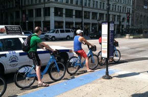
We know that private automobile transportation and the space that cars require work against high-density development. We also know that downtown must accommodate private cars to succeed, but should provide better alternatives for people moving between features within the district. High density development itself brings more things closer together, making walking, biking (including bike share systems), and transit circulators like modern streetcars the most efficient and pleasant ways to go.
We can institute this "virtuous cycle" by:
- Redeveloping surface parking lots with new development, providing new parking in parking structures, and integrating structured parking vertically into new projects.
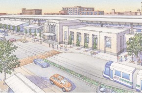
- Developing enhanced transit to downtown and "density-friendly" circulation to points within downtown, including pedestrian and bicycle facilities (including bike share) and the modern streetcar circulator included in the MAPS 3 capital program.
- Preserving and restoring to the degree possible the urban grid of blocks in Downtown Oklahoma City, re-establishing pedestrian linkages lost during the superblock era of Downtown redevelopment.
- Revising development ordinances to limit surface parking, encourage mixed uses on at least the street level of parking garages, and increase overall development yields.
Click to expand policy information.
Maintain existing alleys or construct new alleys where feasible to provide trash collection service and parking behind primary buildings and minimize curb cuts along the primary street frontage.
Prohibit new single-use, on-street commercial surface parking lots from locating Downtown and create incentives for the redevelopment of existing commercial surface parking lots with appropriately-scaled infill development.
Provide incentives for developers to build parking garages in high density areas. Include design requirements for projects receiving incentives.
Evaluate existing regulations for effectiveness in promoting density and mixed-use development and in addressing surface parking. Develop a new urban design code for downtown and other key districts to promote healthy mixes of land uses that are compatible and complementary.
We will incorporate all appropriate forms of transportation into major street and land use corridors. Major corridors provide access to important community destinations, including shopping centers, civic institutions, and employment centers. Multi-modal corridors do not require every form of transportation on every major street. Rather, the corridor taken broadly provides access for all modes of transportation to destinations along the way. For example, service roads, local streets, trails, or other paths parallel to arterials can accommodate local transit, pedestrians, and bicyclists comfortably. The concept of multi-modal corridors also requires that projects that change or expand the motor vehicle capacity of major streets and roads accommodate transit and active modes in the final design and during the construction process.
Click to expand policy information.
Set level of service goals and adopt standards to improve the performance of pedestrian, bicycle, and transit facilities. Emphasize pedestrian, bicycle and transit infrastructure in street widening designs.
Require the construction of new streets, streetscapes, and street widening projects to implement the design components of the assigned street typologies established in this plan.
When approving projects that improve the level of service for vehicular traffic, ensure they do not negatively impact the walkability or bikeability of the area.
Locate, design and upgrade City facilities and infrastructure in a manner that supports neighborhood revitalization and redevelopment.
We will work to establish a regional authority for financing and operating transit in the Oklahoma City metropolitan area. Providing a quality public transportation service requires a reliable funding source. The need for and benefits of public transportation do not stop at the borders of Oklahoma City. Effective transit benefits the region in several ways, including providing direct services in and to surrounding cities and opening street and highway capacity for suburban commuters who do not use transit. A metropolitan authority can coordinate current regional services and expand into areas like commuter rail. Most importantly, it can provide a dedicated and stable source of funding – necessary for fully realizing transit initiatives recommended by the Fixed Guideway and Transit Analysis studies.
Click to expand policy information.
Support the creation of a regional transit authority and pursue the establishment of a dedicated funding source, such as sales tax or property tax to achieve long term transit service goals.
We will implement the general recommendations of the Transportation Service Analysis (TSA) and the Fixed Guideway Study (FGS). These two studies together define a transit future for Oklahoma City. The Service Analysis addresses enhancements of the existing bus system while the FGS provides a long-term direction that introduces new transit technologies. We have begun implementing elements of both studies. The restructured EMBARK system has made the substantial short-term route adjustments and re-imaging recommended by the TSA. The MAPS 3 program, approved by the voters, includes capital funding for a modern streetcar serving the Downtown area, a major recommendation of the FGS. Both projects will change the image and visibility of transit in the city.
The TSA established basic principles to guide short-term adjustments and longer-term system design. These guiding principles include simplicity of service, directness of routes, minimized transfer waits, operation along arterials, route symmetry in both directions, and service to rider destinations. Key long-term recommendations include weekend service expanded evening hours, and more frequent service on routes with high ridership potential. These service expansions are vital to expanding the relevance of transit to more people. The analysis also recommends new routes with available funds, including a direct service to the airport. New service should also serve destinations of special interest to both residents and visitors, using routes that will appeal to specific markets.
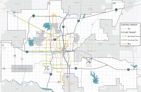
The FGS proposes a future system utilizing four technologies:
- Enhanced bus on the basic system, using conventional buses with more frequent service, longer operating hours, rider amenities such as shelters and schedule information at stops, less frequent stops, and faster operating speeds.
- Bus rapid transit (BRT) on four corridors: Reno Avenue, Northwest Expressway, 59th Street, and Meridian Avenue.
- Modern streetcar, to be implemented on a starter basis through MAPS 3 as noted earlier.
- Commuter rail on two corridors: the primary north-south route from Edmond to Norman via Downtown Oklahoma City and Downtown to Midwest City/Tinker Air Force Base.
Scheduling and funding for this 2008 study must be re-evaluated, but the basic long-term system concept remains sound.
Click to expand policy information.
Increase frequency and time of transit operations to ensure adequate, convenient and safe service for visitors, employees, and residents.
Focus transit improvements in high density areas with high ridership potential and along express routes that move people to activity nodes and downtown.
Implement policies and strategies recommended in the 2013 COTPA Transit Service Analysis.
Develop an urban rail and/or bus rapid transit system to connect downtown with strategic corridors and nodes.
We will develop facilities that encourage people to use other means of transportation to travel to transit stops and stations. The traditional service area around a transit route is a 1/4 mile walking distance. We should maintain clear and continuous pedestrian routes within that service area to transit stops or stations. Safe, comfortable, and attractive shelters and waiting areas should be located at strategic points along routes. Providing features that encourage people to bike or drive to stops and stations can extend these service areas and increase the number of potential riders. These features can include:
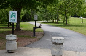
- Connections from trails to transit stops.
- Bike parking, lockers, and potentially rental stations at major transit stops and hubs.
- Park and ride facilities such as lots and structures, integrated into transit-oriented developments or at appropriate commuter sites.
Click to expand policy information.
Develop design standards for bus stops and transit stations that consider location, make connections to sidewalks and bicycle routes/trails, and provide safe, comfortable, and attractive waiting areas for riders.
Locate, design and upgrade City facilities and infrastructure in a manner that supports neighborhood revitalization and redevelopment.
We will incorporate transit access into street design standards and projects on appropriate corridors. As streets that carry transit routes are improved or modified, their design should include features that specifically encourage amenities, pedestrian access, and smoother operations. These features may include enhanced pedestrian access and street crossings at transit stops; signal cycles that give pedestrians time to cross streets; space for shelters; signal controls; and reserved lanes or "JUMP" lanes for bus rapid transit. In addition, street typology standards that include transit-friendly features should be implemented.
We will implement standards that provide good transit access and user connections to major projects on transit routes. The length and nature of the path between a transit stop and the entrance to a major destination determines whether a project really has adequate transit service. For example, a stop should not require people to find their way across a large parking lot to enter the development. New design standards for large projects with transit potential should provide safe and comfortable links from the transit stop, or provide routes into the project for transit use.
Click to expand policy information.
Revise development standards to require sidewalks and transit stops along existing and planned transit routes.
Develop design standards for bus stops and transit stations that consider location, make connections to sidewalks and bicycle routes/trails, and provide safe, comfortable, and attractive waiting areas for riders.
Ensure that new publicly financed developments – those which directly use or receive public dollars – with more than 100 units or with densities greater than 10 units/acre are located where they have easy access to frequent transit service.
We will implement appropriate transit service to Will Rogers World Airport. Airport transit services address two markets: airport employees and airline passengers. Many cities, including Oklahoma City, attempt to serve their airports by extending a local line, a technique which serves neither market effectively. The Transit Service Analysis recommends a direct bus service to the airport in its long-term, unconstrained resources scenario. The proposed route would serve the transit hub, Convention Center , and hotels, with typical weekday headways of 30 minutes.
Click to expand policy information.
We will develop and implement a strategic plan for the city's pedestrian network, building on the foundation of the 2013 Sidewalk Master Plan for MAPS 3. The 2013 Sidewalk Master Plan was a significant step forward, including an analysis of pedestrian demand in different parts of the city. However, its primary purpose was to identify priority projects for a specific sidewalk construction category of MAPS 3. Many of these projects supply new sidewalks along major corridors with high demand, based on a systematic rating system. These are extremely important, but many other problems remain, including:
- Neighborhood sidewalks on local streets that provide access to destinations such as schools and transit stops.
- Barriers to pedestrian travel such as major intersections, long arterial street crossings, and signal timing.
- Relationship of sidewalks to other parts of the active transportation network, including multi-modal streets, bicycle facilities, transit, connections to adjacent development, and trail access.
These issues require an expanded pedestrian system plan that:
- Identifies a Complete Streets Network prioritizing pedestrian corridors that should be developed and funded as part of the city's transportation program. The MAPS 3 and previous bond issue study provide a starting point for this network.
- Establishes standards for local sidewalk coverage and a process to evaluate pedestrian service on a neighborhood by neighborhood basis. An example of such a standard would be provision of a complete and well-maintained web of sidewalks within a 1/2 mile walking radius of elementary and middle schools.
- Identifies key pedestrian barriers that obstruct access for important user groups, including children and older adults. This effort should include standards and techniques to minimize these barriers.
- Relates other active modes or facilities to the sidewalk network.
- Provides a phased implementation program that may include individual categories of funding, such as neighborhood target areas and major network investments.
Click to expand policy information.
Enhance the safety and walkability of the sidewalk network through:
- Establishing a citywide bicycle and pedestrian master plan that includes an inventory of sidewalk locations and conditions, and priorities for enhancement.
- Implementing sidewalk improvements through future bond issues, CIP projects or other sources of funding as prioritized in the citywide bicycle and pedestrian master plan.
- Maintaining currency of the citywide bicycle and pedestrian master plan.
- Explore the feasibility of the City assuming responsibility for sidewalk maintenance.
Establish requirements for providing alternate pedestrian routes when construction activity prohibits use of existing facilities.
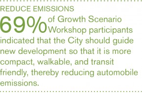
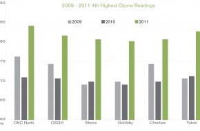
We will adopt land use and development practices that reduce the distance people must drive to meet their daily needs. In Oklahoma City, transportation is the principal cause of our most significant air quality problems. The policies included in the land use and transportation elements of planokc, which promote more compact development, mixed use, and improved transportation choice, will have a beneficial effect on automobile emissions. While cars will continue to be the primary means of transportation in Oklahoma City, even small changes in the number of miles driven, combined with greater fuel efficiency and technologies that reduce emissions, will substantially improve air quality.
We will coordinate initiatives and regulatory changes with local, regional, and state agencies to reduce motor vehicle emissions. In addition to reducing the number of miles that each person must drive, we need to make the vehicles that we use more efficient. We will improve overall fuel efficiency and reduce emissions by taking actions alone or in concert with other agencies that will increase use of alternative fuels in public and private car fleets, and consider new legislation and implement educational programs to reduce unnecessary emissions.most significant air quality problems. The policies included in the land use and transportation elements of planokc, which promote more compact development, mixed use, and improved transportation choice, will have a beneficial effect on automobile emissions. While cars will continue to be the primary means of transportation in Oklahoma City, even small changes in the number of miles driven, combined with greater fuel efficiency and technologies that reduce emissions, will substantially improve air quality.
We will develop incentives and adopt regulatory standards to reduce transportation emissions. In addition to reducing the number of miles driven, we must also improve vehicles fuel efficiency and emissions standards. Working in collaboration with local, regional, and state agencies, we will seek to increase use of clean fuels in public and private automobile fleets, consider new legislation, and implement educational programs.
We will preserve forests and encourage tree planting to improve air quality. Vegetation, particularly trees, plays a large role in both regulating and improving air quality, especially in urban areas. Trees absorb carbon dioxide and other gases, while replenishing the atmosphere with oxygen. They also help trap particle pollutants that can damage human lungs. We will improve our landscape ordinance to more effectively increase tree cover, reduce airborne pollutants, and reduce surface temperatures in the summer. We will also preserve existing trees and forested areas and encourage new tree plantings associated with development and streetscape projects.
A QUICK CALCULATION
Oklahoma City has about 227,000 households, according to the Census Bureau's American Community Survey. Most studies and trip generation estimates indicate that the typical household generates 10 trips daily. In Oklahoma City, this equals about 2.3 million trips. Estimates of the percentage of trips under two miles range from 25% to 40% of the total. For OKC, this ranges from 575,000 to 920,000 trips per day. If only one-quarter of these trips were made by active transportation modes (on foot or by bike), between 143,000 and 230,000 trips would be diverted from cars – the total number of trips on two of our busiest freeways. Assuming an average trip length of one mile, this means that in a course of a year, Oklahoma City residents would drive between 52 and 84 million fewer miles per year! According to the Environmental Protection Administration's report on Average Annual Emissions, a typical car emits .81 pounds (368.4 grams) of carbon dioxide per mile driven. So if one-quarter of short trips in our city were made by walking or biking, we would reduce CO2 emissions per year by between 42 and 68 million pounds annually.
BENEFITS OF TREES
Trees absorb carbon dioxide and potentially harmful gasses such as sulfur dioxide from the air and release oxygen that humans, and other species, need for survival.
According to the North Carolina State University Cooperative Extension, trees provide the following benefits related to air quality and air pollution reduction:
- One large tree can supply a day's supply of oxygen for four people.
- A healthy tree can store 13 pounds of carbon each year. For an acre of trees, that equals 2.6 tons of carbon storage.
- Each gallon of gasoline burned produces almost 20 pounds of carbon dioxide. For every 10,000 miles driven, it takes 7 trees to remove the amount of carbon dioxide produced if the vehicle gets 40 miles per gallon (mpg); it will take 10 trees at 30 mpg; 15 trees at 20 mpg; 20 trees at 15 mpg; and 25 trees at 12 mpg.
Click to expand policy information.
Improve the functionality and efficiency of the street network by:
- Providing direct connections from residential developments to nearby places and to each other.
- Providing street and sidewalk stubs to adjacent vacant land in anticipation of future development.
- Connecting new development to existing street and sidewalk stubs, and to existing trail, open space, and bicycle networks.
- Reducing block sizes and use of dead-end streets.
- Maintaining the existing street grid to preserve connectivity and mobility options.
Prioritize opportunities to restore and reconnect the street grid.
Prioritize construction of pedestrian and bicycle facilities that improve connectivity and eliminate gaps in the transportation network.
Identify areas that could be used to establish a greenbelt network throughout the City that connect major employment centers, commercial sites, parks, and key locations within major residential neighborhoods. Use the greenbelt as the backbone for a bicycle trails network which all other bicycle trails feed into.
Market the trails system as a transportation and recreation system to residents and visitors.
Change subdivision regulations to determine the number of entries into a residential development based on number of lots in order to improve connectivity of the roadway network and emergency response.
Support the creation of a regional transit authority and pursue the establishment of a dedicated funding source, such as sales tax or property tax to achieve long term transit service goals.
Increase frequency and time of transit operations to ensure adequate, convenient and safe service for visitors, employees, and residents.
Implement policies and strategies recommended in the 2013 COTPA Transit Service Analysis.
Develop an urban rail and/or bus rapid transit system to connect downtown with strategic corridors and nodes.
Work with the Association of Central Oklahoma Governments to implement the Early Action Compact to mitigate air quality issues.
Support and incentivize the adaptive use of existing buildings, infill development, and brownfield development.
Preserve natural habitat, maintain wildlife food sources, and reduce the risk of propagating invasive plant species by utilizing vegetation native to Oklahoma, preferably central Oklahoma, for all mitigation and habitat restoration efforts associated with new development and redevelopment projects, public and private, to the greatest extent possible.
Establish an Urban Forestry Program and City Urban Forester position to achieve the following:
- Measure and monitor tree canopy coverage and habitat on a regular basis so that any policies, programs, and regulations may be adjusted accordingly as situations change. Establish a process to maintain current data.
- Develop and maintain regulations, policies, processes, and programs that focus on protection and preservation of native trees.
- Provide assistance with proper tree selection, location, and maintenance to prevent power outages, reduce property damage, and coordinate emergency response during natural disaster events (excessive snow and ice, tornadoes, etc.), address the urban heat island effect, and reduce energy costs, etc.
- Establish programs such as tree give-aways, neighborhood planting programs, and education workshops.
- Provide resources to the public about tree selection, management, and care.
- Seek grant funding for community tree planting to improve City parks, publicly maintained rights-of-way and other areas of the city.
- Inventory the City’s street trees and develop a tree replacement program.
- Partner with volunteer and nonprofit organizations to recruit volunteers for tree planting and maintenance and to coordinate community-wide tree planting efforts.
Develop and adopt a tree preservation ordinance that achieves the following:
- Defines methods of preservation;
- Defines situations where preservation of trees is mandatory versus optional;
- Establishes incentives for tree preservation;
- Establishes mitigation options if preservation cannot be accomplished; and
- Establishes penalties for unauthorized tree removal.
Pursue methods to reduce the impact of the urban heat island effect on Oklahoma City by:
- Establishing a minimum canopy coverage requirement over paved surfaces such as parking lots.
- Instating a “continuous canopy” requirement for new streets and street reconstruction projects.
- Promoting the use of building and roofing materials that reduce heat island effects.
Coordinate with local, regional, and State agencies to pursue initiatives and regulations that help reduce automobile emissions, such as:
- Transitioning commercial and City fleets to alternative-fueled and hybrid vehicles;
- Determining the feasibility of an idling restriction ordinance for all vehicles.
Promote improved air quality and reduced ground-level ozone levels by developing a public education program that will inform residents about the air quality benefits of:
- Proper automobile maintenance
- Proper maintenance and use of gas-powered lawn and garden equipment
- Limiting car idling times
- Alternative fuels
- Alternative / active transportation modes (public transit, walking, biking, car-sharing, etc.)
- Reducing vehicle-miles traveled (VMT)
- Employer sponsored emission reduction programs (carpooling, work from home, telecommuting, etc.)
- Native landscaping (requiring less maintenance)
- Energy efficient housing / buildings
Study of the public health and environmental impacts of degraded air quality on sensitive populations living near highways.
Establish strategies, procedures and policies for City construction projects to achieve higher energy efficiency, including:
- Implementing an energy management plan for City facilities.
- Monitoring energy consumption of City facilities, tracking conservation progress, and communicating results to City administrators, employees, elected officials and the public.
- Assessing water use in City facilities to identify opportunities for conservation and implement appropriate measures.
Develop an enforcement mechanism for the City’s Building Energy Code. Develop a healthy building code to support construction of durable, health-promoting and energy efficient buildings that incorporate proven green development practices, locally-sourced and environmentally responsible materials, water conservation fixtures, innovative design and construction techniques, and low waste construction practices. Incentivize their use with shorter approval procedures, priority permits and inspections, and reduced fees.
Partner with agencies, non-profits, and private entities to:
- Implement a sustainable development online forum – an educational and networking resource that will inform the public about local opportunities and the benefits of sustainable development while increasing builder and developer participation.
- Educate citizens on energy and water conservation opportunities both at work and at home.
- Encourage appropriate re-use and reclamation of water in new development and redevelopment to reduce the reliance on potable water use.
- Provide detailed cost-benefit information about green building practices to encourage increased use of such practices in Oklahoma City.
- Reduce reliance on electricity produced by fossil fuel by encouraging the use of renewable energy sources in new development and redevelopment.
- Explore mechanisms (incentives, regulations, programs) to divert demolition debris from landfills and redirect to facilities that can reuse these materials.
- Establish a promotion/award program to showcase innovative development that utilizes low-impact development practices and energy-efficient building techniques / equipment, conserves riparian buffers, and extends greenway networks with hiking/biking trails.
Establish strategies, procedures and policies that prevent degradation or loss of critical habitat and sensitive areas, such as Cross Timbers, upland forests, wetlands, wildlife corridors, groundwater recharge zones, and riparian areas. Protection methods should ensure that placement of lots, alignment of roads, and installation of structures and infrastructure minimize disturbance of the environmentally sensitive areas using tools such as:
- Directing development to appropriate locations;
- Greenbelt preservation;
- Assurance of no development in protected open space;
- Clustering / conservation subdivisions;
- Pervious surface treatments;
- Density transfers; and/or
- Conservation easements.
Ensure that strategies, procedures, and policies incorporate principles of connectivity, minimal fragmentation, representativeness, and heterogeneity.
Encourage redevelopment and infill development on vacant, underutilized, and brownfield sites in urbanized areas.
Encourage the integration of different land uses in urban areas through the following means:
- Promote the use of performance standards in place of existing zoning methods (which address incompatibility by separating uses). Performance-based regulations should focus on achieving compatibility between uses by addressing the following:
- Noise, odors and air quality
- Traffic and parking (allow flexible, but sufficient parking)
- Site layout and building design
- Waste
- Safety
- Lighting (glare control, placement, and shielding)
- Delivery hours
- Enhance transit service (bus and rail).
- Prevent large areas of concentration of any particular land use such as multi-family or commercial.
Establish development regulations that help improve air quality, including:
- Specifying construction controls that reduce airborne dust;
- Increasing landscaping and tree planting to absorb carbon dioxide and air pollutants; and
- Encouraging development patterns and densities that support alternative modes of transportation in the urban LUTAs.
We will provide complete sidewalk networks to serve local parks. People within the realistic walking radius (or “walkshed”) of a local park should have pedestrian facilities – sidewalks, paths, or trails – that connect to that park. Creating such a pedestrian web around parks includes:
- Analyzing sidewalk coverage within the walkshed, (½ mile for neighborhood parks and one mile for community parks) for interruptions and barriers.
- Evaluating current park access points and their relationship to the pedestrian system.
- Establishing priority routes to parks and focusing funding on closing gaps and removing barriers, including intersection design issues.
- Providing signage and wayfinding information to direct users to parks destinations.
- Within new developments, require street patterns and pedestrian links that provide direct routes to private parks, school parks, and public trails.
We will complete trails to serve all parts of Oklahoma City to meet the community priority placed on trails and increase access to parks. As discussed in connectokc, trails are both a recreational and transportation resource. The basic trail system identified by the Parks Master Plan included four major phases of trail development:
- The existing trail system.
- Programmed trails, including the MAPS 3 trails and a Katy Trail extension.
- Near-term off-street trails, connecting the trail core to outlying parts of the urban area.
- Long-term off-street trails, extending the city system to the periphery of Oklahoma City.
The programmed system should be completed by 2020, by which time priorities should be set for completion of the longer-term system components. The ability to provide park access should be a strong factor in setting priorities.
Other trail-related actions should include:
- Designating on-street routes that connect neighborhoods to trail access points. These routes should focus on low-volume, direct streets that include continuous sidewalks and pavement markings.
- Requiring developments to dedicate trail segments designated by the trails master plan.
- Enhancing the recreational trail experience with landscaping, fitness facilities, wayfinding signage, rest areas, and other amenities.
We will improve the usefulness of transit as a way of getting to parks. Parks can be hard to serve by transit because they rarely generate the trip volume at specific times that help support service. However, we can take steps that help transit service adapt to park needs. Directions include increasing service on potential high-volume routes that serve major park and recreation facilities, and locating new investments, such as multi-generational centers, on sites with good transit service. We also should be open to transportation solutions other than fixed route transit. Examples are special services or brokering of other transportation providers to serve time specific needs, such as after school service to a major recreation facility.
Click to expand policy information.
Modify Subdivision Regulations to require new development adjacent to public trails to provide sufficient connections to the trails.
Update, implement, and maintain the currency of the 1997 Oklahoma City Trails Master Plan.
Enhance the safety and walkability of the sidewalk network through:
- Establishing a citywide bicycle and pedestrian master plan that includes an inventory of sidewalk locations and conditions, and priorities for enhancement.
- Implementing sidewalk improvements through future bond issues, CIP projects or other sources of funding as prioritized in the citywide bicycle and pedestrian master plan.
- Maintaining currency of the citywide bicycle and pedestrian master plan.
- Explore the feasibility of the City assuming responsibility for sidewalk maintenance.
Develop a downtown park master plan that identifies the following:
- Opportunities for providing private parks and open space while still maintaining a dense, urban environment (such as vest pocket parks, rooftop gardens, plazas and courtyards);
- Linkages and connections between public and private parks;
- Programming and amenities that complement and support parks in the system; and
- Funding for operations and maintenance.
Ensure all homes are within walking distance of a park based on level of service standards for each urban land use typology by updating codes and regulations for new construction and by improving connections and access between existing parks and neighborhoods.
Acquire easements in new and existing developments to develop and connect trails.
Establish connections between parks, residential areas, and other points of interest by constructing additional bike routes, trails and pedestrian paths to meet the growing demands for recreation and alternative transportation routes.
Require that new development tie into the park and trail system by providing linkages to existing parks or dedicating new park land. Connect existing parks and neighborhoods to create a continuous system of open spaces, for example along stream corridors.
Prioritize capital improvement to construct linkages and connections from the existing urban parks and open space system to neighborhoods, commercial areas, employment centers, and community facilities.
Adopt subdivision regulations that ensure new neighborhoods meet the basic needs of residents while supporting an efficient development pattern. Regulations should cover:
- Open space (passive and active),
- Demonstration of sustainable funding levels for common area and facility maintenance costs,
- Walkability and bikeability,
- Internal and external street connectivity,
- Block length,
- Integration of uses,
- Integration of a variety of home sizes,
- Integration of a variety of unit types, and
- Preservation of Environmentally Sensitive Areas.
Regulations could be based on a point scale to allow flexibility, while still requiring basic minimum thresholds be met.
New regulations should remove the existing requirement for development in Rural LUTAs to connect to water and sewer systems and establish a minimum one-acre lot size for lots with on-site sewer treatment.
Click to expand policy information.
Coordinate the design, development, expansion, and/or investment in transportation projects with the Land Use Typology map.
Require the construction of new streets, streetscapes, and street widening projects to implement the design components of the assigned street typologies established in this plan.
Revise Subdivision Regulations and development standards to reflect the street typology standards.
When approving projects that improve the level of service for vehicular traffic, ensure they do not negatively impact the walkability or bikeability of the area.
Require sidewalks on both sides of all streets in urban LUTAs and in the Rural Residential LUTA for subdivisions with densities greater than 1 unit per acre.
Prioritize construction of pedestrian and bicycle facilities that improve connectivity and eliminate gaps in the transportation network.
Set level of service goals and adopt standards to improve the performance of pedestrian, bicycle, and transit facilities. Emphasize pedestrian, bicycle and transit infrastructure in street widening designs.
Increase the miles of bike lanes by:
- Including bicycle lanes in future road widening, reconstruction, and resurfacing projects; and
- Adding bicycle lanes to streets that have sufficient capacity.
Create and implement a citywide bicycle and pedestrian master plan that addresses riders of all levels.
Enhance the safety and walkability of the sidewalk network through:
- Establishing a citywide bicycle and pedestrian master plan that includes an inventory of sidewalk locations and conditions, and priorities for enhancement.
- Implementing sidewalk improvements through future bond issues, CIP projects or other sources of funding as prioritized in the citywide bicycle and pedestrian master plan.
- Maintaining currency of the citywide bicycle and pedestrian master plan.
- Explore the feasibility of the City assuming responsibility for sidewalk maintenance.
Establish access management requirements that limit driveways on arterials and collectors and increase connections between uses to improve safety and traffic efficiency.
Limit driveways on arterials and collectors and increase connections between uses to improve safety and traffic efficiency.
Revise development standards to require sidewalks and transit stops along existing and planned transit routes.
Develop design standards for bus stops and transit stations that consider location, make connections to sidewalks and bicycle routes/trails, and provide safe, comfortable, and attractive waiting areas for riders.
Adopt subdivision regulations that ensure new neighborhoods meet the basic needs of residents while supporting an efficient development pattern. Regulations should cover:
- Open space (passive and active),
- Demonstration of sustainable funding levels for common area and facility maintenance costs,
- Walkability and bikeability,
- Internal and external street connectivity,
- Block length,
- Integration of uses,
- Integration of a variety of home sizes,
- Integration of a variety of unit types, and
- Preservation of Environmentally Sensitive Areas.
Regulations could be based on a point scale to allow flexibility, while still requiring basic minimum thresholds be met.
New regulations should remove the existing requirement for development in Rural LUTAs to connect to water and sewer systems and establish a minimum one-acre lot size for lots with on-site sewer treatment.
Identify priority areas where the City can maximize private investment by providing public infrastructure and amenities including:
- Transit;
- Parks, trails, sidewalks;
- Streets;
- Arts and cultural facilities.
Catalyze infill development on vacant, underutilized, and brownfield sites in urbanized areas by:
- Investing in infrastructure improvements;
- Improving multi-modal transportation networks;
- Improving parks and open spaces;
- Improving schools and other civic resources;
- Exploring innovative methods such as:
- A public-private partnership to purchase problem properties in target areas and build or rehabilitate homes while improving infrastructure and amenities
- An infill house plan program similar to Sacramento or Milwaukee
- Identifying and removing barriers to rehabilitation and/or replacement of residential buildings.
- Establishing a position in the City to facilitate medium- and large-scale redevelopment projects through the development process by guiding interactions with City departments, allied agencies, and utility companies.
Regional-, community-, and neighborhood-scale retail developments should provide an internal vehicle and pedestrian circulation system between new and existing centers and individual stores that draws on the following principles:
- Concentrate access for new retail development at shared primary entrance points. Primary entrance points should be aligned with access points immediately across intersecting roads. Limit curb cuts on primary highways and arterials.
- Provide pedestrian circulation, including sidewalks and median breaks along interior and exterior fronting roads and within parking lots.
- Encourage coordinated development of retail centers in order to facilitate internal pedestrian and vehicle circulation and optimal center performance.
Improve parking provisions in neighborhoods that are near vibrant commercial corridors/areas by improving parking and corridor design, non-vehicular networks, transit, and signage.
Establish development regulations that help improve air quality, including:
- Specifying construction controls that reduce airborne dust;
- Increasing landscaping and tree planting to absorb carbon dioxide and air pollutants; and
- Encouraging development patterns and densities that support alternative modes of transportation in the urban LUTAs.
Promote improved air quality and reduced ground-level ozone levels by developing a public education program that will inform residents about the air quality benefits of:
- Proper automobile maintenance
- Proper maintenance and use of gas-powered lawn and garden equipment
- Limiting car idling times
- Alternative fuels
- Alternative / active transportation modes (public transit, walking, biking, car-sharing, etc.)
- Reducing vehicle-miles traveled (VMT)
- Employer sponsored emission reduction programs (carpooling, work from home, telecommuting, etc.)
- Native landscaping (requiring less maintenance)
- Energy efficient housing / buildings
